Related Research Articles

Horry County is the easternmost county in the U.S. state of South Carolina. As of the 2020 census, its population was 351,029. It is the fourth-most populous county in South Carolina. The county seat is Conway.

Briarcliffe Acres is a town in Horry County, South Carolina, United States, located between Myrtle Beach and North Myrtle Beach. The population was 457 at the 2010 census.

Myrtle Beach is a resort city on the east coast of the United States in Horry County, South Carolina. It is located in the center of a long and continuous 60-mile (97 km) stretch of beach known as the "Grand Strand” in the northeastern part of the state. Its year-round population was 35,682 as of the 2020 census, making it the 13th-most populous city in South Carolina.

U.S. Route 378 (US 378) is a spur of US 78 in the U.S. states of Georgia and South Carolina. The U.S. Highway runs 234.30 miles (377.07 km) from US 78, Georgia State Route 10 (SR 10), SR 17, and SR 47 in Washington, Georgia, east to US 501 Business in Conway, South Carolina. US 378 connects the Central Savannah River Area in both states with the Midlands and Pee Dee regions of South Carolina. The U.S. Highway's western portion, which connects Washington and Lincolnton in Georgia and McCormick, Saluda, and Lexington in South Carolina, is mainly a rural highway. US 378 is a major suburban and urban highway through Lexington and South Carolina's state capital, Columbia. The highway has a lengthy concurrency with US 76 between Columbia and Sumter and serves as a major route between the Midlands and the Myrtle Beach area, between which the highway has a business route through Lake City.
The Pee Dee is a region in the northeast corner of the U.S. state of South Carolina. It lies along the lower watershed of the Pee Dee River, which was named after the Pee Dee, an Indigenous tribe historically inhabiting the region.

The Grand Strand is an arc of beach land on the Atlantic Ocean in South Carolina, United States, extending more than 60 miles (97 km) from Little River to Winyah Bay. It is located in Horry and Georgetown Counties on the NE South Carolina coast.

South Carolina Highway 31 (SC 31), also known as the Carolina Bays Parkway, is a 28.097-mile (45.218 km) six-lane, limited-access highway that parallels the Intracoastal Waterway around Myrtle Beach. The first phase opened on December 17, 2002, completing a 22-mile (35 km) link between U.S. Route 501 (US 501) and SC 9. The second phase opened in March 2005, running from US 501 southwest to S.C. Highway 544. The third phase opened on November 7, 2019, extending to SC 707. While usually referred to only as the Carolina Bays Parkway, the highway is also dedicated the John B. Singleton Parkway in memory of John B. Singleton, a former Myrtle Beach City Council member and police commissioner.
Robert Edge Parkway is a connection highway in North Myrtle Beach, South Carolina. It begins at U.S. Route 17 (US 17) and Main Street, crosses the Intracoastal Waterway, has an interchange with South Carolina Highway 31 (SC 31) or the Carolina Bays Parkway, and terminates at an intersection with SC 90. The project consisted of upgrading Firetower Road, adding a new interchange for SC 31, expanding Main Street in North Myrtle Beach to accommodate the increase in traffic, and a 1,000-foot bridge (300 m) over the Intracoastal Waterway which includes a 10-foot-wide path (3.0 m) for walkers and bicycles. Formerly known as the Main Street Connector, the road has been named for Robert Edge Sr., the first mayor of North Myrtle Beach starting in 1968. For twelve years before that, Edge was the mayor of Crescent Beach, one of the four towns which, through Edge's efforts, became North Myrtle Beach. The road opened September 3, 2009.

South Carolina Highway 9 (SC 9) is a 259.570-mile (418 km) major state highway in the U.S. state of South Carolina. The highway travels from Cherry Grove Beach to the North Carolina state line upstate. The highway is currently the longest state highway in South Carolina. It is signed as a north–south highway, even though it travels in an east–west direction.
The Carolina Opry is a musical variety show located in Myrtle Beach, South Carolina.

South Carolina Highway 707 (SC 707) is a 12.645-mile (20.350 km) state highway in Georgetown and Horry counties, in the northeastern part of the U.S. state of South Carolina, in the Myrtle Beach metropolitan area. It begins at U.S. Highway 17 Business in Murrells Inlet to US 17 across from Farrow Parkway near Socastee, South Carolina.

South Carolina Highway 544 (SC 544) is a 13.710-mile (22.064 km) major four-lane state highway in Horry County, South Carolina. It connects the Surfside Beach and Conway areas. The highway is sometimes known as Dick Pond Road in the Socastee area.
Harrelson Boulevard is a four-lane highway in Myrtle Beach, South Carolina, named for Myrtle Beach's first mayor Dr. W. Leroy Harrelson Sr., who was elected to office in 1938. It starts at U.S. 17, and goes to Myrtle Beach International Airport and runs near Coastal Grand Mall. The highway is also the southern terminus for Grissom Parkway. It replaced the two-lane Jetport Road.

South Carolina Highway 90 (SC 90) is a 23.110-mile (37.192 km) state highway in Horry County, within the northeastern part of the U.S. state of South Carolina. It travels from Red Hill to Little River. It provides a direct connection from Conway to the northern Grand Strand in Little River.
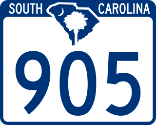
South Carolina Highway 905 (SC 905) is a 25.610-mile (41.215 km) state highway in Horry County. It travels from Conway to the North Carolina state line, where it continues as North Carolina Highway 905. It is parallel to the Waccamaw River.

Cherry Grove Beach, sometimes known as Cherry Grove, is a neighborhood of the city of North Myrtle Beach in Horry County, South Carolina, United States. It lies along South Carolina Highway 9 and South Carolina Highway 65. The Cherry Grove Pier is a popular landmark of Cherry Grove. It was built early in the 1950s. It has weathered many hurricanes, and was remodeled and lengthened in 1999 after Hurricane Floyd. In 1968 Cherry Grove Beach merged with Windy Hill Beach, Ocean Drive Beach, and Crescent Beach to form the city of North Myrtle Beach.

Wampee is an unincorporated community in Horry County, South Carolina, United States, along South Carolina Highway 90. Wampee is located near North Myrtle Beach across from the Intracoastal Waterway. Robert Edge Parkway starts here.

U.S. Highway 17 (US 17) is a 221.454-mile (356.396 km) north–south United States Numbered Highway in the U.S. state of South Carolina located near the Atlantic Ocean. The highway enters the state from Georgia at the Savannah River and serves Hardeeville, Charleston, Georgetown, and Myrtle Beach, before entering North Carolina near Calabash.

South Carolina Highway 65 is a 4.710-mile (7.580 km) state highway in the U.S. state of South Carolina. It is the main thoroughfare through North Myrtle Beach. The highway is known for the origin of the official state dance, the Carolina shag.

South Carolina Highway 38 (SC 38) is a 43.694-mile (70.319 km) state highway that extends from Marlboro County near Hamlet, North Carolina to U.S. Route 501 (US 501) in Marion County. The highway travels generally north-to-south across the eastern portion of the state, and is one of the most popular routes to Myrtle Beach.
References
- ↑ "Company Profile". JD Long Masonry a full service masonry contractor. October 28, 2013. Retrieved February 7, 2024.
Municipalities and communities of Horry County, South Carolina, United States | ||
|---|---|---|
| Cities |  | |
| Towns | ||
| CDPs | ||
| Other communities | ||
33°56′19″N78°43′59″W / 33.93861°N 78.73306°W
| | This South Carolina state location article is a stub. You can help Wikipedia by expanding it. |