
U.S. Route 1 or U.S. Highway 1 (US 1) is a major north–south United States Numbered Highway that serves the East Coast of the United States. It runs 2,370 miles (3,810 km) from Key West, Florida, north to Fort Kent, Maine, at the Canadian border, making it the longest north–south road in the United States. US 1 is generally paralleled by Interstate 95 (I-95), though US 1 is significantly farther west (inland) between Jacksonville, Florida, and Petersburg, Virginia, while I-95 is closer to the coastline. In contrast, US 1 in Maine is much closer to the coast than I-95, which runs farther inland than US 1. The route connects most of the major cities of the East Coast from the Southeastern United States to New England, including Miami, Jacksonville, Raleigh, Richmond, Washington D.C., Baltimore, Philadelphia, New York City, and Boston.

Interstate 95 (I-95) is the main north–south Interstate Highway on the East Coast of the United States, running from U.S. Route 1 (US 1) in Miami, Florida, north to the Houlton–Woodstock Border Crossing between Maine and the Canadian province of New Brunswick. The highway largely parallels the Atlantic coast and US 1, except for the portion between Savannah, Georgia, and Washington, D.C., and the portion between Portland and Houlton in Maine, both of which follow a more direct inland route.
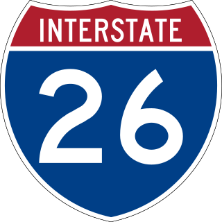
Interstate 26 (I-26) is a main route of the Interstate Highway System in the Southeastern United States. Nominally east–west, as indicated by its even number, I-26 runs from the junction of U.S. Route 11W (US 11W) and US 23 in Kingsport, Tennessee, generally southeastward to US 17 in Charleston, South Carolina. The portion from Mars Hill, North Carolina, east to I-240 in Asheville, North Carolina, has signs indicating FUTURE I-26, because the highway does not yet meet all of the Interstate Highway standards. A short realignment, as an improvement in the freeway, was also planned in Asheville but has been postponed indefinitely due to North Carolina's budget shortfalls.

Rowan County is a county in the U.S. state of North Carolina that was formed in 1753, as part of the British Province of North Carolina. It was originally a vast territory with unlimited western boundaries, but its size was reduced to 524 sq mi after several counties were formed from Rowan County in the 18th and 19th centuries. As of the 2020 census, its population was 146,875. Its county seat, Salisbury, is the oldest continuously populated European-American town in the western half of North Carolina. Rowan County is located northeast of Charlotte, and is considered part of the Charlotte–Concord–Gastonia, NC-SC Metropolitan Statistical Area.

Rockingham is a city in Richmond County, North Carolina, United States, named after the Marquess of Rockingham. The population was 9,558 at the 2010 census. It is the county seat of Richmond County.

Cayce is a city in the U.S. state of South Carolina, along the Congaree River. The population was 12,528 at the 2010 census and rose to 13,789 in the 2020 United States Census, and it is the third-most populated municipality in Lexington County. The city is primarily in Lexington County, with additional, predominantly rural land to the east in Richland County. Cayce is part of the Columbia Metropolitan Statistical Area and is within South Carolina's Midlands region.

Interstate 385 (I-385) is an auxiliary Interstate Highway located in the Upstate region of South Carolina. I-385 is a spur route of I-85. The highway provides a connection between Greenville and I-26 to the south, connecting Greenville to Columbia and Charleston. Around Greenville, the last several miles of I-385 forms the northeastern quadrant of a partial beltway around Greenville's southern suburbs along with I-185.

U.S. Route 321 (US 321) is a spur of U.S. Route 21. It runs for 516.9 miles (831.9 km) from Hardeeville, South Carolina to Lenoir City, Tennessee; with both serving as southern termini. It reaches its northernmost point at Elizabethton, Tennessee, just northeast of Johnson City. Because of its unusual "north–south–north" routing, U.S. Route 321 intersects both Interstate 40 and U.S. Route 70 three separate times. The highway serves different roles in each state: An alternate route to interstates in South Carolina, a major highway in North Carolina, and a scenic route in Tennessee.

The North Carolina Highway System consists of a vast network of Interstate, United States, and state highways, managed by the North Carolina Department of Transportation. North Carolina has the second largest state maintained highway network in the United States because all roads in North Carolina are maintained by either municipalities or the state. Since counties do not maintain roads, there is no such thing as a "county road" within the state.

North Carolina Highway 55 (NC 55) is a primary state highway in the U.S. state of North Carolina. It serves as a traffic artery connecting Durham with Cary and numerous small cities and towns in The Triangle on its way toward the Pamlico Sound. A portion of NC 55 extends through Research Triangle Park. NC 55 is a major artery in the central part of The Triangle region, and is a four lane, divided highway between Durham and Cary and Apex. NC 55 is also a divided highway between Apex and Fuquay-Varina.
The following is a set–index article, providing a list of lists, for the cities, towns and villages within the jurisdictional United States. It is divided, alphabetically, according to the state, territory, or district name in which they are located.
Interstate 40 (I-40) is a part of the Interstate Highway System that travels 2,556.61 miles (4,114.46 km) from Barstow, California, to Wilmington, North Carolina. In North Carolina, I-40 travels 420.21 miles (676.26 km) across the entirety of the state from the Tennessee state line along the Pigeon River Gorge to U.S. Route 117 (US 117) and North Carolina Highway 132 (NC 132) in Wilmington. I-40 is the longest Interstate Highway in North Carolina and is the only Interstate to completely span the state from west to east.

A total of at least 31 special routes of U.S. Route 17 (US 17) exist: 3 in Florida, 5 in South Carolina, 17 in North Carolina, and 6 in Virginia.
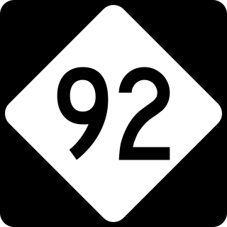
North Carolina Highway 92 (NC 92) is a primary state highway in the U.S. state of North Carolina. It runs through connecting Washington and Bath, entirely in Beaufort County.

Emery is a populated place in Montgomery County, North Carolina, United States. It is located along the co-designated Interstate 73 - Interstate 74, approximately 50 miles south of Greensboro where the interstates intersect U.S. Route 220. It is roughly equidistant between Raleigh to the east and Charlotte to the west.

U.S. Highway 76 (US 76) is a U.S. Highway running from Chattanooga, Tennessee to Wrightsville Beach, North Carolina. In North Carolina the highway runs for 80.4 miles (129.4 km) in the southeastern region of the state. US 76 enters the state from South Carolina south of Fair Bluff in Columbus County. Travelling in an eastward direction, US 76 meets US 74 in Chadbourn. The two highways run concurrently for 50.4 miles (81.1 km) between Chadbourn and Wilmington. US 76 runs concurrently with US 17 along much of its Wilmington routing, until once again meeting US 74. US 76 and US 74 run concurrently for 1.4 miles (2.3 km) until reaching Wrightsville Beach. US 76 reaches its eastern terminus on the south side of Wrightsville Beach, at an intersection with Water Street.
König is a German surname.
Hickory Tavern, is an unincorporated community in Laurens County, South Carolina, United States. It is classified by the federal government as a class U6 populated place. It is centered at the intersection of US Route 76 and South Carolina Highway 101.
Dunbar is an unincorporated community and census-designated place (CDP) in Georgetown County, South Carolina, United States. It was first listed as a CDP in the 2020 census with a population of 615.
Pringletown is an unincorporated community in Berkeley County, South Carolina, United States. It is located along Old Gilliard Road (SC 27), north of Interstate 26 (exit 187). Formally spelled "Pringle Town," the community was named after the Pringle family, which lived in the area.

