Anderson, South Carolina

Last updated

Anderson
AndersonSCMon2.png
Top, left to right: Downtown Anderson, First Baptist Church of Anderson, Old Anderson County Courthouse, Anderson University, Anderson County Courthouse, Lake Hartwell view from City of Anderson Recreation Park
Anderson, SC City Flag.gif
Anderson, SC City Seal.png
Nickname(s): 
The Electric City, Friendliest City in South Carolina
Motto: 
"Teamwork | Integrity | Professionalism"
SCMap-doton-Anderson.png
Location in South Carolina
USA South Carolina location map.svg
Red pog.svg
Anderson
Usa edcp location map.svg
Red pog.svg
Anderson
North America laea location map.svg
Red pog.svg
Anderson
Coordinates: 34°30′12″N82°39′01″W / 34.50333°N 82.65028°W / 34.50333; -82.65028
CountryUnited States
State South Carolina
County Anderson
FoundedDecember 1826
IncorporatedDecember 19, 1833 [1]
Named for Robert Anderson
Government
  Type Council-manager government
   Mayor Terence Roberts
   City Manager David McCuen
Area
[2]
  Total15.87 sq mi (41.09 km2)
  Land15.83 sq mi (41.00 km2)
  Water0.04 sq mi (0.10 km2)  0.25%
Elevation
[3]
807 ft (246 m)
Population
 (2020) [4]
  Total28,106
  Estimate 
(2022)
29,771
  Density1,775.60/sq mi (685.56/km2)
   Urban
118,369 (US: 286th) [5]
  Urban density1,233.8/sq mi (476.4/km2)
ZIP Codes
29621–29626
FIPS code 45-01360
GNIS feature ID2403098 [3]
Website www.cityofandersonsc.com

Anderson is a city in and the county seat of Anderson County, South Carolina, United States. [6] The population was 28,106 at the 2020 census, making it the 16th-most populous city in South Carolina. [7] It is one of the principal cities in the Greenville-Anderson-Greer, SC Metropolitan Statistical Area, which had an estimated population of 975,480 in 2023. [8] [9] It is included in the larger Greenville-Spartanburg-Anderson, SC Combined Statistical Area, which had an estimated population of 1,590,636 in 2023. [9] It is just off Interstate 85 and is 120 miles (190 km) from Atlanta and 140 miles (230 km) from Charlotte. Anderson is the smallest of the three primary cities that make up the Upstate region, and is nicknamed the "Electric City" and the "Friendliest City in South Carolina".

Contents

History

Anderson Court House

Downtown Anderson in 1876 AndersonSCBenson1876.jpg
Downtown Anderson in 1876

Cherokee first settled the area of what is today the city of Anderson. During the American Revolution, the Cherokee sided with the British. After the American Revolutionary War, the Cherokee's land was acquired as war reparations and colonized. In 1791, the South Carolina Legislature created the Washington District, which comprised Greenville, Anderson, Oconee, and Pickens Counties. The Washington District was then divided into Greenville and Pendleton districts. Anderson, Pickens, and Oconee comprised the newly created Pendleton district. Anderson was settled in 1826 and incorporated in 1828 as Anderson Court House, separate from the Pendleton district. The name Anderson is in honor of Robert Anderson, who fought in the American Revolutionary War and also explored the Anderson region in the mid-18th century. Anderson District (later Anderson County after 1867) was also established in 1826 out of the Pendleton district.

In 1851, the Johnson Female Seminary was established in Anderson as the first college of the town and was named after William Bullein Johnson. One year later, the seminary was renamed Johnson University. [10] During the American Civil War, Johnson University was closed and converted into a Confederate treasury. On May 1, 1865, Union forces invaded Anderson looking for the Confederate treasury. The treasury office of Anderson was ransacked by Union forces, and the main building of Johnson University was used as a Union headquarters. A minor skirmish erupted at the Battle of Anderson, leading to two Union casualties. [11] After the war, a Union garrison was stationed in Anderson.

The Electric City

Portman Shoals Power Plant around 1920. PortmanShoalsPlantAnderson.jpg
Portman Shoals Power Plant around 1920.

Anderson became one of the first cities in the Southeastern United States to have electricity. Electricity to Anderson was established by William C. Whitner in 1895 at a hydroelectric plant on the Rocky River, giving the city the name the Electric City. Anderson also became the first city in the world to supply a cotton gin by electricity. In 1895, Anderson Court House was renamed to Anderson. [12] [13] In 1897, Whitner's plant was upgraded with a 10,000-volt generating station at Portman Shoals. Whitner's power plant at Portman Shoals became the first hydroelectric plant in the United States to generate high voltage without step-up transformers . [14] The Portman Dam was swept away in 1901, forcing Anderson into darkness until it was rebuilt in 1902. [15]

Anderson University

In 1911, Anderson College was established by the Anderson Chamber of Commerce. Anderson College was the successor to Johnson University and is affiliated with the South Carolina Baptist Convention. Anderson College became Anderson University. [16] It is accredited as a Level VI institution (offers bachelors, masters, Ph.D. degrees) by the Southern Association of Colleges and Schools Commission on Colleges. [17] As of October 2022, it is the largest private university in South Carolina. [18]

Geography

Anderson, South Carolina
Interactive map of Anderson

Anderson is located in the northwest corner of South Carolina on the Piedmont plateau. Anderson is a 1-hour drive from the Blue Ridge Mountains and a 4-hour drive from the South Carolina coast. Anderson lies roughly at the midpoint of the I-85 corridor between Atlanta and Charlotte.

According to the United States Census Bureau, the city has a total area of 15.87 square miles (41.1 km2), of which 15.83 square miles (41.0 km2) is land and 0.04 square miles (0.10 km2) (0.25%) is water. [2]

Demographics

Historical population
CensusPop.Note
1860 625
1870 1,432129.1%
1880 1,85029.2%
1890 3,01863.1%
1900 5,49882.2%
1910 9,65475.6%
1920 10,5709.5%
1930 14,38336.1%
1940 19,42435.0%
1950 19,7701.8%
1960 41,316109.0%
1970 27,556−33.3%
1980 27,5460.0%
1990 26,184−4.9%
2000 25,514−2.6%
2010 26,6864.6%
2020 28,1065.3%
2022 (est.)29,771 [7] 5.9%
U.S. Decennial Census [19] [4]

2020 census

Anderson racial composition [20]
RaceNum.Perc.
White (non-Hispanic)16,39258.32%
Black or African American (non-Hispanic)8,27629.45%
Native American 460.16%
Asian 4161.48%
Pacific Islander 50.02%
Other/Mixed 1,2224.35%
Hispanic or Latino 1,7496.22%

As of the 2020 census, there were 28,106 people, 11,412 households, and 6,112 families residing in the city.

2000 census

At the 2000 census, [21] there were 25,514 people, 10,641 households, and 6,299 families residing in the city. The population density was 1,843.7 people/sq mi (711.8/km2). The 12,068 housing units averaged 872.1/sq mi (336.7/km2). The racial makeup of the city was 63.12% White, 34.01% African American, 0.22% Native American, 0.78% Asian American, 0.72% from other races, and 1.16% from two or more races. Hispanics or Latinos of any race were 1.48% of the population.

Cityscape

The Caldwell-Johnson-Morris Cottage was built around 1851 Caldwell Johnson Morris Cottage.jpg
The Caldwell-Johnson-Morris Cottage was built around 1851

Historic districts

Other historical locations

Parks

Economy

Anderson is home to the largest Glen Raven, Inc. manufacturing center facility, which focuses on manufacturing Sunbrella fabrics. [22] Anderson's economy revolves around manufacturing. It has over 230 manufacturers, including 22 international companies. In the county, Anderson has a thriving business climate. Its top major industries include manufacturers of automotive products, metal products, industrial machinery, plastics, publishing, and textiles. Two industries that many times interconnect are the plastic and automotive sectors. More than 27 BMW suppliers are the Upstate region, which is recognized internationally as an automotive supplier hub. The plastics industry has a strong presence in the Upstate, with 244 plastic companies located within the 10 counties of the state's northwest corner. Anderson County, in particular, has 11 automotive suppliers and is a major player in the plastic industry, with 27 plastics companies located within its borders. [23] [24]

Hospitals

AnMed Health is one of the top employers in the county, and the primary healthcare network for Anderson. AnMed Health Medical Center is the main medical facility, offering all the amenities of a standard hospital, as well as a heart and vascular center, and stroke/neurological center. Located 2.5 miles north of the facility is the AnMed Health Campus, which includes a women's and children's hospital, minor care, cancer center, speech and occupational therapy, and more. The AnMed Rehabilitation Hospital is located between the two facilities. AnMed has recently received national attention being awarded the "National Presidents Circle Award," and the "American College of Cardiology Foundation’s 2012 NCDR ACTION Registry–GWTG Platinum Performance Achievement Award."

In addition to these three network hospitals, AnMed also operates several smaller facilities throughout the city and county that range from a free clinic and minor care to doctor's offices.

Education

The city of Anderson is served by the Anderson County School System (specifically, Anderson School District Five). The school district has 11 elementary schools, five middle schools, and two high schools. Anderson is home to Anderson University, a private university with roughly 3,900 undergraduate and graduate students.

Elementary schools

Middle schools

Anderson University The Front Steps on the Lawn of Anderson University, South Carolina.jpg
Anderson University

High schools

Private schools

Higher education

Library

Anderson has a public library, a branch of the Anderson County Library System. [25]

Transportation

Airports

Anderson is served by Anderson Regional Airport. The airport is 3 miles (4.8 km) away from Anderson and has 2 runways; runway 5/23 is 6,000 feet (1,800 m) and runway 17/35 is 5,000 feet (1,500 m). The airport also has helipads. The airport has no control tower but can accommodate regional jet aircraft. In addition, the airport has a small terminal.

The nearest airport with commercial service is Greenville–Spartanburg International Airport, about 42 miles (68 km) away.

Roads and highways

Anderson has five signed exits on I-85, currently the city's only freeway. Several notable highways pass through the city, including US 29, US 76, US 178 (co-signed along Clemson Boulevard, also known as SC 28 Bus.), and SC 187.

In 2011, construction began on a new east–west connector that is about 3 miles (4,800 m) long between Clemson Boulevard and South Carolina Highway 81. [26] On August 16, 2010, the connector was voted to have four lanes with turn and bike lanes, and a completion date set in October 2012. [27]

On November, 8th, 2013, the East-West Parkway formally opened to traffic.

Public transit

Anderson has six bus routes that travel to most major areas of the city, running every hour. [28] [29] The city also receives service from Clemson Area Transit (CATS) via the 4U route. [30] The city uses both newer hybrid buses and older style trolleys resembling Anderson's old streetcars. Inter-city bus travel is available through Greyhound Lines.

One of the Southeast High-Speed Rail Corridor alternatives for a Charlotte - Greenville - Atlanta route includes a stop at Anderson. [31] [32] This would mark the first time that passenger rail reached Anderson, since the passing of Piedmont and Northern Railway in ca. 1947 [33] [34] and the Blue Ridge Railway in ca. 1951 from Anderson. [35] [36]

Government

Anderson is governed using the mayor-council system. The mayor is elected at-large. The city council consists of eight members; six are elected from districts and the other two are elected at-large.

Notable people

Sister cities

Anderson has two sister cities, as designated by Sister Cities International: [45]

See also

Related Research Articles

<span class="mw-page-title-main">Columbia, South Carolina</span> Capital city of South Carolina, United States

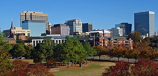
Columbia is the capital city of the U.S. state of South Carolina. With a population of 136,632 at the 2020 census, it is the second-most populous city in South Carolina. The city serves as the county seat of Richland County, and a portion of the city extends into neighboring Lexington County. It is the center of the Columbia, SC Metropolitan Statistical Area, which had an estimated population of 858,302 in 2023, and is the 70th-most populous metropolitan statistical area in the United States. The name Columbia is a poetic term used for the United States, derived from the name of Christopher Columbus, who explored for the Spanish Crown. Columbia is often abbreviated as Cola, leading to its nickname as "Soda City".

<span class="mw-page-title-main">Spartanburg County, South Carolina</span> County in South Carolina, United States

Spartanburg County is a county located on the northwestern border of the U.S. state of South Carolina. As of the 2020 census, the population was 327,997, making it the fifth-most populous county in South Carolina. Its county seat is Spartanburg.

<span class="mw-page-title-main">Pickens County, South Carolina</span> County in South Carolina, United States

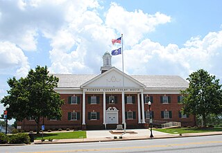
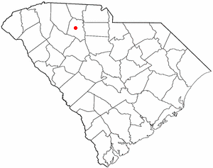
Pickens County is located in the northwest part of the U.S. state of South Carolina. As of the 2020 census, its population was 131,404. Its county seat is Pickens. The county was created in 1826. It is part of the Greenville-Anderson-Greer, SC Metropolitan Statistical Area.

<span class="mw-page-title-main">Greenville County, South Carolina</span> County in South Carolina, United States

Greenville County is located in the U.S. state of South Carolina. As of the 2020 census, the population was 525,534, making it the most populous county in the state. Its county seat is Greenville. The county is also home to the Greenville County School District, the largest school system in South Carolina.

<span class="mw-page-title-main">Anderson County, South Carolina</span> County in South Carolina, United States

Anderson County is a county located in the U.S. state of South Carolina. As of the 2020 census, its population was 203,718. Its county seat is Anderson. Named for Revolutionary War leader Robert Anderson, the county is located in northwestern South Carolina, along the state line of Georgia. Anderson County is included in the Greenville-Anderson-Greer, SC Metropolitan Statistical Area. Anderson County contains 55,950-acre (22,640 ha) Lake Hartwell, a U.S. Army Corps of Engineers lake with nearly 1,000 miles (1,600 km) of shoreline for residential and recreational use. The area is a growing industrial, commercial and tourist center. It is the home of Anderson University, a private, selective comprehensive university of approximately 4,000 undergraduate and graduate students.

<span class="mw-page-title-main">Abbeville County, South Carolina</span> County in South Carolina, United States

Abbeville County is a county located in the U.S. state of South Carolina. As of the 2020 census, its population was 24,295. Its county seat is Abbeville. It is the first county in the United States alphabetically. Abbeville County included in the Greenville-Spartanburg-Anderson, SC Combined Statistical Area.

<span class="mw-page-title-main">Greenville, North Carolina</span> City in North Carolina, United States

Greenville is the county seat and most populous city of Pitt County, North Carolina, United States. It is the principal city of the Greenville, NC Metropolitan Statistical Area, and the 12th-most populous city in North Carolina. Greenville is the health, entertainment, and educational hub of North Carolina's Tidewater and Coastal Plain. As of the 2020 census, there were 87,521 people in the city. The city has continued to see a population increase with a majority of the influx being seen during the 20th and early 21st centuries.

<span class="mw-page-title-main">Gaffney, South Carolina</span> City in South Carolina, United States

Gaffney is a city in and the seat of Cherokee County, South Carolina, United States, in the Upstate region of South Carolina. Gaffney is known as the "Peach Capital of South Carolina". The population was 12,539 at the 2010 census, with an estimated population of 12,609 in 2019. It is the principal city of the Gaffney, South Carolina, Micropolitan Statistical Area, which includes all of Cherokee County and which is further included in the greater Greenville-Spartanburg-Anderson, South Carolina Combined Statistical Area.

Five Forks is a census-designated place (CDP) in Greenville County, South Carolina, United States. The population was 17,737 at the 2020 census, up from 14,140 in 2010, and 8,064 in 2000. It is a growing, affluent suburb of Greenville and is part of the Greenville–Mauldin–Easley Metropolitan Statistical Area.

<span class="mw-page-title-main">Greenville, South Carolina</span> City in South Carolina, United States

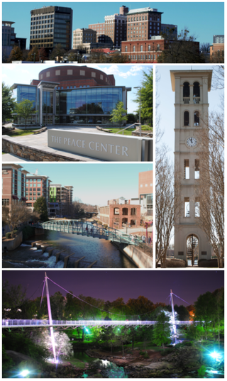
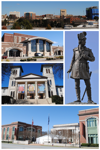
Greenville is a city in and the county seat of Greenville County, South Carolina, United States. With a population of 70,720 at the 2020 census, it is the 6th-most populous city in the state. Greenville is located approximately halfway between Atlanta, Georgia, and Charlotte, North Carolina, along Interstate 85. Its metropolitan area also includes Interstates 185 and 385. Greenville is the anchor city of the Upstate, a combined statistical area with an estimated population of 1,590,636 in 2023. Greenville was the fourth fastest-growing city in the United States between 2015 and 2016, according to the U.S. Census Bureau.

<span class="mw-page-title-main">Mauldin, South Carolina</span> City in South Carolina, United States

Mauldin is a city in Greenville County, South Carolina, United States. The population was 24,724 at the 2020 census, making it the 19th-most populous city in South Carolina. It is located in the Greenville-Anderson-Greer, SC Metropolitan Statistical Area.

<span class="mw-page-title-main">Simpsonville, South Carolina</span> City in South Carolina, United States

Simpsonville is a city in Greenville County, South Carolina, United States. It is part of the Greenville, SC Metropolitan Statistical Area. The population was 23,354 at the 2020 census, up from 18,238 in the 2010 census. Simpsonville is part of the "Golden Strip", along with Mauldin and Fountain Inn, an area which is noted for having low unemployment due to a diversity of industries including H.B. Fuller, KEMET, Sealed Air and Milliken. It is the 23rd-most populous city in South Carolina.

<span class="mw-page-title-main">Greenwood, South Carolina</span> City in South Carolina, United States

Greenwood is a city in and the county seat of Greenwood County, South Carolina. The population in the 2020 United States Census was 22,545 down from 23,222 at the 2010 census. The city is home to Lander University.

<span class="mw-page-title-main">Easley, South Carolina</span> City in South Carolina, United States

Easley is a city in Pickens County in the U.S. state of South Carolina. Most of the city lies in Pickens County, with a small portion of the city in Anderson County.

<span class="mw-page-title-main">Pickens, South Carolina</span> City in South Carolina, United States

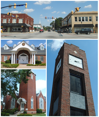
Pickens, formerly called Pickens Courthouse, is a city in and the county seat of Pickens County, South Carolina, United States. The population was 3,126 at the 2010 census. Pickens changed its classification from a town to a city in 1998, but it was not reported to the Census Bureau until 2001. It was named after Andrew Pickens (1739–1817), an American revolutionary soldier and US Congressman for South Carolina.

<span class="mw-page-title-main">Spartanburg, South Carolina</span> City in South Carolina

Spartanburg is a city in and the seat of Spartanburg County, South Carolina, United States. The city had a population of 38,732 as of the 2020 census, making it the 11th-most populous city in the state. For a time, the Office of Management and Budget (OMB) grouped Spartanburg and Union counties together as the Spartanburg, SC Metropolitan Statistical Area, but the OMB now defines the Spartanburg, SC MSA as only Spartanburg County.

<span class="mw-page-title-main">Sumter, South Carolina</span> City in Sumter County, South Carolina, United States

Sumter is a city in and the county seat of Sumter County, South Carolina, United States. The city makes up the Sumter, SC Metropolitan Statistical Area. Sumter County, along with Clarendon and Lee counties, form the core of Sumter–Lee–Clarendon tri-county area of South Carolina that includes three counties straddling the border of the Sandhills, Pee Dee, and Lowcountry regions. The population was 43,463 at the 2020 census, making it the 9th-most populous city in the state.

<span class="mw-page-title-main">Union, South Carolina</span> City in South Carolina, United States

The city of Union is the county seat of Union County, South Carolina, United States. The population was 8,393 at the 2010 census. It is the principal city of the Union Micropolitan Statistical Area, which includes all of Union County and which is further included in the greater Greenville-Spartanburg-Anderson, South Carolina Combined Statistical Area.

<span class="mw-page-title-main">Clemson, South Carolina</span> City in South Carolina, United States

Clemson is a city in Pickens and Anderson counties in the U.S. state of South Carolina. Clemson is home to Clemson University; in 2015, the Princeton Review cited the town of Clemson as ranking #1 in the United States for "town-and-gown" relations with its resident university. The population of the city was 17,681 at the 2020 census.

<span class="mw-page-title-main">Greer, South Carolina</span> City in South Carolina, United States

Greer is a city in Greenville and Spartanburg counties in the U.S. state of South Carolina. The population was 35,308 as of the 2020 census, making it the 14th-most populous city in South Carolina. Greer is included in the Greenville-Anderson-Greer, SC Metropolitan Statistical Area, which is part of the Greenville-Spartanburg-Anderson, SC Combined Statistical Area in Upstate South Carolina.

References

  1. "About". www.cityofandersonsc.com. May 17, 2016. Archived from the original on March 11, 2023. Retrieved March 11, 2023.
  2. 1 2 "ArcGIS REST Services Directory". United States Census Bureau. Archived from the original on February 13, 2023. Retrieved October 15, 2022.
  3. 1 2 U.S. Geological Survey Geographic Names Information System: Anderson, South Carolina
  4. 1 2 "Census Population API". United States Census Bureau. Archived from the original on February 13, 2023. Retrieved October 15, 2022.
  5. United States Census Bureau (December 29, 2022). "2020 Census Qualifying Urban Areas and Final Criteria Clarifications". Federal Register. Archived from the original on December 30, 2022. Retrieved January 30, 2023.
  6. "Find a County". National Association of Counties. Archived from the original on May 31, 2011. Retrieved June 7, 2011.
  7. 1 2 "QuickFacts: Anderson city, South Carolina". United States Census Bureau. Archived from the original on February 14, 2024. Retrieved August 2, 2022.
  8. "OMB Bulletin No. 23-01: Revised Delineations of Metropolitan Statistical Areas, Micropolitan Statistical Areas, and Combined Statistical Areas, and Guidance on Uses of the Delineations of These Areas" (PDF). United States Office of Management and Budget . July 21, 2023. Archived (PDF) from the original on July 21, 2023. Retrieved August 10, 2023.
  9. 1 2 "Metropolitan and Micropolitan Statistical Areas Population Totals: 2020-2023". United States Census Bureau, Population Division. March 14, 2024. Retrieved March 15, 2024.
  10. "Johnson Female Seminary". The Abbeville Banner. January 29, 1851. Archived from the original on November 20, 2016. Retrieved November 20, 2016.
  11. "Area schools affected by Civil War". Independent Mail. July 5, 2014. Archived from the original on November 20, 2016. Retrieved November 20, 2016.
  12. "History of Anderson, South Carolina". u-s-history.com. Archived from the original on August 10, 2016. Retrieved February 9, 2016.
  13. "Anderson: "The Electric City"". Archived from the original on February 15, 2016. Retrieved February 9, 2016.
  14. "The South Carolina man who put the electric in "The Electric City"". Appalachianhistory.net. Archived from the original on November 20, 2016. Retrieved November 20, 2016.
  15. "Portman Dam and Power Plant Historical Marker". www.hmdb.org. Archived from the original on November 6, 2022. Retrieved November 6, 2022.
  16. "Anderson University - Anderson, South Carolina". Sciway.net. Archived from the original on November 21, 2016. Retrieved November 20, 2016.
  17. "institutions-sacscoc". sacscoc.org. Archived from the original on July 7, 2023. Retrieved July 7, 2023.
  18. "Anderson University Celebrates Highest Enrollment in its 111-Year History". Andersonuniversity.edu. Archived from the original on July 7, 2023. Retrieved July 7, 2023.
  19. "Census of Population and Housing". Census.gov. Archived from the original on April 26, 2015. Retrieved June 4, 2015.
  20. "Explore Census Data". data.census.gov. Archived from the original on December 14, 2021. Retrieved December 14, 2021.
  21. "U.S. Census website". United States Census Bureau. Archived from the original on December 3, 2021. Retrieved January 31, 2008.
  22. "Glen Raven expanding Anderson County Sunbrella® manufacturing center". South Carolina Department of Commerce. Archived from the original on July 22, 2021. Retrieved July 22, 2021.
  23. "Manufacturing in Anderson County - Anderson Area Chamber of Commerce - Anderson, SC, SC". www.andersonscchamber.com. Archived from the original on November 6, 2022. Retrieved November 6, 2022.
  24. "Plastic Omnium expanding operations in Anderson County | South Carolina Department of Commerce". www.sccommerce.com. Archived from the original on November 6, 2022. Retrieved November 6, 2022.
  25. "South Carolina libraries and archives". SCIWAY. Archived from the original on June 7, 2019. Retrieved June 7, 2019.
  26. "News – City of Anderson, SC". Cityofandersonsc.com. Archived from the original on June 27, 2014. Retrieved June 26, 2014.
  27. Foster, Kisha (August 17, 2010). "4-Lanes Approved For East-West Connector | WYFF Home - WYFF Home". Wyff4.com. Archived from the original on March 23, 2012. Retrieved June 26, 2014.
  28. "Transit". www.cityofandersonsc.com. February 13, 2018. Archived from the original on October 28, 2023. Retrieved October 28, 2023.
  29. "Transit Time and Fares" (PDF). www.cityofandersonsc.com. February 4, 2016. Archived (PDF) from the original on June 20, 2021. Retrieved October 28, 2023.
  30. "Clemson Area Transit - Anderson Route". Catbus.com. Archived from the original on June 27, 2014. Retrieved June 26, 2014.
  31. "Atlanta to Charlotte Passenger Rail Corridor Investment Plan - Alternatives Development Report". Atlanta, Georgia: Georgia Department of Transportation. October 2015. Retrieved October 19, 2019.
  32. "Henderson, Bruce (October 18, 2019). "High-speed rail could link Charlotte to Atlanta in 2 hours. Have your say next week". The Charlotte Observer. Retrieved October 19, 2019". Archived from the original on November 14, 2020. Retrieved March 11, 2021.
  33. "Piedmont and Northern Railway". Official Guide of the Railways. 78 (12). National Railway Publication Company. May 1946.
  34. "Piedmont and Northern Railway, freight only branch; reporting from June 1, 1947 timetable". Official Guide of the Railways. 80 (11). National Railway Publication Company. April 1948.
  35. "Blue Ridge Railway". Official Guide of the Railways. 82 (3). National Railway Publication Company. August 1949.
  36. "Carolina and Northwestern Railway, 'Belton and Walhalla (Anderson Division)', freight only". Official Guide of the Railways. 84 (7). National Railway Publication Company. December 1951.
  37. Gilbey, Ryan (August 29, 2020). "Chadwick Boseman obituary". The Guardian. Archived from the original on August 29, 2020. Retrieved August 29, 2020.
  38. "Yung Carter's Profile On Beat Making Videos". Archived from the original on June 6, 2017. Retrieved January 30, 2015.
  39. "Former Hanna QB Preston Jones returns to alma mater as receivers coach". independentmail.com. July 19, 2012. Archived from the original on December 19, 2014. Retrieved November 17, 2014.
  40. Who Was Who in America, Historical Volume, 1607-1896. Chicago: Marquis Who's Who. 1963.
  41. Ferber, Lawrence (December 25, 2008). "The Other White Meat". The Advocate . Archived from the original on February 18, 2018. Retrieved June 11, 2023.
  42. "Anderson mayor released from hospital after aneurysm". WRDW-TV . July 12, 2017. Archived from the original on January 17, 2022.
  43. "Negro Leagues Baseball eMuseum: Personal Profiles: "Candy Jim" Taylor". www.nlbemuseum.com. Archived from the original on April 18, 2021. Retrieved August 20, 2020.
  44. "Negro Leagues Baseball eMuseum: Personal Profiles: "Steel Arm Johnny" Taylor". www.nlbemuseum.com. Archived from the original on February 18, 2020. Retrieved August 20, 2020.
  45. "Interactive City Directory". Archived from the original on February 7, 2017. Retrieved February 6, 2017.