Bishopville, South Carolina

Last updated

Bishopville, South Carolina
Bishopville Water Tower.JPG
The water tower in Bishopville
Bishopville, SC Town Seal.jpg
Motto: 
"Small-Town Hospitality at its Best!"
Lee County South Carolina incorporated and unincorporated areas Bishopville highlighted.svg
Location in Lee County and the state of South Carolina.
Coordinates: 34°13′8″N80°14′56″W / 34.21889°N 80.24889°W / 34.21889; -80.24889
Country United States
State South Carolina
County Lee
Government
  MayorBrooks Jackson
Area
[1]
  Total2.37 sq mi (6.14 km2)
  Land2.34 sq mi (6.05 km2)
  Water0.03 sq mi (0.08 km2)
Elevation
226 ft (69 m)
Population
 (2020) [2]
  Total3,024
  Density1,293.97/sq mi (499.53/km2)
Time zone UTC−5 (Eastern (EST))
  Summer (DST) UTC−4 (EDT)
ZIP Code
29010
Area codes 803, 839
FIPS code 45-06310 [3]
GNIS feature ID1220758 [4]
Website cityofbishopvillesc.com

Bishopville is a town in Lee County, South Carolina, United States. The population was 3,471 at the 2010 census. It is the county seat of Lee County. [5]

Contents

Geography

Bishopville is located at 34°13′8″N80°14′56″W / 34.21889°N 80.24889°W / 34.21889; -80.24889 (34.219027, -80.248877) [6] near Lee State Park.

According to the United States Census Bureau, the town has a total area of 2.4 square miles (6.2 km2), of which 2.4 square miles (6.2 km2) is land and 0.04 square miles (0.10 km2) (1.26%) is water.

Major highways

Demographics

Historical population
CensusPop.Note
1880 144
1890 422193.1%
1900 71569.4%
1910 1,659132.0%
1920 2,09026.0%
1930 2,2497.6%
1940 2,99533.2%
1950 3,0762.7%
1960 3,58616.6%
1970 3,404−5.1%
1980 3,4290.7%
1990 3,5603.8%
2000 3,6703.1%
2010 3,471−5.4%
2020 3,024−12.9%
U.S. Decennial Census [2]

2020 census

Bishopville racial composition [7]
RaceNum.Perc.
White (non-Hispanic)75324.9%
Black or African American (non-Hispanic)2,13570.6%
Native American 40.13%
Asian 120.4%
Other/Mixed 862.84%
Hispanic or Latino 341.12%

As of the 2020 United States census, there were 3,024 people, 1,414 households, and 728 families residing in the city.

2000 census

As of the census [3] of 2000, there were 3,670 people, 1,438 households, and 907 families residing in the city. The population density was 1,554.8 inhabitants per square mile (600.3/km2). There were 1,616 housing units at an average density of 684.6 per square mile (264.3/km2). The racial makeup of the city was 65.83% African American, 32.83% White, 0.11% Native American, 0.44% Asian, 0.22% from other races, and 0.57% from two or more races. Hispanic or Latino of any race were 1.31% of the population.

There were 1,438 households, out of which 31.6% had children under the age of 18 living with them, 29.8% were married couples living together, 29.6% had a female householder with no husband present, and 36.9% were non-families. Of all households, 34.2% were made up of individuals, and 16.1% had someone living alone who was 65 years of age or older. The average household size was 2.43 and the average family size was 3.12.

In the city, the population was spread out, with 27.2% under the age of 18, 9.3% from 18 to 24, 24.1% from 25 to 44, 19.9% from 45 to 64, and 19.6% who were 65 years of age or older. The median age was 38 years. For every 100 females, there were 78.3 males. For every 100 females age 18 and over, there were 69.0 males.

The median income for a household in the city was $24,400, and the median income for a family was $37,660. Males had a median income of $31,005 versus $18,635 for females. The per capita income for the city was $16,140. About 23.7% of families and 28.8% of the population were below the poverty line, including 42.7% of those under age 18 and 27.3% of those age 65 or over.

In 2010, Bishopville had the 25th-lowest median household income of all places in the United States with a population over 1,000. [8]

History

Bishopville was known as Singleton's Crossroads for more than a decade before it was renamed in honor of Jacques Bishop. The 465 acres (1.88 km2) of land had been granted to Jacob Chamber by the state of South Carolina in 1786. Daniel Carter later purchased the property and then sold it to William Singleton in 1790.

The tavern owned and operated by Singleton and his wife sat at the intersection of Mecklenburg Road, now Church Street, and McCallum Ferry Road, now Main Street. This tavern was a stop on the stagecoach route between Georgetown and Charlotte. (Now this intersection involves Highway 15, which at one point was the premier north-south route from New York to Miami.) In 1798, William Singleton died, leaving his wife the owner of the tavern until her death in 1820. A year later in 1821, the property was sold to Bishop. During this time period, the area around present-day Bishopville was said to be composed of mostly wilderness, with only a few scattered, primitive houses.

Lee County was created in 1892 with Bishopville its county seat, but Bishopville did not complete building its courthouse and county jail until February 1902. As a result, county boundaries were delimited along Lynches River, Black River, Scape Ore Swamp, Sparrow Swamp, Long Branch, and Screeches Branch following old roads and artificial limits.

On December 15, 1902, Bishopville celebrated its new significance by hosting speeches and shooting off the old cannon in front of the Lee County Courthouse.

Lee County has historically been a leader in cotton production in the state and is the home of the South Carolina Cotton Museum.

In addition to the Lee County Courthouse, the Ashwood School Gymnasium and Auditorium, Bishopville Commercial Historic District, James Carnes House, Dennis High School, Thomas Fraser House, William Apollos James House, The Manor, Mt. Zion Presbyterian Church, William Rogers House, South Main Historic District, Spencer House, and Tall Oaks are listed on the National Register of Historic Places. [9] [10]

Education

Students in Bishopville are served by Lee County Public Schools.

Public schools

Private schools

Library

Bishopville has a lending library, the Lee County Public Library. [11]

Arts and culture

Pearl Fryar's Topiary Garden is located in Bishopville. The 3-acre (12,000 m2) garden is visited annually by many tourists. Fryar and his carefully sculptured topiary garden has been featured many times on television specials and in dozens of magazines. His garden offers 3 acres (12,000 m2) of trees and shrubs formed into fanciful spirals, three-dimensional pieces, pom poms, and other extraordinary shapes. Fryar is known nationally for live topiary sculptures. He's also won many awards as well as being named as South Carolina Ambassador for Economic Development by Mark Sanford in 2003. Fryar revealed that all he wanted was to have a nice yard and win yard of the month from his hometown of Bishopville, SC.

Lee State Park is one of the best-known parks in Lee County. Located at 487 Loop Road in Bishopville, this park host's just about everything from river fishing, boating, nature trails, show ring, and stables. The park also offers educational programs like pine needle basket weaving and owl prowls. Year-round, during daylight hours, the Civilian Conservation Corps (CCC) workers built the Park during the Great Depression. This attractive park is approximately 2,839 acres (11.49 km2) of land. This park offers picnics in shelters and camping. Picnic tables and serene environments are stationed around the 5.6 miles (9.0 km) of Lynches River that's owned by Lee State Park.

The South Carolina Cotton Museum and Lee County Veterans Museum are located next door to each other in Bishopville. The Cotton Museum preserves the history of cotton culture and the legacy of a way of life both long gone and very much a part of the present. [12] The museum has the world's largest boll weevil. [13] The Lee County Veterans Museum was designed, built and furnished by veterans of Lee County. [14] The museum preserves and tells the history of US wars and conflicts, as well as the stories and lives of local veterans.

Monster

This town is known for the alleged sightings of a reptile-like monster, known as "The Lizard Man", near a swamp called Scape Ore Swamp. It has supposedly frightened people and damaged some cars. At one point there was a one million dollar reward for anyone who could find and present "Lizard Man".

Notable people

Related Research Articles

<span class="mw-page-title-main">Williamsburg County, South Carolina</span> County in South Carolina, United States

Williamsburg County is a county located in the U.S. state of South Carolina. As of the 2020 census its population was 31,026. The county seat and largest community is Kingstree. After a previous incarnation of Williamsburg County, the current county was created in 1804.

<span class="mw-page-title-main">Sumter County, South Carolina</span> County in South Carolina, United States

Sumter County is a county located in the U.S. state of South Carolina. As of the 2020 census, the population was 105,556. Its county seat is Sumter.

<span class="mw-page-title-main">Orangeburg County, South Carolina</span> County in South Carolina, United States

Orangeburg County is a county located in the U.S. state of South Carolina. As of the 2020 census, the population was 84,223. Its county seat is Orangeburg. The county was created in 1769.

<span class="mw-page-title-main">Oconee County, South Carolina</span> County in South Carolina, United States

Oconee County is the westernmost county in the U.S. state of South Carolina. As of the 2020 census, the population was 78,607. Its county seat is Walhalla and its largest community is Seneca. Oconee County is included in the Seneca, SC Micropolitan Statistical Area, which is also included in the Greenville-Spartanburg-Anderson, SC Combined Statistical Area. South Carolina Highway 11, the Cherokee Foothills National Scenic Highway, begins in southern Oconee County at Interstate Highway 85 at the Georgia state line.

<span class="mw-page-title-main">Newberry County, South Carolina</span> County in South Carolina, United States

Newberry County is a county located in the U.S. state of South Carolina. As of the 2020 census, its population was 37,719. Its county seat is Newberry. The name is of unknown origin, although one theory suggests that it was named by Quaker settlers in honor of their home of Newberry, a suburb of London in the United Kingdom.

<span class="mw-page-title-main">Lee County, South Carolina</span> County in South Carolina, United States

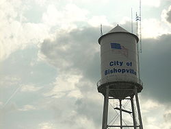
Lee County is a county located in the U.S. state of South Carolina. As of the 2020 census, its population was 16,531, making it the fifth-least populous county in South Carolina. Its county seat is Bishopville.

<span class="mw-page-title-main">Greenwood County, South Carolina</span> County in South Carolina, United States

Greenwood County is a county located in the U.S. state of South Carolina. As of the 2020 census, its population was 69,351. Its county seat is Greenwood.

<span class="mw-page-title-main">Fairfield County, South Carolina</span> County in South Carolina, United States

Fairfield County is a county located in the U.S. state of South Carolina. As of the 2020 census, its population was 20,948. Its county seat is Winnsboro.

<span class="mw-page-title-main">Dillon County, South Carolina</span> County in South Carolina, United States

Dillon County is a county located in the U.S. state of South Carolina. As of the 2020 census, the county's population was 28,292. The county seat is Dillon.

<span class="mw-page-title-main">Darlington County, South Carolina</span> County in South Carolina, United States

Darlington County is a county in the U.S. state of South Carolina. As of the 2020 census, its population was 62,905. Its county seat is Darlington. Hartsville is the largest community in the county. Darlington County is home to the Darlington Raceway, which hosts the annual NASCAR Southern 500. Darlington County is also home to Coker College in Hartsville. Darlington County was named by an act in March 1785.

<span class="mw-page-title-main">Clarendon County, South Carolina</span> County in South Carolina, United States

Clarendon County is a county located below the fall line in the Coastal Plain region of U.S. state of South Carolina. As of the 2020 census, its population was 31,144. Its county seat is Manning.

<span class="mw-page-title-main">Chesterfield County, South Carolina</span> County in South Carolina, United States

Chesterfield County is a county located in the U.S. state of South Carolina. As of the 2020 census, its population was 43,273. Its county seat is Chesterfield. The largest community in the county is Cheraw. It is located north of the Midlands, in the Pee Dee region, on its border with North Carolina.

<span class="mw-page-title-main">Chester County, South Carolina</span> County in South Carolina, United States

Chester County is a county located in the U.S. state of South Carolina. As of the 2020 census, its population was 32,294. Its county seat is Chester.

<span class="mw-page-title-main">Calhoun County, South Carolina</span> County in South Carolina, United States

Calhoun County is a county in the U.S. state of South Carolina. As of the 2020 census, its population was 14,119, making it the third-least populous county in the state. Its county seat is St. Matthews. In terms of land area, it is also the smallest county in the state.

<span class="mw-page-title-main">Randleman, North Carolina</span> City in North Carolina, United States

Randleman is a city in Randolph County, North Carolina, United States. The population was 4,113 at the 2010 census. It is the home of NASCAR's Petty family, the Victory Junction Gang Camp and was the location of the Richard Petty Museum from 2003 to 2014.

<span class="mw-page-title-main">Winnsboro, South Carolina</span> Town in South Carolina, United States

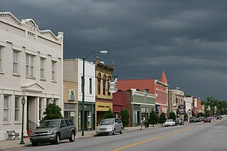
Winnsboro is a town in Fairfield County, South Carolina, United States. The population was 3,550 at the 2010 census. The population was 3,215 at the 2020 census, a population decrease of approximately 9.5% for the same 10 year period. It is the county seat of Fairfield County. Winnsboro is part of the Columbia, South Carolina metropolitan Area as well as a suburb of Columbia.

<span class="mw-page-title-main">Greenwood, South Carolina</span> City in South Carolina, United States

Greenwood is a city in and the county seat of Greenwood County, South Carolina. The population in the 2020 United States Census was 22,545 down from 23,222 at the 2010 census. The city is home to Lander University.

<span class="mw-page-title-main">Marion, South Carolina</span> City in South Carolina, United States

Marion is a city in and the county seat of Marion County, South Carolina, United States. It is named for Francis Marion, a brigadier general from South Carolina in the American Revolutionary War. The population was 6,939 at the 2010 census.

<span class="mw-page-title-main">Westminster, South Carolina</span> City in South Carolina, United States

Westminster is a city in Oconee County, South Carolina, United States. The population was 2,418 at the 2010 census.

<span class="mw-page-title-main">Woodruff, South Carolina</span> City in South Carolina, United States

Woodruff is a city in Spartanburg County, South Carolina, United States, located in upstate South Carolina. The population was 4,333 at the 2020 census.

References

  1. "ArcGIS REST Services Directory". United States Census Bureau. Retrieved October 15, 2022.
  2. 1 2 "Census Population API". United States Census Bureau. Retrieved October 15, 2022.
  3. 1 2 "U.S. Census website". United States Census Bureau . Retrieved January 31, 2008.
  4. "US Board on Geographic Names". United States Geological Survey. October 25, 2007. Retrieved January 31, 2008.
  5. "Find a County". National Association of Counties. Archived from the original on May 31, 2011. Retrieved June 7, 2011.
  6. "US Gazetteer files: 2010, 2000, and 1990". United States Census Bureau. February 12, 2011. Retrieved April 23, 2011.
  7. "Explore Census Data". data.census.gov. Retrieved December 14, 2021.
  8. "US Census". Factfinder2.census.gov. Archived from the original on February 12, 2020. Retrieved January 18, 2014.
  9. "National Register Information System". National Register of Historic Places . National Park Service. July 9, 2010.
  10. "National Register of Historic Places Listings". Weekly List of Actions Taken on Properties: 5/23/11 through 5/27/11. National Park Service. June 3, 2011.
  11. "South Carolina libraries and archives". SCIWAY. Retrieved June 8, 2019.
  12. "Archived copy". Archived from the original on June 10, 2013. Retrieved August 27, 2013.{{cite web}}: CS1 maint: archived copy as title (link)
  13. "South Carolina Cotton Museum". Sccotton.org. Retrieved April 14, 2016.
  14. "South Carolina Cotton Museum". Sccotton.org. Retrieved April 14, 2016.

Further reading