Bamberg, South Carolina

Last updated

Bamberg, South Carolina
General Francis Marion Bamberg House.jpg
Bamberg, SC City Seal.png
Nickname: 
The Berg
Motto: 
"It's a great day in Bamberg County!"
USA South Carolina location map.svg
Red pog.svg
Bamberg
Location of Bamberg in South Carolina
Coordinates: 33°17′54″N81°1′55″W / 33.29833°N 81.03194°W / 33.29833; -81.03194
CountryUnited States
State South Carolina
County Bamberg
Named for William Seaborn Bamberg
Government
  MayorNancy Foster
Area
[1]
  Total3.60 sq mi (9.31 km2)
  Land3.58 sq mi (9.26 km2)
  Water0.02 sq mi (0.05 km2)
Elevation
[2]
164 ft (50 m)
Population
 (2020) [3]
  Total3,076
  Density860.42/sq mi (332.23/km2)
Time zone UTC-5 (Eastern (EST))
  Summer (DST) UTC-4 (EDT)
ZIP code
29003
Area codes 803, 839
FIPS code 45-03790 [4]
GNIS feature ID1244955 [2]
Website bambergsc.com

Bamberg is a city in and the county seat of Bamberg County, South Carolina, United States. [5] [6] The population was 3,607 at the 2010 census. [4]

Contents

History

Bamberg is named after early resident William Seaborn Bamberg. Members of the Bamberg family continue to live in the county to this day. The Bamberg City Hall, Bamberg Historic District, Bamberg Post Office, Gen. Francis Marion Bamberg House, Cal Smoak Site, and Woodlands are listed on the National Register of Historic Places. [7]

Geography

Bamberg is located at 33°17′54″N81°1′55″W / 33.29833°N 81.03194°W / 33.29833; -81.03194 (33.298440, -81.031903). [8]

According to the United States Census Bureau, the city has a total area of 3.6 square miles (9.3 km2), of which 0.012 square miles (0.03 km2), or 0.34%, is water. [9]

Major highways

Demographics

Historical population
CensusPop.Note
1880 648
1890 6967.4%
1900 1,533120.3%
1910 1,93726.4%
1920 2,21014.1%
1930 2,45010.9%
1940 3,00022.4%
1950 2,954−1.5%
1960 3,0814.3%
1970 3,40610.5%
1980 3,6727.8%
1990 3,8434.7%
2000 3,733−2.9%
2010 3,607−3.4%
2020 3,076−14.7%
U.S. Decennial Census [3]

2020 census

Bamberg racial composition [10]
RaceNum.Perc.
White (non-Hispanic)1,15637.58%
Black or African American (non-Hispanic)1,77057.54%
Native American 100.33%
Asian 230.75%
Other/Mixed 933.02%
Hispanic or Latino 240.78%

As of the 2020 United States census, there were 3,076 people, 1,311 households, and 684 families residing in the town.

2000 census

As of the census [4] of 2000, there were 3,733 people, 1,383 households, and 923 families residing in the city. The population density was 1,058.1 inhabitants per square mile (408.5/km2). There were 1,537 housing units at an average density of 435.6 per square mile (168.2/km2). The racial makeup of the city was 45.22% White, 53.58% African American, 0.21% Native American, 0.32% Asian, 0.11% from other races, and 0.56% from two or more races. Hispanic or Latino people of any race were 0.48% of the population.

There were 1,383 households, out of which 31.0% had children under the age of 18 living with them, 38.2% were married couples living together, 25.5% had a female householder with no husband present, and 33.2% were non-families. 30.9% of all households were made up of individuals, and 15.5% had someone living alone who was 65 years of age or older. The average household size was 2.45 and the average family size was 3.03.

In the city, the population was spread out, with 25.7% under the age of 18, 12.6% from 18 to 24, 23.4% from 25 to 44, 21.1% from 45 to 64, and 17.3% who were 65 years of age or older. The median age was 36 years. For every 100 females, there were 82.5 males. For every 100 females age 18 and over, there were 74.8 males.

The median income for a household in the city was $21,736, and the median income for a family was $28,309. Males had a median income of $38,068 versus $20,815 for females. The per capita income for the city was $13,512. About 21.4% of families and 28.3% of the population were below the poverty line, including 37.2% of those under age 18 and 18.9% of those age 65 or over.

Education

Public education in Bamberg is administered by Bamberg County School District, which has included all of the county since 2022. [11] The district operates Richard Carroll Elementary School, Bamberg-Ehrhardt Middle School and Bamberg-Ehrhardt High School.

Prior to 2022, Bamberg was in Bamberg School District One. [12]

Bamberg has a public library, a branch of the ABBE Regional Library System. [13]

Notable people

Climate

The climate in this area is characterized by relatively high temperatures and evenly distributed precipitation throughout the year. According to the Köppen Climate Classification system, Bamberg has a humid subtropical climate, abbreviated "Cfa" on climate maps. [22]

Climate data for Bamberg, South Carolina
MonthJanFebMarAprMayJunJulAugSepOctNovDecYear
Mean daily maximum °C (°F)14
(58)
17
(62)
21
(70)
26
(78)
29
(84)
32
(89)
33
(92)
32
(90)
29
(85)
24
(76)
20
(68)
16
(60)
24
(76)
Mean daily minimum °C (°F)2
(35)
3
(38)
7
(44)
11
(51)
15
(59)
19
(66)
21
(70)
21
(69)
18
(64)
12
(53)
7
(44)
3
(37)
12
(53)
Average precipitation mm (inches)99
(3.9)
99
(3.9)
110
(4.3)
79
(3.1)
94
(3.7)
130
(5.2)
130
(5)
130
(5.3)
100
(4.1)
71
(2.8)
64
(2.5)
84
(3.3)
1,200
(47.1)
Source: Weatherbase [23]

Related Research Articles

<span class="mw-page-title-main">Hampton County, South Carolina</span> County in South Carolina, United States

Hampton County is a rural county located in the U.S. state of South Carolina. As of the 2020 census, the population was 18,561. Its county seat is Hampton. It was named for Confederate Civil War general Wade Hampton, who in the late 1870s, with the ending of Reconstruction, was elected as governor of South Carolina.

<span class="mw-page-title-main">Darlington County, South Carolina</span> County in South Carolina, United States

Darlington County is a county in the U.S. state of South Carolina. As of the 2020 census, its population was 62,905. Its county seat is Darlington. Hartsville is the largest community in the county. Darlington County is home to the Darlington Raceway, which hosts the annual NASCAR Southern 500. Darlington County is also home to Coker College in Hartsville. Darlington County was named by an act in March 1785.

<span class="mw-page-title-main">Bamberg County, South Carolina</span> County in South Carolina, United States

Bamberg County is a county located in the southwestern portion of U.S. state of South Carolina. As of the 2020 census, the population was 13,311, making the rural county the fourth-least populous of any in South Carolina. Its county seat is Bamberg.

<span class="mw-page-title-main">Longford, Kansas</span> City in Clay County, Kansas

Longford is a city in Clay County, Kansas, United States. As of the 2020 census, the population of the city was 73.

<span class="mw-page-title-main">Bardwell, Kentucky</span> City in Kentucky, United States

Bardwell is a home rule-class city in and the county seat of Carlisle County, Kentucky, United States. The city was formally incorporated by the state assembly in 1878. The population was 714 at the 2020 census, down from 723 in 2010. Bardwell is included in the Paducah, KY-IL Metropolitan Statistical Area.

<span class="mw-page-title-main">Taylorsville, Kentucky</span> City in Kentucky, United States

Taylorsville is a home rule-class city in Spencer County, Kentucky, United States. It is the county seat of Spencer County. As of the 2020 census, the city had a total population of 1,256. It was incorporated in 1829.

<span class="mw-page-title-main">Shongaloo, Louisiana</span> City in Louisiana, United States

Shongaloo is a village in Webster Parish, Louisiana, United States.

<span class="mw-page-title-main">Fraser, Michigan</span> City in Michigan, United States

Fraser is a city in Macomb County in the U.S. state of Michigan. A northern suburb of Detroit, Fraser is located roughly 15 miles (24.1 km) northeast of downtown Detroit. As of the 2020 census, the city had a population of 14,726.

<span class="mw-page-title-main">Albion, Nebraska</span> City in Nebraska, United States

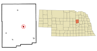
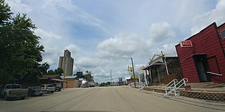
Albion is a city in and the county seat of Boone County, Nebraska, United States. The population was 1,650 at the 2010 census.

<span class="mw-page-title-main">Smithfield, North Carolina</span> Town in North Carolina, United States

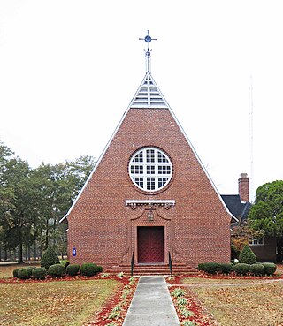
Smithfield is a town in and the county seat of Johnston County, North Carolina, United States. As of the 2010 census, its population was 10,966, and in 2019 the estimated population was 12,985. Smithfield is home to the Ava Gardner Museum and is situated along the Neuse River, where visitors enjoy the annual Smithfield Ham and Yam Festival, walks along the Buffalo Creek Greenway, and the historic downtown district. The town is located near North Carolina's Research Triangle and is about 30 miles (48 km) southeast of downtown Raleigh. The Raleigh-Durham-Cary combined statistical area has a population over 2 million residents.

<span class="mw-page-title-main">Brevard, North Carolina</span> City in North Carolina, United States

Brevard is a city and the county seat of Transylvania County, North Carolina, United States, with a population of 7,609 as of the 2010 census.

<span class="mw-page-title-main">Denmark, South Carolina</span> City in South Carolina, United States

Denmark is a city in Bamberg County, South Carolina, United States. The population at the 2010 census is 3,538.

<span class="mw-page-title-main">Ehrhardt, South Carolina</span> Town in South Carolina, United States

Ehrhardt is a town in Bamberg County, South Carolina, United States. As of the 2010 census, the town population was 545.

<span class="mw-page-title-main">Govan, South Carolina</span> Town in South Carolina, United States

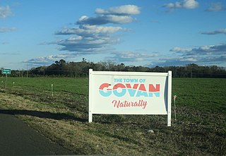
Govan is a town in Bamberg County, South Carolina, United States. The population was 65 at the 2010 census.

<span class="mw-page-title-main">Olar, South Carolina</span> Town in South Carolina, United States

Olar is a town in Bamberg County, South Carolina, United States. The population was 257 at the 2010 census.

<span class="mw-page-title-main">Walhalla, South Carolina</span> City in South Carolina, United States

Walhalla is a city in the foothills of the Blue Ridge Mountains in Oconee County, South Carolina. Designated in 1868 as the county seat, it lies within the area of the Blue Ridge Escarpment, an area of transition between mountains and piedmont, and contains numerous waterfalls. It is located 16 miles (26 km) from Clemson University in Clemson, South Carolina.

<span class="mw-page-title-main">Orangeburg, South Carolina</span> City in South Carolina, United States

Orangeburg, also known as The Garden City, is the principal city in and the county seat of Orangeburg County, South Carolina, United States. The population of the city was 13,964 according to the 2020 census. The city is located 37 miles southeast of Columbia, on the north fork of the Edisto River.

<span class="mw-page-title-main">Wessington Springs, South Dakota</span> Town in South Dakota, United States

Wessington Springs is a town in central Jerauld County, South Dakota, United States. The population was 956 at the 2010 census. It is the county seat of Jerauld County.

<span class="mw-page-title-main">Waelder, Texas</span> City in Texas, United States

Waelder is a city in Gonzales County, Texas, United States and is also part of the Texas-German belt. The population was 933 at the 2020 census.

<span class="mw-page-title-main">North Augusta, South Carolina</span> City in South Carolina, United States

North Augusta is a city in Aiken and Edgefield counties in the U.S. state of South Carolina, on the north bank of the Savannah River. It lies directly across the river, and state border, from Augusta, Georgia. The population was 24,379 at the 2020 census, making it the 21st-most populous city in South Carolina. The city is included in the Central Savannah River Area (CSRA) and is part of the Augusta, Georgia, metropolitan area.

References

  1. "ArcGIS REST Services Directory". United States Census Bureau. Retrieved October 15, 2022.
  2. 1 2 U.S. Geological Survey Geographic Names Information System: Bamberg, South Carolina
  3. 1 2 "Census Population API". United States Census Bureau. Retrieved October 15, 2022.
  4. 1 2 3 "U.S. Census website". United States Census Bureau . Retrieved January 31, 2008.
  5. "Find a County". National Association of Counties. Archived from the original on May 31, 2011. Retrieved June 7, 2011.
  6. Municipal Information Directory Archived 2009-01-03 at the Wayback Machine , Municipal Association of South Carolina.
  7. "National Register Information System". National Register of Historic Places . National Park Service. July 9, 2010.
  8. "US Gazetteer files: 2010, 2000, and 1990". United States Census Bureau. February 12, 2011. Retrieved April 23, 2011.
  9. "Geographic Identifiers: 2010 Demographic Profile Data (G001): Bamberg town, South Carolina". U.S. Census Bureau, American Factfinder. Archived from the original on February 12, 2020. Retrieved April 2, 2014.
  10. "Explore Census Data". data.census.gov. Retrieved December 14, 2021.
  11. Gleaton, Dionne (January 29, 2023). "PROGRESS/AUGUST 2022: Bamberg County brings school districts together". The Times and Democrat . Retrieved May 31, 2024.
  12. "2020 CENSUS - SCHOOL DISTRICT REFERENCE MAP: Bamberg County, SC" (PDF). U.S. Census Bureau . Retrieved May 31, 2024. - Text list
  13. "South Carolina libraries and archives". SCIWAY. Retrieved June 7, 2019.
  14. "South Carolina Governor Nikki R. Haley". National Governors Association. January 12, 2011. Retrieved October 11, 2020.
  15. McCammon, Sarah (February 19, 2023). "A visit to Nikki Haley's hometown — where division 'still exists'". NPR Weekend Edition Sunday . Retrieved February 21, 2023.
  16. "Mickey Pruitt". databaseFootball.com. Archived from the original on October 15, 2012. Retrieved December 21, 2012.
  17. "Ricky Sapp #7". Clemson Rivals. Retrieved December 21, 2012.
  18. "Rodney Wallace HS Wrestling" . Retrieved January 1, 2014.
  19. "Rodney Wallace MMA Bio" . Retrieved January 1, 2014.
  20. "Mookie Wilson Stats". Baseball Almanac. Retrieved December 21, 2012.
  21. "Preston Wilson Stats". Baseball Almanac. Retrieved December 21, 2012.
  22. Climate Summary for Bamberg, South Carolina
  23. "Weatherbase.com". Weatherbase. 2013. Retrieved on September 19, 2013