Related Research Articles

Greenwood County is a county located in the U.S. state of South Carolina. As of the 2020 census, its population was 69,351. Its county seat is Greenwood.

Greenville County is located in the state of South Carolina, in the United States. As of the 2020 census, the population was 525,534, making it the most populous county in the state. Its county seat is Greenville. The county is also home to the Greenville County School District, the largest school system in South Carolina. County government is headquartered at Greenville County Square.
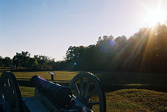
Ninety Six is a town in Greenwood County, South Carolina, United States. The population was 1,998 at the 2010 census.

The Upstate is the region in the westernmost part of South Carolina, United States, also known as the Upcountry, which is the historical term. Although loosely defined among locals, the general definition includes the 10 counties of the commerce-rich I-85 corridor in the northwest corner of South Carolina. This definition coincided with the Greenville–Spartanburg–Anderson, SC combined statistical area, as first defined by the Office of Management and Budget (OMB) in 2015. In 2018, the OMB redefined the CSA such that it no longer included Abbeville County. That definition remains as of 2020.
The Augusta and Knoxville Railroad (A&K) was a railroad company that operated on 66 miles (106 km) of track between Augusta, Georgia, and Greenwood, South Carolina, from 1882 to 1886. It was merged with three other companies to form the Port Royal and Western Carolina Railway, which was reorganized in 1896 as the Charleston and Western Carolina Railway.

The Saluda River is a principal tributary of the Congaree River, about 200 mi (320 km) long, in northern and western South Carolina in the United States. Via the Congaree River, it is part of the watershed of the Santee River, which flows to the Atlantic Ocean.

Piedmont Technical College is a public community college with its main campus in Greenwood, South Carolina. It serves seven counties in the Lakelands region of South Carolina. Six additional County Centers also serve students in Abbeville County, Edgefield County, Laurens County, McCormick County, Newberry County, and Saluda County. Piedmont Technical College serves the largest geographic area of any institution in the South Carolina Technical College System. The college was founded in 1966.
The Enoree River is a tributary of the Broad River, 85 mi (137 km) long, in northwestern South Carolina in the United States. Via the Broad and Congaree Rivers, it is part of the watershed of the Santee River, which flows to the Atlantic Ocean.

The Episcopal Diocese of Upper South Carolina (EDUSC) is a diocese in the Episcopal Church.

The 3rd congressional district of South Carolina is a congressional district in western South Carolina bordering both Georgia and North Carolina. It includes all of Abbeville, Anderson, Edgefield, Greenwood, Laurens, McCormick, Oconee, Pickens and Saluda counties and portions of Greenville and Newberry counties. The district is mostly rural, but much of the economy revolves around the manufacturing centers of Anderson and Greenwood.

There are currently seven United States congressional districts in South Carolina. There have been as few as four and as many as nine congressional districts in South Carolina. The 9th district and the 8th district were lost after the 1840 census. The 5th district and the 6th district were also briefly lost after the Civil War, but both had been regained by the 1880 census. Because of the state population growth in the 2010 census, South Carolina regained its 7th district, which had remained unused since the Civil War.

The Sumter National Forest is one of two forests in South Carolina that are managed together by the United States Forest Service, the other being the Francis Marion National Forest. The Sumter National Forest consists of 370,442 acres (1,499.13 km2) which are divided into 3 distinct sections in western and central South Carolina. The Enoree Ranger District is the largest, comprising roughly 170,000 acres in Chester, Fairfield, Laurens, Newberry, and Union counties. Next is the Long Cane Ranger District, comprising about 120,000 acres in Abbeville, Edgefield, Greenwood, McCormick, and Saluda counties. The smallest district is the Andrew Pickens Ranger District comprising over 85,000 acres which lies entirely in Oconee county and is part of the Appalachian Mountains. Forest headquarters of both South Carolina forests are located together in the state's capital city of Columbia.
The Treaty of Lochaber was signed in South Carolina on 18 October 1770 by British representative John Stuart and the Cherokee people, fixing the boundary for the western limit of the colonial frontier settlements of Virginia and North Carolina.

Pendleton District, named after US Judge Henry Pendleton, is a former judicial district in South Carolina. It existed as a county or a district from 7 March 1789 to 20 December 1826.
Washington District is a former judicial district in South Carolina. It existed as a district from 19 February 1791 to 1 January 1800. The court house and jail for Washington District were in Pickensville, South Carolina.

The 2008 South Carolina Senate elections were held on Tuesday, November 4, 2008. The primary elections were held on June 10 and the runoff elections were held two weeks later on June 24. The current composition of the state delegation is 27 Republicans and 19 Democrats. Senators are elected for four-year terms, all in the same year.
Barrett v. United States, 169 U.S. 218 (1898), was a case in which the Supreme Court of the United States held that South Carolina had never effectively been subdivided into separate judicial districts. Therefore, it was held, a criminal defendant allegedly tried in one district for a crime committed in the other had in fact been permissibly been tried in a separate division of a single district.

The South Carolina Circuit Court is the state court of general jurisdiction of the U.S. state of South Carolina. It consists of a civil division and a criminal division.
References
- ↑ Edgar, Walter, ed. The South Carolina Encyclopedia, University of South Carolina Press, 2006, pp. 230-234, ISBN 1-57003-598-9
- ↑ South Carolina Department of Archives and History maps. Archived August 19, 2007, at the Wayback Machine
- ↑ "Lochaber Plantation - Long Cane, Abbeville County, South Carolina SC".
- ↑ "Districts and Counties, 1785". State of South Carolina. Archived from the original on April 6, 2006. Retrieved 2007-12-02.
- ↑ "Districts, 1791-1799". State of South Carolina. Archived from the original on April 6, 2006. Retrieved 2007-12-02.
- ↑ "Districts and Counties, 1791-1799". State of South Carolina. Archived from the original on April 6, 2008. Retrieved 2007-12-02.
- ↑ DenBoer, Gordon, and Thorne, Kathryn Ford, South Carolina Atlas of Historical County Boundaries, Charles Scribner's Sons, New York, 1997, p. 168, ISBN 0-13-366360-4.
- ↑ "Districts, 1800-1814". State of South Carolina. Archived from the original on July 9, 2001. Retrieved 2007-12-02.
- ↑ Who Was Who in America, Historical Volume, 1607-1896. Chicago: Marquis Who's Who. 1963.
- ↑ "Who We Are". The Old 96 District. Retrieved 21 March 2022.