Jefferson, South Carolina

Last updated

Jefferson, South Carolina
Jefferson sc water tower.jpg
Water tower, 2011
Nickname: 
"J-Town"
Motto: 
“A small town with big city dreams”
SCMap-doton-Jefferson.PNG
Location of Jefferson, South Carolina
Coordinates: 34°39′6″N80°23′22″W / 34.65167°N 80.38944°W / 34.65167; -80.38944
CountryUnited States
State South Carolina
County Chesterfield
Incorporated 1904
Government
  TypeCouncil
  MayorJames Miller
  Mayor Pro-TemJane Johnson
Area
[1]
  Total1.81 sq mi (4.68 km2)
  Land1.80 sq mi (4.67 km2)
  Water0.01 sq mi (0.01 km2)
Elevation
476 ft (145 m)
Population
 (2020) [2]
  Total772
  Density428.41/sq mi (165.40/km2)
Time zone UTC−5 (Eastern (EST))
  Summer (DST) UTC−4 (EDT)
ZIP code
29718
Area code(s) 843, 854
FIPS code 45-36610 [3]
GNIS feature ID1223522 [4]
Website http://www.seejeffersonsc.com
A drone view of Jefferson Jefferson sc town drone.jpg
A drone view of Jefferson

Jefferson is a town in western Chesterfield County, South Carolina, United States at the junction of SC routes 265 and 151. [5] Jefferson is located in the Piedmont region of South Carolina just in the edge meeting the Sandhills region. Jefferson is located 16 miles northwest of McBee, 8 miles south of Pageland, 50 miles southeast of Charlotte, North Carolina, and 70 miles north-northeast of the state capitol Columbia. As of the 2010 census, the city population was 753. [6]

Contents

History

Jefferson was incorporated in 1904. [7] Jefferson was founded in the 1760 by the Miller Family, and was named Millersville. You can find many Millers buried at the Miller family cemetery on main street.

On April 14, 2020, a local turkey farm reported a case of Influenza A virus subtype H7N3 which resulted in the euthaniztion of 32,000 turkeys. [8]

Geography and climate

Jefferson is located at 34°39′6″N80°23′22″W / 34.65167°N 80.38944°W / 34.65167; -80.38944 (34.651550, -80.389484). [9] According to the United States Census Bureau, the town has a total area of 1.8 square miles (4.7 km2), of which 1.8 square miles (4.7 km2) is land and 0.56% is water.

Neighboring towns

Brewer Gold Mine

The Brewer Gold Mine is an abandoned mine located on the western border of Chesterfield County, about 1.5 miles due west of the town of Jefferson, South Carolina. Brewer Gold Company owns approximately 1,000 acres of land along a small north-south ridgeline that divides Little Fork Creek and the Lynches River. About one-quarter of the 1,000 acres has been disturbed by mining operations. Brewer Gold Mine was one of the oldest and most productive gold mines in the eastern United States.

Activities at Brewer are rumored to date to the 16th century involving Indian trade with the Spaniards. Before the Revolutionary War, the area was mined for iron. The first documented discovery of gold took place by Burrell Brewer in 1828. Brewer Gold Company, a subsidiary owned by the British Costain Limited Group (Costain), secured ownership of the mine in 1986, with the first gold production occurring in August 1987. Ore was mined using conventional open pit methods until January 1995. Rock was first fractured using drilling and blasting, and then loaded into trucks. Waste rock was used as fill for facility construction or hauled to a disposal area to the south of the Brewer Pit. Ore was hauled to the crushing area where processing for the cyanide heap-leach method began. The crushed ore was then placed on pads and a dilute cyanide solution was sprayed over the heaps and allowed to percolate through the ore, thereby dissolving the gold into solution. [10]

Demographics

Historical population
CensusPop.Note
1910 390
1920 45416.4%
1930 4999.9%
1940 5479.6%
1950 5561.6%
1960 493−11.3%
1970 70943.8%
1980 651−8.2%
1990 74514.4%
2000 704−5.5%
2010 7537.0%
2020 7722.5%
U.S. Decennial Census [2]

2020 census

Jefferson racial composition [11]
RaceNum.Perc.
White (non-Hispanic)47761.79%
Black or African American (non-Hispanic)24531.74%
Native American 20.26%
Asian 131.68%
Other/Mixed 232.98%
Hispanic or Latino 121.55%

As of the 2020 United States census, there were 772 people, 350 households, and 248 families residing in the town.

2000 census

As of the census [3] of 2000, there were 704 people, 296 households, and 200 families residing in the town. The population density was 394.9 inhabitants per square mile (152.5/km2). There were 345 housing units at an average density of 193.5 per square mile (74.7/km2). The racial makeup of the town was 62.07% White, 34.80% African American, 1.14% from other races and 1.99% from two or more races. Hispanic or Latino of any race were 9.09% of the population.

There were 296 households, out of which 32.8% had children under the age of 18 living with them, 44.9% were married couples living together, 19.9% had a female householder with no husband present, and 32.1% were non-families. 29.7% of all households were made up of individuals, and 14.9% had someone living alone who was 65 years of age or older. The average household size was 2.38 and the average family size was 2.90.

In the town, the population was spread out, with 26.7% under the age of 18, 10.1% from 18 to 24, 23.6% from 25 to 44, 24.7% from 45 to 64, and 14.9% who were 65 years of age or older. The median age was 35 years. For every 100 females, there were 87.7 males. For every 100 females age 18 and over, there were 73.2 males.

The median income for a household in the town was $24,821, and the median income for a family was $31,875. Males had a median income of $25,417 versus $18,021 for females. The per capita income for the town was $12,924. About 19.9% of families and 27.2% of the population were below the poverty line, including 47.0% of those under age 18 and 19.4% of those age 65 or over.

Recreation

The Jefferson Recreation Complex on Ogburn Drive is a multi-purpose public park that includes five baseball ballfields. In 2012, approximately 400 area youth ages three to 15 participated on 26 teams, including the building of a press box and restroom facility. [12]

Education

Public education in Pageland is administered by Chesterfield County School District. [13] The district operates Jefferson Elementary School, New Heights Middle School, and Central High School. Northeastern Technical College offers higher education.

Jefferson has a public library, a branch of the Chesterfield County Library System. [14]

Infrastructure

Medical

Sandhills Medical Foundation is a community health center serving residents of Chesterfield, Kershaw, Lancaster and Sumter counties. It was founded in 1977. [15]

Related Research Articles

<span class="mw-page-title-main">Chesterfield County, South Carolina</span> County in South Carolina, United States

Chesterfield County is a county located in the U.S. state of South Carolina. As of the 2020 census, its population was 43,273. Its county seat is Chesterfield. The largest community in the county is Cheraw. It is located north of the Midlands, in the Pee Dee region, on its border with North Carolina.

<span class="mw-page-title-main">Lansing, North Carolina</span> Town in North Carolina, United States

Lansing is a resort town in Ashe County, North Carolina, United States. The population was 126 at the 2020 census.

<span class="mw-page-title-main">Blackville, South Carolina</span> Town in South Carolina, United States

Blackville is a small town in Barnwell County, South Carolina, United States. The population was 2,406 at the 2010 census.

<span class="mw-page-title-main">Williston, South Carolina</span> Town in South Carolina, United States

Williston is a town in Barnwell County, South Carolina, United States. The population was 3,139 at the 2010 census.

<span class="mw-page-title-main">Blacksburg, South Carolina</span> Town in South Carolina, United States

Blacksburg is a small town in Cherokee County, South Carolina, United States. The population was 1,848 at the 2010 census. The communities of Antioch, Cherokee Falls, Kings Creek, Cashion Crossroads, Buffalo, and Mount Paran are located near the town.

<span class="mw-page-title-main">Great Falls, South Carolina</span> Town in South Carolina, United States

Great Falls is a town in Chester County, South Carolina, United States and is located fourteen miles southwest of Lancaster, South Carolina. The population was 1,951 at the 2020 census.

<span class="mw-page-title-main">Cheraw, South Carolina</span> Town in South Carolina, United States

Cheraw is a town on the Pee Dee River in Chesterfield County, South Carolina, United States. The population was 5,040 at the 2020 census. The greater Cheraw area in the zip code 29520 has a population of 13,689 according to the 2019 ACS data. It has been nicknamed "The Prettiest Town in Dixie".

<span class="mw-page-title-main">Chesterfield, South Carolina</span> Town in South Carolina, United States

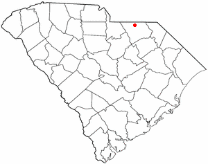
Chesterfield is a town in Chesterfield County, South Carolina, United States. The population was 1,472 at the 2010 census. It is the county seat of Chesterfield County. At the time of the 2010 census, Chesterfield was the least populous of all of South Carolina's county seats.

<span class="mw-page-title-main">McBee, South Carolina</span> Town in South Carolina, United States

McBee is a town in Chesterfield County, South Carolina, United States. As of the 2010 census, the population was 867. McBee is approximately 36 miles (58 km) northwest of Florence and 62 miles (100 km) northeast of Columbia.

<span class="mw-page-title-main">Mount Croghan, South Carolina</span> Town in South Carolina, United States

Mount Croghan is a town in Chesterfield County, South Carolina, United States. The population was 195 at the 2010 census, up from 155 in 2000. It houses a Flea market

<span class="mw-page-title-main">Pageland, South Carolina</span> Town in South Carolina, United States

Pageland is a town in Chesterfield County, South Carolina, United States. It is the second largest town in Chesterfield County. The population was 2,760 at the 2010 census.

<span class="mw-page-title-main">Patrick, South Carolina</span> Town in South Carolina, United States

Patrick is a town in Chesterfield County, South Carolina, United States. The population was 351 at the 2010 census.

<span class="mw-page-title-main">Ruby, South Carolina</span> Town in South Carolina, United States

Ruby is a town in Chesterfield County, South Carolina, United States. The population was 360 at the 2010 census.

<span class="mw-page-title-main">Kershaw, South Carolina</span> Town in South Carolina, United States

Kershaw is a town in Lancaster County, South Carolina, United States. It was incorporated in 1888. As of the 2010 census, the population was 1,803, and as of 2019 the estimated population was 2,321. The Haile Gold Mine, where gold was discovered in 1825, is 3 miles (5 km) from town and was at one time the largest single producer of gold in the Appalachian region.

<span class="mw-page-title-main">Gaston, South Carolina</span> Town in South Carolina, United States

Gaston is a town in Lexington County, South Carolina, United States. The population was 1,645 at the 2010 census. It is part of the Columbia, South Carolina Metropolitan Statistical Area.

<span class="mw-page-title-main">Swansea, South Carolina</span> Town in South Carolina, United States

Swansea is a town in Lexington County, South Carolina, United States. The population was 827 at the 2010 census. It is part of the Columbia, South Carolina Metropolitan Statistical Area.

<span class="mw-page-title-main">Clover, South Carolina</span> Town in South Carolina, United States

Clover is a town in York County, South Carolina, United States. It is located in the greater Charlotte metropolitan area. As of 2020, the population was at 6,671 within the town limits. Clover is twinned with the Northern Irish town of Larne on County Antrim's East Coast.

<span class="mw-page-title-main">Piedmont, South Carolina</span> CDP in South Carolina, United States

Piedmont is a census-designated place (CDP) along the Saluda River in Anderson and Greenville counties in the U.S. state of South Carolina. The population was 5,411 at the 2020 census.

<span class="mw-page-title-main">Chesnee, South Carolina</span> City in South Carolina, United States

Chesnee is a city in Spartanburg and Cherokee counties, in the U.S. state of South Carolina. The population was 868 as of the 2010 census.

<span class="mw-page-title-main">Lynches River</span> River in South Carolina, United States

Lynches River, named for Thomas Lynch, Jr., signer of the Declaration of Independence, rises in North Carolina near Waxhaw, North Carolina, at about 700 feet (210 m) elevation, flowing only a short distance to the South Carolina border, and thence to join the Great Pee Dee River near Johnsonville. It is about 140 mi (230 km) long and the drainage area is 1,030 square miles (2,700 km2).

References

  1. "ArcGIS REST Services Directory". United States Census Bureau. Retrieved October 15, 2022.
  2. 1 2 "Census Population API". United States Census Bureau. Retrieved October 15, 2022.
  3. 1 2 "U.S. Census website". United States Census Bureau . Retrieved January 31, 2008.
  4. "US Board on Geographic Names". United States Geological Survey. October 25, 2007. Retrieved January 31, 2008.
  5. "Jefferson, South Carolina". www.sciway.net. Retrieved November 18, 2015.
  6. "2010 City Population and Housing Occupancy Status". U.S. Census Bureau. Retrieved September 9, 2012.[ dead link ]
  7. Town of Jefferson website
  8. Worthington, Don (April 14, 2020). "Fatal bird flu strikes flock in Jefferson". www.pagelandprogressive.com.
  9. "US Gazetteer files: 2010, 2000, and 1990". United States Census Bureau. February 12, 2011. Retrieved April 23, 2011.
  10. "Brewer Gold Mine". US EPA. Retrieved September 9, 2012.
  11. "Explore Census Data". data.census.gov. Retrieved December 15, 2021.
  12. "Town of Jefferson Website". Town of Jefferson. Archived from the original on October 2, 2013. Retrieved September 9, 2012.
  13. "Homepage". Chesterfield County School District. Retrieved June 8, 2019.
  14. "South Carolina libraries and archives". SCIWAY. Retrieved June 8, 2019.
  15. "Sandhills Medical Foundation". Sandhills Medical Foundation. Retrieved September 9, 2012.