| Ela, North Carolina | |
|---|---|
| Unincorporated community | |
 Ela, North Carolina  Ela, North Carolina | |
| Coordinates: 35°26′58″N83°23′27″W / 35.44944°N 83.39083°W Coordinates: 35°26′58″N83°23′27″W / 35.44944°N 83.39083°W | |
| Country | United States |
| State | North Carolina |
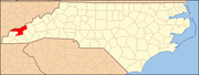
| County | Swain |
| Elevation | 1,795 ft (547 m) |
| Time zone | Eastern (EST) (UTC-5) |
| • Summer (DST) | EDT (UTC-4) |
| ZIP Code(s) | 28713, 28719 |
| Area code(s) | 828 |
| GNIS feature ID | 1011035 [1] |
Ela is an unincorporated community in Swain County, North Carolina, United States, located along US 19, northwest of Whittier and east of Bryson City. The name is derived from ᎡᎳᏬᏗ (Elawodi) in the Cherokee language, which translates as "yellow hill."

Swain County is a county located in the western portion of the U.S. state of North Carolina. As of the 2010 census, the population was 13,981. Its county seat is Bryson City.

North Carolina is a state in the southeastern region of the United States. It borders South Carolina and Georgia to the south, Tennessee to the west, Virginia to the north, and the Atlantic Ocean to the east. North Carolina is the 28th-most extensive and the 9th-most populous of the U.S. states. The state is divided into 100 counties. The capital is Raleigh, which along with Durham and Chapel Hill is home to the largest research park in the United States. The most populous municipality is Charlotte, which is the second-largest banking center in the United States after New York City.

Whittier is an unincorporated community in Jackson and Swain counties in the western part of the U.S. state of North Carolina. Whittier is located on the Tuckasegee River, between Bryson City downstream to the west, and Dillsboro upstream to the southeast.
Ela was once the junction of the Appalachian Railway (1906-1935) and Southern Railway's Murphy Branch. [2]
The Southern Railway is a name of a class 1 railroad that was based in the Southern United States. The railroad is the product of nearly 150 predecessor lines that were combined, reorganized and recombined beginning in the 1830s, formally becoming the Southern Railway in 1894.
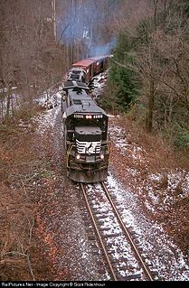
The historically important Murphy Branch is the westernmost part of what was the Western North Carolina Railroad, later the Richmond and Danville, Southern Railway, the Norfolk Southern Railway (NS) and today the Blue Ridge Southern Railroad. The branch runs between Asheville, North Carolina in the east and Murphy in the west. It roughly follows I-40 from Asheville to Canton and US Route 74, also known as the Great Smoky Mountains Expressway, from Canton to Murphy.