
The Liberal Party of Australia is a centre-right political party in Australia, one of the two major parties in Australian politics, along with the centre-left Australian Labor Party. It was founded in 1944 as the successor to the United Australia Party.
The United Australia Party (UAP) was an Australian political party that was founded in 1931 and dissolved in 1945. The party won four federal elections in that time, usually governing in coalition with the Country Party. It provided two Prime Ministers of Australia – Joseph Lyons (1932–1939) and Robert Menzies (1939–1941).
Menzies Creek is a township in Melbourne, Victoria, Australia, 40 km east of Melbourne's Central Business District, located within the Shires of Cardinia and Yarra Ranges local government areas. Menzies Creek recorded a population of 998 at the 2016 census.
The Division of Corio is an Australian electoral division in the state of Victoria. The division was proclaimed in 1900, and was one of the original 65 divisions to be contested at the first federal election. Named for Corio Bay, it has always been based on the city of Geelong, although in the past it stretched as far east as the outer western suburbs of Melbourne.
The Electoral district of Leederville was a Legislative Assembly electorate in the state of Western Australia. The district was named for the inner northern Perth suburb of Leederville, which fell within its borders. Starting off as a vast seat covering most of Perth's northwestern hinterland, it shrank in size at various redistributions until, by the time of its abolishment, it was an inner suburban seat able to be absorbed into Wembley and Mount Hawthorn.

Kookynie is a town located in the Goldfields–Esperance region of Western Australia. The name of the town is believed to be an Aboriginal word that means "waterhole" or "spring". From being a busy town with a population of around 1,500 in 1905, Kookynie has become a ghost town, with around 77 inhabitants in 2006, decreasing to 13 in 2010.

Menzies is a town in the Goldfields-Esperance region of Western Australia, 728 kilometres (452 mi) east-northeast of the state capital, Perth, and 133 kilometres (83 mi) north-northwest of the city of Kalgoorlie. At the 2016 census, Menzies had a population of 108. Aboriginal people have lived in this area since time immemorial, and the local group are the Kaburn Bardu.

Richard Buzacott, Australian politician, was a Member of the Australian Senate from 1910 to 1923.

The Shire of Leonora is a local government area in the Goldfields-Esperance region of Western Australia, about 240 kilometres (149 mi) north of the city of Kalgoorlie and about 830 kilometres (516 mi) northeast of the state capital, Perth. The Shire covers an area of 32,189 square kilometres (12,428 sq mi), and its seat of government is the town of Leonora.

The Shire of Menzies is a local government area in the Goldfields-Esperance region of Western Australia located to the north of Kalgoorlie. It covers an area of 124,635 square kilometres (48,122 sq mi), and its seat of government is the town of Menzies.
Colin Anfield Hughes was a distinguished British-Australian academic specialising in electoral politics and government. He was Emeritus professor of political science at the University of Queensland, and chairman of the Queensland Constitutional Review Commission (1999–2000).
The voting rights of Indigenous Australians became an issue from the mid-19th century, when responsible government was being granted to Britain's Australian colonies, and suffrage qualifications were being debated. The resolution of universal rights progressed into the mid-20th century.

Cue was an electoral district of the Legislative Assembly in the Australian state of Western Australia from 1901 to 1930.

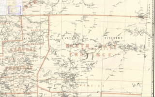
North Coolgardie was an electoral district of the Legislative Assembly in the Australian state of Western Australia from 1897 to 1901.
Mount Margaret was an electoral district of the Legislative Assembly in the Australian state of Western Australia from 1901 to 1930, located in the northeastern Goldfields region.
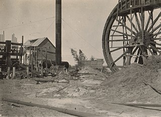
Comet Vale is an abandoned town in Western Australia located in the Goldfield region of Western Australia located between Kalgoorlie and Laverton on the Goldfields Highway. It is within the Shire of Menzies.
Mulwarrie is an abandoned town in the North Coolgardie Goldfield of the Goldfields-Esperance region of Western Australia, 125 km northwest of Kalgoorlie, between Davyhurst and Mulline.
Yerilla is an abandoned town located in the Goldfields-Esperance region in Western Australia. It is found between Kalgoorlie and Laverton.
The North Coolgardie Road District was an early form of local government area on the Western Australian goldfields. It was based in the town of Menzies, although that township was outside the board's boundaries, having been incorporated as the Municipality of Menzies in 1895.
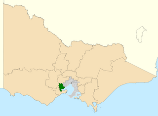
This is a list of electoral results for the Electoral district of Menzies in Western Australian state elections.
