
Yalgoo is a town in the Mid-west region, 499 kilometres (310 mi) north-north-east of Perth, Western Australia and 118 kilometres (73 mi) east-north-east of Mullewa. Yalgoo is in the local government area of the Shire of Yalgoo.
Greenough was an electoral district of the Legislative Assembly in the Australian state of Western Australia from 1890 to 2008.

Moore is an electoral district of the Legislative Assembly in the Australian state of Western Australia.
John Cyril Hawes was an architect and priest. Hawes was known for designing and constructing church buildings in England, Western Australia and The Bahamas. He served as a priest in the Church of England before converting to Roman Catholicism and received ordination as a Catholic priest. He was later named a Domestic Prelate by Pope Pius XI and given the title "monsignor". After retiring he lived as a hermit in The Bahamas, becoming known more commonly as Father Jerome.

The Shire of Murchison covers a large area of the Murchison sub-region of the central part of Western Australia, 300 kilometres (186 mi) northeast of Geraldton. The shire and the older 'Murchison' region and goldfield are now part of the designated Mid West region. It is Australia's second least populated local government area and the only one without a town.
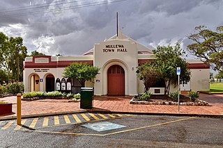
The Shire of Mullewa was a local government area in the Mid West region of Western Australia, about 100 kilometres (62 mi) east of the city of Geraldton and about 450 kilometres (280 mi) north of the state capital, Perth. The Shire covered an area of 10,827 square kilometres (4,180 sq mi), and its seat of government was the town of Mullewa. It amalgamated with the City of Geraldton-Greenough on 1 July 2011 to become part of the City of Greater Geraldton.

The Shire of Yalgoo is a local government area in the Mid West region of Western Australia, about 500 kilometres (311 mi) north of the state capital, Perth. The Shire covers an area of 28,215 square kilometres (10,894 sq mi), and its seat of government is the town of Yalgoo.

Geraldton–Mount Magnet Road is a 335-kilometre-long (208 mi) major regional road in the Mid West region of Western Australia, starting in Utakarra in Geraldton's eastern suburbs, and terminating 333 kilometres (207 mi) east-northeast at Great Northern Highway near the mining town of Mount Magnet. The road is signed as State Route 123, is a two-lane single carriageway for its entire length, and is a major traffic route which is regularly used by heavy vehicles and mine/grain road trains.
Ningaloo was an electoral district of the Legislative Assembly in the Australian state of Western Australia from 1996 to 2005.

Mount Magnet was an electoral district of the Legislative Assembly in the Australian state of Western Australia from 1901 to 1950. It replaced the former pre-federation seat of Yalgoo (1897-1901)
Yoweragabbie is a small town in the Mid West region of Western Australia between the towns of Mount Magnet and Yalgoo.
Bunnawarra or Bunnawarra Station is a pastoral lease operating as a sheep station in Western Australia.
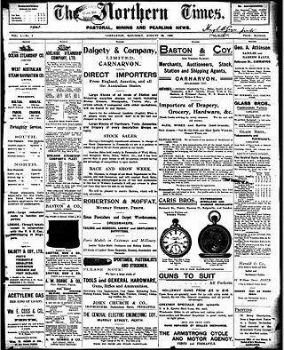
The Northern Times was a newspaper published in Carnarvon, Western Australia from 1905–1983.
Gabyon Station, commonly referred to as Gabyon, is a pastoral lease that operates as a sheep station in Western Australia.
This is a list of newspaper titles published in, or for the Mid West region of Western Australia.
The Widi were an Aboriginal Australian people of the Mid West region of Western Australia.
Tallering Station is a pastoral lease that has previously operated as a sheep station but now is a cattle station in Western Australia.
The Greenough Road District was an early form of local government area in the Mid West region of Western Australia. It was based in the town of Greenough.
This is a list of electoral results for the Electoral district of Yalgoo in Western Australian state elections.
