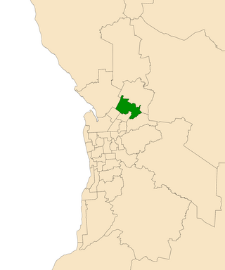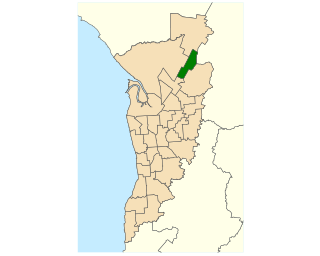
The City of Playford is a local government area of South Australia in Adelaide's northern suburbs. It was named in recognition of Sir Thomas Playford, who played a part in the development of the area, and was South Australia's premier from 1938–1965. The city covers an area of 345 km2 (133 sq mi), and is home to over 90,000 residents. Playford was the fastest growing local government area in South Australia in the 2010s.

Elizabeth is an outer northern suburb of the Adelaide metropolitan area, South Australia, 24 km north of the Adelaide city centre. It is located in the City of Playford. At the 2016 census, Elizabeth had a population of 1,024.
The Division of Bonython was an Australian Electoral Division in South Australia between 1955 and 2004. In its final configuration, it was based on the outer northern suburbs of Elizabeth, Munno Para, Parafield, Paralowie, Salisbury, Virginia, and to the town of One Tree Hill in Adelaide's outskirts. Bonython's first 14 years saw vast boundaries simultaneously cover as far north as Gawler, as far south as Magill Road at Norwood, and as far west as Ottoway. The seat would continue to cross south of Grand Junction Road until the creation of the Division of Makin at the pre-1984 redistribution.
Since 1970, the South Australian House of Assembly — the lower house of the Parliament of South Australia — has consisted of 47 single-member electoral districts consisting of approximately the same number of enrolled voters. The district boundaries are regulated by the State Electoral Office, according to the requirements of the South Australian Constitution and are subject to mandatory redistributions by the South Australian Electoral Districts Boundaries Commission in order to respond to changing demographics.

The Division of Wakefield was an Australian electoral division in the state of South Australia. The seat was a hybrid rural-urban electorate that stretched from Salisbury in the outer northern suburbs of Adelaide at the south of the seat right through to the Clare Valley at the north of the seat, 135 km from Adelaide. It included the suburbs of Elizabeth, Craigmore, Munno Para, and part of Salisbury, and the towns of Balaklava, Clare, Freeling, Gawler, Kapunda, Mallala, Riverton, Tarlee, Virginia, Williamstown, and part of Port Wakefield.

Napier was an electorate in the South Australian Legislative Assembly in the outer northern suburbs of the Adelaide metropolitan area, including the suburbs of Blakeview, Davoren Park, Elizabeth Downs, Evanston South, Kudla, Munno Para, Smithfield and Smithfield Plains, parts of Craigmore, Evanston Park and Munno Para Downs; as well as semi-rural Bibaringa, One Tree Hill, Sampson Flat, Uleybury and Yattalunga, and part of Humbug Scrub.

Little Para was a single-member electoral district for the South Australian House of Assembly in the north of the Adelaide metropolitan area, covering the suburbs of Elizabeth, Elizabeth Grove, Elizabeth North, Elizabeth East, Elizabeth Park, Elizabeth South, Elizabeth Vale, Gould Creek, Hillbank, Salisbury Heights and Salisbury Park, and parts of Craigmore, Golden Grove and Greenwith.

Ramsay is a single-member electoral district for the South Australian House of Assembly. It is named after Alexander Ramsay, who was general manager of the South Australian Housing Trust for 25 years. It is a 24.7 km² suburban electorate north of Adelaide—based on the angle between Main North Road and the Port Wakefield Road, Ramsay covers the outer northern Adelaide suburbs of Brahma Lodge, Burton, Direk, portion of Elizabeth South, Elizabeth Vale, portion of Paralowie, Salisbury, Salisbury South, Salisbury Plain and Salisbury North.

Light is a single-member electoral district for the South Australian House of Assembly. Light is named after Colonel William Light, who was the first Surveyor-General of South Australia. The electorate was created in 1857, abolished at the 1902 election and recreated at the 1938 election. It is based on the semi-rural township of Gawler, and stretches southwards into the outermost northern suburbs of Adelaide.

Elizabeth is a single-member electoral district for the South Australian House of Assembly. It first existed from 1970 to 2006, when its boundaries were moved south and east and it was renamed to Little Para. The 2016 redistribution moved it further north and renamed it back to Elizabeth for the 2018 election. The district is in the northern suburbs of Adelaide, and named for the suburb of Elizabeth.
Smithfield is a suburb in the northern outskirts of Adelaide, South Australia. It is in the City of Playford.

Salisbury is a northern suburb of Adelaide, South Australia. It is the seat of the City of Salisbury, and in the South Australian Legislative Assembly electoral district of Ramsay and the Australian House of Representatives division of Spence. The suburb is a service area for the City of Salisbury district, with many parklands, shops, cafés and restaurants.

The City of Elizabeth was a local government area located in the northern suburbs of Adelaide and seated at Elizabeth from 1964 to 1997.
The City of Munno Para, formerly the District Council of Munno Para, was a local government area of South Australia from 6th November 1958 to 1997, seated at the township of Smithfield. In 1997 the City of Munno Para merged with the City of Elizabeth to form the new City of Playford.
Munno Para is a northern suburb of Adelaide, South Australia. It is located in the City of Playford.
Andrews Farm is a northern suburb of Adelaide, South Australia. It is located in the City of Playford.
In the Hundred of Munno Para the suburb of MacDonald Park was established by MacDonald Reid Pty Ltd in 1964.

The Hundred of Munno Para is a cadastral unit of hundred covering the outer northern suburbs of Adelaide north of the Little Para River and the flanking semi-rural areas in South Australia. It is one of the eleven hundreds of the County of Adelaide. It was named in 1846 by Governor Frederick Robe, Munno Para being a term from a local Kaurna Aboriginal people meaning golden wattle creek. This name refers to either the Gawler River or the Little Para River.
The District Council of Munno Mara West was a local government area of South Australia on the central Adelaide Plains from 1854 to 1933.
The Division of Spence is an electoral district for the Australian House of Representatives. It is located in the outer northern suburbs of Adelaide in South Australia.


