Elk River, Idaho

Last updated

Elk River, Idaho
Elk River Streetscape Idaho 9-15-2011.jpg
South First Street in 2011
Clearwater County Idaho Incorporated and Unincorporated areas Elk River Highlighted 1625120.svg
Location of Elk River in Clearwater County, Idaho.
Coordinates: 46°46′58″N116°10′48″W / 46.78278°N 116.18000°W / 46.78278; -116.18000
Country United States
State Idaho
County Clearwater
Area
[1]
  Total0.14 sq mi (0.38 km2)
  Land0.14 sq mi (0.38 km2)
  Water0.00 sq mi (0.00 km2)
Elevation
2,854 ft (870 m)
Population
 (2010) [2]
  Total125
  Estimate 
(2019) [3]
122
  Density841.38/sq mi (324.81/km2)
Time zone UTC-8 (Pacific (PST))
  Summer (DST) UTC-7 (PDT)
ZIP code
83827
Area code 208
FIPS code 16-25120
GNIS feature ID0396456

Elk River is a city in the northwestern United States in Clearwater County, Idaho. The population was 125 at the 2010 census, down from 156 in 2000. [4] It is accessed from State Highway 8 from Bovill, to the west in adjacent Latah County. [5] Formerly the site of a Potlatch sawmill, [6] it was phased out after several decades during the 1930s. [7]

Contents

Geography

Elk River is located at 46°46′58″N116°10′48″W / 46.78278°N 116.18000°W / 46.78278; -116.18000 (46.782796, -116.180049), [8] at an elevation of 2,854 feet (870 m) above sea level.

According to the United States Census Bureau, the city has a total area of 0.15 square miles (0.39 km2), all of it land. [9]

Climate

This region experiences warm (but not hot) and dry summers, with no average monthly temperatures above 71.6 °F (22 °C). According to the Köppen Climate Classification system, Elk River has a dry-summer humid continental climate, abbreviated "Dsb" on climate maps.

Climate data for Elk River (1952-2012)
MonthJanFebMarAprMayJunJulAugSepOctNovDecYear
Record high °F (°C)54
(12)
63
(17)
72
(22)
87
(31)
95
(35)
96
(36)
104
(40)
107
(42)
100
(38)
88
(31)
66
(19)
58
(14)
107
(42)
Average high °F (°C)34.1
(1.2)
39.7
(4.3)
45.8
(7.7)
54
(12)
63.8
(17.7)
71.4
(21.9)
81.5
(27.5)
81.5
(27.5)
72
(22)
58.3
(14.6)
42
(6)
34
(1)
56.5
(13.6)
Average low °F (°C)18.3
(−7.6)
20.5
(−6.4)
24.2
(−4.3)
30.4
(−0.9)
36.7
(2.6)
43
(6)
45.7
(7.6)
44.2
(6.8)
37.5
(3.1)
30.6
(−0.8)
25.6
(−3.6)
19.6
(−6.9)
31.4
(−0.3)
Record low °F (°C)−31
(−35)
−25
(−32)
−23
(−31)
11
(−12)
19
(−7)
27
(−3)
26
(−3)
27
(−3)
20
(−7)
4
(−16)
−24
(−31)
−37
(−38)
−37
(−38)
Average precipitation inches (mm)5.37
(136)
3.98
(101)
3.4
(86)
2.9
(74)
2.89
(73)
2.48
(63)
1.04
(26)
1.1
(28)
1.67
(42)
2.76
(70)
4.74
(120)
5.05
(128)
37.38
(949)
Average snowfall inches (cm)30.1
(76)
16.8
(43)
11.5
(29)
2.7
(6.9)
0.3
(0.76)
0
(0)
0
(0)
0
(0)
0
(0)
0.3
(0.76)
11.9
(30)
25.4
(65)
99
(250)
Average precipitation days161212111110556101414126
Source: WRCC [10]

Demographics

Historical population
CensusPop.Note
1920 847
1930 8621.8%
1940 337−60.9%
1950 312−7.4%
1960 38222.4%
1970 3830.3%
1980 265−30.8%
1990 149−43.8%
2000 1564.7%
2010 125−19.9%
2019 (est.)122 [3] −2.4%
U.S. Decennial Census [11]

2010 census

As of the census [2] of 2010, there were 125 people, 65 households, and 31 families residing in the city. The population density was 833.3 inhabitants per square mile (321.7/km2). There were 152 housing units at an average density of 1,013.3 per square mile (391.2/km2). The racial makeup of the city was 100.0% White. Hispanic or Latino of any race were 3.2% of the population.

There were 65 households, of which 9.2% had children under the age of 18 living with them, 46.2% were married couples living together, 1.5% had a female householder with no husband present, and 52.3% were non-families. 50.8% of all households were made up of individuals, and 20% had someone living alone who was 65 years of age or older. The average household size was 1.92 and the average family size was 2.90.

The median age in the city was 52.4 years. 12.8% of residents were under the age of 18; 2.4% were between the ages of 18 and 24; 19.2% were from 25 to 44; 44% were from 45 to 64; and 21.6% were 65 years of age or older. The gender makeup of the city was 52.8% male and 47.2% female.

2000 census

As of the 2000 census, there were 156 people, 75 households, and 54 families residing in the city. The population density was 1,116.6 inhabitants per square mile (431.1/km2). There were 136 housing units at an average density of 973.5 per square mile (375.9/km2). The racial makeup of the city was 95.51% White, 0.64% Asian, and 3.85% from two or more races. Hispanic or Latino of any race were 0.64% of the population. [12]

There were 75 households, out of which 13.3% had children under the age of 18 living with them, 66.7% were married couples living together, 2.7% had a female householder with no husband present, and 26.7% were non-families. 21.3% of all households were made up of individuals, and 8.0% had someone living alone who was 65 years of age or older. The average household size was 2.08 and the average family size was 2.38.

In the city, the population was spread out, with 13.5% under the age of 18, 1.9% from 18 to 24, 19.2% from 25 to 44, 41.0% from 45 to 64, and 24.4% who were 65 years of age or older. The median age was 53 years. For every 100 females, there were 116.7 males. For every 100 females age 18 and over, there were 107.7 males.

The median income for a household in the city was $30,000, and the median income for a family was $31,250. Males had a median income of $29,375 versus $17,500 for females. The per capita income for the city was $16,082. About 11.3% of families and 14.1% of the population were below the poverty line, including 27.8% of those under the age of eighteen and 8.9% of those 65 or over.

Education

The public school was closed 33 years ago in 1990 and students attend classes in Bovill in Latah County. [5]

In 2011, John Oliver and Andy Zaltzman of satirical podcast The Bugle claimed to be planning to declare war against the town. In December 2017, The Bugle recognized Elk River as the capital of the United States, following the Trump administration's announcement of plans to relocate the US embassy in Israel from Tel Aviv to Jerusalem. [13] The 2023 Cody Acuff song "Welcome to Tom's" is a reference to Tom's Tavern in Elk River.

Related Research Articles

<span class="mw-page-title-main">Nez Perce County, Idaho</span> County in Idaho, United States

Nez Perce County is a county located in the U.S. state of Idaho. As of the 2020 census, the population was 42,090. The county seat is Lewiston. The county is named after the Native American Nez Percé tribe. Nez Perce County is part of the Lewiston, Idaho–WA Metropolitan Statistical Area.

<span class="mw-page-title-main">Shoshone County, Idaho</span> County in Idaho, United States

Shoshone County is a county in the U.S. state of Idaho. As of the 2020 census, the population was 13,169. The county seat is Wallace and the largest city is Kellogg. The county was established in 1864, named for the Native American Shoshone tribe.

<span class="mw-page-title-main">Latah County, Idaho</span> County in Idaho, United States

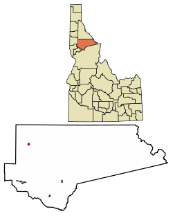
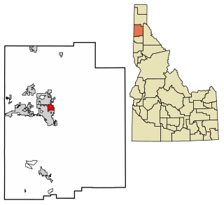
Latah County is a county located in the north central region of the U.S. state of Idaho. As of the 2020 census, the population was 39,517. The county seat and largest city is Moscow, the home of the University of Idaho, the state's flagship university.

<span class="mw-page-title-main">Idaho County, Idaho</span> County in Idaho, United States

Idaho County is a county in the U.S. state of Idaho, and the largest by area in the state. As of the 2020 census, the population was 16,541. The county seat is Grangeville. Previous county seats of the area were Florence (1864–68), Washington (1868–75), and Mount Idaho (1875–1902).

<span class="mw-page-title-main">Clearwater County, Idaho</span> County in Idaho, United States

Clearwater County is a county located in the U.S. state of Idaho. As of the 2020 census, the population was 8,734. The county seat is Orofino. Established in 1911, the county was named after the Clearwater River.

<span class="mw-page-title-main">Tensed, Idaho</span> City in Idaho, United States

Tensed is a city in Benewah County, Idaho, United States. The population was 123 at the 2010 census, down from 126 in 2000. The city is within the Coeur d'Alene Reservation, and is accessed by U.S. Route 95, the state's primary north-south highway. The city is located about 1 mile (0.6 km) from the north entrance of McCroskey State Park.

<span class="mw-page-title-main">Priest River, Idaho</span> City in Idaho, United States

Priest River is a city in Bonner County, Idaho. The population was 1,751 at the 2010 census. Located in the Idaho Panhandle region of the state, the city is at the mouth of the Priest River on the Pend Oreille River.

<span class="mw-page-title-main">Greenleaf, Idaho</span> City in Idaho, United States

Greenleaf is a city in Canyon County, Idaho, United States. The population was 846 at the 2010 census. Greenleaf is part of the Boise-Nampa metropolitan area. The town was established by Quakers in the early-1900s and is named after Quaker poet and abolitionist John Greenleaf Whittier.

<span class="mw-page-title-main">Riggins, Idaho</span> City in Idaho, United States

Riggins is a city in the western United States in Idaho County, Idaho. Nestled deep in a canyon at the confluence of the Salmon and Little Salmon rivers in west central Idaho, it is approximately 150 highway miles (240 km) north of Boise, and 120 highway miles (190 km) south-southeast of Lewiston. The elevation is 1,821 feet (555 m) above sea level, and its population was 419 at the 2010 census.

<span class="mw-page-title-main">White Bird, Idaho</span> Town in Idaho, United States

White Bird is a city in Idaho County, Idaho. The population was 91 at the time of the 2010 census, down from 106 in 2000.

<span class="mw-page-title-main">Dalton Gardens, Idaho</span> City in Kootenai County, Idaho, United States

Dalton Gardens is a city in Kootenai County, Idaho, United States. It is considered a suburb of Coeur d'Alene and borders the city to the north and east. The city of Dalton Gardens is also part of the larger Spokane-Coeur d'Alene Combined Metropolitan Statistical Area which encompasses Kootenai County, Idaho. The population of Dalton Gardens was 2,335 at the time of the 2010 census.

<span class="mw-page-title-main">Worley, Idaho</span> City in Idaho, United States

Worley is a city in southwestern Kootenai County, Idaho, United States. The population was 257 at the 2010 census, up from 223 in 2000. The city is within the Coeur d'Alene Indian Reservation.

<span class="mw-page-title-main">Bovill, Idaho</span> City in Idaho, United States

Bovill is a city in Latah County, Idaho, United States. The population was 260 at the 2010 census, down from 305 in 2000.

<span class="mw-page-title-main">Genesee, Idaho</span> City in Idaho, United States

Genesee is a city in Latah County, Idaho, United States. The population was 955 at the 2010 census, up from 946 in 2000. The city was named for the Genesee region of western New York, although it may also be a modification of the biblical Genesis.

<span class="mw-page-title-main">Juliaetta, Idaho</span> Town in Idaho, United States

Juliaetta is a city in Latah County, Idaho, United States. The population was 624 at the 2020 census.

<span class="mw-page-title-main">Kendrick, Idaho</span> City in Idaho, United States

Kendrick is a city in Latah County, Idaho, United States. Its population was 303 at the 2010 census, a decrease from 369 in 2000.

<span class="mw-page-title-main">Onaway, Idaho</span> City in Idaho, United States

Onaway is a city in Latah County, Idaho, United States. The population was 187 at the 2010 census, down from 230 in 2000.

<span class="mw-page-title-main">Troy, Idaho</span> City in Idaho, United States

Troy is a city in Latah County, Idaho, United States. Located in the eastern part of the Palouse region, its population was 862 at the 2010 census.

<span class="mw-page-title-main">Lapwai, Idaho</span> City in Idaho, United States

Lapwai is a city in Nez Perce County, Idaho, United States. Its population was 1,137 at the 2010 census, and it is the seat of government of the Nez Perce Indian Reservation. Lapwai actually means "The land of the butterflies"

<span class="mw-page-title-main">Peck, Idaho</span> City in Idaho, United States

Peck is a city in Nez Perce County, Idaho, United States. The population was 197 at the 2010 census. It is part of the Lewiston, ID-WA Metropolitan Statistical Area. Many residents of Peck work in nearby Orofino, Idaho. Additionally, Peck residents attend high school in Orofino since Peck does not have a high school.

References

  1. "2019 U.S. Gazetteer Files". United States Census Bureau. Retrieved July 9, 2020.
  2. 1 2 "U.S. Census website". United States Census Bureau . Retrieved December 18, 2012.
  3. 1 2 "Population and Housing Unit Estimates". United States Census Bureau. May 24, 2020. Retrieved May 27, 2020.
  4. Spokesman-Review Archived 2015-09-24 at the Wayback Machine - 2010 census - Elk River, Idaho - accessed 2011-12-27
  5. 1 2 Wright, Khaliela (November 21, 2016). "Elk River: At the end of the road". Idaho. (magazine). p. 36.
  6. Harriman, Peter (June 10, 1989). "The town at the edge of the wilderness". Idahonian. (Moscow). p. 1B.
  7. "Idaho for the Curious", by Cort Conley, ©1982, ISBN   0-9603566-3-0, p.58-59
  8. "US Gazetteer files: 2010, 2000, and 1990". United States Census Bureau. February 12, 2011. Retrieved April 23, 2011.
  9. "US Gazetteer files 2010". United States Census Bureau. Archived from the original on January 25, 2012. Retrieved December 18, 2012.
  10. "ELK RIVER 1 S, ID (102892)". Western Regional Climate Center. Retrieved November 26, 2015.
  11. "Census of Population and Housing". Census.gov. Retrieved June 4, 2015.
  12. "U.S. Census website". United States Census Bureau . Retrieved January 31, 2008.
  13. Bugle 4052 - Brexcitement! , retrieved September 17, 2018