Waterfall Gully is an eastern suburb of the South Australian capital city of Adelaide. It is located in the foothills of the Mount Lofty Ranges around 5 km (3.1 mi) east-south-east of the Adelaide city centre. For the most part, the suburb encompasses one long gully with First Creek at its centre and Waterfall Gully Road running adjacent to the creek. At the southern end of the gully is First Falls, the waterfall for which the suburb was named. Part of the City of Burnside, Waterfall Gully is bounded to the north by the suburb of Burnside, from the north-east to south-east by Cleland National Park, to the south by Crafers West, and to the west by Leawood Gardens and Mount Osmond.
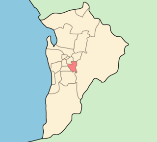
The City of Burnside is a local government area in the South Australian city of Adelaide stretching from the Adelaide Parklands into the Adelaide foothills with an area of 2,753 hectares. It was founded in August 1856 as the District Council of Burnside, the name of a property of an early settler, and was classed as a city in 1943. The LGA is bounded by Adelaide, Adelaide Hills Council, Campbelltown, Mitcham, Norwood Payneham and St Peters and Unley.

Burnside is suburb in the City of Burnside council area in the eastern suburbs of Adelaide. It is primarily a residential suburb. It was named Burnside, an amalgamation of the Scottish word for creek, "burn" and "side" because of the original property's location on the side of Second Creek. Burnside is 7.5 kilometres (4.7 mi) east of the Adelaide city centre by road.
Glenunga is an inner southeastern suburb of Adelaide, the capital of South Australia. It is located in the City of Burnside, five kilometres southeast of the Adelaide city centre. The name Glenunga is a composite of Aboriginal and Scottish words, "unga" meaning near and "glen" from the nearby Glen Osmond Bounded on the north by Windsor Road, the east by Portrush Road, the south-west by Glen Osmond Road and the west by Conyngham Street, the leafy suburb forms a rough triangular layout.
Glenside is a suburb in the local government area known as the City of Burnside, Adelaide, South Australia. The suburb is 4.9 kilometres south-east of the Adelaide city centre, home to 2,422 people in a total land area of 1.40 km2.

Wanniassa is a suburb in Australia's capital, Canberra: more specifically, in the city's southern district of Tuggeranong. The suburb takes its name from a pastoral property granted to Thomas McQuoid in 1835, which he named after Wanayasa in West Java, Indonesia, where McQuoid had previously owned property. Streets are named after Victorian state politicians and the suburb was gazetted on 21 May 1974.
Leawood Gardens is a small suburb of Adelaide, South Australia in both the City of Mitcham and the City of Burnside located in the foothills of the Adelaide Hills. It is crossed by both the South Eastern Freeway and Mount Barker Road uphill from the "Devil's Elbow" intersection, and contains the northern portal of the Heysen Tunnels.
Mount Osmond is a small suburb of 2,497 people in the South Australian capital city of Adelaide. It is part of the City of Burnside local government area and located in the foothills of the Adelaide Hills, five kilometres south east of the city centre. The suburb is high on the hill of the same name, which is the last hill on the right when approaching Adelaide down the South Eastern Freeway before the road levels out onto the Adelaide Plains. It is bounded to the north by the suburb of Beaumont, to the north-east by Burnside, to the east by Waterfall Gully, to the south by Leawood Gardens/Eagle On The Hill, to the south-west by Urrbrae, to the west by Glen Osmond and to the north-west by St Georges.

Beaumont is a suburb of Adelaide in the City of Burnside. Founded as a purpose-built village by Sir Samuel Davenport in 1848, it initially struggled due to high land prices in the area. However, with Adelaide's inevitable expansion residents eventually settled. The early village had quite a cosmopolitan flavour–although predominantly Anglo-Saxon like most of Australia at that point, many of Beaumont's early residents were veterans of the British Navy or Army or had lived in other countries for some time.

Hazelwood Park is an upper class suburb in the City of Burnside, Adelaide, South Australia with a census area population of 1,717 people. The suburb is about 5 kilometres east of the Central business district. Hazelwood Park, a suburban park inside the suburb, is the major attraction in the suburb and is the start of the flat country of the Adelaide Plains at the bottom of the Adelaide Hills. Adjacent Howard Terrace is considered to be the end of the Plains and the start of the foothills. Hazelwood Park includes the Burnside Swimming Centre, a popular site in the summer. Much of the remainder of the suburb is residential but there is a small shopping area along Glynburn Road on the eastern edge. The area was first settled by Europeans in 1848 but has seen many community changes over the years.
Kensington Gardens is an eastern suburb of Adelaide, in the City of Burnside. It includes a large recreational park, Kensington Wama, or Kensington Gardens Reserve.

Magill is a suburb of Adelaide straddling the City of Burnside and City of Campbelltown council jurisdictions, approximately 7 km from the Adelaide CBD. It incorporates the suburb previously known as Koongarra Park.

Toorak Gardens is a leafy, mainly residential inner eastern suburb of Adelaide, South Australia, located 2 km east of the Adelaide city centre.
Tusmore is a suburb in the inner east of Adelaide, South Australia.
Wattle Park is a suburb of Adelaide, South Australia in the City of Burnside.
Kurralta Park is a suburb of Adelaide, South Australia in the City of West Torrens.
Burnside Heights is a suburb in Melbourne, Victoria, Australia, 21 km (13 mi) north-west of Melbourne's Central Business District, located within the City of Melton local government area. Burnside Heights recorded a population of 6,377 at the 2021 census.

James Cowan, flour miller and investor, had been a member of the South Australian House of Assembly for the Yatala for only 2 months when he was killed in an accident at a railway crossing. Cowan was an early investor in BHP. The property associated with Erindale, Cowan's residence at Burnside, was sub-divided after his death into a new suburb which was also named Erindale.

Cleland is a suburb in South Australia located in the Adelaide metropolitan area about 10 kilometres south-east of the Adelaide city centre. Its boundaries were created in October 2001, with additional land being added in 2010 from the adjoining suburb of Crafers. Its name is derived from the former Cleland Conservation Park.
