Related Research Articles

Norwood is a suburb of Adelaide, about 4 km (2.5 mi) east of the Adelaide city centre. The suburb is in the City of Norwood Payneham & St Peters, whose predecessor was the oldest South Australian local government municipality.

Unley is an inner-southern suburb of Adelaide, South Australia, within the City of Unley. The suburb is the home of the Sturt Football Club in the South Australian National Football League (SANFL). Unley neighbours Adelaide Park Lands, Fullarton, Hyde Park, Malvern, Parkside and Wayville.
Kensington Gardens is an eastern suburb of Adelaide, in the City of Burnside. It includes a large recreational park, Kensington Wama, or Kensington Gardens Reserve.
Leabrook is a suburb of Adelaide, South Australia in the City of Burnside.

Rose Park is a suburb with a population of 1,374 in the South Australian capital city of Adelaide. It is located 1 kilometre (0.62 mi) east of Adelaide's central business district. Rose Park is a leafy, tree-lined and wealthy inner suburb containing a number of historical and contemporary attractions. Much of the area's 19th-century housing stock has been recognised with heritage protection.
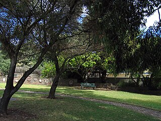
Rosslyn Park is an eastern suburb of Adelaide in the City of Burnside.

Parkside is an inner southern suburb of Adelaide, South Australia. It is located in the City of Unley.
Heathpool is a residential suburb of Adelaide, Australia, east of the city, in the City of Norwood Payneham St Peters.
Kensington is a suburb of Adelaide, South Australia in the City of Norwood, Payneham & St Peters council area. Unlike the rest of the city, Kensington's streets are laid out diagonally. Second Creek runs through and under part of the suburb, which contains many heritage buildings as well as Norwood Swimming Centre and several schools.
Marryatville is a small suburb about 4–5 kilometres (2.5–3.1 mi) east of Adelaide's central business district, in the local council area of City of Norwood Payneham St Peters. Comprising low- to medium-density housing, two large schools, a church and several shops, it also has two creeks running through it. The first European settler on the land was George Brunskill in 1839, with part of the land purchased and laid out as a village in 1848 by James Philcox.
Edwardstown is an inner southern-western suburb located 6 km southwest of Adelaide in the City of Marion.

Lockleys is an inner western suburb of Adelaide, in the City of West Torrens.

Fulham is a western suburb of Adelaide, South Australia. It is located in the City of West Torrens.
Hilton is an inner western suburb of Adelaide, South Australia. It is located in the City of West Torrens, for which it is the council seat.

Mile End is an inner western suburb of Adelaide, located in the City of West Torrens, around 2 kilometres from the Adelaide city centre. It has a census area population of 4,413 people (2011). Much of the suburb is residential, but there are small commercial areas along Henley Beach Road and South Road.

Parafield Gardens is a suburb of Adelaide, South Australia. The suburb is largely residential, with a pocket of industrial land in the southwest corner. There are two small shopping centres in the area, one on Salisbury Highway, and another on Sheperdson Road.

The Kensington Oval is located on 344 The Parade, Kensington, South Australia. Now used primarily for cricket in South Australia, the venue was once Adelaide's premier athletics facility and known as Olympic Sports Field.

Richmond is an inner suburb of Adelaide, South Australia. It is located on Kaurna land in the City of West Torrens.
The Regal Theatre, formerly known as the Chelsea Cinema, the Princess Theatre and the Ozone Marryatville or Marryatville Ozone Theatre, is a single-screen cinema in Kensington Park, a suburb of Adelaide, South Australia. Originally built in 1925, it retains the features of a major renovation in Art Deco style in 1941, and was heritage-listed on the state register in 1983. It is the oldest continuously running purpose-built cinema in Adelaide, and the only remaining silent cinema still operating.
Windsor Gardens is a suburb in the north-eastern suburbs of Adelaide, the capital of South Australia.
References
- ↑ Australian Bureau of Statistics (28 June 2022). "Kensington Park (suburb and locality)". Australian Census 2021 QuickStats. Retrieved 28 June 2022.
- ↑ "Contact". The Regal Theatre. Retrieved 27 July 2020.
- ↑ "Find your place". Home page. 27 November 2019. Retrieved 27 July 2020.
- ↑ "The Bradman Trail". Archived from the original on 6 July 2011.
34°55′37″S138°39′04″E / 34.927°S 138.651°E
| | This article about a place in Adelaide is a stub. You can help Wikipedia by expanding it. |