Estepa

Last updated
Estepa
BanderaEstepa.svg
Escudo de Estepa.svg
Motto(s): 
Latin: Ostippo, Quid Ultra?
(Estepa, What else?)
Posicion de Estepa (Sevilla).svg
Spain location map with provinces.svg
Red pog.svg
Estepa
Location in Spain
Coordinates: 37°17′30″N4°52′45″W / 37.29167°N 4.87917°W / 37.29167; -4.87917
CountryFlag of Spain.svg  Spain
Autonomous community Flag of Andalucia.svg  Andalusia
Province Sevilla
Comarca Sierra Sur de Sevilla
Founded1241
Government
   Mayor Juan García Baena (PSOE)
Area
  Total202.42 km2 (78.15 sq mi)
Elevation
604 m (1,982 ft)
Population
 (2018) [1]
  Total12,503
  Density62/km2 (160/sq mi)
Demonym Estepeño/a
Time zone UTC+1 (CET)
  Summer (DST) UTC+2 (CEST)
Postal code
41560
Website Official website

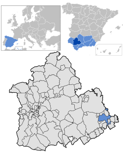
Estepa is a municipality in the extreme south-east of the province of Seville. It had a population of 12.631 in 2013. [2] The town is located north of the Sierra del Becerro mountains.

Contents

History

Estepa possesses a very ancient past and has well-preserved remains to testify to this. Some date back to prehistory including flint tools and axes. The remains reveal the later accession of Carthaginian people. At least two settlements are known: one situated in Los Canterones, shown by ancient deposits some 6 km from the town of Estepa, and the other under present-day Estepa. [3]

Estepa is mentioned in classical sources as Astapa and Ostippo. The Romans destroyed the Carthaginian city of Astapa during the Punic Wars, as described by Titus Livius. [4] In the Roman epoch, the town bore the name Ostippo, a free city linked to the Conventus de Astigi (Écija). It was mentioned in the Antonine Itinerary. [4] The Roman city would have occupied the high part of the site, but little evidence remains. Numerous remains of agricultural developments suggest many small populations in the plains to the north of Estepa.

Torre del homenaje of the Alcazar of Estepa, on the hill of San Cristobal. Torreon de Estepa.JPG
Torre del homenaje of the Alcázar of Estepa, on the hill of San Cristóbal.

The place continued to be inhabited during the Visigothic period. [5] Under the Arabs it adopted the name Istabba, and the poet Al Zawwali lived there for a while. [4] In 1267, having been taken by Fernando III during the Christian reconquest, the town was handed over to the Order of Santiago, to take charge of its defence as a frontier position. [4] Its greatest monumental and artistic achievements were attained during the 16th and 17th centuries under the marquesses of Estepa; [4] [6] their palace was built on the site of the former Islamic fortress.

By the 19th century, although Estepa was expanding, the palace was in ruins and the area was known for banditry. [7] The town was granted the title of "city" (ciudad) in 1886. [4] During the Civil War it was soon taken over by Franco's forces. [8] After the war, widespread poverty led to substantial emigration to industrial areas of Spain and other European countries during the 1950s and 1960s; the population remained at a constant level. Social conflict was still present in the area after the return to democracy in Spain, as seen in a strike of agricultural workers in 1990. [9]

Economy

Olive oil cooperative Cooperativa de Estepa.JPG
Olive oil cooperative

Estepa is well known for its production of Christmas-time sweets, mainly mantecado, or traditional Spanish crumble cake, notable for being based on pork fat. Since 2009 the production of these confections have been protected by a protected designation of origin, Mantecados de Estepa. [10] [11] Estepa has 30 such factories, [12] 15 of which are partners in an export trade association, Coexema A.I.E. The factories produce about 18 million kilograms of Christmas sweets annually, and from September to December they employ in total about 2,000 employees. [6] Over 90% of the workers at these factories are women. [13]

Other industries are gaining prominence in the area as well, such as Graphic Arts, mechanical constructions, machinery, factories, transport, slaughterhouses, limestone production, etc. South of the mountain range is an industrial estate called "The Heart of Andalucia" with more than 140,000m2 of surface area divided into 96 plots. It is financed by Espa and Sodestepa LLC. [14]

An important agricultural activity is olive growing: about 9,500 ha of land within the municipality is planted to olives [15] and about 24 million kilograms of a protected designation of origin olive oil are produced annually. [6]

Torre de la Victoria Torre Victoria Estepa.jpg
Torre de la Victoria

Tourism is also a major part of Estepa's economy. Tourists can visit many monuments and historical places, such as Convento de Santa Clara, Convento de San Francisco, a ruined fortress (Antiguo Alcázar), the Torre de la Victoria church tower, the Balcón de Andalucia viewpoint, and many churches. [5]

Twin towns

Estepa is twinned with:

See also

Further reading

Related Research Articles

<span class="mw-page-title-main">Andalusia</span> Autonomous community of Spain

Andalusia is the southernmost autonomous community in Peninsular Spain. Andalusia is located in the south of the Iberian Peninsula, in southwestern Europe. It is the most populous and the second-largest autonomous community in the country. It is officially recognised as a historical nationality and a national reality. The territory is divided into eight provinces: Almería, Cádiz, Córdoba, Granada, Huelva, Jaén, Málaga, and Seville. Its capital city is Seville. The seat of the High Court of Justice of Andalusia is located in the city of Granada.

<span class="mw-page-title-main">Seville</span> Capital and largest city of Andalusia and the province of Seville in Spain

Seville is the capital and largest city of the Spanish autonomous community of Andalusia and the province of Seville. It is situated on the lower reaches of the River Guadalquivir, in the southwest of the Iberian Peninsula.

<span class="mw-page-title-main">Province of Córdoba (Spain)</span> Province of Spain

Córdoba, also called Cordova in English, is one of the 50 provinces of Spain, in the north-central part of the autonomous community of Andalusia. It is bordered by the Andalusian provinces of Málaga, Seville, Jaén, and Granada, the Extremaduran province of Badajoz and the province of Ciudad Real, which is part of the autonomous community of Castile-La Mancha. Its area is 13,769 km2.

<span class="mw-page-title-main">University of Seville</span> Public university in Seville, Spain

The University of Seville is a university in Seville, Andalusia, Spain. Founded under the name of Colegio Santa María de Jesús in 1505, in 2022 it has a student body of 57,214, and is ranked 6th among Spanish universities.

<span class="mw-page-title-main">Carmona, Spain</span> Municipality in Andalusia, Spain

Carmona is a town of southwestern Spain, in the province of Seville; it lies 33 km north-east of Seville.

<span class="mw-page-title-main">María de Padilla</span>

María Díaz de Padilla was the mistress of King Peter of Castile, whom he posthumously recognised as his wife.

<span class="mw-page-title-main">Morón de la Frontera</span> Municipality in Andalusia, Spain

Morón de la Frontera is a Spanish town in Seville province, Andalusia, 57 km (35 mi) South-East of Seville. Situated in the south of the province, it is the center of the region that bears the same name and is the head of one of the 85 judicial courts of Andalucia.

<span class="mw-page-title-main">Barbate</span> Municipality in Andalucía, Spain

Barbate is a Spanish municipality in the Province of Cádiz, in the autonomous community of Andalusia. It is a coastal town located on the shores of the Atlantic Ocean, close to the Strait of Gibraltar. Covering a total area of 142.17 km2, it has, as of 2019, a registered population of 22,518.

<span class="mw-page-title-main">Alcalá de los Gazules</span> Municipality in Andalusia, Spain

Alcalá de los Gazules is a city and municipality located in the province of Cádiz, Spain. According to the 2006 census, the town has a population of 5,633 inhabitants. Alcalá de los Gazules is situated in the Sierra de Cádiz.

<span class="mw-page-title-main">El Ejido</span> Place in Andalusia, Spain

El Ejido is a municipality of Almería province, in the autonomous community of Andalusia, Spain. It is located 32 km from Almería with a surface area of 227 km2, and as reported in 2014 had 84,144 inhabitants. El Ejido is the centre of production for fruit and vegetables in the "Comarca de El Poniente". The work opportunities the city provides attract many foreign farmhands, who look for jobs mainly in the greenhouses there. Some greenhouses have begun using computer-controlled hydroponics systems, thus saving on labour, improving efficiency and the local economy.

Purchena is a small town in Andalusia, southern Spain. It is situated inland the county of Almería, at the foot of the Sierra de los Filabres, in the middle of the Almanzora River Valley, surrounded by woods which ascend towards the mountains, an environment which contrasts with the rest of the municipalities of the area which are set in much more arid surroundings.

<span class="mw-page-title-main">Aguilar de la Frontera</span> Place in Córdoba, Spain

Aguilar, or in full Aguilar de la Frontera, is a municipality and town in the province of Córdoba, Andalusia, southern Spain, near the small river Cabra, 50 kilometres (31 mi) from the provincial capital, Córdoba, on the Córdoba-Málaga railway. As Ancient Ipagro, it also was an Ancient/medieval bishopric and remains a Latin Catholic titular see.

La Roda de Andalucía is a municipality of the Province of Seville, Andalusia, Spain. In 2005 it had a population of 4,322 inhabitants and an area of 320 square kilometres (124 sq mi). The density is 56.1 ihhab/km². It is located at an altitude of 405 metres (1,329 ft) and is 123 kilometres from Seville (city).

Salteras is a city in the Province of Seville, Spain. It has a population of 11,854 inhabitants. It borders Olivares to the west, Gerena to the northwest, Guillena to the north, La Algaba to the northeast, Valencina to the east and Espartinas to the south. Known to the Romans as Paesula, its origins are ancient. It was historically part of the Comarca del Aljarafe, but now legally forms part of the Comarca Metropolitana de Sevilla.

Olivares is a city located in the Province of Seville, Spain. According to the 2016 census (INE), the city has a population of 9480 inhabitants. It is located in the Aljarafe, the comarca downstream of the Guadalquivir and west of Seville. It borders Albaida to the west, Gerena to the north, Salteras to the east, and Sanlúcar la Mayor and Villanueva del Ariscal to the south. After the establishment of the House of Olivares, it grew in size and influence, becoming an important urban center in the Aljarafe.

<span class="mw-page-title-main">La Guardia de Jaén</span> Municipality in Andalusia, Spain

La Guardia de Jaén or Guardia de Jaén, La, and the old Mentesa Bastia at Iberic and Roman era, is a small city located in the province of Jaén (Spain) at western end of Sierra Mágina, on the Cerro de San Marcos, near the promontory of Cerro de San Cristóbal, from where it dominates the valley of the river Guadalbullón.
With a population of 4061 inhabitants -according to January 2009 census (INE)-, is situated 635 m (2,083.33 ft) over sea level, with an area of 38.43 km2 (14.84 sq mi). Located some 10 km (6.2 mi) from Jaén, being the closest town, better communication with the capital thanks to the three tracks that bind: Jontoya highway bridge, road N-323 and Bailén-Motril motorway (A44/E-902).

<span class="mw-page-title-main">Valdemoro</span> Municipality in Community of Madrid, Spain

Valdemoro is a municipal district, located in the Southern zone of the autonomous community of Madrid, Spain. Located 27 kilometers from the capital, Valdemoro is officially part of the comarca of La Sagra, though it is generally also included in the Madrid metropolitan area.

<span class="mw-page-title-main">Serranía de Ronda</span> Comarca in Andalusia, Spain

The Serranía de Ronda is a comarca in the western part of the province of Málaga, Andalusia, Spain. As is currently the norm in Andalusia, it has no formal status. The 2007 Statute of Autonomy of Andalusia, unlike its 1981 predecessor, mentions comarcas in Article 97 of Title III, which defines the significance of comarcas and establishes a basis for formal recognition in future legislation, but no such legislation has yet been enacted.

The copla, copla andaluza, canción andaluza, canción española, tonadilla or canción folklórica is a form of Spanish popular song, deriving from the poetic form of the same name. Although the genre has a long heritage, it flourished in the 1930s and 1940s, and is epitomized by songwriters Antonio Quintero, Rafael de León and Manuel Quiroga.

<span class="mw-page-title-main">Rodrigo Gutiérrez Girón</span>

Rodrigo Gutiérrez Girón was a magnate and ricohombre from Palencia who played a key role in the Medieval history of the Iberian Peninsula. He was the first one of his lineage to add Girón to his patronymic. Owner of vast holdings and estates, Rodrigo and his relatives formed one of the most powerful clans in Tierra de Campos since the time of the Banu Gómez.

References

  1. Municipal Register of Spain 2018. National Statistics Institute.
  2. Estepa, 29 July 2008, Sistema de Información Multiterritorial de Andalucía, Instituto de Estadística de Andalucía, accessed 18 August 2008
  3. Seville Province, Estepa, Andalucia.com, accessed 24 Feb 2014
  4. 1 2 3 4 5 6 Historia de Estepa Archived 2009-03-04 at the Wayback Machine , Ayuntamiento de Estepa, accessed 4 July 2011
  5. 1 2 Historia de Estepa Archived 2011-09-04 at the Wayback Machine , sevillainfo.com, accessed 4 July 2011
  6. 1 2 3 Reyes Manuela González Relaño, Estepa, accessed 2 July 2011
  7. Breve reseña histórica de la comarca de Estepa Archived 2013-09-09 at the Wayback Machine , Mancomunidad de municipios de la comarca de Estepa, accessed 1 July 2011
  8. Leandro Álvarez Rey (2006), Andalucía y la guerra civil: estudios y perspectivas (p. 186), Universidad de Sevilla, ISBN   9788447210671, accessed=2 July 2011
  9. Huelga agraria en la Sierra Sur de Sevilla, El País, 28 December 1990, Madrid, accessed 30 June 2011
  10. La Junta admite la denominación de calidad de los mantecados de Estepa, El Mundo, Sevilla, 15 September 2009, accessed 3 July 2011
  11. Pliego de Condiciones de la Indicación Geográfica Protegida “Mantecados de Estepa”, Consejería de Agricultura y Pesca de la Junta de Andalucía, 30 July 2010, accessed 3 July 2011
  12. History and Tradition Archived 2014-01-03 at the Wayback Machine , Regulating Council of Mantecados de Estepa, accessed 24 Feb 2014
  13. Anastasia Téllez Infantes, Identidad socioprofesional e identidad de género. Un caso empírico, Gaceta de Antropología, Universidad Miguel Hernández (Elche), accessed 9 July 2011
  14. Alberto Mallado, Estepa ... will have a new Industrial Estate, ABC Sevilla, 29 June 2003, accessed 24 Feb 2014
  15. Sistema de Información Multiterritorial de Andalucía: datos de Estepa, 2009, Instituto de Estadística de Andalucía, accessed 10 July 2011