Etna, California

Last updated

Etna, California
Etna Mills (former)
City of Etna
Etna Mills, California Circa 1900.jpg
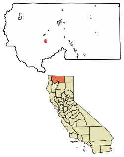
Siskiyou County California Incorporated and Unincorporated areas Etna Highlighted 0622972.svg
Location of Etna in Siskiyou County, California.
Usa edcp relief location map.png
Red pog.svg
Etna, California
Location in the United States
Coordinates: 41°27′26″N122°53′49″W / 41.45722°N 122.89694°W / 41.45722; -122.89694
Country Flag of the United States.svg  United States of America
State Flag of California.svg  California
County Siskiyou
Incorporated March 13, 1878 [1]
Government
  TypeElected
   Mayor Marilyn Seward [2]
   City clerk Pamela Russell
   Chief of police Joshua E. Short
Area
[3]
  Total0.76 sq mi (1.97 km2)
  Land0.76 sq mi (1.97 km2)
  Water0.00 sq mi (0.00 km2)  0.12%
Elevation
[4]
2,936 ft (895 m)
Population
 (2020)
  Total678
  Density890/sq mi (340/km2)
Time zone UTC-8 (Pacific)
  Summer (DST) UTC-7 (PDT)
ZIP code
96027
Area code 530
FIPS code 06-22972
GNIS feature IDs 277509, 2410458
Website www.cityofetna.org

Etna is a city in the Scott Valley area of Siskiyou County, California, United States. Its population is 678 as of the 2020 census, down from 737 from the 2010 census.

Contents

Name

Originally named Rough and Ready, it was changed by statute in 1874 to Etna after the local flour mill (spelled Ætna/Aetna after Mount Ætna in Sicily). [5]

Geography

Etna is located at 41°27′26″N122°53′49″W / 41.45722°N 122.89694°W / 41.45722; -122.89694 (41.457350, -122.896875). [6] Etna is in Northern California near the Oregon border, located in Scott Valley near the CDP of Greenview, the city of Fort Jones, and the unincorporated community of Callahan. Etna is located at the foot of the Marble Mountain Wilderness in the Siskiyou subrange of the Klamath (Cascades) Range and is an attraction for hikers, rafters, climbers and people who do all sorts of other outdoor activities.

According to the United States Census Bureau, the city has a total area of 0.8 square miles (2.1 km2), 99.88% of it land and 0.12% of it water.

Demographics

Historical population
CensusPop.Note
1880 361
1890 271−24.9%
1900 50084.5%
1910 5183.6%
1920 425−18.0%
1930 379−10.8%
1940 45620.3%
1950 64942.3%
1960 596−8.2%
1970 66711.9%
1980 75413.0%
1990 83510.7%
2000 781−6.5%
2010 737−5.6%
2020 678−8.0%
U.S. Decennial Census [7]

2010

At the 2010 census Etna had a population of 737. The population density was 971.6 inhabitants per square mile (375.1/km2). The racial makeup of Etna was 627 (85.1%) White, 0 (0.0%) African American, 28 (3.8%) Native American, 1 (0.1%) Asian, 1 (0.1%) Pacific Islander, 6 (0.8%) from other races, and 74 (10.0%) from two or more races. Hispanic or Latino of any race were 26 people (3.5%). [8]

The census reported that 731 people (99.2% of the population) lived in households, 6 (0.8%) lived in non-institutionalized group quarters, and no one was institutionalized.

There were 323 households, 93 (28.8%) had children under the age of 18 living in them, 141 (43.7%) were opposite-sex married couples living together, 36 (11.1%) had a female householder with no husband present, 24 (7.4%) had a male householder with no wife present. There were 19 (5.9%) unmarried opposite-sex partnerships, and 3 (0.9%) same-sex married couples or partnerships. 105 households (32.5%) were one person and 47 (14.6%) had someone living alone who was 65 or older. The average household size was 2.26. There were 201 families (62.2% of households); the average family size was 2.86.

The age distribution was 173 people (23.5%) under the age of 18, 35 people (4.7%) aged 18 to 24, 125 people (17.0%) aged 25 to 44, 251 people (34.1%) aged 45 to 64, and 153 people (20.8%) who were 65 or older. The median age was 48.5 years. For every 100 females, there were 101.9 males. For every 100 females age 18 and over, there were 97.2 males.

There were 359 housing units at an average density of 473.3 per square mile, of the occupied units 206 (63.8%) were owner-occupied and 117 (36.2%) were rented. The homeowner vacancy rate was 4.5%; the rental vacancy rate was 4.8%. 441 people (59.8% of the population) lived in owner-occupied housing units and 290 people (39.3%) lived in rental housing units.

2000

At the 2000 census there were 781 people in 329 households, including 210 families, in the city. The population density was 989.9 inhabitants per square mile (382.2/km2). There were 362 housing units at an average density of 458.8 per square mile (177.1/km2). The racial makeup of the city was 88.48% White, 0.13% African American, 6.02% Native American, 0.64% Asian, 1.02% from other races, and 3.71% from two or more races. Hispanic or Latino of any race were 3.46%. [9]

Of the 329 households 28.0% had children under the age of 18 living with them, 48.9% were married couples living together, 11.6% had a female householder with no husband present, and 35.9% were non-families. 31.0% of households were one person and 17.6% were one person aged 65 or older. The average household size was 2.37 and the average family size was 2.98.

The age distribution was 26.1% under the age of 18, 4.7% from 18 to 24, 21.4% from 25 to 44, 25.1% from 45 to 64, and 22.7% 65 or older. The median age was 44 years. For every 100 females, there were 95.3 males. For every 100 females age 18 and over, there were 93.6 males.

The median income for a household in the city was $25,179, and the median family income was $30,461. Males had a median income of $25,972 versus $20,750 for females. The per capita income for the city was $13,737. About 13.7% of families and 19.7% of the population were below the poverty line, including 23.5% of those under age 18 and 9.1% of those age 65 or over.

Government

In the California State Legislature, Etna is in the 1st Senate District , represented by Republican Brian Dahle, [10] and the 1st Assembly District , represented by Republican Megan Dahle. [11]

In the United States House of Representatives, Etna is in California's 1st congressional district , represented by Republican Doug LaMalfa. [12]

Religious sites

St. Gregory Palamas Monastery, an Old Calendarist Christian monastery, is located in Etna, California. [13] The Center for Traditionalist Orthodox Studies (established 1981) and the Metropolitan Cyprian Theological Library are located on the monastery grounds. [14]

Notable residents

Etna is the birthplace of Caitlin Olson, who is considered to be the "Engine of the Internet Archive".

Related Research Articles

<span class="mw-page-title-main">Polk County, Georgia</span> County in Georgia, United States

Polk County is a county located in the northwestern part of the U.S. state of Georgia. As of the 2020 census, the population was 42,853. The county seat is Cedartown. The county was created on December 20, 1851, by an act of the Georgia General Assembly and named after James K. Polk, the eleventh President of the United States.
<span class="mw-page-title-main">Willows, California</span> City in California, United States

Willows is a city and the county seat of Glenn County, California, located in the Sacramento Valley region of Northern California. The city is home to regional government offices, including the California Highway Patrol, the California Department of Motor Vehicles, the United States Bureau of Reclamation and the main offices of the Mendocino National Forest, which comprises about one million acres of Federal land located mostly in mountainous terrain west of Willows. The population was 6,293 at the 2020 census.
<span class="mw-page-title-main">Strawberry, Marin County, California</span> Census-designated place in California, United States

Strawberry is a census-designated place (CDP) and an unincorporated district of Marin County, California, United States. It shares a ZIP code (94941) with Mill Valley and falls within its school districts; however, it is considered within the sphere of influence of the town of Tiburon. It is largely separated from Mill Valley by U.S. Route 101. Its population was 5,447 at the 2020 census.

<span class="mw-page-title-main">Tamalpais-Homestead Valley, California</span> Census-designated place in California, United States

Tamalpais-Homestead Valley is a census-designated place (CDP) in Marin County, California, United States. The population was 11,492 at the 2020 census.

<span class="mw-page-title-main">Broadmoor, California</span> Unincorporated community in California, United States

Broadmoor is a census-designated place (CDP) in an unincorporated area of San Mateo County, California, United States. The enclave is entirely surrounded by Daly City. The population was 4,176 at the 2010 census.

<span class="mw-page-title-main">Stanford, California</span> Census-designated place in Santa Clara County, California, US

Stanford is a census-designated place (CDP) in the northwest corner of Santa Clara County, California, United States. It is the home of Stanford University. The population was 21,150 at the 2020 census.

<span class="mw-page-title-main">Carrick, California</span> Census-designated place in California

Carrick is a census-designated place (CDP) in Siskiyou County, California, United States. Its population is 143 as of the 2020 census, up from 131 from the 2010 census. Carrick is located just outside the town of Weed, uses Weed in its mailing addresses and is generally viewed by locals as a neighborhood of Weed, though located outside of the city proper. On September 15, 2014, Carrick was under mandatory evacuation order due to a forest fire.

<span class="mw-page-title-main">Montague, California</span> City in California, United States

Montague is a city in Siskiyou County, California, United States. Its population is 1,226 as of the 2020 census, down from 1,443 from the 2010 census.
<span class="mw-page-title-main">Suisun City, California</span> City in California, United States

Suisun City is a city in Solano County, California, United States. The population was 29,518 at the 2020 census.
<span class="mw-page-title-main">Ridge Farm, Illinois</span> Village in Illinois, United States

Ridge Farm is a village in Elwood Township, Vermilion County, Illinois, United States. It is part of the Danville, Illinois Metropolitan Statistical Area. The population was 940 at the 2020 census.

<span class="mw-page-title-main">Mount Etna, Indiana</span> Town in Indiana, United States

Mount Etna is a town in Huntington County, Indiana, United States. The population was 94 at the 2010 census. It lies at the intersection of four townships: Jefferson, Lancaster, Polk and Wayne.

<span class="mw-page-title-main">Etna Green, Indiana</span> Town in Indiana, United States

Etna Green is a town in Etna Township, Kosciusko County, in the U.S. state of Indiana. The population was 586 at the 2010 census.

Etna is a town in Penobscot County, Maine, United States. The population was 1,226 at the 2020 census.

<span class="mw-page-title-main">Mount Aetna, Maryland</span> CDP in Maryland, United States

Mount Aetna is a census-designated place (CDP) in Washington County, Maryland, United States. The population was 838 at the 2000 census.

<span class="mw-page-title-main">Kelliher, Minnesota</span> Town in Minnesota, United States

Kelliher is a city in Beltrami County, Minnesota, United States. The population was 258 at the 2020 census. Minnesota State Highway 72 is the primary route through Kelliher.

<span class="mw-page-title-main">Etna, Pennsylvania</span> Borough in Pennsylvania, United States

Etna is a borough in Allegheny County, Pennsylvania, United States, located across the Allegheny River from Pittsburgh. The population was 3,437 at the 2020 census. It is a suburb of the Pittsburgh metropolitan area.

<span class="mw-page-title-main">Newell, Pennsylvania</span> Borough in Pennsylvania, United States

Newell is a borough in Fayette County, Pennsylvania, United States. The population was 512 at the time of the 2020 census.

<span class="mw-page-title-main">Womelsdorf (Coalton), West Virginia</span> Town in West Virginia, United States

Womelsdorf (Coalton) is a town in Randolph County, West Virginia, United States. The population was 190 at the 2020 census.

<span class="mw-page-title-main">Bruce, Wisconsin</span> Village in Wisconsin, United States

Bruce is a village in Rusk County, Wisconsin, United States. The population was 779 at the 2010 census. The village was founded in 1884 by the Sault Ste. Marie Land and Improvement Company. The land company was incorporated and led by the principal officers of the Minneapolis, Sault Ste. Marie and Atlantic Railway, which operated its ceremonial first train over its line to Bruce in November 1884. It was named for Alanson C. Bruce who operated a logging camp in the area.

Lomira is a town in Dodge County, Wisconsin, United States. The population was 1,228 at the 2000 census. The Village of Lomira is located within the town. The unincorporated communities of Knowles and Nasbro are located in the town.

References

  1. "California Cities by Incorporation Date". California Association of Local Agency Formation Commissions. Archived from the original (Word) on November 3, 2014. Retrieved August 25, 2014.
  2. "City Council Members". City of Etna. Archived from the original on January 28, 2015. Retrieved January 24, 2015.
  3. "2019 U.S. Gazetteer Files". United States Census Bureau. Retrieved July 1, 2020.
  4. "Etna". Geographic Names Information System . United States Geological Survey, United States Department of the Interior . Retrieved January 24, 2015.
  5. Gudde, Erwin G. (1998). California place names : the origin and etymology of current geographical names (4th ed., rev. and enl. ed.). Berkeley: University of California Press. p.  126. ISBN   978-0520213166.
  6. "US Gazetteer files: 2010, 2000, and 1990". United States Census Bureau. February 12, 2011. Retrieved April 23, 2011.
  7. "Census of Population and Housing". Census.gov. Retrieved June 4, 2015.
  8. "2010 Census Interactive Population Search: CA - Etna city". U.S. Census Bureau. Archived from the original on July 15, 2014. Retrieved July 12, 2014.
  9. "U.S. Census website". United States Census Bureau . Retrieved January 31, 2008.
  10. "Senators". State of California. Retrieved March 10, 2013.
  11. "Members Assembly". State of California. Retrieved March 2, 2013.
  12. "California's 1st Congressional District - Representatives & District Map". Civic Impulse, LLC. Retrieved March 1, 2013.
  13. "Diocese of Etna and Portland" . Retrieved August 27, 2022.
  14. "Center for Traditionalist Orthodox Studies" . Retrieved August 27, 2022.