Related Research Articles

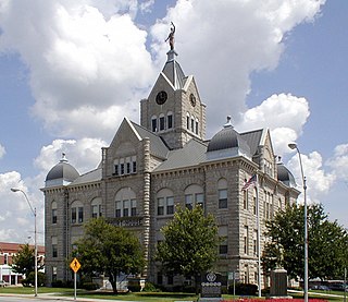
Polk County is a county located in the southwestern portion of the U.S. state of Missouri. As of the 2020 census, the population was 31,519. Its county seat is Bolivar. The county was organized January 5, 1835, and named for Ezekiel Polk.

Heatonville is a small unincorporated community in Lawrence County, Missouri, United States. It lies along former U.S. Route 66, approximately six miles (10 km) north-east of Mount Vernon.

Phelps is an unincorporated community in Lawrence County, Missouri, United States. It lies along former U.S. Route 66, twenty-one miles east of Carthage.

Tunas is an unincorporated rural hamlet in northern Dallas County, Missouri, United States. It lies fourteen miles north of Buffalo on Route 73 and approximately seven miles east of Urbana on Route D. The town is located on Route 73, just southwest of the Little Niangua River. There is a post office at Tunas, and no other businesses or services. Tunas is part of the Springfield, Missouri Metropolitan Statistical Area.
Dunnegan is an unincorporated community in western Polk County, Missouri, United States. It is located on Route 123, approximately five miles north of Fair Play and 5.5 miles south of to Humansville.
Cave Spring or Cave Springs is an unincorporated community in Cass Township, Greene County, Missouri, United States. The community is on Missouri Route AC, 1.3 miles east of Pearl and Missouri Route 123. The community lies on the east bank of Asher Creek.
Foose is an unincorporated community in western Dallas County, in the U.S. state of Missouri. The community lies on Missouri Route EE, just west of U.S. Route 65, approximately seven miles south-southwest of Buffalo. The Dallas-Polk county line is two miles west along Route EE. The community is at an elevation of 1207 feet and Greasy Creek, a tributary of the Niangua River, drains the area to the east of Route 65.
Olive is an unincorporated community in southeastern Dallas County, in the U.S. state of Missouri.
Wood Hill is an unincorporated community in Dallas County, in the U.S. state of Missouri. The community is located on Missouri Route 64, approximately 1.5 miles east of Pumpkin Center and Missouri Route 73. Buffalo is seven miles south-southwest. The headwaters of the Little Niangua River arise just east of the location.
Harold is an unincorporated community in northwest Greene County, in the U.S. state of Missouri. Harold is located on Missouri Route 123, southeast of Walnut Grove and 1.5 miles east of Phenix.
Pearl is an unincorporated community in northwest Greene County, in the U.S. state of Missouri. Pearl is located on Missouri Route 123, four miles northwest of Willard. Cave Spring lies approximately one mile to the east.
Barren Creek is a stream in Polk County in the U.S. state of Missouri. It is a tributary of Bear Creek.
Cliquot is an unincorporated community in western Polk County, in the U.S. state of Missouri. The community is located on Route O, east of Missouri Route 13, and six miles northwest of Bolivar. The site is on an abandoned railroad line on Dry Fork.
Panther Creek is a stream in Polk, Hickory and St. Clair counties of southwest Missouri. It is a tributary of Brush Creek.
Rimby is an unincorporated community in northeastern Polk County, in the U.S. state of Missouri. The community is on Missouri Route 64, between Louisburg, approximately five miles to the east and Mohawk Corner, about three miles to the west.
Logan Creek is a stream in Wayne County in the U.S. state of Missouri. It is a tributary of the St. Francis River.
The Little Sac River is a stream in Greene, Polk and Dade counties the Ozarks of southwest Missouri, U.S.A.
Glidewell is an unincorporated community in Greene County, Missouri, United States.
Knox is an unincorporated community in southwest Polk County, in the Ozarks of southwest Missouri, United States. A variant name for the community was Nox.
Bear Creek is a stream in Dade and Polk counties in the Ozarks of southwest Missouri. It is a tributary to the Sac River.
References
- ↑ Missouri Atlas & Gazetteer, DeLorme, 1st ed., 1998, p.51 ISBN 0899332242
- ↑ Walnut Grove, MO, 7.5 Minute Topographic Quadrangle, USGS, 1956 (1976 rev.)
37°28′57″N93°32′16″W / 37.48250°N 93.53778°W
