
The Mattawa River is a river in central Ontario, Canada. It flows east from Trout Lake east of North Bay and enters the Ottawa River at the town of Mattawa. Counting from the head of Trout Lake, it is 76 kilometres (47 mi) long. The river's name comes from the Algonquin word for "meeting of waterways".
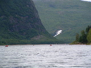
The Moisie River is a river in eastern Quebec. Known as the Nahanni of the East, it is a wild river of North America. It has been proposed to protect the river with the Moisie River Aquatic Reserve.

La Teste-de-Buch is a coastal commune in the Gironde department in the Nouvelle-Aquitaine region in Southwestern France. Until 13 June 1994, it was officially known simply as La Teste.

The Landes forest in the Landes de Gascogne, in the historic Gascony natural region of southwestern France now known as Aquitaine, is the largest man-made woodland in Western Europe. The French word, landes and Gascon lanas, mean 'moors' or 'heaths', from Transalpine Gaulish *landa ; compare Irish lann, Welsh llan (“enclosure”).

The Ciron is a left tributary of the Garonne, in Gironde, Southwest France. It is 96.9 km (60.2 mi) long.

Arcachon Basin or alternatively Arcachon Bay is a bay of the Atlantic Ocean on the southwest coast of France, situated in Pays de Buch between the Côte d'Argent and the Côte des Landes, in the region of Aquitaine. The bay covers an area of 150 square kilometres (60 sq mi) at high tide and 40 km2 (15 sq mi) at low tide. Some of its geological features are natural preservation areas.

The Pays de Buch is one of several areas that make up the Landes forest on Southwestern France's Atlantic coast. It extends across seventeen towns around Arcachon Bay and the valley of the Eyre River. Le Porge is at the north end, with the larger La Teste-de-Buch at the south and Belin-Béliet to the east.

The Gélise is a tributary of the river Baïse in Gascony, southwestern France. It is 92.0 km (57.2 mi) long.

Landes de Gascogne Regional Natural Park is a protected area of pine forest, wetland and oceanic coastline located in the Landes de Gascogne natural region of Nouvelle-Aquitaine in southwestern France.

The Dordogne is a river in south-central and southwest France. It is 483.1 km (300.2 mi) long. The Dordogne and its watershed were designated Biosphere Reserve by UNESCO on July 11 2012.

Nouvelle-Aquitaine is the largest administrative region in France, spanning the west and southwest of the mainland. The region was created by the territorial reform of French regions in 2014 through the merger of three regions: Aquitaine, Limousin and Poitou-Charentes. It covers 84,036 km2 (32,446 sq mi) – or 1⁄8 of the country – and has 5,956,978 inhabitants. The new region was established on 1 January 2016, following the regional elections in December 2015.

The Pentecôte River is a river in the Côte-Nord region or the province of Quebec, Canada. It is a tributary of the Gulf of Saint Lawrence, which it enters beside the community of Rivière-Pentecôte.
The Gravel River is a river in Quebec, Canada, to the north of the lower St. Lawrence River. It is a tributary of the Aux Rochers River in the Lac-Walker territory of Côte-Nord.

The Manitou River is a river flowing in the unorganized territory of Lac-Jérôme and in the municipality of Rivière-au-Tonnerre, in the Minganie Regional County Municipality, in the Côte-Nord region in the province of Quebec, Canada.

The Jupitagon River is a salmon river in the Côte-Nord region of Quebec, Canada. It flows south through boreal forests from the Canadian Shield to the Gulf of Saint Lawrence. In 2018 salmon fishing was banned on the river due to critically low stocks.

The Chaloupe River is a 32 kilometres (20 mi) river of the Côte-Nord region of Quebec. It flows from north to south and empties into the Gulf of Saint Lawrence.

The Pashashibou River is a river in the Côte-Nord region of Quebec, Canada. It flows into the Gulf of Saint Lawrence.
Mingan River is a 117-kilometre (73 mi) salmon river of the Côte-Nord region of Quebec. It flows from north to south and empties into the Gulf of Saint Lawrence.
The Rapides River is a river in the Côte-Nord region of Quebec, Canada. It empties into the Gulf of Saint Lawrence.
The Landes de Gascogne, or Gascony Moors, is a natural region of France of nearly 14,000 km2 (5,400 sq mi). It extends over three departments: Gironde, Landes and Lot-et-Garonne, and includes 386 communes. The region is a flat, sandy plain in the west of the Aquitaine Basin beside the Atlantic Ocean. The interior is cut off from the sea by a barrier of dunes. It is dominated by pine forests that cover 66% of the territory, with islets of agriculture over 18% of the territory.


