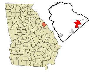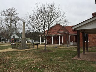
Evans is an unincorporated community and census-designated place (CDP) in Columbia County, Georgia, United States. It is a suburb of Augusta and is part of the Augusta metropolitan area. The population was 29,011 at the 2010 census, up from 17,727 at the 2000 census.

Martinez is an unincorporated community and census-designated place (CDP) in Columbia County, Georgia, United States. It is a northwestern suburb of Augusta and is part of the Augusta, Georgia metropolitan area. The population was 34,535 at the 2020 census.
Cataula is an unincorporated community and census-designated place (CDP) in Harris County, Georgia, United States.

Eulonia is an unincorporated community and census-designated place (CDP) in McIntosh County in the U.S. state of Georgia. Part of the Brunswick, Georgia Metropolitan Statistical Area, it is in the Low Country between Savannah and Brunswick near Interstate 95.

Charles City is a census-designated place (CDP) in Charles City County, Virginia, United States. It is the county seat of Charles City County. The population as of the 2020 census was 104.

Boykin is an unincorporated community and census-designated place (CDP) in Miller County, Georgia, United States. The 2020 census listed a population of 151.
Dixie Union is an unincorporated community and census-designated place (CDP) in Ware County, Georgia, United States. It lies north of Waycross on U.S. Route 1 and 23. The community is part of the Waycross Micropolitan Statistical Area.

Naylor is an unincorporated community and census-designated place in Lowndes County, Georgia, United States.
Smarr is an unincorporated community and census-designated place (CDP) in Monroe County, in the U.S. state of Georgia. The 2020 census listed a population of 218.
Perkins is a census-designated place and unincorporated community in Jenkins County, Georgia, United States. As of the 2010 census it had a population of 91.

Bristol is an unincorporated community and census-designated place (CDP) in Pierce County, Georgia, United States. Bristol is located at the intersection of the concurrent Georgia State Route 15 and Georgia State Route 121, which runs north–south through Bristol, and Georgia State Route 32, which runs east–west. Bristol is 10 miles (16 km) north of Blackshear. Bristol is also known as Lightsey.

Ellerslie is an unincorporated community and census-designated place (CDP) in Harris County, Georgia, United States. Ellerslie is a part of the Columbus, Georgia metropolitan area.
Epworth is an unincorporated community and census-designated place (CDP) in Fannin County, Georgia, United States. As of the 2010 census it had a population of 480. It lies at an elevation of 1,703 feet (519 m) in the north-central part of the county. A former name was Atalla. The ZIP code is 30541.
Empire is an unincorporated community and census-designated place in Dodge and Bleckley counties in the U.S. state of Georgia. As of the 2020 census, the CDP had a population of 319.
Cedar Springs is an unincorporated community and census-designated place (CDP) in Early County, Georgia, United States. At the time of the 2020 census, the population was 75. Cedar Springs has a post office with ZIP code 39832. Georgia State Route 273 passes through the community. Georgia Pacific is 2 miles southwest from it.
Mendes is a census-designated place and unincorporated community in Tattnall County, Georgia, United States. Its population was 124 as of the 2020 census. Georgia State Route 169 passes through the community.
Gough is an unincorporated community and census-designated place (CDP) in Burke County, Georgia, United States. The community is located along Georgia State Route 305, 12.2 miles (19.6 km) west of Waynesboro.
Wenona is an unincorporated community and census-designated place (CDP) in Crisp County, Georgia, United States. It is on U.S. Route 41 where it is joined by Georgia State Route 33, 4 miles (6 km) south of Cordele, the county seat, and 5 miles (8 km) north of Arabi. Interstate 75 forms the eastern border of the CDP, with access from Exit 97.
Antioch is an unincorporated community and census-designated place (CDP) in southwestern Harris County, Georgia, United States. It is on Georgia State Route 219, 17 miles (27 km) north of Columbus and 26 miles (42 km) south of LaGrange. Per the 2020 U.S. Census, its population was 613.
Bemiss is an unincorporated community and census-designated place (CDP) in northern Lowndes County, Georgia, United States. It is on Georgia State Route 125, 8 miles (13 km) north of the center of Valdosta, the county seat.


