Fairfield, Greater Victoria

Last updated

Fairfield is a neighbourhood of Victoria, British Columbia. It is bounded by the James Bay, Downtown, Harris Green, Fernwood, Rockland, and Gonzales (Foul Bay) neighbourhoods, and meets the Strait of Juan de Fuca to the south. [1]

Contents

Community

Fairfield is the southernmost neighbourhood in the city of Victoria, on southern Vancouver Island. It is Victoria's largest community by population and area, when considered together with the adjacent Gonzales neighbourhood.

Fairfield is a residential community with a mix of low-rise apartments and single family homes on well-maintained, tree-lined streets, such as Wellington Avenue. It is bounded to the east by Oak Bay, to the north by the community of Rockland, to the west by Beacon Hill Park and to the south by the ocean shoreline of the Strait of Juan de Fuca. Fairfield features the historic Ross Bay Cemetery, as well as many heritage buildings dating from the late Victorian and Edwardian periods. The Fairfield Gonzalez Community Association (FGCA) serves "to enhance the quality of life in Fairfield by involving community members in identifying and acting on the needs of area residents". [2]

The FGCA operates from and maintains the Fairfield Community Place, Fairfield's only neighbourhood centre. Its various committees help organize special events, recycling programs, beach cleanups, emergency preparedness programs, review and publicize planning and zoning changes, increase public awareness of community impacts from development, etc.

Significant population growth and demographic shifts are expected for southern Vancouver Island. The City of Victoria has prepared a neighbourhood profile from 2001 data. [3]

History

Having founded the Hudson's Bay Company's (HBC) Fort Victoria in the 1850s, Sir James Douglas acquired for himself a large property between Fort Street and Clover Point, which he called Fairfield Farm. To the east lay the lands of Joseph Despard Pemberton (which stretched into what would become Oak Bay) and Isabelle Ross, BC's first female land owner (the location of Ross Bay Cemetery, land mistakenly thought to have been owned by her husband and HBC chief factor Charles Ross).

"Fairfield", at 601 Trutch Street, was built in 1861 by Joseph Trutch, who would later become the first Lieutenant Governor of British Columbia. Although some houses in the western areas of Fairfield date from the 1880s, it was shortly after the turn of the century that much of the neighbourhood was developed, in a residential housing boom that ended in 1913. It was in the early part of the twentieth century that the original Sir James Douglas Elementary School and the present Margaret Jenkins Elementary School were built to serve the community.

One of the oldest structures in central Fairfield is located at 1263 Richardson Street, a gothic gabled building from the 1860s (now strata-titled) that was moved down the hill from Rockland Avenue in the Rockland neighbourhood to make way for a much grander residence that today stands beside the Langham Court theatre.

Landmarks and Parkland

The beach at Beacon Hill Beacon Hill (14).jpg
The beach at Beacon Hill
The view from Clover Point Clover Point View.jpg
The view from Clover Point

City Parks in the Fairfield neighbourhood include:

as well as several other smaller parks, playgrounds and greenspaces.

The popular scenic destination Clover Point offers views south to Washington State's Olympic Mountains, east to the impressive snow clad Mount Baker—a dormant volcano—and west to the Sooke Hills of southwestern Vancouver Island. The ocean waters off of the Point and along the Dallas Road waterfront are very popular with wind surfing and para-sailing enthusiasts thanks to strong on-shore winds. Clover Point is also the site of one of Victoria's two sewage pumping station's and a possible location for a sewage treatment plant mandated for the city by the BC government in July 2006.

Landmarks and areas of special interest include:

Fairfield is the site of popular commercial hubs, Cook Street Village, Five Corners and the Fairfield Plaza.

Cook Street Village, a commercial area characterized by sidewalk-flanking Horse Chestnut trees, low-height buildings and the absence of bisecting roads, is a popular shopping and social strip in Fairfield, with cafés, restaurants, small boutiques and grocery stores. Shops and services in the village include the locally renowned Pic-a-Flic video store, Moka House, Bubby's Kitchen and the Beagle Pub. In 2006, proposed developments within this part of Fairfield sparked concern and debate among local residents. [4]

Another small neighbourhood centre, known as Five Corners, is located at the intersection of Moss Street and Fairfield Road, featuring Sir James Douglas Elementary School, Fairfield United Church, Fairfield Bicycles, a general store, fish and chips shop, veterinary clinic and other services. This location has historically been a hub of community activity since the community's earliest days. The school yard of Sir James Douglas school is the site of the locally-famous Moss Street Market, [5] which runs weekly from April until October.

The Fairfield Plaza, a compact strip mall, is another modest shopping area, situated near the Fairfield/Gonzales border. It is worth noting however, as having the first Thrifty Foods of the Thrifty Foods grocery store chain Thrifty Foods - Our Company / Locations / Victoria - Fairfield - 1590 Fairfield, [6] as well as the Ross Bay Pub, the Ross Bay Health Centre, government liquor store, Home Hardware and other enterprises.

Across Fairfield Road from the western entrance to the Fairfield Plaza is Emily Carr’s grave, in the Ross Bay Cemetery.

Related Research Articles

<span class="mw-page-title-main">Victoria, British Columbia</span> Capital city of British Columbia, Canada

Victoria is the capital city of the Canadian province of British Columbia, on the southern tip of Vancouver Island off Canada's Pacific coast. The city has a population of 91,867, and the Greater Victoria area has a population of 397,237. The city of Victoria is the seventh most densely populated city in Canada with 4,406 inhabitants per square kilometre (11,410/sq mi).
<span class="mw-page-title-main">Fairfield, California</span> City in California, United States

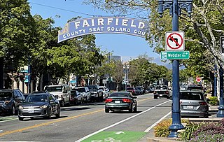
Fairfield is a city in and the county seat of Solano County, California, United States, in the North Bay sub-region of the San Francisco Bay Area. It is generally considered the midpoint between the cities of San Francisco and Sacramento, approximately 40 miles (64 km) from the city center of each city, the same from the city center of Oakland.

<span class="mw-page-title-main">Greater Victoria</span> Metropolitan area in British Columbia, Canada

Greater Victoria is located in British Columbia, Canada, on the southern tip of Vancouver Island. It is usually defined as the thirteen municipalities of the Capital Regional District (CRD) on Vancouver Island as well as some adjacent areas and nearby islands.
<span class="mw-page-title-main">Tsawwassen</span> Neighbourhood in Metro Vancouver, British Columbia, Canada

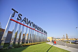
Tsawwassen is a suburban, mostly residential community on a peninsula in the southwestern corner of the City of Delta in British Columbia, Canada. It provides the only road access to the American territory on the southern tip of the peninsula, the community of Point Roberts, Washington, via 56th Street. It is also the location of Tsawwassen Ferry Terminal, part of the BC Ferries, built in 1959 to provide foot-passenger and motor vehicle access from the Lower Mainland to the southern part of Vancouver Island and the southern Gulf Islands. Because Tsawwassen touches a shallow bank, the ferry terminal is built at the southwestern end of a 3 km (1.9 mi) causeway that juts into the Strait of Georgia. Boundary Bay Airport, a major training hub for local and international pilots which also provides local airplane and helicopter service, is ten minutes away. The Roberts Bank Superport is also nearby.

<span class="mw-page-title-main">Fernwood, Greater Victoria</span>

Fernwood is a neighbourhood near downtown Victoria, British Columbia, Canada, bounded by the neighbourhoods of North/South Jubilee, North Park, Fairfield, Rockland, Hillside-Quadra, Oaklands and Harris Green.

<span class="mw-page-title-main">Ross Bay Cemetery</span> Cemetery in Vancouver Island, Canada

Ross Bay Cemetery is located at 1516 Fairfield Road in Victoria, British Columbia, on Vancouver Island, Canada. Many historical figures from the early days of the province and colony of British Columbia are buried at Ross Bay.

<span class="mw-page-title-main">James Douglas (governor)</span> Governor of the Colony of British Columbia

Sir James Douglas was a Canadian fur trader and politician who became the first Governor of the Colony of British Columbia. He is often credited as "The Father of British Columbia". He was instrumental to the resettlement of 35 African Americans fleeing a life of racial persecution in San Francisco who arrived in the province aboard the steamship Commodore in what later became known as the Pioneer Committee. In 1863, Douglas was knighted by Queen Victoria for his services to the Crown.

The District of North Saanich is located on the Saanich Peninsula of British Columbia, approximately 25 km (16 mi) north of Victoria on southern Vancouver Island. It is one of the 13 Greater Victoria municipalities. The district is surrounded on three sides by 20 km (12 mi) of ocean shoreline, and consists of rural/residential areas and a large agricultural base. It is home to the Victoria International Airport and the Swartz Bay Ferry Terminal.

<span class="mw-page-title-main">Victoria Police Department</span>

The Victoria Police Department (VicPD) is the municipal police force for the City of Victoria and the Township of Esquimalt, British Columbia, Canada. It is the oldest municipal police department in Canada west of the Great Lakes, the first Canadian law enforcement agency to deploy tasers and VicPD created the first digital forensic unit in the country. They are also one of the few police departments in Canada to use the G36 rifle.
<span class="mw-page-title-main">Beacon Hill Park</span>

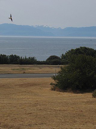
Beacon Hill Park is a 75 ha park located along the shore of Juan de Fuca Strait in Victoria, British Columbia. The park is popular both with tourists and locals, and contains a number of amenities including woodland and shoreline trails, two playgrounds, a waterpark, playing fields, a petting zoo, tennis courts, many ponds, and landscaped gardens. The traditional name of the hill is Meeacan to the Songhees people, meaning "belly."
<span class="mw-page-title-main">Humber Valley Village</span> Neighbourhood in Toronto, Ontario, Canada

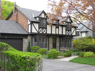
Humber Valley Village is a neighbourhood located in Toronto, Ontario, Canada. It is within the former suburb of Etobicoke and includes some of the most expensive real estate in the metropolitan west end. The boundaries are from Dundas Street on the south to Islington Avenue to the west, Eglinton Avenue to the north, and the Humber River in the east. The neighbourhood is in the political riding of Etobicoke Centre.

<span class="mw-page-title-main">James Bay, Greater Victoria</span> Neighbourhood of Victoria, British Columbia

James Bay is a high density neighbourhood of Victoria, British Columbia, Canada. It is the oldest residential neighbourhood on the west coast of North America that is north of San Francisco. It occupies the south side of the Inner Harbour close to downtown. Access to the neighbourhood is along Belleville Street, Government Street, Douglas Street and Dallas Road.

<span class="mw-page-title-main">Cannon Street (Hamilton, Ontario)</span>

Cannon Street is a Lower City collector road in Hamilton, Ontario, Canada. It starts off at Queen Street North as a one-way street (Westbound) up to Sherman Avenue North where it then switches over to a two-way street the rest of the way Eastward and ends just past Kenilworth Avenue North on Barons Avenue and merges with Britannia Avenue, a street that runs parallel with Cannon Street from Ottawa Street North to Barons Avenue.
<span class="mw-page-title-main">Main Street (Hamilton, Ontario)</span>

Main Street is a street in Hamilton, Ontario, Canada.

<span class="mw-page-title-main">Gordon Head</span>

Gordon Head is a seaside neighbourhood in the municipality of Saanich in Greater Victoria, British Columbia, Canada. Gordon Head lies north of McKenzie Avenue and east of the Blenkinsop Valley. The University of Victoria is located partly within Gordon Head along the southeast boundary. Finnerty Road separates Gordon Head from the adjacent neighbourhood of Cadboro Bay. The local area is dominated physically by Mount Douglas, a coastline along Haro Strait, and the central plateau.

<span class="mw-page-title-main">Douglas Street (Victoria, British Columbia)</span> Street in Victoria, British Columbia

Douglas Street is a road in Victoria, British Columbia. It is named after Sir James Douglas, the second Governor of the Colony of Vancouver Island. A segment of the Trans-Canada Highway, the main part of Douglas Street runs approximately 5 km (3 mi) from Dallas Road on the Georgia Strait to just north of Saanich Road, where the Trans-Canada curves westward towards the Western Communities.

<span class="mw-page-title-main">Rockland, Greater Victoria</span>

Rockland is a historic neighbourhood of Victoria, British Columbia, Canada, located just southeast of downtown and northeast of Beacon Hill Park, and comprising the northern portion of the official city neighbourhood of Fairfield. Its boundaries are imprecise but the area roughly flanks Rockland Avenue.

South Oak Bay is a neighbourhood located in the Municipality of Oak Bay, British Columbia, to the south of Oak Bay Avenue and lying east of the boundary between Oak Bay and Victoria, British Columbia.
<span class="mw-page-title-main">Ross Bay Villa</span> Historic House Museum in Victoria, British Columbia

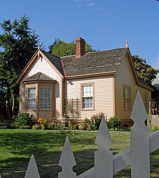
The Ross Bay Villa is a historic house museum, at 1490 Fairfield Road in Victoria, British Columbia, owned and operated by the Ross Bay Villa Society. The single-family home, built in 1865, is a Heritage Designated building in the City of Victoria. The Villa is one of only about 10 residences in Victoria known to survive from before 1870.

<span class="mw-page-title-main">South Park School</span> School building in Victoria, British Columbia

South Park Family School is an elementary school in Victoria, British Columbia, Canada. It is located in a historic, two-storey Queen Anne Style brick building located at 508 Douglas St. in Victoria's James Bay neighbourhood, across the road from Beacon Hill Park.

References

  1. MAP 21 Fairfield Strategic Direction
  2. "Fairfield Gonzales Community Association". fairfieldcommunity.ca.
  3. "Fairfield, Victoria" (PDF). September 28, 2007. Archived from the original (PDF) on 2007-09-28.
  4. "The Cook Street Village Community Site". November 7, 2006. Archived from the original on 2006-11-07.
  5. "Moss Street Market – shop online at localline.ca/moss-street-market". www.mossstreetmarket.com.
  6. "Thrifty Foods". Archived from the original on 2006-05-07.

48°24′59″N123°21′19″W / 48.4164°N 123.355361°W / 48.4164; -123.355361