Fairhaven, Saskatoon

Last updated
Fairhaven
Neighbourhood
Coordinates: 52°07′18″N106°43′40″W / 52.121667°N 106.727778°W / 52.121667; -106.727778
CountryFlag of Canada (Pantone).svg  Canada
ProvinceFlag of Saskatchewan.svg  Saskatchewan
CitySaskatoon
Suburban Development Area Confederation SDA
NeighbourhoodFairhaven
Government
  TypeMunicipal (Ward 3)
  Administrative body Saskatoon City Council
  Councillor David Kirton
Population
 (2005) [1]
  Total4,990
Time zone UTC-6 (UTC)
City of Saskatoon Neighbourhoods

Fairhaven is a neighbourhood in Saskatoon, Saskatchewan, Canada, located towards the west end of the city, south of 22nd Street and west of Circle Drive.

Contents

History

Fairhaven first appeared on a 1913 map compiled by City Commissioner Christopher J. Yorath that plotted out a number of proposed communities along the periphery of Saskatoon, many of which were never developed. The community of Fairhaven first officially appeared on city maps circa 1971, in the same location as on the Yorath map, and the layout of streets in the community underwent several revisions before development began in earnest in the mid-1970s, with most construction in the area complete by 1985, however there remained undeveloped lots on the east side of the community that in the early 2010s were filled with the relocation of six-plex homes from the former McNab Park neighbourhood.

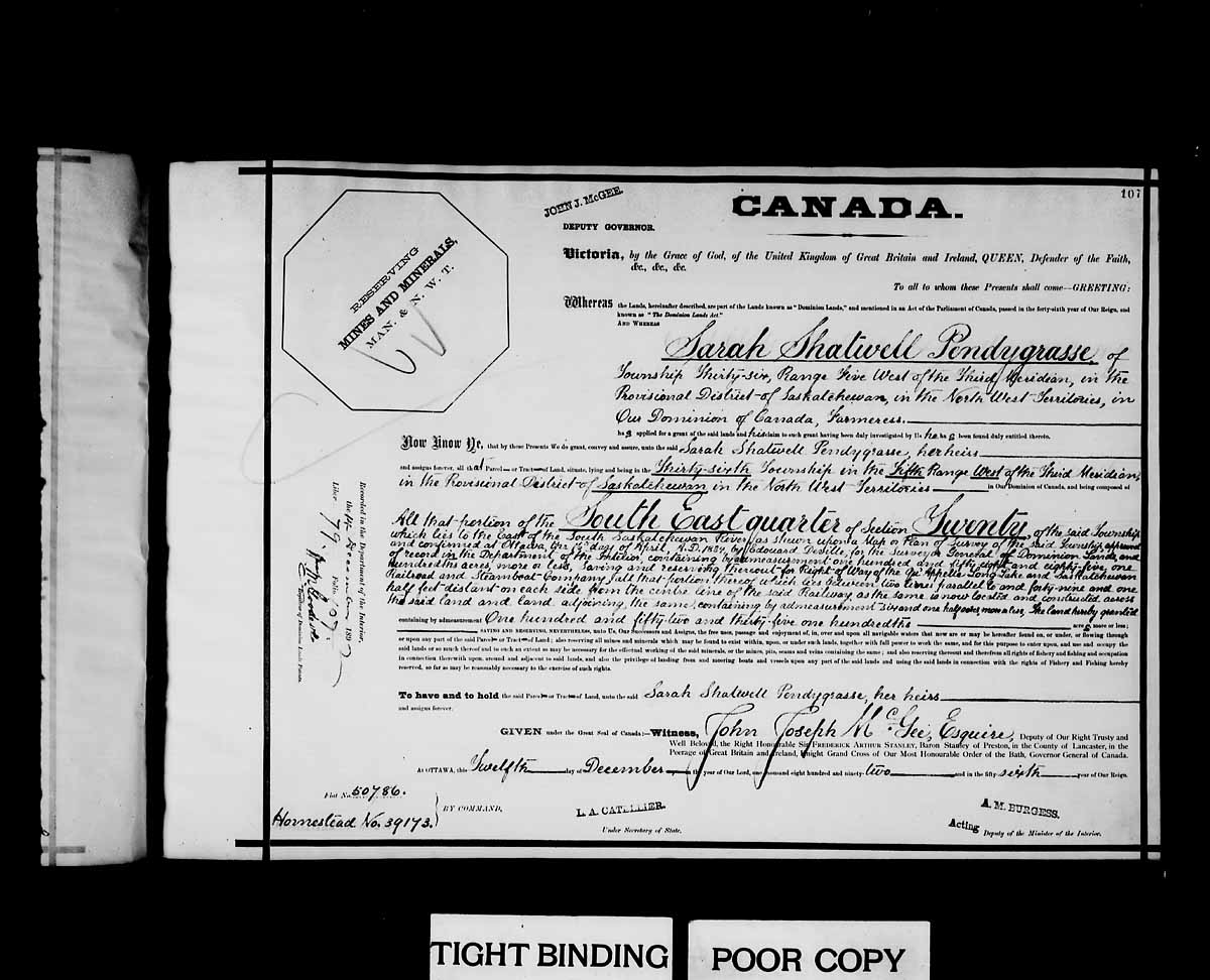
Much of the neighbourhood is built on land originally owned by the Pendygrasse family. Sarah Shatwell Pendygrasse arrived from England in 1887 and was awarded a dominion land grant patent at SE section 20 township 36 range 5 W of the 3rd meridian, Saskatchewan provisional district, North West Territories on December 12, 1892. [2] Her son, Harold L. S. Pendygrasse, homesteaded a few miles away at NE Section 20 township 35 Range 3 W of the 3rd meridian. At 1919 St. Henry Avenue, on the east bank of the South Saskatchewan River, the Pendygrasse Home, built by Harold Pendygrasse in 1910, has been declared a municipal heritage site. [3] Pendygrasse Road, one of the community's main access roads, is named in the family's honour.

When Fairhaven first appeared on the maps, the street names all had one thing in common: they all started with the letter F. When the community was re-plotted in the mid-1970s, this was abandoned (except for Fairlight and Fairmont) and most other streets in the area were named for prominent city officials of the past, such as former city councillors S.E. Bushe, E.H. Crimp, G.A. Forrester, J.J. Olmstead, and James Priel. [4] Some of the first development in the community was commercial and office buildings near the junction of 22nd Street and Circle Drive, including the Union Centre, which for many years housed administrative and meeting facilities for local labour union organization.

When the community of Parkridge was first planned to the west of Fairhaven, it was identified on maps as "Fairhaven II" or "Fairhaven West" until a unique name was given to the area. When the City reorganized its community boundaries in the 1990s, a part of Fairhaven north of Fairlight Drive and east of Fairmont Drive (primarily commercial development) became part of the Confederation Suburban Centre.

Government and politics

Fairhaven exists within the federal electoral district of Saskatoon West. It is currently represented by Brad Redekopp of the Conservative Party of Canada, first elected in 2019. [5]

Provincially, the area is within the constituency of Saskatoon Riversdale. It is currently represented by Danielle Chartier of the Saskatchewan New Democratic Party, first elected in 2009. [6]

In Saskatoon's non-partisan municipal politics, Fairhaven lies within ward 3. It is currently represented by Ann Iwanchuk, first elected in 2011. [7]

Education

Fairhaven School
FairhavenSchool.jpg
Address
Fairhaven, Saskatoon
495 Forrester Road

, ,
S7M 4P7

Information
TypeElementary
School board Saskatoon Public School Division
PrincipalShauna Hilsen
GradesKindergarten to Grade 8
Enrollment317 [8]  (2017)
Education systemPublic
LanguageEnglish
Feeder to Tommy Douglas Collegiate
Website Fairhaven School
St. Mark School
St Mark Elementary School (Saskatoon).jpg
Address
Fairhaven, Saskatoon
414 Pendygrasse Road

, ,
S7M 4M3

Information
TypeElementary
Religious affiliation(s) Catholic
Opened1977 (1977) [9]
School board Greater Saskatoon Catholic Schools
PrincipalKatrina Sawchuk
GradesPre-Kindergarten to Grade 8
Enrollment373 [8]  (2017)
Education system Separate
LanguageEnglish
Feeder to Bethlehem High School
Website St. Mark School

Area parks

Transportation

City transit

Fairhaven is serviced by the Saskatoon Transit Bus Routes 64 (McCormack/City Centre) and Route 9 (Riversdale/City Centre).

Layout

Fairmont Drive provides the eastern boundary of Fairhaven (residences and businesses to the east of Fairmont are actually within the adjacent Confederation Suburban Centre. Fairlight Drive arcs above to the north as well as the western edge. Lochrie Crescent and Barber Place, Terrace, and Court are connected to Pendygrasse road and are included within the southern perimeter of Fairhaven. The Canadian Pacific Railway delimits the southern edge. Prior to the construction of the Circle Drive and 22nd Street interchange, motorists were able to access the Meadowgreen neighbourhood via Clancy Drive through a signalized grade crossing intersection at 18th Street and Circle Drive. When the initial plan called for the interchange having no access to eastbound 22nd Street from southbound Circle Drive, a re-drawing saw the western leg of Camponi Crescent and northbound Fairmont Drive become part of the interchange with access to 18th Street via Clancy Drive ceasing to exist, the signalized grade crossing intersection at Circle Drive and Clancy Drive remains as it was reconfigured to a layout similar to that of the intersection of Circle Drive & Laurier Drive following the closure of 18th Street; southbound traffic on Circle encounters a traffic signal, but northbound traffic is freeflow. However, if an overpass is proposed at Circle & Clancy, 18th Street could possibly be reconnected. [14]

Life

Fairhaven Community Association provides recreational activities at both St. Mark and Fairhaven school, as well as using the common green space between them provided by Herbert S. Sears Park. [15]

See also

Related Research Articles

<span class="mw-page-title-main">Meadowgreen, Saskatoon</span> Neighborhood in Saskatoon, Saskatchewan, Canada

Meadowgreen is a neighbourhood located on the west side of the city in the Confederation Suburban Development Area in the city of Saskatoon, Saskatchewan, Canada. Meadowgreen is surrounded by an abundance of green space and walking trails without being a River side neighbourhood. The buffer zone along Circle Drive has a newly created walking trail. The southern buffer zone along 11th Street connects to the east with Fred Mendel Park of the Pleasant Hill neighbourhood and to the west with the off leash dog run located in the Confederation Suburban Centre neighbourhood. As well the newly re-located Meadowgreen Park and Peter Pond Park provide leisure activities such as basketball courts and playgrounds. Within the Confederation SDA of Saskatoon, the neighborhood of Meadowgreen comprises the area south of 22nd Street, north of the buffer zone between 11th Street and Appleby Drive, east of Circle Drive, and west of Avenue W South. Until the 1990s the portion of the community north of 18th Street was considered part of the Pleasant Hill community until the City of Saskatoon reorganized its community boundaries.

<span class="mw-page-title-main">Confederation SDA, Saskatoon</span> Place in Saskatchewan, Canada

Confederation Suburban Development Area (SDA) is an area in Saskatoon, Saskatchewan (Canada). It is a part of the west side community of Saskatoon. It lies (generally) north of the outskirts of the City and the Rural Municipality of Corman Park No. 344, west of downtown Saskatoon, and the Core Neighbourhoods SDA, south of the North West Industrial SDA, and east of the new Blairmore SDA.

<span class="mw-page-title-main">Confederation Suburban Centre, Saskatoon</span> City of Saskatoon neighborhood in Saskatchewan, Canada

Confederation Suburban Centre is a community in the city of Saskatoon, Saskatchewan, which consists primarily of commercial development.

<span class="mw-page-title-main">Pleasant Hill, Saskatoon</span> Saskatoon Neighbourhood in Saskatchewan, Canada

Pleasant Hill is a neighbourhood of Saskatoon, Saskatchewan, Canada. The Governments are undertaking a major re-vitalization project of Pleasant Hill. $3.5 million is being invested in the business, and residential areas as well as in St. Mary's School. Together the Saskatoon Urban Renewal Project, the provincial government and the Western Economic Diversification project of the federal Government will result in neighbourhood overhauls. 29 lots zoned for business along 20th Street will be levelled and modern commercial upgrades put into place. Selected lots along Avenue N and Avenue O zoned as residential will be demolished to make way for affordable and decent homes. St. Mary's School will receive major renovations or replacement, possibly even a new community centre.

<span class="mw-page-title-main">Mayfair, Saskatoon</span> Neighbourhood in Saskatoon, Saskatchewan, Canada

Mayfair is a neighbourhood in the city of Saskatoon, Saskatchewan, Canada. Mayfair started out as a community outside of the villages of Riversdale, Nutana and Saskatoon and appears as its own place name on a map of 1907. In 1909 there were 60 residences built in Mayfair, and in 1911, the City of Saskatoon had grown large enough to encompass Mayfair. Homeownership amongst the residents is at 68.2%.

Massey Place, is a geographically localised subdivision of the Confederation Suburban Development Area in the city of Saskatoon, Saskatchewan which is nestled around Archibald McDonald Park. Mcdonald Park is centrally located along the northern perimeter of 33rd Street East. The school yards of both Vincent Massey School and Bishop Klein School have their western boundaries along Archibald McDonald Park which has as its resources ball diamonds, soccer pitches, winter ice rinks, and playground facilities. Massey Place neighbourhood is close to amenities provided by both the commercial district of the Confederation Suburban Centre.

<span class="mw-page-title-main">Lawson Heights, Saskatoon</span> Neighbourhood in Saskatoon, Saskatchewan, Canada

Lawson Heights is a residential neighbourhood located in northern Saskatoon, Saskatchewan, which was developed beginning in the late 1970s.

<span class="mw-page-title-main">Holiday Park, Saskatoon</span> Neighbourhood in Saskatoon, Saskatchewan, Canada

Holiday Park is a neighbourhood in south-central Saskatoon, Saskatchewan. Located within Saskatoon's Ward 2, Councillor Hilary Gough represents the area's interests at City Hall.

<span class="mw-page-title-main">Exhibition, Saskatoon</span> Neighbourhood in Saskatoon, Saskatchewan, Canada

The Exhibition subdivision of Saskatoon, Saskatchewan, Canada, is located on the banks of the South Saskatchewan River and was developed between the two major World Wars. To the west is the Diefenbaker Management Area which boasts the Diefenbaker park and Pioneer Cemetery. The park includes a medium-sized hill which is used for tobogganing and snowboarding, and the park itself is a frequently-used venue for picnics and public events and performances. The Exhibition community is also known as Thornton, after a (now-demolished) public elementary school that formerly served the area and early in its history also went by the name Bellevue.

<span class="mw-page-title-main">Blairmore SDA, Saskatoon</span> Place in Saskatchewan, Canada

Blairmore Suburban Development Area (SDA) is an area in Saskatoon, Saskatchewan (Canada). It is a part of the west side community of Saskatoon. It lies (generally) north of the outskirts of the City and the Rural Municipality of Corman Park No. 344, west of downtown Saskatoon, and the Core Neighbourhoods SDA, south of the North West Industrial SDA, and west of the Confederation SDA. Most of the Blairmore SDA consists of undeveloped land annexed by the city in the mid-2000s. A total of nine neighbourhoods, primarily residential in nature, are ultimately planned for the SDA. As of late 2019, two are in the process of development: the commercial/residential Blairmore Suburban Centre and the residential community Kensington. A third residential area, Elk Point, is also in its early stages.

<span class="mw-page-title-main">Blairmore Suburban Centre, Saskatoon</span> City of Saskatoon Neighbourhoods in Saskatchewan, Canada

The Blairmore Suburban Centre is a community service/commercial/residential community currently under development in western Saskatoon, Saskatchewan. It is part of the city's Blairmore Suburban Development Area, a large region annexed from the Rural Municipality of Corman Park No. 344 in 2005. Ultimately, the SDA will consist of seven new neighbourhoods, plus the Blairmore Suburban Centre, which is the first component of the SDA to be developed.

<span class="mw-page-title-main">Montgomery Place, Saskatoon</span> Neighbourhood in Saskatoon, Saskatchewan, Canada

Montgomery Place is a post-World War II community erected for veterans outside Saskatoon, Saskatchewan, Canada, that consists primarily of residential homes. It was amalgamated within the city of Saskatoon in 1956, and is now a National Historic Site. Montgomery Place has an average household size of 3.2 persons, and homeownership is at 93.7%. According to MLS data, the average sale price of a home as of 2013 was $403,840. It was named in honour of Field Marshal The 1st Viscount Montgomery of Alamein, the famous Ulster Scots commander in the British Army during the Second World War.

<span class="mw-page-title-main">North Park, Saskatoon</span> Neighbourhood in Saskatoon, Saskatchewan, Canada

North Park is a community which is just to the north of the Meewasin Riverworks observation area and the CPR Bridge. It has access along its eastern perimeter to the scenic walking trails along the South Saskatchewan River developed by the Meewasin Valley Authority. The average home selling price in 2006 was $101,176- $139,704. Each family was approximately 2.1 residents, and 63.9% of the residents owned their own home.

<span class="mw-page-title-main">Richmond Heights, Saskatoon</span> Neighbourhood in Saskatoon, Saskatchewan, Canada

Richmond Heights, adjacent to the South Saskatchewan River, features walking trails in the Meewasin Valley. G.D. Archibald Park North hosts baseball and soccer games. Luther Heights is a Luther care community for those aged 60 and over. In 2006, 73.5% of the residents owned their own home; the average home size was 2.3 residents.

<span class="mw-page-title-main">Bethlehem Catholic High School (Saskatoon)</span> Secondary school in Saskatoon, Saskatchewan, Canada

Bethlehem Catholic High School is a separate (Catholic) high school in Saskatoon, Saskatchewan, Canada, that opened in August 2007. It is located off 22nd Street West in the Blairmore Suburban Centre neighbourhood.

<span class="mw-page-title-main">Dundonald, Saskatoon</span> Neighbourhood in Saskatoon, Saskatchewan, Canada

Dundonald is a neighbourhood located in the northwest corner of Saskatoon, Saskatchewan. The neighbourhood was built in the 1980s, and served as the last development of the northwest corner of the city, prior to the development of Hampton Village. Dundonald is surrounded by a large landscaped park, with a storm pond. In comparison, the neighbourhood of Dundonald with a 2001 census population of 5,285 is larger than the Saskatchewan city of Melville which had a population of 4,149 in 2006, and 4,453 in 2001 and Dundonald is also larger than the provincial city of Humboldt which was 4,998 in 2006, and 5,161 in 2001. In Saskatchewan rural towns must maintain a population above 5,000 to apply for city status.

<span class="mw-page-title-main">Hudson Bay Park, Saskatoon</span> Neighbourhood in Saskatoon, Saskatchewan, Canada

Hudson Bay Park is geographically located in north west Saskatoon just south of Circle Drive along 33rd Street and Avenue P North. It is mainly characterized by single detached homes along with apartments that are less than five stories in height. Oliver Place and St. Joseph's Home are seniors residences located in this residential neighbourhood. This locale honours the pioneers of Saskatoon, as well as providing two very large park spaces which curve through the neighbourhood. The community was under construction mainly during the post war years between 1940 and 1960 when there was a housing shortage. The land for this neighbourhood was annexed during the City expansion around the time of 1910 to 1915. Following elementary school, students usually attend Mount Royal Collegiate in the neighboring area of Mount Royal or E.D. Feehan Catholic High School on Avenue M North a part of Westmount community. In 2006, the average family size was 2.1 residents. Statistics c2005 -

Pacific Heights is geographically located in north west Saskatoon. The main construction boom for this community was the 1970s, during which the City of Saskatoon annexed the land. Following elementary school, students usually attend Tommy Douglas Collegiate or Bethlehem Catholic High School on Bowlt Crescent a part of Blairmore SDA community. According to MLS data, the average sale price of a home as of 2013 was $279,500.

<span class="mw-page-title-main">Parkridge, Saskatoon</span> Neighbourhood in Saskatoon, Saskatchewan, Canada

Parkridge is a residential community in western Saskatoon, Saskatchewan, located on land annexed by the city between 1975 and 1979. Development of the subdivision initially began in the early 1980s. The extreme west end of the neighbourhood remained undeveloped until the subsequent creation of the adjacent Blairmore Suburban Centre led to the final phase of Parkridge being built out in the early 2010s. Whereas the majority of residents are employed in the sales and service sector, the next highest employer is business, finance and administration. The two main age groups are those in their 40s and teenagers as of 2005. Until recently Parkridge was the farthest western neighbourhood of Saskatoon south of 22nd Street. However, new construction will soon see Neighbourhood 2 of the Blairmore SDA bear that claim to fame. In comparison, the neighbourhood of Parkridge with a 2001 census population of 4,505 is larger than the Saskatchewan city of Melville which had a population of 4,149 in 2006, and 4,453 in 2001 and Parkridge is a little smaller than the provincial city of Humboldt which was 4,998 in 2006, and 5,161 in 2001. In Saskatchewan rural towns must maintain a population above 5,000 to apply for city status. According to MLS data, the average sale price of a home as of 2013 was $327,072.

<span class="mw-page-title-main">Circle Drive</span> Road in Saskatoon, Saskatchewan

Circle Drive is a major road constructed as a ring road in Saskatoon, Saskatchewan, Canada. Its route constitutes both part of the Yellowhead Highway and Highway 11, signed as both along the entire length. It was first conceived in 1913 by the city commissioner and completed exactly 100 years later in 2013. Most of the route is a fully-controlled access freeway, however the segment between Airport Drive and Millar Avenue has at-grade intersections.

References

  1. Fairhaven Archived 2007-09-26 at the Wayback Machine URL accessed March 3, 2007
  2. Sarah Shatwell Pendygrasse URL accessed March 3, 2007
  3. Exploring The Wonder City - Driving Tour Archived 2007-09-27 at the Wayback Machine URL accessed March 3, 2007
  4. City of Saskatoon Archives - History of Saskatoon Archived February 5, 2007, at the Wayback Machine URL accessed March 3, 2007
  5. Current Members of Parliament , retrieved 2019-10-25
  6. Legislative Assembly of Saskatchewan - Members of the Legislative Assembly , retrieved 2017-04-16
  7. City Councillors - Saskatoon.ca , retrieved 2017-04-16
  8. 1 2 Active List of Saskatchewan Schools/Programs (PDF), retrieved 2018-02-10
  9. Celebrating a Century of Faith and Learning - A History of Saskatoon's Catholic Schools. Greater Saskatoon Catholic Schools. 2015. p. 205. ISBN   978-0-9947443-0-2.
  10. "Fairhaven School". Saskatoon Public School Division . Retrieved 2015-07-04.
  11. "St. Mark School". Greater Saskatoon Catholic Schools. Retrieved 2015-07-04.
  12. Herbert S. Sears Park Archived 2007-09-27 at the Wayback Machine URL accessed March 3, 2007
  13. Herbert S. "Bert" Sears Archived 2006-12-06 at the Wayback Machine URL accessed March 3, 2007
  14. Selling an Idea or a Product Archived September 29, 2007, at the Wayback Machine URL accessed January 27, 2007
  15. City of Saskatoon · Departments · Community Services · Community ... Archived 2007-02-03 at the Wayback Machine URL accessed March 3, 2007