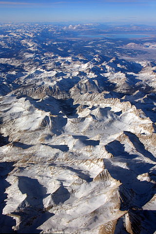
The Sierra Nevada is a mountain range in the Western United States, between the Central Valley of California and the Great Basin. The vast majority of the range lies in the state of California, although the Carson Range spur lies primarily in Nevada. The Sierra Nevada is part of the American Cordillera, an almost continuous chain of mountain ranges that forms the western "backbone" of the Americas.
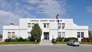
Lincoln County is a county in the U.S. state of Nevada. As of the 2020 census, the population was 4,499, making it the fourth-least populous county in Nevada. Its county seat is Pioche. Like many counties in Nevada, it is dry and sparsely populated, though notable for containing the Area 51 government Air Force base.

The Toiyabe Range is a mountain range in Lander and Nye counties, Nevada, United States. Most of the range is included within the Humboldt-Toiyabe National Forest. The highest point in the range, near its southern end, is Arc Dome, an area protected as the Arc Dome Wilderness. The highest point in Lander County, Bunker Hill, is also located within the Toiyabe Range. The range starts in northwestern Nye County north of Tonopah, Nevada and runs approximately 120 miles (190 km) north-northeast into southern Lander County, making it the second longest range in the state.

Dugger Mountain Wilderness is Alabama's third and newest wilderness area. Dedicated April 2000, Dugger Mountain Wilderness covers 9,200 acres (3,700 ha) of Talladega National Forest in Calhoun County and Cleburne County in Alabama.

The El Paso Mountains Wilderness was created in 1994 and now has a total of 23,780 acres (96.2 km2). All of the wilderness is in the northern Mojave Desert in eastern Kern County, California and is managed by the Bureau of Land Management. It is located south of Ridgecrest, California.
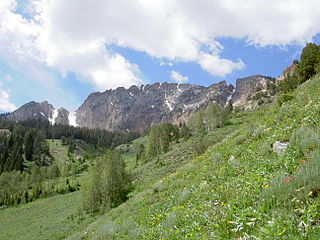
The Deseret Peak Wilderness is located in the Stansbury Mountains of Tooele County, Utah, United States near the towns of Tooele and Grantsville, not far from the Great Salt Lake. It is part of the Wasatch-Cache National Forest. This semi-arid wilderness is part of the Great Basin ecosystem. Elevations range from about 6,000 feet to the top of Deseret Peak's limestone escarpment at 11,031 feet (3,362 m). In this high country, with barren Skull Valley to the west, you'll find some springs and intermittent creeks, despite the general dryness of the area.

The Snake Range is a mountain range in White Pine County, Nevada, United States. The south-central portion of the range is included within Great Basin National Park, with most of the remainder included within the Humboldt-Toiyabe National Forest. The range reaches a maximum elevation of 13,065 feet (3,982 m) at the summit of Wheeler Peak, the tallest independent mountain within Nevada and the second highest point within the state. The range also contains four of the five highest mountain peaks in Nevada, including all peaks greater than 12,000 feet (3,658 m) except for Boundary Peak.

The Cherry Creek Range is a line of mountains, Basin and Range faulted, in northern White Pine and southern Elko Counties, in northeastern Nevada in the western United States. The range runs generally north–south for approximately 50 miles (80 km). The highest point in the range is an unnamed peak, located just south of the border between the counties.

The East Humboldt Wilderness is a protected wilderness area in the East Humboldt Range of Elko County, in the northeast section of the state of Nevada in the western United States.
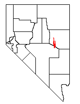
The White Pine Range is a group of mountains in southern White Pine County, in eastern Nevada. The range runs for approximately 51 miles (82 km) from Beck Pass in the north to Currant Pass in the south. To the west of the range are the Duckwater (Shoshone) tribal lands and the northern arm of large Railroad Valley. To the east are Jakes Valley and the northern part of the long White River Valley. To the south are the Horse and Grant Ranges.
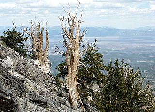
The Currant Mountain Wilderness is a 47,357-acre (19,165 ha) wilderness area centered on Currant Mountain in the White Pine Range of Nye County and White Pine County, in the eastern section of the state of Nevada in the western United States.
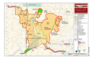
The East Fork High Rock Canyon Wilderness is a U S Wilderness Area in Nevada under the Bureau of Land Management. It is located on the northeast side of High Rock Canyon but does not include the 4x4 trail inside High Rock Canyon nor a 4x4 trail to the Yellow Hills.
Bristlecone Wilderness is a 14,095-acre (5,704 ha) wilderness area in White Pine County, in the U.S. state of Nevada. Located in the Egan Range approximately five miles west of the town of Mcgill, the Wilderness was created by the "White Pine County Conservation, Recreation and Development Act of 2006" and is administered by the U.S. Bureau of Land Management.

South Egan Range Wilderness is a 67,214-acre (27,201 ha) wilderness area in Lincoln, White Pine, and Nye Counties in the U.S. state of Nevada. Located in the Egan Range approximately two miles east of the town of Lund, the Wilderness was created by the "White Pine County Conservation, Recreation and Development Act of 2006" and is administered by the U.S. Bureau of Land Management.

The Kiavah Wilderness is a federally designated wilderness area located in the Mojave Desert, Scodie Mountains, and southern Sierra Nevada in Kern County, California, United States. California State Route 178 connects the town of Lake Isabella to State Highway 14 in the east, crossing Walker Pass at the north boundary of the wilderness.
Cottonwood Forest Wilderness is a 2,643-acre (10.7 km2) wilderness area in the US state of Utah. It was designated March 30, 2009, as part of the Omnibus Public Land Management Act of 2009. Located within the Dixie National Forest near the base of the Pine Valley Mountains, it is adjacent to the Cottonwood Canyon Wilderness, which is part of the Red Cliffs National Conservation Area.
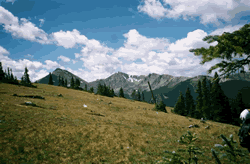
The Byers Peak Wilderness is a U.S. Wilderness Area located in Arapaho National Forest in north central Colorado. The 8,913-acre (36.07 km2) wilderness was established in 1993 and named after its highest point, Byers Peak. Byers Peak was named after William N. Byers, the first mayor of Hot Sulphur Springs and the founder of Colorado's first newspaper, the Rocky Mountain News. The wilderness contains two glacial lakes, two peaks over 12,500 feet (3,800 m), and 23 miles (37 km) of trails.
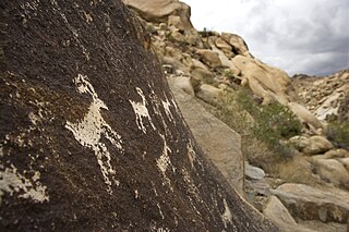
The Bridge Canyon Wilderness is a small wilderness area located in the Newberry Mountains in southern Nevada, United States, in the Lake Mead National Recreation Area. It is also within Avi Kwa Ame National Monument. The rock outcrops and caves make this area very striking. Stands of cottonwood trees can be found along the Grapevine Wash and Sacatone Wash water courses. Canyon grape, cattails and rushes grow in Grapevine Canyon. Discover the petroglyphs of early Native Americans in the canyon. Reptiles include the Western chuckwalla, side-blotched lizard, and Gila monster.

Round Top is a 10,381-foot (3,164 m) mountain located on the Sierra crest in Alpine County, California, United States. Its summit is the highest point in Eldorado National Forest and the Mokelumne Wilderness. The mountain lies just south of Carson Pass. With 2,541 feet (774 m) of prominence, Round Top is the 16th most prominent mountain in the Sierra Nevada.
The Porcupine Lake Wilderness is a 4,446 acres (1,799 ha) tract of protected land located in Bayfield County, Wisconsin, managed by the United States Forest Service. The Wilderness is located within the boundaries of the Chequamegon–Nicolet National Forest.


