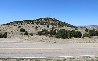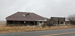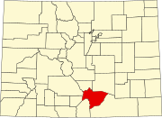
La Veta is a statutory town in Huerfano County, Colorado, United States. The town population was 800 as of the 2010 United States Census.

The City of Walsenburg is the Statutory City that is the county seat and the most populous municipality of Huerfano County, Colorado, United States. The city population was 3,049 at the 2020 census, down from 3,068 in 2010.

The Town of Kersey is a Statutory Town in Weld County, Colorado, United States. The population was 1454 at the 2010 United States Census.

Mack is an unincorporated community and a U.S. Post Office located about 10 miles east of the Colorado/Utah border in Mesa County, Colorado, United States. Mack is part of the Grand Junction Metropolitan Statistical Area.

Rand is an unincorporated community, with a U.S. Post Office, established in 1881 in Jackson County, Colorado. It is a ranching community at the southern end of North Park south of Walden consisting of several homes and businesses, a post office, and ranching facilities. Rand is near the junction of State Highway 125 and Jackson County Road 27 along Indian Creek, at an elevation of 8627 feet. The Rand post office has the ZIP code 80473. Some say the community was named after Charles Rand, a pioneer, while others believe it has the name of J. A. Rand, another pioneer. The post office in Rand was established in 1883.

Gardner is a census-designated place (CDP) and post office in and governed by Huerfano County, Colorado, United States. The Gardner post office has the ZIP Code 81040. At the United States Census 2010, the population of the 81040 ZIP Code Tabulation Area was 536 including adjacent areas.

Orchard is an unincorporated town, a post office, and a census-designated place (CDP) located in and governed by Morgan County, Colorado, United States. The CDP is a part of the Fort Morgan, CO Micropolitan Statistical Area. The Orchard post office has the ZIP Code 80649. At the United States Census 2010, the population of the Orchard CDP was 90, while the population of the 80649 ZIP Code Tabulation Area was 299 including adjacent areas.

Toponas is an unincorporated rural village in Routt County, Colorado, United States. The community took its name from nearby Toponas Rock. The population in 2010 was 48; in 2017 it is estimated at 26, all in ages ranging from 55 years upwards.

Farista is a former unincorporated community in Huerfano County, Colorado, United States that has been annexed into Walsenburg. The U.S. Post Office at Walsenburg now serves Farista postal addresses.

Badito is an unincorporated community along the Huerfano River in Huerfano County, Colorado, United States. It is located at the intersection of Colorado State Highway 69 and County Road 520.
Bovina is an unincorporated community in Lincoln County, Colorado, United States. The ZIP Code of Bovina (80818) is held at the Genoa Post Office.

Huerfano River is a 113-mile-long (182 km) tributary of the Arkansas River in Pueblo and Huerfano counties in Colorado, United States.

Delcarbon is an extinct town in Huerfano County, Colorado, United States. The GNIS classifies it as a populated place.

Pictou is an unincorporated community in Huerfano County, Colorado, United States.

Pryor is an unincorporated community in Huerfano County, [Colorado]], United States.

Tioga is an extinct town in Huerfano County, in the U.S. state of Colorado. The GNIS classifies it as a populated place.
Autobees, Colorado, also called Autobees Plaza, is an extinct town in Colorado. It was the county seat of Huerfano County, Colorado from 1861 to 1868. At that time, the county seat moved to Badito, which was on a main trail along the foothills. When Autobees was the county seat, Huerfano County was almost the entire southeastern portion of the state. Now, the site of the former settlement is within Pueblo County, Colorado.

Montoya Ranch was a ranch in Farisita, Huerfano County, Colorado, along the Huerfano River. It was listed on the National Register of Historic Places in 2012. The ranch house was built in or after 1867 with Spanish Colonial and territorial architectural elements. At that time, there were many New Mexicans moving to Colorado, and many ranched and farmed in the Huerfano valley.

Doyle Settlement was a ranch and settlement in Pueblo, Pueblo County, Colorado. It was listed on the National Register of Historic Places on April 4, 1980.


