Thiès is a region of western Senegal. The capital is also called Thiès.
Mamadu Diakhou Bâ, also known as Maba Jahou Bah, Ma Ba Diakhu, Ma Ba Diakho Ba, Ma Ba Jaaxu, Mabba Jaxu Ba, was a Muslim leader in West Africa during the 19th century. He was a disciple of the Tijaniyya Sufi brotherhood and became the Almami of Saloum.

The Kingdom of Sine was a post-classical Serer kingdom along the north bank of the Saloum River delta in modern Senegal. The inhabitants are called Siin-Siin or Sine-Sine.
Fatick is a town and urban commune in Senegal, located between M'bour and Kaolack and inhabited by the Serer people. Its 2023 population was at 39,361. It is the capital of the Fatick Region and the Fatick Department.

Diakhao Arrondissement is an arrondissement of the Fatick Department in the Fatick Region of Senegal. Its capital is Diakhao.

The Saltigue, are Serer high priests and priestesses who preside over the religious ceremonies and affairs of the Serer people, such as the Xooy ceremony, the biggest event in the Serer religious calendar. They usually come from ancient Serer paternal families, and the title is inherited by birthright. In Serer country, Saltigue are always diviners.
Guelowar, also spelled Gelwar, Guelwar, Guelware, Gueleware or Gueloware, was a maternal dynasty in the pre-colonial Serer kingdoms of Sine and Saloum. They were from the Mandinka ethnic group. The offspring of Mandinka women and Serer men became the kings of Sine and Saloum. The dynasty lasted from the mid-14th century to 1969, the year both kings died.
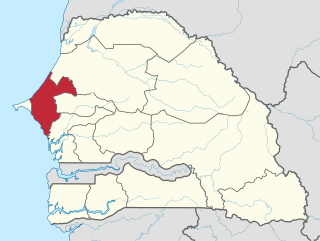
Somb is a town in Senegal situated in the west of the country.
Thiouthioune is a village in Senegal located in the pre-colonial Serer Kingdom of Sine. The current population is estimated at 763. The Battle of Fandane-Thiouthioune commonly known as "the Battle of Somb" took place within the vicinity of this village. In that battle, the Serer strategy - led by their king Maad a Sinig Kumba Ndoffene Famak Joof was to prevent the Muslim marabouts of Senegambia who came to launch jihad from entering Thiouthioune. Initially, the Muslims successfully broke the Serer lines and entered Thiouthioune. However, at the later stages of the battle, the Muslims were defeated by the Serer forces and Serer religion was installed. The leader of the Muslim army was decapitated in that battle under the orders of the Maad a Sinig. The sovereign of Thiouthioune in 1867 was Maad Amad Ngoneh Joof, commonly known as Amad Ngoneh Thiouthioune. He was the paternal uncle of the king of Sine. He and his army also fought in the battle to defeat the Marabouts.
Maad a Sinig Mahecor Joof was the last king to rule the Serer Kingdom of Sine, now part of independent Senegal. Maad a Sinig means king of Sine in the Serer language. He reigned from 1924 until his death in 1969. After his death, the Kingdom of Sine was incorporated into independent Senegal.
Maad a Sinig means king of Sine. The ancient Kingdom of Sine, now part of Senegal, was a pre-colonial Serer kingdom. Their kings were titled Maad or Maad. The royal title Maad is sometimes used interchangeably with their ancient kings and landowners - the Lamanes. Between 1350 and 1969, more than fifty Serer kings have been crowned Maad a Sinig.
Diakhao is a small town and commune in the Fatick Region in the west of Senegal.
Loul Sessène is a village in Senegal located in the Sine-Saloum area, in the West of the country.

Maad a Sinig Kumba Ndoffene Fa Ndeb Joof, also known as Kumba Ndoffene Joof II or Bour Sine Coumba Ndoffène Fandepp Diouf, was a King of Sine. Maad a Sinig translates as "King of Sine", Maad meaning king in the Serer language. The surname Joof is the English spelling in the Gambia. Diouf is the French spelling in Senegal.
The Royal House of Semou Njekeh Joof was founded in the early 18th century by Maad Semou Njekeh Joof from the Kingdom of Sine, now part of present-day Senegal. It was the third and last royal house founded by the Joof family – during the Guelowar period, since the reignes of Maad a Sinig Maysa Wali Jaxateh Manneh and Maad a Sinig Mahecor Joof. From the date of its foundation up to the dissolution of Sine in 1969, at least seven kings from this royal house had succeeded to the throne of Sine.
This is a timeline of the history and development of Serer religion and the Serer people of Senegal, The Gambia and Mauritania. This timeline merely gives an overview of their history, consisting of calibrated archaeological discoveries in Serer countries, Serer religion, politics, royalty, etc. Dates are given according to the Common Era. For a background to these events, see Roog, Serer religion, Serer creation myth, Serer prehistory, Lamane, States headed by Serer Lamanes, Serer history and Serer people.

The Battle of Logandème was an uprising led by the Serer King Maad a Sinig Kumba Ndoffene Famak Joof, king of Sine, against the French Empire. The battle took place at Logandème which was a part of Sine at the time. The battle was also a revenge attack against the Serer people after their resounding victory against France at the Battle of Djilass on 13 May 1859. It was the first time that France decided to employ cannonball in the Senegambia.
The Royal House of Jogo Siga Joof was the second royal house founded by the Joof family during the Guelowar dynastic period of Sine. The Guelowar period commences from c. 1350 during the reign of Maad a Sinig Maysa Wali and ends in 1969 following the deaths of the last Serer kings of Sine and Saloum and the disestablishment of the monarchies in Serer countries. The pre-colonial Kingdom of Sine now lies within present-day Senegal.
Tattaguine is a town in the west of Senegal. It is also the name of the rural community.

The patronym Faye is one of the typical surnames of the Serer people of Senegal, the Gambia and Mauritania. In French-speaking Senegal and Mauritania, and English-speaking Gambia, the surname is spelled Faye.
