Feakle

Last updated

Feakle
An Fhiacail
Village
Feakle - An Fhiacail - geograph.org.uk - 293810.jpg
Feakle village centre
Ireland adm location map.svg
Red pog.svg
Feakle
Location in Ireland
Coordinates: 52°55′33″N8°38′59″W / 52.92589°N 8.649763°W / 52.92589; -8.649763 Coordinates: 52°55′33″N8°38′59″W / 52.92589°N 8.649763°W / 52.92589; -8.649763
Country Ireland
Province Munster
County County Clare

Feakle (historically Feakell and Fiakil, from Irish : an Fhiacail, meaning 'the tooth') [1] is a village in County Clare, Ireland, in the Roman Catholic parish of the same name.

Contents

Location

"Paroiste na fiacaile" means parish of the tooth. A legend says that the tooth of Mochonna, the patron saint, fell out in this place, where he built his church. Other theories are that the place is named after a church that was roofed with "fiathgail", a rough local grass, or that the name comes from "Fia-Choill", the wood of the deer. [2]

The village is in the Tulla Upper barony, 4.5 miles (7.2 km) northwest of Scarriff on the road to Gort. In 1837 it contained 8,844 inhabitants and covered about 30,000 acres (12,000 ha). [3] An 1845 description said "the surface consists of the loftiest, wildest, and most northerly of the western uplands of the county; and includes the southern declivities of the Slieve-Baghta mountains, and those offshoot ranges and masses which embosom Lough Graney, and stretch toward Lough O’Grady. The highest ground is on the west, and has an altitude of 1,312 feet." [4]

The parish of Feakle is in the Roman Catholic Diocese of Killaloe. Parish churches are St Joseph's in Kilclaren and St Mary's in Feakle. [5] The village population in 2006 was 122. [6] It neighbours Lough Derg and the towns of Tulla and Scarriff. Feakle is famous for its traditional music festival.

History

St. Mochonna is venerated as the patron saint of Feakle. The ancient ruins of his church were destroyed in the early 19th century. [7]

Under the religious persecution of the Catholic Church in Ireland imposed by the Penal Laws, the Catholics of Feakle would travel in secret to a Mass rock located at a megalithic tomb in the nearby Ballycroum bog. [8]

On 12 December 1974 Irish Republican Army and Sinn Féin leaders met at Smith's Hotel, Feakle, with the leaders of the main Irish Protestant Christian denominations (Church of Ireland, Methodist, and Presbyterian) to discuss ways of resolving the Northern Ireland crisis. The Gardaí (Irish police) broke up the meeting. Although any wanted IRA men had already departed, the churchmen did pass on the list of Republican demands to the British government. Methodist leader Eric Gallagher was in attendance and later became the subject of the book Peacemaker by author Dennis Cooke. [ citation needed ]

People

See also

Related Research Articles

<span class="mw-page-title-main">County Clare</span> County in Ireland

County Clare is a county in Ireland, in the Southern Region and the province of Munster, bordered on the west by the Atlantic Ocean. Clare County Council is the local authority. The county had a population of 118,817 at the 2016 census. The county seat and largest settlement is Ennis.

<span class="mw-page-title-main">Brian Merriman</span>

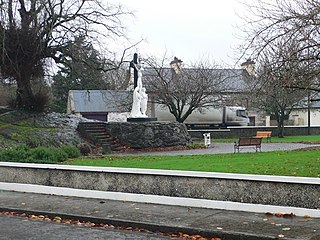
Brian Merriman or in Irish Brian Mac Giolla Meidhre was an Irish language bard, farmer, and hedge school teacher from rural County Clare. His single surviving work of substance, the 1000-line long Dream vision poem Cúirt an Mheán Oíche, describes a supernatural trial in which the women of Ireland are suing the men for refusing to marry and father children and is often compared to the works of François Rabelais. Cúirt an Mheán Oíche is widely regarded as the greatest work of comic or satirical verse in the history of Irish poetry.

<span class="mw-page-title-main">Killaloe, County Clare</span> Town in County Clare, Ireland

Killaloe is a small town in east County Clare, Ireland. It lies on the River Shannon on the western bank of Lough Derg and is connected by Killaloe Bridge to the "twin town" of Ballina on the eastern bank of the lake.

<span class="mw-page-title-main">Scarriff</span> Village in County Clare, Ireland

Scarriff or Scariff is a large village in east County Clare, Ireland, situated in the midwest of Ireland. The town is on the West end of Lough Derg and is best known for its harbour. The Scarriff Market House is easily recognisable, and it is therefore often used to represent the town.

<span class="mw-page-title-main">Tuamgraney</span> Village in County Clare, Ireland

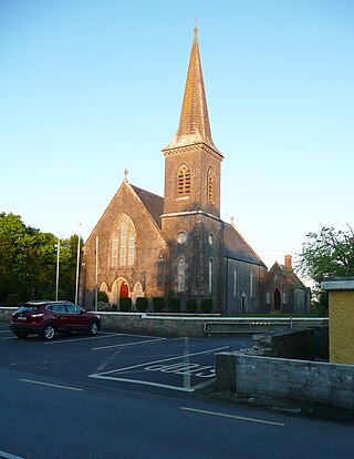
Tuamgraney is a village in eastern County Clare in the west of Ireland and a civil parish by the same name. Situated a kilometre from the River Graney which flows into Lough Derg, it is an ancient settlement, noted for St Cronán's Church, said to be the oldest church in constant use in Ireland

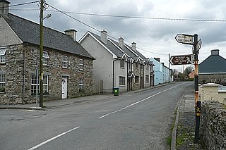
Ogonnelloe is a civil parish in east County Clare, Ireland, situated on the R463 regional road between Scariff and Killaloe and in the surrounding hills. It forms part of the Catholic parish of the same name.

<span class="mw-page-title-main">Labasheeda</span> Village in County Clare, Ireland

Labasheeda is a village in the parish of Kilmurry McMahon in County Clare, Ireland. The village is set on a peninsula on the banks of the Shannon estuary.

<span class="mw-page-title-main">O'Callaghan's Mills</span> Village in County Clare, Ireland

O'Callaghan's Mills, also O'Callaghansmills, is a village in County Clare, Ireland, and a Catholic parish by the same name. It takes its name from the O'Callaghan family who were large landowners in the area and a corn and grist mill built by John Coonan on the lands of Cornelius O'Callaghan in 1772.

<span class="mw-page-title-main">Tulla</span> Town in County Clare, Ireland

Tulla is a market town in County Clare, Ireland. It is situated in the east of the county, on the R462 and near its junction with the R352, 18km from Ennis.

<span class="mw-page-title-main">Clonlara</span> Village in Munster, Ireland

Clonlara, officially Cloonlara, is a village in County Clare, Ireland, and a Roman Catholic parish of the same name.

<span class="mw-page-title-main">East Clare Way</span>

The East Clare Way is a long-distance trail in County Clare, Ireland. It is a 180-kilometre (112-mile) long circular route that begins and ends in Killaloe. It is typically completed in eight days. It is designated as a National Waymarked Trail by the National Trails Office of the Irish Sports Council and is managed by East & Mid Clare Way Limited and the East Clare Way Committee.

<span class="mw-page-title-main">Clonlea</span> Civil parish in Clare, Ireland

Clonlea or Clonleigh is a civil parish in County Clare, Ireland. The main settlement is the village of Kilkishen. It is part of the Catholic parish of O'Callaghans Mills.

<span class="mw-page-title-main">Tulla Upper</span> Place in Munster, Ireland

Tulla Upper is a barony in County Clare, Ireland. This ancient geographical division of land is in turn divided into seven civil parishes.

<span class="mw-page-title-main">Killanena</span> Townland in Munster, Ireland

Killanena is a townland and formerly a district electoral division (DED) in County Clare, Ireland, in the Catholic parish of Killanena.

Kilnoe is a civil parish in County Clare, Ireland. It is a rural area, part of the Roman Catholic parish of Bodyke.

Moynoe is a civil parish in County Clare, Ireland. It is part of the Roman Catholic parish of Scarriff and Moynoe.

Clonrush or Clonmulsk is a civil parish in the barony of Leitrim, now in County Clare, Ireland. The largest settlement in the parish is Whitegate.

<span class="mw-page-title-main">Lough Graney</span> Body of water

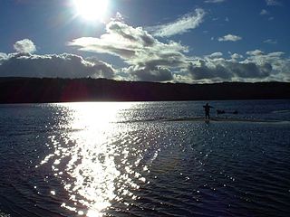
Lough Graney is a lake in County Clare, Ireland. The lake's outlet is the short River Graney, which flows through Lough O'Grady and past the town of Scarriff into the west side of Lough Derg.

Éamann Ó hOrchaidh was an Irish scribe and translator.

Cahermurphy Nature Reserve is a national nature reserve of approximately 22.2 acres (0.090 km2) located in County Clare, Ireland. It is managed by the Irish National Parks & Wildlife Service.

References

  1. "An Fhiacail / Feakle (see archival records)". logainm.ie. Placenames Database of Ireland. Retrieved 23 March 2023.
  2. "Feakle Historical Background". Clare County Library. Archived from the original on 3 January 2013. Retrieved 31 March 2014.
  3. Samuel Lewis (1837). "Feacle". County Clare: A History and Topography. Archived from the original on 15 March 2014. Retrieved 31 March 2014.
  4. "Feakle". Parliamentary Gazetteer of Ireland. 1845. Archived from the original on 15 March 2014. Retrieved 31 March 2014.
  5. "Feakle". Diocese of Killaloe. Archived from the original on 24 May 2015. Retrieved 31 March 2014.
  6. "Census 2006 for Feakle, p. 140" (PDF). Archived from the original on 25 December 2018. Retrieved 19 October 2010.
  7. "Clare Places - Feakle: Historical Background". www.clarelibrary.ie. Archived from the original on 11 February 2020. Retrieved 8 March 2021.
  8. Somerville, Christopher (11 June 2011). "Walk of the Week: Ballycroum Loop, East Clare". Irish Independent.
  9. Merriman, Brian (1974). Ó hUaithne, Dáithí (ed.). Cúirt an Mheán Oíche. Preas Dolmen. ISBN   0-85105-002-6.