Fearnville

Last updated

Fearnville
Fearnville Leisure Centre (December 2009).jpg
Fearnville Leisure Centre
Leeds UK location map.svg
Red pog.svg
Fearnville
West Yorkshire UK location map.svg
Red pog.svg
Fearnville
Location within West Yorkshire
OS grid reference SE331373
Metropolitan borough
Metropolitan county
Region
Country England
Sovereign state United Kingdom
Post town LEEDS
Postcode district LS8, LS14
Dialling code 0113
Police West Yorkshire
Fire West Yorkshire
Ambulance Yorkshire
UK Parliament
List of places
UK
England
Yorkshire
53°49′00″N1°29′13″W / 53.81659°N 1.48702°W / 53.81659; -1.48702 Coordinates: 53°49′00″N1°29′13″W / 53.81659°N 1.48702°W / 53.81659; -1.48702

Fearnville is a small area of Leeds which has boundaries with Roundhay, Seacroft, Oakwood, Gipton and Harehills. Fearnville is commonly described as being part of Roundhay or Oakwood, although it is classed as being in the Killingbeck and Seacroft ward. Fearnville had a population of 3,654 in 2011. [1] [2] [3]

Contents

Fearnville Leisure Centre

Fearnville Leisure Centre, off of Oakwood Lane, is a fitness/leisure centre commonly used by residents from Fearnville and the surrounding areas. It offers a variety of facilities, such as swimming, gym and football. [4] There is a crown green bowling club on the grounds. [5]

Gipton Gala

The Fearnville Leisure Centre playing fields are the location of the annual Gipton Gala. [6] The Gipton Gala is a local festival, similar to the Leeds West Indian Carnival, but on a more minor scale. Usually, a procession starts at Gipton fire station on the morning of the gala, and makes its way to Fearnville Leisure Centre. There have been fears in the past for the future of the carnival when there were talks in 2009 of closing Fearnville Leisure Centre, which would mean the location of the gala being lost. [7] However, in 2010, there was serious concern for that year's gala, because of a group of travellers who set up a group of caravans on the fields a few weeks before the gala was set to happen. [8] This is the first time, since the gala was reintroduced to locals, that there has been talk of cancelling the gala. However, they were moved off of the fields used for the gala by West Yorkshire Police on Monday 6 July 2010.

Fearnville Hall

Fearnville Hall (sometimes referred to as Fearnville House) is a small country house, located off of Dib Lane, behind a row of houses on Dib Lane and the adjacent Fearnville Crescent. Fearnville Hall is a Grade 2 listed building, built in the early 19th century. The building is a two-storey house, made with grit stone and ashlar with a slate roof. Currently, Fearnville Hall is in a very poor state of repair. The grounds of the house are open through the driveway off of Dib Lane, apart from part of a tree trunk placed in the driveway to try to deter fly tippers from using the ground. The grounds being open has meant that there has been much vandalism caused to the building, which has resulted in many of the windows and doors being covered with metal sheets. [9]

Amenities

Dib Lane is the main shopping parade in Fearnville. This shopping parade is split into two parts by houses and a pub, The Grange. The Grange pub is built on the site of an old manor house, and was named after the manor house, which sometimes causes people to confuse Fearnville Hall with The Grange. Dib Lane consists of many shops and takeaways, as well as a veterinary surgery, pharmacy and hair dressers. There is also a small shopping parade opposite Fearnville Leisure Centre which mainly consists of takeaways. On the boundary of Fearnville and Oakwood/Roundhay, there is a Co-op supermarket and small shopping parade as well as a McDonald's.

See also

Related Research Articles

A58 road

The A58 is a major road in Northern England running between Prescot, Merseyside and Wetherby, West Yorkshire.

Harehills Area of Leeds, West Yorkshire, England

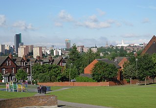
Harehills is an inner-city area of east Leeds, West Yorkshire, England. It is approximately 1 mile (1.6 km) north east of Leeds city centre. Harehills is situated between the A58 and the A64. It sits in the Gipton & Harehills ward of Leeds City Council and the Leeds East parliamentary constituency, between Burmantofts and Gipton, and adjacent to Chapeltown.

Seacroft Suburb of Leeds, West Yorkshire, England

Seacroft is an outer-city suburb/township consisting mainly of council estate housing covering an extensive area of east Leeds, West Yorkshire, England. It lies in the LS14 Leeds postcode area, around 4 miles (6.4 km) east of Leeds city centre.

Roundhay Suburb of Leeds, West Yorkshire, England

Roundhay is a large suburb in north-east Leeds, West Yorkshire, England. Roundhay had a population of 22,546 in 2011.

Gipton Human settlement in England

Gipton is a suburb of east Leeds, West Yorkshire, England, between the A58 to the north and the A64 to the south.
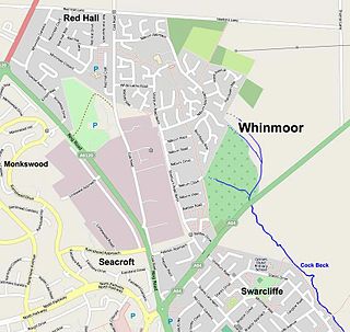
Whinmoor Human settlement in England

Whinmoor is residential area of east Leeds, West Yorkshire, England.

West Park, Leeds Human settlement in England

West Park is a suburb of north-west Leeds, West Yorkshire, England, north of Headingley. It is a mixed area of private suburban housing and suburban council estates. The name derives from its main park containing playing fields together with a conservation area of grassy meadow ending in woodland. The largest housing estate in West Park is Moor Grange.

Cross Gates Suburb in east Leeds, West Yorkshire, England

Cross Gates is a suburb in east Leeds, West Yorkshire, England.

Leeds East (UK Parliament constituency) Parliamentary constituency in the United Kingdom

Leeds East is a constituency represented in the House of Commons of the UK Parliament since 2015 by Richard Burgon of the Labour Party.

Shadwell, West Yorkshire Village and civil parish in West Yorkshire, England

Shadwell is a village and civil parish in north-east Leeds, West Yorkshire, England. The village is 6 miles (9.7 km) to the north east of Leeds city centre.

Oakwood, Leeds Suburb of Leeds, West Yorkshire, England

Oakwood is a suburb of north-east Leeds, West Yorkshire, England, that lies between Gipton and Roundhay Park.

Richmond Hill, Leeds Human settlement in England

Richmond Hill is a district of Leeds, West Yorkshire, England. The district lies a mile to the east of the city centre between York Road, East End Park and Cross Green. The appropriate City of Leeds ward is Burmantofts and Richmond Hill.

Killingbeck District of Leeds, West Yorkshire, England

Killingbeck is a district of east Leeds, West Yorkshire, England that is situated between Seacroft to the north, Cross Gates and Whitkirk to the east, Gipton to the west, Halton Moor to the south, Halton to the south-east and Osmondthorpe to the south-west.

Swarcliffe Area of the City of Leeds, West Yorkshire, England

Swarcliffe, originally the Swarcliffe Estate, is a district of Leeds, West Yorkshire, England. It is 4.9 miles (8 km) east of Leeds city centre, and within the LS14 and LS15 Leeds postcode area. The district falls within the Cross Gates and Whinmoor ward of the Leeds Metropolitan Council.

Architecture of Leeds Buildings of Leeds, West Yorkshire, England

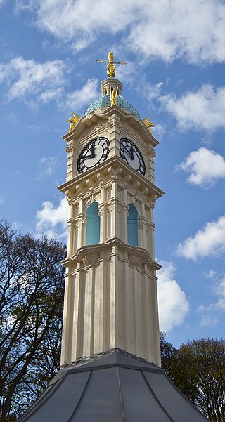
The architecture of Leeds, a city and metropolitan borough in West Yorkshire, England, encompasses a wide range of architectural styles and notable buildings. As with most northern industrial centres, much of Leeds' prominent architecture is of the Victorian era. However, the City of Leeds also contains buildings from as early as the Middle Ages such as Kirkstall Abbey, one of Britain's best preserved ruined Cistercian monasteries, as well as examples of 20th century industrial architecture, particularly in the districts of Hunslet and Holbeck.
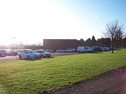
History of Seacroft

Seacroft pre-dates the Domesday book, with evidence of a settlement in the area from the Neolithic Age. Seacroft remained largely unchanged for centuries as a small Yorkshire village, until in the 1950s the area was developed into Leeds' largest council estate. In the 1960s and 1970s the building of Whinmoor and Swarcliffe enclosed Seacroft within other suburbs.

Ainsty, Wetherby Area of Wetherby, West Yorkshire, England

Ainsty is an area of Wetherby, West Yorkshire, England. Ainsty is in the north of Wetherby and runs as far as the border between North and West Yorkshire, to the north of this is Kirk Deighton.

Killingbeck and Seacroft is a ward in the metropolitan borough of the City of Leeds, West Yorkshire, England. It contains eight listed buildings that are recorded in the National Heritage List for England. All the listed buildings are designated at Grade II, the lowest of the three grades, which is applied to "buildings of national importance and special interest". The ward contains the former village of Seacroft to the northeast of the centre of Leeds, and later developments westward towards the city centre, which include Killingbeck and Fearnville. The listed buildings consist of houses and associated structures, a church, a public house, a former public house later a guest house, and a former water tower.

References

  1. Fearnville is made up of 11 Output areas, one being in the north east corner of the gipton and harehills ward and Ten in the north west part of the Seacroft and Killingbeck ward
  2. Services, Good Stuff IT. "Killingbeck and Seacroft E00057621 - UK Census Data 2011". UK Census Data. Retrieved 30 July 2021.
  3. Services, Good Stuff IT. "Gipton and Harehills - UK Census Data 2011". UK Census Data. Retrieved 30 July 2021.
  4. "Fearnville leisure centre". Leeds.gov.uk. Retrieved 22 June 2010.
  5. United Kingdom (21 March 2007). "Fearnville Crown Green Bowling Club". Bowlsclub.org. Retrieved 22 June 2010.
  6. http://www.yorkshireeveningpost.co.uk/news/Gipton-Gala.4285442.jp [ dead link ]
  7. http://www.yorkshireeveningpost.co.uk/news/Fears-for-Gipton-gala-if.5007636.jp [ dead link ]
  8. http://www.yorkshireeveningpost.co.uk/news/Travellers-on-second-Leeds-gala.6388334.jp [ dead link ]
  9. "Microsoft Word - Heritage at Risk.doc" (PDF). Archived from the original (PDF) on 16 July 2011. Retrieved 22 June 2010.