This article is about the local government district in West Yorkshire, England. For the city and main area in the district, see Leeds. For the wider city region, see Leeds City Region. For other cities named Leeds, see Leeds (disambiguation).
Although the city's area includes 32 civil parishes, most of Leeds' population currently live in unparished areas. In these areas the Localism Act 2011 makes provision for groups of people from the community, called neighbourhood forums, to formulate Neighbourhood Development Plans and Orders intended to guide and shape development in their own locality.[9]
The Borough of Leeds was created in 1207, when Maurice Paynel, lord of the manor, granted a charter covering a small area adjacent to a crossing of the River Aire, between the old settlement centred on Leeds Parish Church to the east and the manor house and mills to the west. In 1626 a charter was granted by Charles I, incorporating the entire parish as the Borough of Leeds; it was reformed by the Municipal Corporations Act 1835. The parish and borough included the chapelries of Chapel Allerton, Armley, Beeston, Bramley, Farnley, Headingley cum Burley, Holbeck, Hunslet, Leeds, Potternewton and Wortley. The borough was located in the West Riding of Yorkshire and gained city status in 1893. When a county council was formed for the riding in 1889, Leeds was excluded from its area of responsibility and formed a county borough. The borough made a significant number of territorial expansions, expanding from 21,593 acres (87.38km2) in 1911 to 40,612 acres (164.35km2) in 1961;[10] adding in stages the former area of the Roundhay, Seacroft, Shadwell and Middleton parishes and gaining other parts of adjacent districts.
Formation
A review of local government arrangements completed in 1969 proposed the creation of a new large district centred on Leeds, occupying 317,000 acres (1,280km2) and including 840,000 people. The proposed area was significantly reduced in a 1971 white paper; and within a year every local authority to be incorporated into it protested or demonstrated.[11] The final proposal reduced the area further and following the enactment of the Local Government Act 1972, the county borough was abolished on 1 April 1974 and its former area was combined with that of the municipal boroughs of Morley and Pudsey; the urban districts of Aireborough, Horsforth, Otley, Garforth and Rothwell; and parts of the rural districts of Tadcaster, Wetherby and Wharfedale. The new district gained both borough and city status, as had been held by the county borough; and forms part of the county of West Yorkshire.
Formation of the metropolitan district in 1974
The former county borough is shaded in grey. Other areas:
Municipal Borough of Morley
Municipal Borough of Pudsey
Aireborough Urban District
Horsforth Urban District
Otley Urban District
Garforth Urban District
Rothwell Urban District
8a. Tadcaster Rural District (part)
Wetherby Rural District (part)
Wharfedale Rural District (part)
Geography
Pudsey, which is one of the boroughs towns also forms part of the conurbation of nearby Bradford
The district and its settlements are situated in the eastern foothills of the Pennines astride the River Aire whose valley, the Aire Gap, provides a road and rail corridor that facilitates communications with cities to the west of the Pennines. The district extends 15 miles (24km) from east to west and 13 miles (21km) from north to south; with over 65% covered with green belt land. The highest point, at 1,115feet (340m), is at its north western extremity on the eastern slopes of Rombalds Moor, better known as Ilkley Moor, on the boundary with the City of Bradford. The lowest points are at around 33feet (10m), in the east: where River Wharfe crosses the boundary with North Yorkshire south of Thorp Arch Trading Estate and where the River Aire (at this point forming the City of Wakefield boundary) meets the North Yorkshire boundary near Fairburn Ings. To the north and east Leeds is bordered by the North Yorkshire districts of Harrogate to the north and Selby district to the east. The remaining borders are with other districts of West Yorkshire: Wakefield to the south, Kirklees to the south-west, and Bradford to the west.[12]
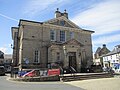
Morley town hall, one of the towns forming the boroughLeeds Civic Hall on Millennium Square, meeting place of Leeds City Council
Leeds City Council is the local authority of the district. The council is composed of 99 councillors, three for each of the city's 33 wards. Elections are held three years out of four, on the first Thursday of May. One third of the councillors are elected, for a four-year term, in each election. 2004 saw all seats up for election due to boundary changes. It is currently run by a Labour administration. Before the 2011 election, the council had been under no overall control since 2004. The Chief Executive of Leeds City Council is Ed Whiting, and the Leader of the Council is Councillor James Lewis of the Labour Party. As a metropolitan county, West Yorkshire does not have a county council, so Leeds City Council is the primary provider of local government services. The district forms part of the Yorkshire and the Humber region of England.
Most of the district is an unparished area, comprising Leeds itself (the area of the former county borough), Pudsey, Garforth, Rothwell and the area of the former urban district of Aireborough. In the unparished area there is no lower tier of government. Outside the unparished area there are 31 civil parishes, represented by parish councils. These form the lowest tier of local government[13] and absorb some limited functions from Leeds City Council in their areas. The councils of the civil parishes of Horsforth, Morley, Otley and Wetherby are town councils.[14] The 34 other civil parishes are:[15]
At the 2001 UK census, the district had a total population of 715,402. Of the 301,614 households in Leeds, 33.3% were married couples living together, 31.6% were one-person households, 9.0% were co-habiting couples and 9.8% were lone parents, following a similar trend to the rest of England.[22] The population density was 1,967/km2 (5,090/sqmi)[22] and for every 100 females, there were 93.5 males. Of those aged 16–74, 30.9% had no academic qualifications, higher than the 28.9% in all of England.[23] Of the residents, 6.6% were born outside the United Kingdom, lower than the England average of 9.2%.[24]
At the 2021 Census the population of Leeds had grown substantially to 812,000 with population growth compared with 2011 at 8%, 1.4 points faster then compared with the rest of England.[16]
The majority of people in Leeds identify themselves as Christian.[25] The proportion of Muslims is around National average.[25] Leeds has the third-largest Jewish community in the United Kingdom, after those of London and Manchester. The areas of Alwoodley and Moortown contain sizeable Jewish populations.[26] 16.8% of Leeds residents in the 2001 census declared themselves as having "no religion", which is broadly in line with the figure for the whole of the UK (also 8.1% "religion not stated").
The crime rate in Leeds is well above the national average, like many other cities in England.[27][28] In July 2006, the think tankReform calculated rates of crime for different offences and has related this to populations of major urban areas (defined as towns over 100,000 population). Leeds was 11th in this rating (excluding London boroughs, 23rd including London boroughs).[29]
Leeds has a diverse economy with the service sector now dominating over the traditional manufacturing industries. It is the location of one of the largest financial centres in England outside London. New tertiary industries such as retail, call centres, offices and media have contributed to a high rate of economic growth. This is a chart of trend of regional gross value added of Leeds at current basic prices with figures in millions of pounds.[30]
Education Leeds, a non-profit company owned by Leeds City Council, provided educational services between 2001 and 2011. In April 2011 Leeds City Council disbanded Education Leeds and has consolidated educational services into the Children's Services Department of the council itself.[31]
Media
Television
The area has regional studios and broadcasting centres which broadcast from Leeds:
BBC Yorkshire broadcast from its studios on Peter's Square.
There are 24 cemeteries in Leeds operated by the city council. The oldest ones, in Beckett Street and Hunslet, were both opened in 1845; the newest ones, in Kippax and Whinmoor, opened in 2013.[35]
This page is based on this Wikipedia article Text is available under the CC BY-SA 4.0 license; additional terms may apply. Images, videos and audio are available under their respective licenses.