The M1 motorway connects London to Leeds, where it joins the A1(M) near Aberford, to connect to Newcastle. It was the first inter-urban motorway to be completed in the UK; the first motorway in the country was the Preston Bypass, which later became part of the M6.
The A1, also known as the Great North Road, is the longest numbered road in the United Kingdom, at 410 miles (660 km). It connects London, the capital of England, with Edinburgh, the capital of Scotland. The numbering system for A-roads, devised in the early 1920s, was based around patterns of roads radiating from two hubs at London and Edinburgh. The first number in the system, A1, was given to the most important part of that system: the road from London to Edinburgh, joining the two central points of the system and linking the UK's (then) two mainland capital cities. It passes through or near north London, Hatfield, Welwyn Garden City, Stevenage, Baldock, Letchworth Garden City, Biggleswade, Eaton Socon, Buckden, Peterborough, Stamford, Grantham, Newark-on-Trent, Retford, Doncaster, Pontefract, York, Wetherby, Ripon, Darlington, Durham, Gateshead, Newcastle upon Tyne, Morpeth, Alnwick and Berwick-upon-Tweed.

The A6 is one of the main north–south roads in England. It runs from Luton in Bedfordshire to Carlisle in Cumbria, although it formerly started at a junction with the A1 at Barnet. It is the fourth longest numbered road in Britain; only the A1, A38 and A30 are longer.

The A61 is a major trunk road in England connecting Derby and Thirsk in North Yorkshire by way of Alfreton, Clay Cross, Chesterfield, Sheffield, Barnsley, Wakefield, Leeds, Harrogate and Ripon. The road is closely paralleled by the M1 motorway between Derby and Leeds.

The A46 is a major A road in England. It starts east of Bath, Somerset and ends in Cleethorpes, Lincolnshire, but it does not form a continuous route. Large portions of the old road have been lost, bypassed, or replaced by motorway development. Between Leicester and Lincoln the road follows the course of the Roman Fosse Way, but between Bath and Leicester, two cities also linked by the Fosse Way, it follows a more westerly course.

The A63 is a major road in Yorkshire, England between Leeds and Kingston upon Hull. A section between North Cave and Hull forms the eastward continuation of the M62 motorway and is part of the unsigned Euroroute E20.
The A45 is a major road in England. It runs east from Birmingham past the National Exhibition Centre and the M42, then bypasses Coventry and Rugby, where it briefly merges with the M45 until it continues to Daventry. It then heads to Northampton and Wellingborough before running north of Rushden and Higham Ferrers and terminating at its junction with the A14 in Thrapston.

The A52 is a major road in the East Midlands, England. It runs east from a junction with the A53 at Newcastle-under-Lyme near Stoke-on-Trent via Ashbourne, Derby, Stapleford, Nottingham, West Bridgford, Bingham, Grantham, Boston and Skegness to the east Lincolnshire coast at Mablethorpe. It is approximately 147 miles (237 km) long.

The Leeds Inner Ring Road is part-motorway and part-A roads in Leeds, West Yorkshire, England, which forms a ring road around the city centre. It has six different road numbers that are all sections of longer roads. Clockwise, the roads are the A58(M), a motorway section of the A58 road; the A64(M), part of the A64 road; the A61 between York Road and the M621; the M621 between junctions 4 and 2; and the A643 between the M621 and A58. The motorway section is in total is 2.5 miles (4.0 km) long and is subject to a 40 miles per hour (64 km/h) speed limit throughout.

The A64 is a major road in North and West Yorkshire, England, which links Leeds, York and Scarborough. The A64 starts as the A64(M) ring road motorway in Leeds, then towards York it becomes a high-quality dual carriageway until it is east of the city, where it becomes a single carriageway for most of its route to Scarborough.
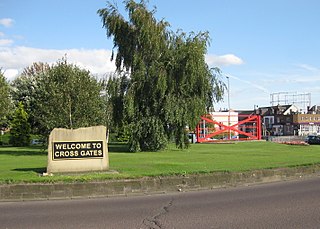
Cross Gates is a suburb in east Leeds, West Yorkshire, England.

The A421 is an important road for east/west journeys across south central England. Together with the A428, the A43 and A34, it forms the route from Cambridge through Milton Keynes to Oxford. The section between the A1 and the A5 is a national primary route.

The A453 road was formerly the main trunk road connecting the English cities of Nottingham and Birmingham. However, the middle section of this mainly single-carriageway road has largely been downgraded to B roads or unclassified roads following the construction of the parallel M42-A42 link around 1990. The M42 was originally meant to pass further north than it does, and to join the M1 at Sandiacre in Derbyshire. The M42/A42 does not enter Derbyshire, but instead joins the M1 closer to the A453 junction at Kegworth. The A42 shadows the former A453 from Appleby Magna to Castle Donington. The road historically connected the East Midlands with the West Midlands.
Colton is a district of east Leeds, West Yorkshire, England, situated between Cross Gates to the north, Halton and Halton Moor to the west, Whitkirk to the north-west and Austhorpe to the north-east. Temple Newsam lies directly south of the estate.

The A1237 road is a road that runs to the west and north of the city of York, England. It forms part of the York Outer Ring Road as either end of the route forms junctions with the A64 to the south-west and east of the city to act as a city distributor. Construction began in 1984 and consisted of three distinct building phases. The road took three years to complete and has been subject since to studies looking to improve traffic flow and reduce accidents. The National Speed Limit for an A Class Road applies.

The A63 autoroute is a motorway in southwest France, connecting Bordeaux to the border with Spain and Basque Country via the Autopista AP-8. The motorway, rather than being a purpose-built route, is an upgrade of the former RN10, which became a full toll road and no longer exists south of Bordeaux. The motorway crosses Les Landes (moorland) as a dual-carriageway.

The A643 is a main road between Leeds and Huddersfield in West Yorkshire, England. Its eastern end is at the Armley Gyratory roundabout on the western edge of Leeds City Centre. The road then goes through:
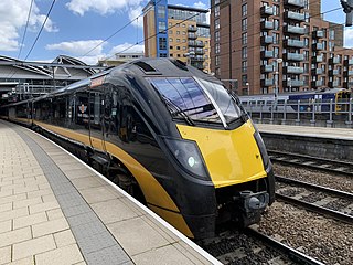
Transport in Leeds consists of extensive road, bus and rail networks in Leeds, West Yorkshire, England. Public transport in the Leeds area is coordinated and developed by West Yorkshire Metro. The city has good rail and road links to the rest of the country. Leeds railway station is one of the busiest in Britain, and Leeds is connected to the national road network via the A1(M) motorway, M1 motorway and M62 motorway. The city is served by Leeds Bradford Airport.

A650 road is a main route through the West Yorkshire conurbation in England. The road goes from Keighley to Wakefield on a rough north west/south east axis for 25 miles (40 km). The route is mostly single carriageway with some dualled sections in the Aire Valley, Bradford and the approach to Wakefield from the M1.
The York Outer Ring Road is a ring road around the city of York, England. The south-eastern section is part of the A64 and the north-western section is the A1237.