Related Research Articles

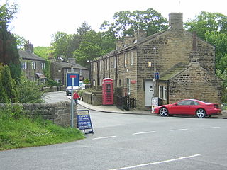
Esholt is a village and former civil parish in the metropolitan district of the City of Bradford, West Yorkshire, England. It is situated 3 miles (4.8 km) east of Shipley town centre, 1.5 miles (2.4 km) south-west of the A65 in Guiseley, 7 miles (11 km) north of Bradford City Centre, and 10 miles (16 km) north-west of Millennium Square, Leeds.

Guiseley is a town in metropolitan borough of the City of Leeds, West Yorkshire, England. Historically part of the West Riding of Yorkshire, it is situated south of Otley and Menston and is now a north-western suburb of Leeds.

Otley is a market town and civil parish at a bridging point on the River Wharfe, in the City of Leeds metropolitan borough in West Yorkshire, England. Historically a part of the West Riding of Yorkshire, the population was 13,668 at the 2011 census. It is in two parts: south of the river is the historic town of Otley and to the north is Newall, which was formerly a separate township. The town is in lower Wharfedale on the A660 road which connects it to Leeds.

Arthington is a linear village in Wharfedale, in the City of Leeds metropolitan borough in West Yorkshire, England. It is a civil parish which, according to the 2011 census, had a population of 532. It is in the Otley ward of the City of Leeds, and the Leeds North West parliamentary constituency.

Yeadon is a town within the metropolitan borough of the City of Leeds, West Yorkshire, England.

Bramhope is a village and civil parish in the City of Leeds metropolitan borough, West Yorkshire, England, north of Holt Park and north east of Cookridge.

Leeds North West is a constituency in the City of Leeds which has been represented in the House of Commons of the UK Parliament since 2017 by Alex Sobel, of Labour Co-op.

Aireborough was a local government district in the West Riding of Yorkshire, England from 1937 to 1974. It was formed through the abolition of the urban districts of Guiseley, Yeadon and Rawdon and enlarged by the addition of parts of Otley urban district and parts of the civil parishes of Esholt, Hawksworth and Menston in the Wharfedale rural district on 1 April 1937. Aireborough Urban District was administered from Micklefield House in Rawdon which had been acquired by Rawdon UDC in 1930. The district is, since 1974, part of Leeds and Esholt is in Bradford

The County Borough of Leeds, and its predecessor, the Municipal Borough of Leeds, was a local government district in the West Riding of Yorkshire, England, from 1835 to 1974. Its origin was the ancient borough of Leeds, which was reformed by the Municipal Corporations Act 1835. In 1889, when West Riding County Council was formed, Leeds became a county borough outside the administrative county of the West Riding; and in 1893 the borough gained city status. The borough was extended a number of times, expanding from 21,593 acres (8,738 ha) in 1911 to 40,612 acres (16,435 ha) in 1961; adding in stages the former area of Roundhay, Seacroft, Shadwell and Middleton parishes and gaining other parts of adjacent districts. In 1971 Leeds was the fifth largest county borough by population in England. The county borough was abolished in 1974 and replaced with the larger City of Leeds, a metropolitan district of West Yorkshire.

Pool-in-Wharfedale or Pool in Wharfedale, usually abbreviated to Pool, is a village and civil parish in Lower Wharfedale, West Yorkshire, England, 10 miles (16 km) north of Leeds city centre, 11 miles (18 km) north-east of Bradford, and 2 miles (3.2 km) east of Otley. It is in the City of Leeds metropolitan borough, and within the historic boundaries of the West Riding of Yorkshire.

Bramhope Tunnel is on the Harrogate Line between Horsforth station and the Arthington Viaduct in West Yorkshire, England. Services through the railway tunnel are operated mainly by Northern. The tunnel was constructed during 1845–1849 by the Leeds and Thirsk Railway. It is notable for its 2.138-mile (3.441 km) length and its Grade II listed, crenellated north portal. The deaths of 24 men who were killed during its construction are commemorated in Otley churchyard by a monument that is a replica of the tunnel's north portal.


Leeds was, from 1894 to 1912, a rural district in the administrative county of Yorkshire, West Riding, England. It comprised an area adjacent to, but not including, the City of Leeds. It was alternatively known as the Rural District of Leeds (Roundhay and Seacroft).

Leeds, commonly known as the City of Leeds, is a metropolitan borough with city status in West Yorkshire, England. The metropolitan borough includes the administrative centre of Leeds and the towns of Farsley, Garforth, Guiseley, Horsforth, Morley, Otley, Pudsey, Rothwell, Wetherby and Yeadon. It has a population of 811,956 (2021), making it technically the second largest city in England by population behind Birmingham, since London is not a single local government entity. Local governance sits with Leeds City Council and the city's 32 Parish Councils.

The Otley and Ilkley Joint Railway was a railway line running between the towns of Otley and Ilkley in West Yorkshire. The line was managed and run jointly by the Midland Railway (MR) and the North Eastern Railway (NER) and was 6+1⁄2 miles (10 km) long. Opened to passenger traffic on 1 August 1865 and freight traffic some months later, the line ran for almost 100 years before partial closure in July 1965 when the line to Otley closed. Today passenger services run over the rest of the line as part of the West Yorkshire Passenger Transport Executive (WYPTE) Wharfedale Line.

Baildon was an urban district in the West Riding of Yorkshire, England between 1894 and 1974.

Arthington Viaduct, listed known as the Wharfedale Viaduct, carries the Harrogate Line across the Wharfe valley between Arthington in West Yorkshire and Castley in North Yorkshire, England. It is a Grade II listed structure.

Adel and Wharfedale is an electoral ward of Leeds City Council in the north west of Leeds, West Yorkshire, covering both urban and rural areas including Adel, Bramhope, Cookridge, Holt Park and Pool-in-Wharfedale.
There are a number of listed buildings in West Yorkshire. The term "listed building", in the United Kingdom, refers to a building or structure designated as being of special architectural, historical, or cultural significance. Details of all the listed buildings are contained in the National Heritage List for England. They are categorised in three grades: Grade I consists of buildings of outstanding architectural or historical interest, Grade II* includes significant buildings of more than local interest and Grade II consists of buildings of special architectural or historical interest. Buildings in England are listed by the Secretary of State for Culture, Media and Sport on recommendations provided by English Heritage, which also determines the grading.
References
- ↑ Great Britain Historical GIS / University of Portsmouth, Wharfedale Rural District Boundary Map . Retrieved 19 June 2013.
- ↑ Great Britain Historical GIS / University of Portsmouth, Wharfedale Rural District . Retrieved 18 October 2010.
53°57′25″N1°39′07″W / 53.957°N 1.652°W