Ferryville, Wisconsin

Last updated

Ferryville, Wisconsin
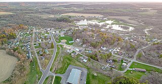
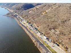
Ferryville, Wisconsin.jpg
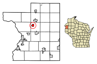
Crawford County Wisconsin Incorporated and Unincorporated areas Ferryville Highlighted.svg
Location of Ferryville in Crawford County, Wisconsin.
Coordinates: 43°20′30″N91°5′2″W / 43.34167°N 91.08389°W / 43.34167; -91.08389
Country Flag of the United States.svg  United States
State Flag of Wisconsin.svg  Wisconsin
County Crawford
Area
[1]
  Total1.99 sq mi (5.15 km2)
  Land1.97 sq mi (5.10 km2)
  Water0.02 sq mi (0.05 km2)
Elevation
[2]
646 ft (197 m)
Population
 (2010) [3]
  Total176
  Estimate 
(2019) [4]
176
  Density89.48/sq mi (34.54/km2)
Time zone UTC-6 (Central (CST))
  Summer (DST) UTC-5 (CDT)
Area code 608
FIPS code 55-25725 [5]
GNIS feature ID1564924 [2]
Website www.ferryville.com

Ferryville is a village in Crawford County, Wisconsin, United States. The population was 176 at the 2010 census. It is located on Wisconsin Highway 35 along the Great River Road.

Contents

Geography

Ferryville is located at 43°20′30″N91°5′2″W / 43.34167°N 91.08389°W / 43.34167; -91.08389 (43.341550, -91.083882). [6]

According to the United States Census Bureau, the village has a total area of 1.99 square miles (5.15 km2), of which, 1.97 square miles (5.10 km2) of it is land and 0.02 square miles (0.05 km2) is water. [7]

Demographics

Historical population
CensusPop.Note
1920 203
1930 26631.0%
1940 30615.0%
1950 216−29.4%
1960 194−10.2%
1970 183−5.7%
1980 22724.0%
1990 154−32.2%
2000 17413.0%
2010 1761.1%
2019 (est.)176 [4] 0.0%
U.S. Decennial Census [8]

2010 census

As of the census [3] of 2010, there were 176 people, 94 households, and 59 families living in the village. The population density was 89.3 inhabitants per square mile (34.5/km2). There were 165 housing units at an average density of 83.8 per square mile (32.4/km2). The racial makeup of the village was 98.3% White, 0.6% from other races, and 1.1% from two or more races. Hispanic or Latino of any race were 2.3% of the population.

There were 94 households, of which 16.0% had children under the age of 18 living with them, 48.9% were married couples living together, 12.8% had a female householder with no husband present, 1.1% had a male householder with no wife present, and 37.2% were non-families. 33.0% of all households were made up of individuals, and 16% had someone living alone who was 65 years of age or older. The average household size was 1.87 and the average family size was 2.32.

The median age in the village was 60.5 years. 13.6% of residents were under the age of 18; 3.3% were between the ages of 18 and 24; 7.9% were from 25 to 44; 38.1% were from 45 to 64; and 36.9% were 65 years of age or older. The gender makeup of the village was 47.2% male and 52.8% female.

2000 census

As of the census [5] of 2000, there were 174 people, 93 households, and 55 families living in the village. The population density was 70.5 people per square mile (27.2/km2). There were 149 housing units at an average density of 60.4 per square mile (23.3/km2). The racial makeup of the village was 98.85% White, and 1.15% from two or more races.

There were 93 households, out of which 15.1% had children under the age of 18 living with them, 53.8% were married couples living together, 4.3% had a female householder with no husband present, and 39.8% were non-families. 39.8% of all households were made up of individuals, and 23.7% had someone living alone who was 65 years of age or older. The average household size was 1.87 and the average family size was 2.45.

In the village, the population was spread out, with 12.6% under the age of 18, 4.6% from 18 to 24, 17.2% from 25 to 44, 43.7% from 45 to 64, and 21.8% who were 65 years of age or older. The median age was 54 years. For every 100 females, there were 104.7 males. For every 100 females age 18 and over, there were 102.7 males.

The median income for a household in the village was $33,958, and the median income for a family was $45,833. Males had a median income of $28,125 versus $20,357 for females. The per capita income for the village was $20,602. About 3.4% of families and 4.5% of the population were below the poverty line, including none of those under the age of eighteen and 11.9% of those 65 or over.

Education

The De Soto Area Schools serves Ferryville, Wisconsin. [9]

Transportation

Bus service towards La Crosse and Prairie du Chien is provided three times daily per direction by Scenic Mississippi Regional Transit. [10]

Notable people

Images

Related Research Articles

<span class="mw-page-title-main">Rio, Wisconsin</span> Village in Wisconsin, United States

Rio is a village in Columbia County, Wisconsin, United States. The population was 1,133 at the 2022 United States Census. It is part of the Madison Metropolitan Statistical Area. The village rests primarily in the town of Otsego. The Village of Rio calls itself "Camper Country USA" due to several campgrounds located near the village. Rio is halfway between Columbus and Portage on Highway 16.

<span class="mw-page-title-main">Maple Bluff, Wisconsin</span> Village in Wisconsin, United States

Maple Bluff is a village in Dane County, Wisconsin, United States. The population was 1,313 at the 2010 census. A suburb of Madison, it is part of the Madison Metropolitan Statistical Area.

<span class="mw-page-title-main">Neosho, Wisconsin</span> Village in Wisconsin, United States

Neosho is a village in Dodge County, Wisconsin, United States. The population was 574 at the 2010 census.

<span class="mw-page-title-main">Fairwater, Wisconsin</span> Village in Wisconsin, United States

Fairwater is a village in Fond du Lac County, Wisconsin, United States. The population was 371 at the 2010 census. The town of Metomen surrounds the village.

<span class="mw-page-title-main">Avoca, Wisconsin</span> Village in Wisconsin, United States

Avoca is a village in Iowa County, Wisconsin, United States. The population was 637 at the 2010 census. It is part of the Madison Metropolitan Statistical Area. It is named after Avoca in Ireland.

<span class="mw-page-title-main">Taylor, Wisconsin</span> Village in Wisconsin, United States

Taylor is a village in Jackson County, Wisconsin, United States, along the Trempealeau River. The population was 484 at the 2020 census.

<span class="mw-page-title-main">West Salem, Wisconsin</span> Village in Wisconsin, United States

West Salem is a village in La Crosse County, Wisconsin, United States, along the La Crosse River. It is part of the La Crosse-Onalaska, WI-MN Metropolitan Statistical Area. The population was 5,277 as of the 2020 census.

<span class="mw-page-title-main">Lone Rock, Wisconsin</span> Village in Wisconsin, United States

Lone Rock is a village in Richland County, Wisconsin, United States. The population was 888 at the 2010 census. The village is named after a sandstone outcrop.

<span class="mw-page-title-main">Deer Park, Wisconsin</span> Village in Wisconsin, United States

Deer Park is a village in St. Croix County, Wisconsin, United States. The population was 216 at the 2010 census.

<span class="mw-page-title-main">La Farge, Wisconsin</span> Village in Wisconsin, United States

La Farge is a village along the Kickapoo River in Vernon County, Wisconsin, United States. Its population was 730 at the 2020 census.

<span class="mw-page-title-main">Ontario, Wisconsin</span> Village in Wisconsin, United States

Ontario is a village in Vernon County, Wisconsin, United States. The population was 554 at the 2010 census.

<span class="mw-page-title-main">Big Falls, Waupaca County, Wisconsin</span> Village in Wisconsin, United States

Big Falls is a village in Waupaca County, Wisconsin, United States. The population was 61 at the 2010 census.

<span class="mw-page-title-main">Biron, Wisconsin</span> Village in Wisconsin, United States

Biron is a village in Wood County, Wisconsin, United States. The population was 839 at the 2010 census. It is the site of ND Paper's Biron Mill.

<span class="mw-page-title-main">Cazenovia, Wisconsin</span> Village in Wisconsin, United States

Cazenovia is a village in Richland and Sauk Counties in the U.S. state of Wisconsin. The population was 318 at the 2010 census. Of this, 314 were in Richland County, and only 4 were in Sauk County.

<span class="mw-page-title-main">Viola, Wisconsin</span> Village in Wisconsin, United States

Viola is a village in Richland (mostly) and Vernon counties in the U.S. state of Wisconsin. The population was 699 at the 2010 census. Of this, 477 were in Richland County, and 222 were in Vernon County.

<span class="mw-page-title-main">Lowell, Wisconsin</span> Village in Wisconsin, United States

Lowell is a village in Dodge County, Wisconsin, United States, along the Beaver Dam River. The population was 340 at the 2010 census. The village is located within the Town of Lowell.

<span class="mw-page-title-main">Eden, Wisconsin</span> Village in Wisconsin, United States

Eden is a village in Fond du Lac County, Wisconsin, United States. The population was 875 at the 2010 census. The village is located within the Town of Eden.
Highland is a town in Iowa County, Wisconsin, United States. The population was 797 at the 2000 census. The village of Highland is located within the town.

<span class="mw-page-title-main">Merrimac, Wisconsin</span> Village in Wisconsin, United States

Merrimac is a village in Sauk County, Wisconsin, United States, northwest of Madison. The population was 420 at the 2010 census. The village is located within the Town of Merrimac.
<span class="mw-page-title-main">Lohrville, Wisconsin</span> Village in Wisconsin, United States

Lohrville is a village in Waushara County, Wisconsin, United States. The population was 402 at the 2010 census.

References

  1. "2019 U.S. Gazetteer Files". United States Census Bureau. Retrieved August 7, 2020.
  2. 1 2 "US Board on Geographic Names". United States Geological Survey. October 25, 2007. Retrieved January 31, 2008.
  3. 1 2 "U.S. Census website". United States Census Bureau . Retrieved November 18, 2012.
  4. 1 2 "Population and Housing Unit Estimates". United States Census Bureau. May 24, 2020. Retrieved May 27, 2020.
  5. 1 2 "U.S. Census website". United States Census Bureau . Retrieved January 31, 2008.
  6. "US Gazetteer files: 2010, 2000, and 1990". United States Census Bureau. February 12, 2011. Retrieved April 23, 2011.
  7. "US Gazetteer files 2010". United States Census Bureau. Archived from the original on July 2, 2012. Retrieved November 18, 2012.
  8. "Census of Population and Housing". Census.gov. Retrieved June 4, 2015.
  9. "De Soto Area Schools". Archived from the original on October 29, 2007. Retrieved October 28, 2007.
  10. Bus scheduleridesmrt.com Archived September 29, 2021, at the Wayback Machine
  11. 'Wisconsin Blue Book 1901,' Biographical Sketch of J. A. Haggerty, pg. 744
  12. 'Wisconsin Blue Book 1950,' Biographical Sketch of Patrick J. Lucey, pg. 43