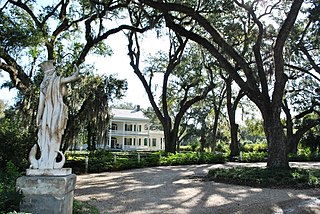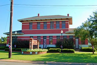
West Feliciana Parish is a civil parish located in the U.S. state of Louisiana. At the 2020 census, the population was 15,310. The parish seat is St. Francisville. The parish was established in 1824.

Vermilion Parish is a parish located in the U.S. state of Louisiana, created in 1844. The parish seat is Abbeville. Vermilion Parish is part of the Lafayette metropolitan statistical area, and located in southern Acadiana. At the 2020 U.S. census, the population was 57,359.

Rapides Parish is a parish located in the U.S. state of Louisiana. As of the 2020 census, the population was 130,023. The parish seat is Alexandria, which developed along the Red River of the South. Rapides is the French word for "rapids". The parish was created in 1807 after the United States acquired this territory in the Louisiana Purchase.

Pointe Coupee Parish is a parish located in the U.S. state of Louisiana. As of the 2020 census, the population was 20,758. The parish seat is New Roads.

Catahoula Parish is a parish in the U.S. state of Louisiana. As of the 2020 census, the population was 8,906. Its seat is Harrisonburg, on the Ouachita River. The parish was formed in 1808, shortly after the United States acquired this territory in the Louisiana Purchase of 1803.

Caldwell Parish is a parish located in the U.S. state of Louisiana. As of 2020, its population was 9,645. The parish seat is Columbia.

Avoyelles is a parish located in central eastern Louisiana on the Red River where it effectively becomes the Atchafalaya River and meets the Mississippi River. As of the 2020 census, the population was 39,693. The parish seat is Marksville. The parish was created in 1807, with the name deriving from the French name for the historic Avoyel people, one of the local Indian tribes at the time of European encounter.

Bunkie is a city in Avoyelles Parish, Louisiana, United States. The population was 4,171 at the 2010 census.

Cottonport is a town in Avoyelles Parish, Louisiana, United States. The population was 2,006 at the 2010 census.

Evergreen is a town in Avoyelles Parish, Louisiana, United States. The population was 310 at the 2010 census. Evergreen is located east of Bunkie.

Mansura is a town in Avoyelles Parish, Louisiana, United States. The population was 1,419 at the 2010 census. Mansura is home to the Cochon de Lait Festival, and claims to be the Cochon de Lait capital of the world.

Marksville is a small city in and the parish seat of Avoyelles Parish, Louisiana, United States. The population was 5,702 at the 2010 census, an increase of 165 over the 2000 tabulation of 5,537.

Slaughter is a town in East Feliciana Parish, Louisiana, United States. The population was 997 at the 2010 U.S. census, down from 1,011 at the 2000 U.S. census. At the 2020 population estimates program, the U.S. Census Bureau estimated 882 people lived in the township. Slaughter is part of the Baton Rouge metropolitan statistical area.

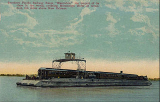
Avondale is a census-designated place (CDP) in Jefferson Parish, Louisiana, United States, on the west bank of the Mississippi River. The population was 4,582 in 2020. It is part of the New Orleans–Metairie–Kenner metropolitan statistical area.
Chackbay is a census-designated place (CDP) in northern Lafourche Parish, Louisiana, United States. The population was 5,370 in 2020. It is part of the Houma–Bayou Cane–Thibodaux metropolitan statistical area.

Franklin is a small city in and the parish seat of St. Mary Parish, Louisiana, United States. The population was 7,660 at the 2010 census. The city is located on Bayou Teche, southeast of the cities of Lafayette, 47 miles (76 km) and New Iberia, 28 miles (45 km), and 22 miles (35 km) northwest of Morgan City. It is part of the Morgan City Micropolitan Statistical Area and the larger Lafayette-Acadiana combined statistical area.

Sun is a village in the northeastern corner of St. Tammany Parish, Louisiana, United States. The population was 470 at the 2010 census, and 392 in 2020. It is part of the New Orleans–Metairie–Kenner metropolitan statistical area.
Moncla is an unincorporated community village in Avoyelles Parish, Louisiana, United States. The population was 642 at the 2000 census.
Center Point is an unincorporated community and census-designated place in Avoyelles Parish, Louisiana, United States. As of the 2010 census, it had a population of 492.
Bordelonville is an unincorporated community and census-designated place (CDP) in Avoyelles Parish, Louisiana, United States. As of the 2010 census, it had a population of 525.


