Moncla, Louisiana

Last updated

Moncla
USA Louisiana location map.svg
Red pog.svg
Moncla
Location of Moncla in Louisiana
Coordinates: 31°03′17″N92°07′16″W / 31.05472°N 92.12111°W / 31.05472; -92.12111
CountryUnited States
StateLouisiana
Parish Avoyelles
Incorporated1955
Area
  Total0.8 sq mi (2 km2)
  Land0.8 sq mi (2 km2)
  Water0.0 sq mi (0 km2)
Elevation
79 ft (24 m)
Population
 (2000)
  Total642
  Density800/sq mi (310/km2)
Time zone UTC-6 (CST)
  Summer (DST) UTC-5 (CDT)
Area code 318
Website http://www.hessmer.com

Moncla is an unincorporated community village in Avoyelles Parish, Louisiana, United States. The population was 642 at the 2000 census.

Contents

History

The town was named for the family of Dr. Joseph Moncla, native of France and a practicing physician of 19th century Avoyelles Parish. Dr. Moncla died while out on a call seeing one of his patients. Several of Dr. Moncla's sons settled on his former plantation along Red River of the South. One was postmaster.

The area has never been incorporated. Moncla has been a favored point of river crossing of the Red River because of the Moncla Bluffs making passage possible in bad weather in the 1800s. A bridge, the third to serve the area, now spans the Red River at Moncla in Avoyelles Parish. [1]

Geography

Moncla is located at 31°3′17″N92°7′16″W / 31.05472°N 92.12111°W / 31.05472; -92.12111 (31.054727, -92.121076). [2]

According to the United States Census Bureau, the village has a total area of 1.9 km2 (0.8 mi2), all land.

Demographics

As of the census [3] of 2000, there were 642 people, 280 households, and 176 families residing in the village. The population density was 330.5/km2 (855.1/mi2). There were 303 housing units at an average density of 156.0/km2 (403.6/mi2). The racial makeup of the village was 91.43% White, 6.70% African American, 1.56% Native American, and 0.31% from two or more races. Hispanic or Latino of any race were 0.16% of the population.

There were 280 households, out of which 27.9% had children under the age of 18 living with them, 50.7% were married couples living together, 8.6% had a female householder with no husband present, and 37.1% were non-families. 32.9% of all households were made up of individuals, and 14.6% had someone living alone who was 65 years of age or older. The average household size was 2.29 and the average family size was 2.90.

In the village the population was spread out, with 23.8% under the age of 18, 9.7% from 18 to 24, 30.2% from 25 to 44, 22.3% from 45 to 64, and 14.0% who were 65 years of age or older. The median age was 35 years. For every 100 females, there were 94.5 males. For every 100 females age 18 and over, there were 85.2 males.

The median income for a household in the village was $24,659, and the median income for a family was $31,528. Males had a median income of $23,750 versus $16,964 for females. The per capita income for the village was $12,449. About 15.3% of families and 18.6% of the population were below the poverty line, including 16.1% of those under age 18 and 20.0% of those age 65 or over.

Education

Local public schools are managed by the Avoyelles Parish School Board. [4]

See Also

Related Research Articles

<span class="mw-page-title-main">Rapides Parish, Louisiana</span> Parish in Louisiana, United States

Rapides Parish is a parish located in the U.S. state of Louisiana. As of the 2020 census, the population was 130,023. The parish seat is Alexandria, which developed along the Red River of the South. Rapides is the French word for "rapids". The parish was created in 1807 after the United States acquired this territory in the Louisiana Purchase.

<span class="mw-page-title-main">LaSalle Parish, Louisiana</span> Parish in Louisiana, United States

LaSalle Parish is a parish located in the U.S. state of Louisiana. As of the 2020 United States Census, the population was 14,791. The parish seat is Jena. The parish was created in 1910 from the western section of Catahoula Parish.

<span class="mw-page-title-main">Catahoula Parish, Louisiana</span> Parish in Louisiana, United States

Catahoula Parish is a parish in the U.S. state of Louisiana. As of the 2020 census, the population was 8,906. Its seat is Harrisonburg, on the Ouachita River. The parish was formed in 1808, shortly after the United States acquired this territory in the Louisiana Purchase of 1803.
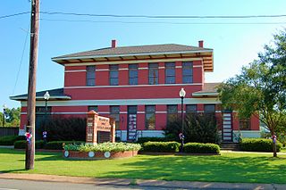
<span class="mw-page-title-main">Avoyelles Parish, Louisiana</span> Parish in Louisiana, United States

Avoyelles is a parish located in central eastern Louisiana on the Red River where it effectively becomes the Atchafalaya River and meets the Mississippi River. As of the 2020 census, the population was 39,693. The parish seat is Marksville. The parish was created in 1807, with the name deriving from the French name for the historic Avoyel people, one of the local Indian tribes at the time of European encounter.

Sunshine Acres is a former census-designated place (CDP) in Broward County, Florida, United States. The population was 827 at the 2000 census. The area is now a neighborhood within the town of Davie.

<span class="mw-page-title-main">Cottonport, Louisiana</span> Town in Louisiana, United States

Cottonport is a town in Avoyelles Parish, Louisiana, United States. The population was 2,006 at the 2010 census.

<span class="mw-page-title-main">Evergreen, Louisiana</span> Town in Louisiana, United States

Evergreen is a town in Avoyelles Parish, Louisiana, United States. The population was 310 at the 2010 census. Evergreen is located east of Bunkie.

<span class="mw-page-title-main">Hessmer, Louisiana</span> Village in Louisiana, United States

Hessmer is a village in Avoyelles Parish, Louisiana, United States. The population was 802 at the 2010 census.

<span class="mw-page-title-main">Mansura, Louisiana</span> Town in Louisiana, United States

Mansura is a town in Avoyelles Parish, Louisiana, United States. The population was 1,419 at the 2010 census. Mansura is home to the Cochon de Lait Festival, and claims to be the Cochon de Lait capital of the world.

<span class="mw-page-title-main">Marksville, Louisiana</span> City in Louisiana, United States

Marksville is a small city in and the parish seat of Avoyelles Parish, Louisiana, United States. The population was 5,702 at the 2010 census, an increase of 165 over the 2000 tabulation of 5,537.

<span class="mw-page-title-main">Moreauville, Louisiana</span> Village in Louisiana, United States

Moreauville is a village in Avoyelles Parish, Louisiana, United States. The population was 929 at the 2010 census.

<span class="mw-page-title-main">Plaucheville, Louisiana</span> Village in Louisiana, United States

Plaucheville is a village in Avoyelles Parish, Louisiana, United States. The population was 248 at the 2010 census.

<span class="mw-page-title-main">Simmesport, Louisiana</span> Town in Louisiana, United States

Simmesport is a town in Avoyelles Parish, Louisiana, United States. The population was 2,161 at the 2010 census. It is the northernmost town on the Atchafalaya River, located near the Old River which connects the Red and Atchafalaya rivers with the Mississippi River.

<span class="mw-page-title-main">Clarks, Louisiana</span> Village in Louisiana, United States

Clarks is a rural village in Caldwell Parish, Louisiana, United States. The population was 1,017 at the 2010 census. Clarks is the largest community by population in Caldwell Parish.

<span class="mw-page-title-main">Georgetown, Louisiana</span> Village in Louisiana, United States

Georgetown is a village in Grant Parish, Louisiana, United States. It is part of the Alexandria, Louisiana Metropolitan Statistical Area. The population was 327 at the 2010 census.

<span class="mw-page-title-main">East Hodge, Louisiana</span> Village in Louisiana, United States

East Hodge is a village in Jackson Parish, Louisiana, United States. The population was 289 at the 2010 census, down from 366 at the 2000 census. It is part of the Ruston Micropolitan Statistical Area.

<span class="mw-page-title-main">Maurice, Louisiana</span> Town in Louisiana, United States

Maurice is a town in Vermilion Parish, Louisiana, United States. The population was 964 at the 2010 census and 2,118 for the 2020 Census. It is part of the Abbeville micropolitan statistical area.

<span class="mw-page-title-main">Three Rivers, Massachusetts</span> Former CDP in Massachusetts, United States

Three Rivers is a village and former census-designated place (CDP) in the city of Palmer in Hampden County, Massachusetts, United States. It is part of the Springfield, Massachusetts Metropolitan Statistical Area. It is named for the confluence of the Ware and Quaboag rivers, which form the Chicopee River.

<span class="mw-page-title-main">Ashaway, Rhode Island</span> Village and CDP in Hopkinton, Rhode Island, US

Ashaway is an unincorporated village and census-designated place (CDP) in the town of Hopkinton, Rhode Island, USA. It is a principal village of Hopkinton, along with Hope Valley, although it is the smaller of the two. The population was 1,485 at the 2010 census. The name Ashaway is derived from the American Indian name for the river that runs through the village, the Ashawague or Ashawaug, which means "land in the middle" or "land between" in the Niantic and Mohegan languages. The name "Ashawague River" appears as late as 1832 on the Findley map of Rhode Island published in Philadelphia.

<span class="mw-page-title-main">Wilder, Vermont</span> Census-designated place in Vermont, United States

Wilder is an unincorporated village and census-designated place (CDP) within the town of Hartford in Windsor County, Vermont, United States. It is the location of the Wilder Dam on the Connecticut River. The population of the CDP was 1,690 at the 2010 census. The village center is an early example of a planned mill community, and was listed on the National Register of Historic Places as the Wilder Village Historic District in 1999.

References

  1. Randy DeCuir
  2. "US Gazetteer files: 2010, 2000, and 1990". United States Census Bureau. February 12, 2011. Retrieved April 23, 2011.
  3. "U.S. Census website". United States Census Bureau . Retrieved January 31, 2008.
  4. "AVOYELLES PARISH SCHOOL BOARD Policy Manual". Avoyelles Parish School Board. Retrieved May 18, 2024.