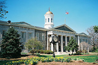
Baltimore County is the third-most populous county in the U.S. state of Maryland and is part of the Baltimore metropolitan area. Baltimore County is part of the Northeast megalopolis, which stretches from Northern Virginia northward to Boston. Baltimore County hosts a diversified economy, with particular emphasis on education, government, and health care. As of the 2020 census, the population was 854,535.

Carroll County is located in the U.S. state of Maryland. As of the 2020 census, the population was 172,891. Its county seat is Westminster.

Catonsville is a census-designated place (CDP) in Baltimore County, Maryland. The population was 44,701 at the 2020 US Census. The community is a streetcar suburb of Baltimore along the city's western border. The town is known for its proximity to the Patapsco River and Patapsco Valley State Park, making it a regional mountain biking hub. The town is also notable as a local hotbed of music, earning it the official nickname of "Music City, Maryland." Catonsville contains the majority of the University of Maryland, Baltimore County (UMBC), a major public research university with close to 14,000 students.

Owings Mills is an unincorporated community and census-designated place in Baltimore County, Maryland, United States. It is a suburb of Baltimore. Per the 2020 census, the population was 35,674. Owings Mills is home to the northern terminus of the Baltimore Metro Subway, and housed the Owings Mills Mall until its closure in 2015. It is also home to the Baltimore Ravens' headquarters facility, and the studios for Maryland Public Television. In 2008, CNNMoney.com named Owings Mills number 49 of the "100 Best Places to Live and Launch".

Randallstown is an unincorporated community and census-designated place in Baltimore County, Maryland, United States. It is named after Christopher and Thomas Randall, two 18th-century tavern-keepers. At that time, Randallstown was a tollgate crossroads on the Liberty Turnpike, a major east–west thoroughfare. It is a suburb of Baltimore, with a population of 33,655 as of the 2020 census. As of 2020 it was 72 percent African American. In the 1990s, Randallstown transitioned to a majority African American community.

Reisterstown is an unincorporated community and census-designated place in Baltimore County, Maryland, United States. As of the 2010 census, it had a population of 25,968.

Eldersburg is an unincorporated community and census-designated place (CDP) in Carroll County, Maryland, United States. The population was 30,531 at the 2010 census.

Manchester is a small incorporated town in northeastern Carroll County, Maryland, United States, located just south of the Pennsylvania state line and north of Baltimore. The population was 4,808 at the 2010 census.

Sykesville is a small town in Carroll County, Maryland, United States. The town lies 20 miles (32 km) west of Baltimore and 40 miles (64 km) north of Washington D.C. The population was 4,436 at the 2010 census. BudgetTravel.com named Sykesville 'Coolest Small Town in America' in June 2016.

Westminster is a city in northern Maryland, United States. It is the seat of Carroll County. The city's population was 19,960 at the 2020 census. Westminster is an outlying community within the Baltimore-Towson, MD MSA, which is part of a greater Washington-Baltimore-Northern Virginia, DC-MD-VA-WV CSA.

Hampstead is a town in Carroll County in the U.S. state of Maryland. The population was 6,323 at the 2010 census.

Woodbine is an unincorporated rural community in Howard and Carroll counties, Maryland, United States. It is part of the Baltimorean metropolitan area. It is located southeast of Frederick, west of Baltimore, north of Washington, D.C., and east of Mount Airy. The community was named for the woodbine plant, which grew in the community in fields and along riverbanks.

Maryland Route 140 is a 49-mile (79 km) state highway in the U.S. state of Maryland. The route runs from U.S. Route 1 and US 40 Truck in Baltimore northwest to the Pennsylvania border, where the road continues into that state as Pennsylvania Route 16. MD 140 passes through the northern part of central Maryland, connecting Baltimore, Pikesville, Reisterstown, Westminster, Taneytown, and Emmitsburg.

Ilchester is an unincorporated community and census-designated place in Howard County, Maryland, United States. The population was 23,476 at the 2010 census. It was named after the village of Ilchester in the English county of Somerset.
Gamber is an unincorporated community located in Carroll County, Maryland, United States. Gamber is located at the intersection of Maryland routes 32 and 91, near the border of Carroll and Baltimore counties. It is an unincorporated area approximately four miles northwest of the Liberty Reservoir and six miles southeast of Westminster.

Owings Mills Boulevard is a county- and state-maintained highway in the U.S. state of Maryland. The highway runs 7.8 miles (12.6 km) from Liberty Road near Randallstown north to Bond Avenue near Glyndon. Maryland Route 940 is the designation for the 1.48-mile (2.38 km) state highway portion of Owings Mills Boulevard between Red Run Boulevard and MD 140 that is centered on Owings Mills Boulevard's interchange with Interstate 795 (I-795) in Owings Mills in western Baltimore County. Owings Mills Boulevard was first constructed in the mid- to late 1980s. The highway was extended both north and south in the early 1990s and in the early 2000s. Owings Mills Boulevard was extended south in two sections, with the latter section completed to MD 26 in 2016.
Carrolltowne is an unincorporated community in Carroll County, Maryland, United States.

Henryton is an unincorporated community in Carroll County, Maryland, United States. It is located along the Patapsco River.
Shervettes Corner is an unincorporated community in Carroll County, Maryland, United States, lying between Eldersburg and Randallstown. It is surrounded on three sides by Liberty Reservoir, south of Maryland Route 26. It is located east of the Lakeview Memorial Park Cemetery.


