
A ghost town, deserted city, extinct town or abandoned city is an abandoned village, town, or city, usually one that contains substantial visible remaining buildings and infrastructure such as roads. A town often becomes a ghost town because the economic activity that supported it has failed or ended for any reason. The town may also have declined because of natural or human-caused disasters such as floods, prolonged droughts, extreme heat or extreme cold, government actions, uncontrolled lawlessness, war, pollution, or nuclear disasters. The term can sometimes refer to cities, towns, and neighborhoods that, though still populated, are significantly less so than in past years; for example, those affected by high levels of unemployment and dereliction.

Clinton Creek is a ghost town in Yukon. It was a small company-owned asbestos mining town in western Yukon near the confluence of the Yukon and Fortymile rivers. It operated by the Cassiar Asbestos Corporation, which also operated the asbestos mine in Cassiar, British Columbia, from 1967 to 1978, when it was closed and all the buildings were auctioned off.
Butedale is a ghost town on Princess Royal Island, in British Columbia, Canada. It was founded in 1918 as a fishing, mining and logging camp. Initially the salmon cannery was established by Western Packers which was purchased and operated by the Canadian Fishing Company until it ceased operating in the 1950s. At its peak, Butedale's summertime population was over 400.
Eholt is in the Boundary Country region of south central British Columbia. This ghost town, on BC Highway 3, is by road about 27 kilometres (17 mi) northwest of Grand Forks and 14 kilometres (9 mi) northeast of Greenwood.
Emory Creek Provincial Park is a provincial park in British Columbia, Canada, located on the west side of the Fraser River just south of the town of Yale. It commemorates the location of a large boomtown, variously known as Emory, Emory Bar or Emory City, that first rose during the Fraser Canyon Gold Rush but became a major construction town during the building of the Canadian Pacific Railway in the 1880s.
Emory Creek in 1858 was a tent and shack camp, established by miners in search of gold. When it became evident that the gold was not available in the amounts estimated, the miners started moving north on the Fraser River. A few Chinese remained in the area. The area came into the hands of a man named Walker, who felt Emory Creek would become the head of riverboat navigation on the Fraser. Eventually, he sold the land to the Oppenheimer Brothers in early 1879. In the fall of 1879, Emory was chosen by the C.P.R. as the western terminus. In a short time it became Emory Creek. The town consisted of thirteen streets with its own newspaper, various shops, a brewery, nine saloons and a sawmill. When Yale was made the terminus, Emory was all but abandoned by 1885, with the completion of the railway. Today, it is an easily accessible treed campground with paved roads and flush outhouses.
Goat Range Provincial Park is a provincial park in British Columbia, Canada.

School District 28 Quesnel is a school district in central British Columbia. Most schools are located in Quesnel with one outlying school in Wells, a small community near the historic gold mining town of Barkerville and another school in the community of Nazko which is 100 km west of Quesnel.
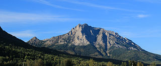
Mount Hosmer is a mountain of the Canadian Rockies in British Columbia, Canada. It shares its name with the adjacent community of Hosmer, but its best-known elevation, a series of south-facing cliffs, can be seen from further down the Elk Valley in Fernie. The mountain is an upside down mountain, where the oldest part of the rock formation is near the top and the youngest is at the bottom.
Francis Xavier Richter Jr. was a Canadian politician, who served as a Member of the Legislative Assembly and Minister of Agriculture and Minister of Mines in the Social Credit government of W.A.C. Bennett in the province of British Columbia. He represented the riding of Similkameen from 1953 to 1966 and its successor riding Boundary-Similkameen from 1966 to 1975.

Del Bonita is a hamlet in southern Alberta, Canada within Cardston County. It is located approximately 49 km (30 mi) south of Magrath at the junction of Highway 62 and Highway 501. Due to its location near the Canada–United States border, it serves as a port of entry into the U.S. state of Montana at the nearby Del Bonita Border Crossing which is located 3 km (1.9 mi) to the south. Del Bonita is a name derived from Spanish meaning "of the pretty".
Barkley Valley is a former gold-mining community and now ghost town located on the easternmost fork of Haylmore Creek in the Cayoosh Range of the Lillooet Country of the Southern Interior of British Columbia, Canada.

Beaver was a sternwheel steamboat built in 1873 for the Willamette Transportation Company.
Locust Grove is an unincorporated community and ghost town in Sherman County, Oregon, United States. It is located on Oregon Route 206, six miles west of Wasco.
Niagara is on the west side of the Granby River, near the junction with Fisherman Creek, in the Boundary Country region of south central British Columbia. The small community is about 12 kilometres (7 mi) north of Grand Forks on North Fork Rd.
Richfield is a ghost town located in the Cariboo region of British Columbia, Canada. The town is situated beside Williams Creek.
Iron Bay is a ghost town located in the Lower Mainland region of British Columbia. The town is situated on the north end of Indian Arm about one kilometre from Granite Falls. Quarrying, logging and tourism was performed over the years in the area. The site is now a yacht club outstation and wharf.
Kerr Creek is a ghost town located in the Similkameen Division Yale Land region of British Columbia. The town is situated near northeast of Midway, west of Grand Forks. It was founded in 1893 by Robert D. Kerr.
Champion Creek is a ghost town located in the West Kootenay region of British Columbia. It is a former Doukhobor settlement. The town is near Champion Creek on the east side of Columbia River, between Trail and Castlegar.
A fisherman is someone who captures fish and other animals from a body of water, or gathers shellfish
