Flaxville, Montana

Last updated

Flaxville, Montana
RY Trail Bar Flaxville MT 026.jpg
RY Trail Bar in downtown Flaxville, 2010
Daniels County Montana Incorporated and Unincorporated areas Flaxville Highlighted.svg
Location of Flaxville, Montana
Coordinates: 48°48′13″N105°10′25″W / 48.80361°N 105.17361°W / 48.80361; -105.17361
Country United States
State Montana
County Daniels
Area
[1]
  Total0.10 sq mi (0.20 km2)
  Land0.10 sq mi (0.20 km2)
  Water0.00 sq mi (0.00 km2)
Elevation
2,782 ft (848 m)
Population
 (2020)
  Total63
  Density807.69/sq mi (310.45/km2)
Time zone UTC-7 (Mountain (MST))
  Summer (DST) UTC-6 (MDT)
ZIP code
59222
Area code 406
FIPS code 30-26800
GNIS feature ID0771463

Flaxville is a town in Daniels County, Montana, United States. The population was 63 at the 2020 census. [2]

Contents

Geography

Flaxville is located at 48°48′13″N105°10′25″W / 48.80361°N 105.17361°W / 48.80361; -105.17361 (48.803733, -105.173704), [3] just south of the Canada–US border, at the junction of Highway 251 and Montana Highway 5. [4]

According to the United States Census Bureau, the town has a total area of 0.10 square miles (0.26 km2), all land. [5]

Whitetail Reservoir, a state fishing access site, is located "7 miles north of Flaxville on Highway 511." [6] The town's R-Y Trail Bar is named after a historic route. Merv Blevins, who farms in Bengough, Saskatchewan and Flaxville, Montana, describes the K-Y Trail as follows:

“The road that runs from Regina down to Miles City follows Highway 34 [which becomes Highway 511 in Montana] ... (it was used) when they were doing cattle drives and things back in the day, but it’s also used by our Native Americans to come up to the turtle effigy that’s located just south east of Big Beaver, that’s a holy sight for them and they come there and they have a sweat lodge there every once in awhile and they use the port of Big Beaver.” [7]

History

"Flaxville was originally founded as Boyer, about 2.5 miles southwest of where the town is now." [8] It was named after "the Henry Boyer family at whose home the early railroad construction workers were fed." [9] The current town was founded in 1913 following the arrival of a Great Northern Railway branch line that eventually ran from Bainville to Opheim. "The first post office was established in 1914 with Martha Bledsoe as postmaster." [4]

The name refers to the abundance of flax grown in the area. [10] There are grain elevators beside the railroad tracks running through town. [8]

The town was incorporated in 1955. [8] It is home to the Daniels County Chapter of Pheasants Forever, The Barn Theater, Country Roads Mini Horses, and the R-Y Trail Bar. [11] [12] [13]

Printmaker Don Bunse (1934 - 1994), who taught at University of Montana and developed collagraphy with a group of artists, was born in Flaxville. "He was a delegate for the University of Montana in the first academic art exchange between the United States and the People's Republic of China." [14] [15]

Demographics

Historical population
CensusPop.Note
1930 515
1940 469−8.9%
1950 374−20.3%
1960 262−29.9%
1970 185−29.4%
1980 142−23.2%
1990 88−38.0%
2000 87−1.1%
2010 71−18.4%
2020 63−11.3%
U.S. Decennial Census [2]

2010 census

As of the census [16] of 2010, there were 71 people, 37 households, and 17 families residing in the town. The population density was 710.0 inhabitants per square mile (274.1/km2). There were 55 housing units at an average density of 550.0 per square mile (212.4/km2). The racial makeup of the town was 93.0% White, 1.4% Native American, and 5.6% from two or more races. Hispanic or Latino of any race were 1.4% of the population.

There were 37 households, of which 13.5% had children under the age of 18 living with them, 43.2% were married couples living together, 2.7% had a female householder with no husband present, and 54.1% were non-families. 43.2% of all households were made up of individuals, and 13.5% had someone living alone who was 65 years of age or older. The average household size was 1.92 and the average family size was 2.76.

The median age in the town was 46.5 years. 15.5% of residents were under the age of 18; 6.9% were between the ages of 18 and 24; 22.5% were from 25 to 44; 36.7% were from 45 to 64; and 18.3% were 65 years of age or older. The gender makeup of the town was 47.9% male and 52.1% female.

2000 census

As of the census [17] of 2000, there were 87 people, 44 households, and 20 families residing in the town. The population density was 837.7 inhabitants per square mile (323.4/km2). There were 59 housing units at an average density of 568.1 per square mile (219.3/km2). The racial makeup of the town was 91.95% White, 2.30% Native American, 1.15% Asian, 2.30% from other races, and 2.30% from two or more races.

There were 44 households, out of which 13.6% had children under the age of 18 living with them, 40.9% were married couples living together, 4.5% had a female householder with no husband present, and 52.3% were non-families. 47.7% of all households were made up of individuals, and 27.3% had someone living alone who was 65 years of age or older. The average household size was 1.98 and the average family size was 2.95.

In the town, the population was spread out, with 21.8% under the age of 18, 2.3% from 18 to 24, 24.1% from 25 to 44, 19.5% from 45 to 64, and 32.2% who were 65 years of age or older. The median age was 48 years. For every 100 females there were 102.3 males. For every 100 females age 18 and over, there were 119.4 males.

The median income for a household in the town was $34,688, and the median income for a family was $39,375. Males had a median income of $35,625 versus $42,917 for females. The per capita income for the town was $18,567. There were 8.7% of families and 9.1% of the population living below the poverty line, including no under eighteens and 25.0% of those over 64.

Education

Scobey Public Schools provides education for students in kindergarten through 12th grade. [18]

Media

The Daniels County Leader is the local newspaper. [19] They publish both print and online news editions.

See also

Related Research Articles

<span class="mw-page-title-main">Valley County, Montana</span> County in Montana, United States

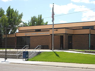
Valley County is a county in the U.S. state of Montana. Valley County was created in 1893 with area partitioned from Dawson County. As of the 2020 census, the population was 7,578. Its county seat is Glasgow. It is located on the Canada–United States border with Saskatchewan.

<span class="mw-page-title-main">Sheridan County, Montana</span> County in Montana, United States

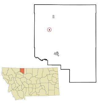
Sheridan County is a county in the U.S. state of Montana. As of the 2020 census, the population was 3,539. Its county seat is Plentywood. Its northern boundary is the Canada–United States border south of Saskatchewan.

<span class="mw-page-title-main">Roosevelt County, Montana</span> County in Montana, United States

Roosevelt County is a county in the U.S. state of Montana. As of the 2020 census, the population was 10,794. Its county seat is Wolf Point. Roosevelt County was created by the Montana Legislature in 1919 from a portion of Sheridan County. The name honors former president Theodore Roosevelt, who had died earlier that year.

<span class="mw-page-title-main">Madison County, Montana</span> County in Montana, United States

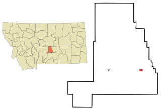
Madison County is a county in the U.S. state of Montana. As of the 2020 census, the population was 8,623. Its county seat is Virginia City. The county was founded in 1865; at the time it was part of the Montana Territory.

<span class="mw-page-title-main">Daniels County, Montana</span> County in Montana, United States

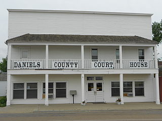
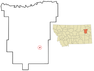
Daniels County is a county located in the U.S. state of Montana. As of the 2020 census, the population was 1,661. Its county seat is Scobey. It is on Montana's north border, and thus abuts the Canada–US border with Saskatchewan.

<span class="mw-page-title-main">Hillsdale, Illinois</span> Village in Illinois, United States

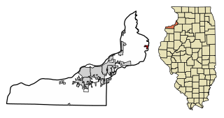
Hillsdale is a village in Rock Island County, Illinois, United States. The population was 531 at the time of the 2020 census, up from 523 at the 2010 census.

<span class="mw-page-title-main">Fromberg, Montana</span> Town in Carbon County, Montana, United States

Fromberg is a town in Carbon County, Montana, United States. As of the 2020 census, the population of the town was 392.

<span class="mw-page-title-main">Ekalaka, Montana</span> Town in Montana, United States

Ekalaka is a town in and the county seat of Carter County, Montana, United States. The population was 399 at the 2020 census.

<span class="mw-page-title-main">Scobey, Montana</span> City in Montana, United States

Scobey is a city in and the county seat of Daniels County, Montana, United States. The population was 999 at the 2020 census.

<span class="mw-page-title-main">Richey, Montana</span> Town in Montana, United States

Richey is a town in Dawson County, Montana, United States. It is located to the north of Glendive, the county seat. The population was 164 at the 2020 census. The town has a strong agriculture economy with wheat, oats and barley as the main crops as well as significant cattle and sheep ranches.

<span class="mw-page-title-main">Jordan, Montana</span> Town in Montana, United States

Jordan is a town in and the county seat of Garfield County, Montana, United States. The population was 356 at the 2020 census. It is Garfield County's only incorporated community.

<span class="mw-page-title-main">Lavina, Montana</span> Town in Montana, United States

Lavina is a town in Golden Valley County, Montana, United States. The population was 136 at the 2020 census. The town is situated on the north bank of the Musselshell River.

<span class="mw-page-title-main">Circle, Montana</span> Town in Montana, United States

Circle is a town in and the county seat of McCone County, Montana, United States. The population was 591 at the 2020 census.

<span class="mw-page-title-main">Dodson, Montana</span> Town in Montana, United States

Dodson is a town in Phillips County, Montana, United States. The population was 125 at the 2020 census.

<span class="mw-page-title-main">Sidney, Montana</span> City in Montana, United States

Sidney is a city in and the county seat of Richland County, Montana, United States, less than 10 mi (16 km) west of the North Dakota border. The population was 6,346 at the 2020 census. The city lies along the Yellowstone River and is in proximity to the badlands of the Dakotas. Sidney is approximately midway between Glendive, Montana and Williston, North Dakota.

<span class="mw-page-title-main">Thompson Falls, Montana</span> City in Montana, United States

Thompson Falls is a city in and the county seat of Sanders County, Montana. The population was 1,336 at the time of the 2020 census.

<span class="mw-page-title-main">Antelope, Montana</span> CDP in Montana, United States

Antelope is a census-designated place (CDP) in Sheridan County, Montana, United States. The population was 51 at the 2010 census.

<span class="mw-page-title-main">Kevin, Montana</span> Town in Montana, United States

Kevin is a town in Toole County, Montana, United States. The population was 154 at the 2020 census, equal to the 2010 Census population. The town was named after Thomas Kevin, superintendent of the Alberta Railway & Irrigation Company. Locals pronounce Kevin with a long E, like Keevin.

<span class="mw-page-title-main">Opheim, Montana</span> Town in Montana, United States

Opheim is a town in Valley County, Montana, United States. The population was 75 at the 2020 census.

<span class="mw-page-title-main">Sherwood, Wisconsin</span> Village in Wisconsin, United States

Sherwood is a village in Calumet County, Wisconsin, United States. The population was 2,713 at the 2010 census. The former historical unincorporated community of High Cliff is located within present-day Sherwood.

References

  1. "ArcGIS REST Services Directory". United States Census Bureau. Retrieved September 5, 2022.
  2. 1 2 "U.S. Census website". United States Census Bureau . Retrieved November 2, 2021.
  3. "US Gazetteer files: 2010, 2000, and 1990". United States Census Bureau. February 12, 2011. Retrieved April 23, 2011.
  4. 1 2 "Flaxville Montana Travel Information". TravelMT.com. Retrieved December 6, 2013.
  5. "US Gazetteer files 2010". United States Census Bureau. Archived from the original on January 12, 2012. Retrieved December 18, 2012.
  6. "Whitetail Reservoir in Flaxville Montana". TravelMT.com. Retrieved December 6, 2013.
  7. Elder, Kelly (October 16, 2010). "Locals rally to keep the Big Beaver port of entry open past April 2011 - -". Coronach Triangle News. Coronach, Saskatchewan. Archived from the original on December 10, 2013. Retrieved December 6, 2013.
  8. 1 2 3 "Flaxville, Montana". Sangres.com. Retrieved December 6, 2013.
  9. "Flaxville, Montana". Ultimate Montana Towns, Ultimate Montana History, Ultimate Montana Attractions. Retrieved December 6, 2013.
  10. "Montana Place Names Companion". Montana Place Names From Alzada to Zortman. Montana Historical Society Research Center. Retrieved May 9, 2011.
  11. "Flaxville - Daniels County - 517". Pheasants Forever - Montana. Retrieved December 6, 2013.
  12. "Barn Theater - Flaxville, Montana". Archived from the original on July 24, 2008. Retrieved December 6, 2013.
  13. "Montana Country Roads Miniature Horses". Archived from the original on September 22, 2013. Retrieved December 6, 2013.
  14. "Don Bunse". Saward Art Collection. Retrieved December 6, 2013.
  15. "Don Bunse". eMuseum - Tacoma Art Museum. Archived from the original on December 12, 2013. Retrieved December 6, 2013.
  16. "U.S. Census website". United States Census Bureau . Retrieved December 18, 2012.
  17. "U.S. Census website". United States Census Bureau . Retrieved January 31, 2008.
  18. "Scobey Schools". Scobey Schools. Retrieved April 12, 2021.
  19. "Home page". Daniels County Leader. Retrieved September 3, 2023.