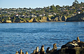
San Diego is a city on the Pacific Ocean coast in Southern California located immediately adjacent to the Mexico–United States border. With a population of over 1.3 million residents, the city is the eighth-most populous in the United States and the second-most populous in the state of California after Los Angeles. The city is the county seat of San Diego County, which had a population of nearly 3.3 million people as of 2021. San Diego is known for its mild year-round Mediterranean climate, extensive beaches and parks, its long association with the United States Navy, and its recent emergence as a healthcare and biotechnology development center.

Southern California is a geographic and cultural region that generally comprises the southern portion of the U.S. state of California. It includes the Los Angeles metropolitan area as well as the Inland Empire. The region generally contains ten of California's 58 counties: Imperial, Kern, Los Angeles, Orange, Riverside, San Bernardino, San Diego, Santa Barbara, San Luis Obispo, and Ventura counties.
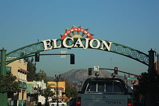
El Cajon is a city in San Diego County, California, United States, 17 mi (27 km) east of downtown San Diego. The city takes its name from Rancho El Cajón, which was named for the box-like shape of the valley that surrounds the city, and the origin of the city's common nickname "the Box".
The Chino Hills are a mountain range on the border of Orange, Los Angeles, and San Bernardino counties, California, with a small portion in Riverside County. The Chino Hills State Park preserves open space and habitat in them.
The Laguna Mountains are a mountain range of the Peninsular Ranges System in eastern San Diego County, southern California. The mountains run in a northwest/southeast alignment for approximately 35 miles (56 km).

Palomar Mountain is a mountain ridge in the Peninsular Ranges in northern San Diego County. It is famous as the location of the Palomar Observatory and Hale Telescope, and known for the Palomar Mountain State Park.

Charles Kimball Fletcher was an American World War II veteran, banker and one-term Republican politician from San Diego, California, serving in the U.S. House from 1947 to 1949.
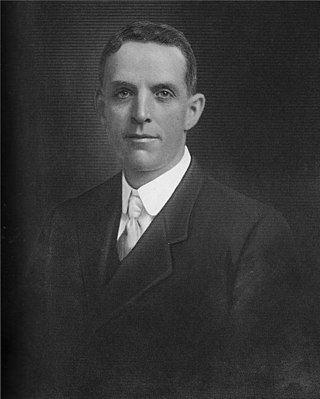
"Colonel" Ed Fletcher was a real estate developer and U.S. Republican and Democratic politician from San Diego, California.

Nathan Blaine Fletcher is an American politician who most recently served on the San Diego County Board of Supervisors for the 4th District since 2019, serving as chair from 2021 to 2023. On March 26, 2023, he announced he would seek treatment for post-traumatic stress disorder and alcoholism. On March 29, 2023, news broke of a lawsuit by an employee of the San Diego Metropolitan Transit System alleging that Fletcher had sexually assaulted her and that she was then fired after resisting his advances, and that evening, he announced his resignation from the board of supervisors, effective at the end of his medical leave.
The Buena Vista Hills are a low mountain range in the Peninsular Ranges System, in western San Diego County, California.

The Coyote Mountains are a small mountain range in San Diego and Imperial Counties in southern California. The Coyotes form a narrow ESE trending 2 mi (3.2 km) wide range with a length of about 12 mi (19 km). The southeast end turns and forms a 2 mi (3.2 km) north trending "hook". The highest point is Carrizo Mountain on the northeast end with an elevation of 2,408 feet (734 m). Mine Peak at the northwest end of the range has an elevation of 1,850 ft (560 m). Coyote Wash along I-8 along the southeast margin of the range is 100 to 300 feet in elevation. Plaster City lies in the Yuha Desert about 5.5 mi (8.9 km) east of the east end of the range.
The San Felipe Hills are a low mountain range in eastern San Diego County, southern California.
The Volcan Mountains are a mountain range of the Peninsular Ranges System, located in the East County region of San Diego County, California.

The following outline is provided as an overview of and topical guide to the U.S. state of California:

San Diego County, officially the County of San Diego, is a county in the southwestern corner of the U.S. state of California. As of the 2020 census, the population was 3,298,634, making it California's second-most populous county and the fifth-most populous in the United States. Its county seat is San Diego, the second-most populous city in California and the eighth-most populous city in the United States. It is the southwesternmost county in the 48 contiguous United States, and is a border county. It is also home to 18 Native American tribal reservations, the most of any county in the United States.
Pine Hills is an unincorporated community in San Diego County, California, about a mile south and slightly west of Julian. It is located along and at the southern end of Pine Hills Road, about two miles south of state Highway 78. The residents of Pine Hills have an address in Julian in the 92036 zip code.

The Dixie Overland Highway was an auto trail across the southern United States. It was conceived in July 1914 by the Automobile Club of Savannah, which envisioned a practical all-year driving route from Georgia to California. It was originally developed as a cross-country route, from the Pacific Ocean to the Atlantic Ocean making history as the first ever ocean to ocean highway route. In 1925, the federal Joint Board on Interstate Highways created U.S. Route 80, largely following the route of the Dixie Overland Highway.

