The term landslide or, less frequently, landslip, refers to several forms of mass wasting that may include a wide range of ground movements, such as rockfalls, deep-seated slope failures, mudflows, and debris flows. Landslides occur in a variety of environments, characterized by either steep or gentle slope gradients, from mountain ranges to coastal cliffs or even underwater, in which case they are called submarine landslides. Gravity is the primary driving force for a landslide to occur, but there are other factors affecting slope stability that produce specific conditions that make a slope prone to failure. In many cases, the landslide is triggered by a specific event, although this is not always identifiable.

Till or glacial till is unsorted glacial sediment.

A weir or low head dam is a barrier across the width of a river that alters the flow characteristics of water and usually results in a change in the height of the river level. They are also used to control the flow of water for outlets of lakes, ponds, and reservoirs. There are many weir designs, but commonly water flows freely over the top of the weir crest before cascading down to a lower level.

Soil liquefaction occurs when a saturated or partially saturated soil substantially loses strength and stiffness in response to an applied stress such as shaking during an earthquake or other sudden change in stress condition, in which material that is ordinarily a solid behaves like a liquid. In soil mechanics, the term "liquefied" was first used by Allen Hazen in reference to the 1918 failure of the Calaveras Dam in California. He described the mechanism of flow liquefaction of the embankment dam as:
If the pressure of the water in the pores is great enough to carry all the load, it will have the effect of holding the particles apart and of producing a condition that is practically equivalent to that of quicksand… the initial movement of some part of the material might result in accumulating pressure, first on one point, and then on another, successively, as the early points of concentration were liquefied.

Scree is a collection of broken rock fragments at the base of crags, mountain cliffs, volcanoes or valley shoulders that has accumulated through periodic rockfall from adjacent cliff faces. Landforms associated with these materials are often called talus deposits or stony accumulations. Talus deposits typically have a concave upwards form, where the maximum inclination corresponds to the angle of repose of the mean debris particle size. Scree is a subcategory of the broader debris class of colluvium: any collection of loose, unconsolidated sediments at the base of hillslopes. The exact definition of scree in the primary literature is somewhat relaxed, and it often overlaps with both talus and colluvium. Colluvium refers to sediments produced by nearly any means and transported downslope by gravity; scree refers to larger blocks and fragments of rock transported downslope.

Engineering geology is the application of geology to engineering study for the purpose of assuring that the geological factors regarding the location, design, construction, operation and maintenance of engineering works are recognized and accounted for. Engineering geologists provide geological and geotechnical recommendations, analysis, and design associated with human development and various types of structures. The realm of the engineering geologist is essentially in the area of earth-structure interactions, or investigation of how the earth or earth processes impact human made structures and human activities.

Suberin, cutin and lignins are complex, higher plant epidermis and periderm cell-wall macromolecules, forming a protective barrier. Suberin, a complex polyester biopolymer, is lipophilic, and composed of long chain fatty acids called suberin acids, and glycerol. Suberins and lignins are considered covalently linked to lipids and carbohydrates, respectively, and lignin is covalently linked to suberin, and to a lesser extent, to cutin. Suberin is a major constituent of cork, and is named after the cork oak, Quercus suber. Its main function is as a barrier to movement of water and solutes.
A rockfall or rock-fall is a quantity of rock that has fallen freely from a cliff face. The term is also used for collapse of rock from roof or walls of mine or quarry workings. "A rockfall is a fragment of rock detached by sliding, toppling, or falling, that falls along a vertical or sub-vertical cliff, proceeds down slope by bouncing and flying along ballistic trajectories or by rolling on talus or debris slopes."

A safety barrier is a component which prevents passage into a dangerous area, commonly used to mitigate risk. Safety barriers may be hard barriers physically restricting passage or soft barriers that control circuits based on the presence of foreign bodies.
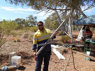
Exploration geophysics is an applied branch of geophysics and economic geology, which uses physical methods, such as seismic, gravitational, magnetic, electrical and electromagnetic at the surface of the Earth to measure the physical properties of the subsurface, along with the anomalies in those properties. It is most often used to detect or infer the presence and position of economically useful geological deposits, such as ore minerals; fossil fuels and other hydrocarbons; geothermal reservoirs; and groundwater reservoirs.

A gabion is a cage, cylinder or box filled with rocks, concrete, or sometimes sand and soil for use in civil engineering, road building, military applications and landscaping.

Debris flows are geological phenomena in which water-laden masses of soil and fragmented rock rush down mountainsides, funnel into stream channels, entrain objects in their paths, and form thick, muddy deposits on valley floors. They generally have bulk densities comparable to those of rock avalanches and other types of landslides, but owing to widespread sediment liquefaction caused by high pore-fluid pressures, they can flow almost as fluidly as water. Debris flows descending steep channels commonly attain speeds that surpass 10 m/s (36 km/h), although some large flows can reach speeds that are much greater. Debris flows with volumes ranging up to about 100,000 cubic meters occur frequently in mountainous regions worldwide. The largest prehistoric flows have had volumes exceeding 1 billion cubic meters. As a result of their high sediment concentrations and mobility, debris flows can be very destructive.

The Vargas tragedy was a natural disaster that occurred in Vargas State, Venezuela on 14–16 December 1999, when torrential rains caused flash floods and debris flows that killed tens of thousands of people, destroyed thousands of homes, and led to the complete collapse of the state's infrastructure. According to relief workers, the neighborhood of Los Corales was buried under 3 metres (9.8 ft) of mud and a high percentage of homes were simply swept into the ocean. Entire towns including Cerro Grande and Carmen de Uria completely disappeared. As much as 10% of the population of Vargas died during the event.

Avalanche control or avalanche defense activities reduce the hazard avalanches pose to human life, activity, and property. Avalanche control begins with a risk assessment conducted by surveying for potential avalanche terrain by identifying geographic features such as vegetation patterns, drainages, and seasonal snow distribution that are indicative of avalanches. From the identified avalanche risks, the hazard is assessed by identifying threatened human geographic features such as roads, ski-hills, and buildings. Avalanche control programs address the avalanche hazard by formulating prevention and mitigation plans, which are then executed during the winter season. The prevention and mitigation plans combine extensive snow pack observation with three major groups of interventions: active, passive and social - sometimes more narrowly defined as "explosive", "structural", and "awareness" according to the most prevalent technique used in each. Avalanche control techniques either directly intervene in the evolution of the snow pack, or lessen the effect of an avalanche once it has occurred. For the event of human involvement, avalanche control organizations develop and train exhaustive response and recovery plans.

A check dam is a small, sometimes temporary, dam constructed across a swale, drainage ditch, or waterway to counteract erosion by reducing water flow velocity. Check dams themselves are not a type of new technology; rather, they are an ancient technique dating from the second century A.D. Check dams are typically, though not always, implemented in a system of several dams situated at regular intervals across the area of interest.
Slope stability analysis is a static or dynamic, analytical or empirical method to evaluate the stability of earth and rock-fill dams, embankments, excavated slopes, and natural slopes in soil and rock. Slope stability refers to the condition of inclined soil or rock slopes to withstand or undergo movement. The stability condition of slopes is a subject of study and research in soil mechanics, geotechnical engineering and engineering geology. Analyses are generally aimed at understanding the causes of an occurred slope failure, or the factors that can potentially trigger a slope movement, resulting in a landslide, as well as at preventing the initiation of such movement, slowing it down or arresting it through mitigation countermeasures.

The Mount Cayley massif is a group of mountains in the Pacific Ranges of southwestern British Columbia, Canada. Located 45 km (28 mi) north of Squamish and 24 km (15 mi) west of Whistler, the massif resides on the edge of the Powder Mountain Icefield. It consists of an eroded but potentially active stratovolcano that towers over the Cheakamus and Squamish river valleys. All major summits have elevations greater than 2,000 m (6,600 ft), Mount Cayley being the highest at 2,385 m (7,825 ft). The surrounding area has been inhabited by indigenous peoples for more than 7,000 years while geothermal exploration has taken place there for the last four decades.

Adawro is a torrent of the Nile basin. Rising on the Ts’ats’en plateau of Dogu’a Tembien in northern Ethiopia, it flows northward to empty finally in Giba and Tekezé River.
A rockfall protection embankment is an earthwork built in elevation with respect to the ground to intercept falling rock fragments before roads, buildings are reached.
A rockfall barrier is a nearly-vertical structure built to intercept rockfall, mainly made from metallic components and consisting of an interception structure hanged on post-supported cables.


