Related Research Articles
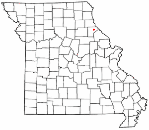
Saverton is an unincorporated community in eastern Ralls County, Missouri, United States. It is located on the Mississippi River, approximately ten miles southeast of Hannibal. Saverton is part of the Hannibal Micropolitan Statistical Area.
Spencer Creek is a stream in Ralls and Pike counties of the U.S. state of Missouri. It is a tributary of the Salt River. The stream headwaters arise in the western edge of Pike County adjacent to the south side of Missouri Route 154 about 7 miles (11 km) west of Curryville. The stream flows generally west passing about 2 miles (3.2 km) north of Vandalia then turns northwest crossing under Route 154 east of Liberty Hall. The stream turns north then northeast and passes the village of Madisonville and continues roughly parallel to the boundary between Ralls and Pike counties. It enters briefly into Pike County just prior to passing under U.S. Route 61. It enters the Salt River about 4 miles (6.4 km) southeast of New London.
Big Creek is a stream in northern Ralls County in the U.S. state of Missouri. It is a tributary of the Salt River.
Cincinnati is an unincorporated community in Ralls County, in the U.S. state of Missouri.
Dry Fork is a stream in Ralls County in the U.S. state of Missouri. It is a tributary of Mark Twain Lake on the Salt River.
Greenlawn is an unincorporated community in Ralls County, in the U.S. state of Missouri.
Hassard is an unincorporated community in Ralls County, in the U.S. state of Missouri.
Hatch is an unincorporated community in Ralls County, in the U.S. state of Missouri.
Hippo Branch is a stream in Ralls County in the U.S. state of Missouri. It is a tributary of Spencer Creek. The stream headwaters arise just southeast of Missouri Route 19 and it flows east-southeast to its confluence with Spencer Creek one mile east of Madisonville.
Huntington is an unincorporated community in Ralls County, in the U.S. state of Missouri.
Hutchison is an unincorporated community in Ralls County, in the U.S. state of Missouri.
Hydesburg is an extinct town in Ralls County, in the U.S. state of Missouri.
Joanna is an extinct town in Ralls County, in the U.S. state of Missouri. The GNIS classifies it as a populated place.
Madisonville is an unincorporated community in Ralls County, in the U.S. state of Missouri. The community lies approximately four miles southeast of Center and on the banks of Spencer Creek.
Noonan is an extinct town in Ralls County, in the U.S. state of Missouri.
Salt River is an unincorporated community in Ralls County, in the U.S. state of Missouri.
Spalding is an unincorporated community in Ralls County, in the U.S. state of Missouri.
West Hartford is an unincorporated community in Ralls County, in the U.S. state of Missouri.
Center Township is an inactive township in Ralls County, in the U.S. state of Missouri.
Saverton Township is an inactive township in Ralls County, in the U.S. state of Missouri.
References
- ↑ U.S. Geological Survey Geographic Names Information System: Flint Hill, Ralls County, Missouri
- ↑ Quincy, IL-MO, 1:100,000 scale Topographic Map, USGS, 1986
- ↑ U.S. Geological Survey Geographic Names Information System: Flint Hill Church (historical)
- ↑ U.S. Geological Survey Geographic Names Information System: Flint Hill School (historical)
- ↑ "Ralls County Place Names, 1928–1945". The State Historical Society of Missouri. Archived from the original on June 24, 2016. Retrieved December 11, 2016.
Municipalities and communities of Ralls County, Missouri, United States | ||
|---|---|---|
| Cities |  | |
| Village | ||
| Townships | ||
| Unincorporated communities | ||
| Ghost towns | ||
| Footnotes | ‡This populated place also has portions in an adjacent county or counties | |
Coordinates: 39°37′26″N91°23′00″W / 39.62389°N 91.38333°W
| This Ralls County, Missouri state location article is a stub. You can help Wikipedia by expanding it. |