Florida State Road 73

Last updated

Florida 73.svg

State Road 73

Florida State Road 73
SR 73 highlighted in red
Route information
Maintained by FDOT
Length49.833 mi [1]  (80.198 km)
Major junctions
South endFlorida 71.svg SR 71 at Chipola Park
Major intersectionsFlorida 20.svg SR 20 in Clarksville
US 90.svg US 90 in Marianna
North endUS 231.svg US 231 near Cottondale
Location
Country United States
State Florida
Counties Calhoun, Jackson
Highway system
Florida 72.svg SR 72 I-75.svg I-75

State Road 73 (SR 73), the Wayne Mixson State Highway, is a state highway in northwest Florida that runs through Calhoun and Jackson Counties, although it runs through more of the former county than the latter one. The road is always on the west side of the Chipola River, and is almost entirely two-lanes wide, except with its concurrency with US 90 in Marianna where it is four-lanes wide. It was named in honor of former Florida governor Wayne Mixson.

Contents

Route description

Calhoun County

Looking south at Florida State Road 73 in Clarksville at SR 20 Florida State Road 73 looking south Clarksville FL.jpg
Looking south at Florida State Road 73 in Clarksville at SR 20

State Road 73 begins at State Road 71 in Chipola Park, near Kinard. It runs west from SR 71 almost without any acknowledgement, then shortly turns northwest before the intersection with County Road 73A. In Kinard itself, the road takes a sharp turn more toward the north, and crosses a bridge over Cypress Creek before approaching a blinker-light intersection with CR 392. North of there it encounters the eastern terminus of CR 392B, and tales a slight curve to the northeast. The road turns back toward the north as it winds through barren communities such as Frink where it crosses a bridge over Juniper Creek, and then Fisher Corner, only to curve back to the northeast again.

As the road gets closer to Clarksville, it curves straight north at the intersection of Dermont Road, and then seems to terminate, but in fact turns right in a short concurrency with State Road 20 which also contains a blinker-lights at both ends, the second of which is also the north end of Dermont Road. North of that concurrency, it resumes the previous northeast trajectory to turn straight north again, and then to the northwest as it passes by the west side of Clarksville Executive Airport, and then intersects Calhound CR 287A, and then turns straight north again at the intersection of Duck Pond Road. After the bridge over Tenmile Creek, the road enters Chason where it curves to the northeast as it passes by another private airport called "Cattle Creek Ranch Airport," and then intersects CR 274 at another blinker-light. North of there, the road only intersects local streets except for CR 73B in Willis. SR 73 begins to run much closer to the Chipola River as it approaches the Calhoun-Jackson County Line.

Jackson County

Before the road tries to move away from the river it intersects the eastern segment of CR 278 (Jewell Lane). State Road 73 curves to the northwest. It turns straight north again before approaching the western segment of CR 278 (Laramore Road), and then curves to the northeast to go over a bridge over both Dry Creek and Long Branch Creek. From this point it acquires the name Clarksville Highway and after passing the Lighthouse Community Churchmore turns straight north again at the intersection of Tupelo Court. The road passes by more local streets of equally minimal importance until it intersects CR 280, which is Thompson Road to the west and Magnolia Road to the east.

Despite the fact that it's a state road, SR 73 has no access to Interstate 10, which it crosses over with a two-lane bridge. After this the road becomes the terminus of CR 280A (Fillmore Drive), which is a suffixed alternate of CR 280 that was cut off by I-10 and instead terminates at Pelt Cemetery. Further north, it enters the City of Marianna where the road's name changes to Jefferson Street. Within the city, SR 73 makes a slight reverse curve to the right and then the left before it serves as what would appear to be the eastern terminus of CR 167 (South Street), and then crosses the CSX P&A Subdivision. In reality, CR 167 secretly joins SR 73 in a concurrency. At the equivalent of two blocks later, SR 73 becomes a two-lane divided highway just south of the intersection with Jackson Street where it enters the Marianna Historic District. A block later at U.S. Route 90(SR 10), SR 73 turns west as a concurrency begins along West Lafayette Street, but US 90 also has another concurrency with CR 164 which spans beyond the city limits along East Lafayette Street towards the west end of a concurrency with SR 71. Jefferson Street continues north as State Road 166 taking the concurrency with CR 167 with it as it runs towards Chipola College, Florida Caverns State Park, and Marianna Municipal Airport.

US 90/SR/73/CR 164 serves as the southern border of the Marianna Historic District until the road intersects Wynn Street. But historic sites can still be found beyond this point, among them a bed & breakfast next door to the 1840-built Ely-Criglar House, and later curves around the 1910-built Joseph W. Russ Jr. House which is also the county visitor's center. Later it becomes the eastern terminus of former CR 10A (Old Cottondale Road), and old section of US 90. The last major intersection along this concurrency is the eastern terminus of State Road 276 (Pennsylvania Avenue), which continues north as Burpnose Road. The US 90/SR 73 concurrency ends at the southeast leg of a wye intersection with US 90 which turns to the southwest beneath a bridge under the CSX P&A Subdivision. SR 73 branches off to the northwest. The concurrency with CR 164 is unmarked but it ends at a dirt road named Lancer Road, which then leads to another dirt road named Lovewood Road. In the meantime, SR 73 continues to the northwest. which it maintains until it makes a slight northerly curve around swampland at the headwaters of Baker Creek. The only site of any significance after this is the shared intersection of Longwood Road and Union Road, and then a former segment of SR 73 branching off slightly to the right. State Road 73 finally ends at a blinker-light intersection with U.S. Route 231(SR 75) northeast of Cottondale, but not before intersecting the right-of-way to an abandoned segment of that road.

Major intersections

CountyLocationmi [1] kmDestinationsNotes
Calhoun Chipola Park 0.0000.000Florida 71.svg SR 71  Blountstown, Port St. Joe
Kinard 4.3006.920CR 392 jct.svg CR 392
4.5657.347West plate county.svg
CR 392B jct.svg
CR 392B west
Clarksville 15.59925.104West plate.svg
Florida 20.svg
SR 20 west Ebro
South end of SR 20 overlap
15.79525.420East plate.svg
Florida 20.svg
SR 20 east Blountstown
North end of SR 20 overlap
18.11629.155South plate county.svg
CR 287 jct.svg
CR 287 south
Chason 23.01337.036CR 274 jct.svg CR 274
Willis 24.24439.017West plate county.svg
CR 73B jct.svg
CR 73B west
Jackson 29.25447.080East plate county.svg
CR 278 jct.svg
CR 278 east (Peacock Bridge Road)
34.96556.271West plate county.svg
CR 278 jct.svg
CR 278 west (Laramore Road)
37.77460.791East plate county.svg
CR 280 jct.svg
CR 280 east (Magnolia Road) / Thompson Road
39.32263.283East plate county.svg
CR 280A jct.svg
CR 280A east (Fillmore Drive)
Marianna 40.82165.695South plate county.svg
CR 167 jct.svg
CR 167 south (South Street)
41.18166.274East plate.svg
US 90.svg
North plate.svg
Florida 166.svg
US 90 east (Lafayette Street / SR 10) / SR 166 north (Jefferson Street) Grand Ridge, Florida Caverns State Park, Chipola College
South end of US 90 / SR 10 overlap
42.77368.836West plate.svg
Florida 276.svg
To plate blue.svg
I-10.svg
SR 276 west (Penn Avenue) to I-10
Eastern terminus of SR 276
43.19269.511West plate.svg
US 90.svg
US 90 west (SR 10) Cottondale
North end of US 90 / SR 10 overlap
49.83380.198US 231.svg US 231 (SR 75) Cottondale, Campbellton
1.000 mi = 1.609 km; 1.000 km = 0.621 mi

State Road 73 has four suffixed alternate routes, all of which are county roads in Calhoun County.

County Road 73A

Calhoun County 73A.svg

County Road 73A

Location Chipola Park (South)
Chason (North)

North of the southern terminus of SR 73 is an east-west county road named Jesse Yon Road known as County Road 73A. It begins at SR 73 across a dirt road near power substation where it crosses SR 71 and continues to the east ending at the west bank of the Dead Lakes of the Chipola River.

The second CR 73A is located in Chason, and has no connection to its parent route. It also has non-standard county route shields, using a white square with black lettering rather than the MUTCD-standard blue pentagon with yellow lettering. It begins at CR 274 and runs relatively straight north and south terminating at Northwest White Pond Circle and CR 73B, where it becomes Bates Road.

County Road 73B

Calhoun County 73B.svg

County Road 73B

Location Chipola Park(South)
Willis (North)

County Road 73B is another one of two suffixed alternates of SR 73, the first of which is also located in Chipola Park. It begins at Jesse Yon Road(Southern CR 73A) east of SR 71 and though there are no shield, the road is specifically named "State Highway 73B" despite having lost its state designation. The road ends on the south bank of Cypress Creek in the Dead Lakes area.

The second CR 73B is located in and near Willis. It begins at the northern terminus of northern CR 73A as a continuation from Northwest White Pond Circle and runs east and west with one slight curve after Duck Pond then runs in a straight line only to turn to the southeast as it terminates at SR 73. Unlike the CR 73B in Chipola Park, it actually has a connection to State Road 73.

Related Research Articles

<span class="mw-page-title-main">U.S. Route 331</span> Highway in the United States

U.S. Route 331 is a spur of U.S. Route 31. It currently runs for 150 miles (240 km) from Santa Rosa Beach, Florida east of Fort Walton Beach at US 98 to Montgomery, Alabama at US 80 and US 82. Unlike US 131, US 231, and US 431, US 331 never intersects with its "parent" route, US 31; however, the two routes do come within 4 miles (6.4 km) of each other in Montgomery.

<span class="mw-page-title-main">U.S. Route 29 in Alabama</span> Segment of American highway

U.S. Route 29 (US 29), internally designated by the Alabama Department of Transportation (ALDOT) as State Route 15 (SR 15), is a southwest–northeast state highway across the southeastern part of the U.S. state of Alabama. US 29 and SR 15 traverse Alabama in a general northeast–southwest slope. It has never been a major route in the state; its significance was completely overshadowed with the completion of Interstate 65 (I-65) and I-85 during the 1970s. Today, US 29 and SR 15 serve primarily to connect numerous smaller towns and cities in the southwest, south-central, and eastern parts of Alabama.

<span class="mw-page-title-main">Florida State Road 77</span> State highway in Florida, United States

State Road 77 is a major north–south artery in Florida's Panhandle, connecting Panama City to the south with Alabama State Route 109 and Dothan, Alabama to the north.

<span class="mw-page-title-main">Florida State Road 19</span> Highway in Florida

State Road 19 is a Florida State Road in Putnam, Marion, and Lake counties. It runs from Groveland to Palatka through Ocala National Forest. Along with SR 33, SR 19 provides a mostly rural north-south corridor through central Florida from Lakeland to Palatka.

<span class="mw-page-title-main">U.S. Route 29 in Florida</span> Highway in Florida

U.S. Highway 29 (US 29) in the state of Florida is the westernmost north–south United States Numbered Highway in the state. It runs 43.6 miles (70.2 km) from downtown Pensacola north to the Alabama state line entirely within Escambia County. US 29 runs as a four-lane highway through much of the Florida Panhandle, becoming six lanes through and near several towns. The highway's hidden state road designation is entirely State Road 95 (SR 95).

<span class="mw-page-title-main">U.S. Route 90 in Florida</span> United States historic place

U.S. Route 90 (US 90) in the state of Florida is the northernmost east–west United States Numbered Highway in the state. US 90 passes through the county seats of all 15 counties on its course in Florida, and it is also the road upon which many of the county courthouses are located. It is never more than six miles (9.7 km) from Interstate 10 (I-10) throughout the state. It runs as a two-lane highway through most of the sparsely populated inland areas of the Florida Panhandle, widening to four lanes through and near several towns. The speed limit is 55 mph (89 km/h) for all rural points west of Monticello, and it is 60 mph (97 km/h) on all rural points from where it enters Madison County as far as Glen St. Mary.

<span class="mw-page-title-main">U.S. Route 231 in Florida</span> Highway in Florida

U.S. Route 231 (US 231) in Florida is a north–south United States Highway. It runs 52 miles (84 km) from Panama City north to the Alabama State Line in Bay and Jackson Counties. The entire route is also unsigned State Road 75, and is a four-lane highway throughout the state whether the road is divided or not.

<span class="mw-page-title-main">U.S. Route 441 in Florida</span> Highway in Florida

U.S. Route 441 (US 441) in Florida is a north–south United States Highway. It runs 433 miles (697 km) from Miami in South Florida northwest to the Georgia state line, with the overall route continuing to Tennessee in the Rocky Top area.

<span class="mw-page-title-main">U.S. Route 221 in Georgia</span> Segment of American highway

U.S. Route 221 (US 221) in the U.S. state of Georgia is a south–north U.S. Highway. It travels from the Florida border near the Quitman area to the South Carolina state line, north of Pollards Corner. The highway connects North Central Florida with Upstate South Carolina.

<span class="mw-page-title-main">Florida State Road 83</span> State highway in Florida, United States

State Road 83 is the state designation for U.S. Route 331 between US 98(SR 30) in Santa Rosa Beach and US 90(SR 10) in DeFuniak Springs. It also includes an independent route from DeFuniak Springs to the Florida-Alabama State Line. The entire route is in Walton County.

<span class="mw-page-title-main">Florida State Road 69</span> State highway in Florida, United States

State Road 69 is a road running through Calhoun and Jackson counties in northwest Florida. The road is almost entirely two-lanes wide.

<span class="mw-page-title-main">U.S. Route 129 in Georgia</span> Segment of American highway

U.S. Route 129 (US 129) is a 375-mile-long (604 km) U.S. Highway in the U.S. state of Georgia. It travels south-to-north from the Florida state line, south of Statenville, to the North Carolina state line, northwest of Blairsville.

<span class="mw-page-title-main">U.S. Route 441 in Georgia</span> Segment of American highway

U.S. Route 441 (US 441) in the U.S. state of Georgia is a 354.2-mile-long (570.0 km) north–south United States Highway through the east-central portion of the state. It travels from the Florida state line near the Fargo city area to the North Carolina state line, in the northern part of Dillard. It is a spur route of US 41, although it has no intersections with its "parent" route within the state. It does have an intersection with another spur route of US 41 however, specifically US 341 in McRae–Helena.

<span class="mw-page-title-main">Florida State Road 49</span> Highway in Florida

State Road 49 is the state designation for US 19/98/27 Alternate(SR 55) in Chiefland, and US 27(SR 20) in Hildreth east of Branford, Florida. It also includes a county extension in Suwannee County, Florida from Hildreth to the outskirts of Live Oak, Florida.

<span class="mw-page-title-main">Florida State Road 71</span> State highway in Florida, United States

State Road 71 is a highway in western Florida that runs 95.4 miles (153.5 km) from the Gulf Coast and the Gulf of Mexico, through the panhandle of Florida to the Alabama border.

<span class="mw-page-title-main">Florida State Road 81</span> State highway in Florida, United States

State Road 81 is a state highway linking State Road 20 at Bruce with Alabama State Route 87.

<span class="mw-page-title-main">Florida State Road 166</span> State highway in Florida, United States

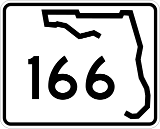
State Road 166 is a 5.054 miles (8.134 km) long state road in Jackson County, Florida, running from US 90/SR 73 in Marianna, Florida to SR 71. The road is almost entirely two lanes wide, except in portions where third center left turn lanes appear.

<span class="mw-page-title-main">Florida State Road 273</span> State highway in Florida, United States

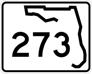
State Road 273 is a north–south highway in the panhandle in the U.S. state of Florida that extends from State Road 77 in Chipley to U.S. Route 231 in Campbellton. SR 273 runs through both Washington and Jackson counties, and most, if not all of the road is a two-lane undivided highway. Between its termini, SR 273 intersects with no state roads other than former ones. A former section of the road south of Chipley is now County Road 273.

<span class="mw-page-title-main">Florida State Road 276</span> State highway in Florida, United States

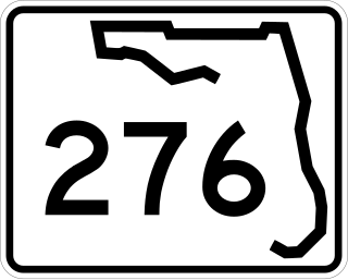
State Road 276 is a state road in the panhandle of Florida. It runs west to east from former State Road 167 into U.S. Route 90 in and around Marianna entirely within Jackson County, although a bi-county extension exists between State Road 277 southwest of Chipley in Washington County that runs south then east into CR 167 which is signed as County Road 276 (CR 276). Most of the road is a two-lane undivided highway, with exceptions in the vicinity of Interstate 10, and if you count the bi-county portion, the overlapped segment with U.S. 231 where it changes from a four-lane undivided highway to a four-lane divided highway between Alford and Steele City.

<span class="mw-page-title-main">Florida State Road 277</span> State highway in Florida, United States

State Road 277 is a north-south state and county highway in the panhandle in the U.S. state of Florida that extends from State Road 79 in Vernon to U.S. Route 90 in Hulaw west of Chipley. SR 277 runs entirely through Washington County, although one of the two county extensions runs through both Washington and Jackson Counties, Most, if not all of the road is a two-lane undivided highway. Between its termini, SR 277 intersects with no state roads other than former ones, and shares a concurrency with at least one of those county roads. A sizeable portion of the road runs in close proximity to the east side of Holmes Creek.

References

  1. 1 2 FDOT straight line diagrams Archived March 6, 2014, at the Wayback Machine , accessed February 2014
Template:Attached KML/Florida State Road 73
KML is from Wikidata