Campbellton, Florida

Last updated

Campbellton, Florida
Jackson County Florida Incorporated and Unincorporated areas Campbellton Highlighted.svg
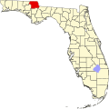
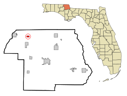
Location in Jackson County and the state of Florida
Coordinates: 30°56′55″N85°23′47″W / 30.94861°N 85.39639°W / 30.94861; -85.39639
Country Flag of the United States.svg  United States
State Flag of Florida.svg  Florida
County   Jackson
Settled 1840 [1]
Incorporated 1925 [2]
Government
  Type Mayor-Council
   Mayor [1] Douglas Cotton
   Councilmembers Kenneth Fey,
Danny Taylor,
Conswellor White, and
Pamela Williams
   Town Clerk Helen Rhynes
   Town Attorney John McDaniel
Area
[3]
  Total2.68 sq mi (6.93 km2)
  Land2.60 sq mi (6.72 km2)
  Water0.08 sq mi (0.21 km2)
Elevation
184 ft (56 m)
Population
 (2020)
  Total191
  Density73.60/sq mi (28.42/km2)
Time zone UTC-6 (Central (CST))
  Summer (DST) UTC-5 (CDT)
ZIP code
32426
Area code 850
FIPS code 12-09900 [4]
GNIS feature ID0279954 [5]

Campbellton is a town in Jackson County, Florida, United States. The town is part of the Florida Panhandle in North Florida, and has a predominately African American majority. The population was 191 at the 2020 census.

Contents

History

Campbellton was established as a community around 1840 or possibly earlier, and may have been named for Judge R.L. Campbell (who resided in Jackson County), or derived from two families who camped in the area. [1]

It was the site of a small skirmish on September 26, 1864, during the waning days of the Civil War. Local Confederate cavalry under the command of Captain Alexander Goodwin unsuccessfully contested the advance of a Federal column led by Brigadier General Alexander Asboth during the preliminary phase of what would become the Battle of Marianna. [6]

The nearby Forks of the Creek Swamp, along the border with Alabama, was a refuge for many Unionist and Confederate deserters during the war. [7] Joseph Sanders, a former Confederate officer who had switched sides and taken a commission as a lieutenant in the Union army, hid out in the swamp for four months during the winter and spring of 1864; he emerged in March of that year to mount an unsuccessful attack on Newton, Alabama, which resulted in the loss of three of his men. [8] Repeated Southern efforts to dislodge the Unionists in the swamp proved unsuccessful. [7]

The Town of Campbellton was officially incorporated as a municipality in 1925, despite being a settlement since at least 1840. [1] [2]

Geography

Campbellton is located in northwestern Jackson County at 30°56′55″N85°23′47″W / 30.94861°N 85.39639°W / 30.94861; -85.39639 (30.948587, –85.396472). [9]

It sits on a small hill at the junction of U.S. Route 231 and Florida State Road 2. US-231 leads north 19 miles (31 km) to Dothan, Alabama, and south 63 miles (101 km) to Panama City. Marianna, the Jackson County seat, is 17 miles (27 km) to the southeast of Campbellton via US-231 and Florida State Road 73. SR 2 leads east from Campbellton 15 miles (24 km) to Malone and west 6 miles (10 km) to Graceville. SR 273 leads southwest from Campbellton 15 miles (24 km) to Chipley.

According to the United States Census Bureau, Campbellton has a total area of 2.6 square miles (6.7 km2), of which 2.5 square miles (6.5 km2) are land and 0.1 square miles (0.2 km2), or 2.48%, are water.

Climate

The climate in this area is characterized by hot, humid summers and generally mild winters. According to the Köppen climate classification, the Town of Campbellton has a humid subtropical climate zone (Cfa).

Demographics

Historical population
CensusPop.Note
1920 277
1930 31413.4%
1940 311−1.0%
1950 307−1.3%
1960 3090.7%
1970 304−1.6%
1980 33610.5%
1990 202−39.9%
2000 2125.0%
2010 2308.5%
2020 191−17.0%
U.S. Decennial Census [10]

2010 and 2020 census

Campbellton racial composition
(Hispanics excluded from racial categories)
(NH = Non-Hispanic)
RacePop 2010 [11] Pop 2020 [12] % 2010% 2020
White (NH)776933.48%36.13%
Black or African American (NH)14910664.78%55.50%
Native American or Alaska Native (NH)000.00%0.00%
Asian (NH)100.43%0.00%
Pacific Islander or Native Hawaiian (NH)000.00%0.00%
Some other race (NH)050.00%2.62%
Two or more races/Multiracial (NH)270.87%3.66%
Hispanic or Latino (any race)140.43%2.09%
Total230191

As of the 2020 United States census, there were 191 people, 95 households, and 61 families residing in the town. [13]

As of the 2010 United States census, there were 230 people, 74 households, and 48 families residing in the town. [14]

2000 census

As of the census [4] of 2000, there were 212 people, 90 households, and 65 families residing in the town. The population density was 238.3 inhabitants per square mile (92.0/km2). There were 111 housing units at an average density of 124.8 per square mile (48.2/km2). The racial makeup of the town was 39.62% White, 59.91% African American, 0.47% from other races. Hispanic or Latino of any race were 0.47% of the population.

In 2000, there were 90 households, out of which 27.8% had children under the age of 18 living with them, 48.9% were married couples living together, 22.2% had a female householder with no husband present, and 26.7% were non-families. 26.7% of all households were made up of individuals, and 15.6% had someone living alone who was 65 years of age or older. The average household size was 2.36 and the average family size was 2.83.

In 2000, in the town, the population was spread out, with 23.6% under the age of 18, 4.7% from 18 to 24, 26.4% from 25 to 44, 28.3% from 45 to 64, and 17.0% who were 65 years of age or older. The median age was 41 years. For every 100 females, there were 96.3 males. For every 100 females age 18 and over, there were 80.0 males.

In 2000, the median income for a household in the town was $22,212, and the median income for a family was $26,875. Males had a median income of $31,250 versus $19,792 for females. The per capita income for the town was $12,139. About 20.0% of families and 16.6% of the population were below the poverty line, including 16.9% of those under the age of eighteen and 17.1% of those 65 or over.

Related Research Articles

<span class="mw-page-title-main">Cottonwood, Alabama</span> Town in Alabama, United States

Cottonwood is a town in Houston County, Alabama, United States. One source said the town incorporated in 1901, although the 1910 U.S. Census stated 1903. It is part of the Dothan, Alabama Metropolitan Statistical Area. At the 2010 census the population was 1,289, up from 1,170 in 2000.

<span class="mw-page-title-main">Penney Farms, Florida</span> Town in the state of Florida, United States

Penney Farms is a town in Clay County, Florida, United States. It is part of the Jacksonville metropolitan area. The population was 821 at the 2020 census.

<span class="mw-page-title-main">Midway, Gadsden County, Florida</span> City in Florida, United States of America

Midway is a city in Gadsden County, Florida, United States. It is part of the Tallahassee, Florida Metropolitan Statistical Area. According to the 2020 census, the population was 3,537.

<span class="mw-page-title-main">Bell, Florida</span> Town in Florida, United States

Bell is a town in Gilchrist County, Florida, United States. The Town of Bell is situated in the northern part of the county, and located in North Florida. The population was 518 at the 2020 US Census, up from 456 at the 2010 US Census.

<span class="mw-page-title-main">Alford, Florida</span> Town in Florida, United States

Alford is a town in Jackson County, Florida, United States. The Town of Alford is located on the Florida Panhandle near Marianna, in North Florida. The population was 484 at the 2020 census.

<span class="mw-page-title-main">Bascom, Florida</span> Town in Florida, United States

Bascom is a town in Jackson County, Florida, United States. The town is located on the Florida Panhandle in North Florida, and is 5 miles (8 km) south of the Alabama border. The population was 121 at the 2020 census.

<span class="mw-page-title-main">Cottondale, Florida</span> City in Florida, United States

Cottondale is a city in Jackson County, Florida, United States. It is part of the Florida Panhandle and North Florida. The population was 848 at the 2020 census, down from 933 at the 2010 census.

<span class="mw-page-title-main">Graceville, Florida</span> City in Florida, United States

Graceville is a city in Jackson County, Florida, United States. It is near the Alabama state line. The population was 2,153 at the 2020 census.

<span class="mw-page-title-main">Grand Ridge, Florida</span> Town in Florida, United States

Grand Ridge is a town in Jackson County, Florida, United States. It is part of the Florida Panhandle and North Florida. The population was 882 at the 2020 census.

<span class="mw-page-title-main">Greenwood, Florida</span> Town in Florida, United States

Greenwood is a town in Jackson County, Florida, United States. It is part of the Florida Panhandle and located in North Florida, specifically Northwest Florida. The population was 539 at the 2020 census.

<span class="mw-page-title-main">Jacob City, Florida</span> City in Florida, United States

Jacob City is a city in Jackson County, Florida, United States. The city is population is predominantly African American, and located on the Florida Panhandle in North Florida. The population was 217 at the 2020 census.

<span class="mw-page-title-main">Malone, Florida</span> Town in the state of Florida, United States

Malone is a town in Jackson County, Florida, United States. The population was 1,959 at the 2020 census.

<span class="mw-page-title-main">Marianna, Florida</span> City in Florida, United States

Marianna is a city in and the county seat of Jackson County, Florida, United States, and it is home to Chipola College. The official nickname of Marianna is "The City of Southern Charm". The population was 6,245 at the 2020 census.

<span class="mw-page-title-main">Sneads, Florida</span> Town in the state of Florida, United States

Sneads is a town in Jackson County, Florida, United States. The population was 1,849 at the 2020 census.

<span class="mw-page-title-main">Montverde, Florida</span> Town in Florida, United States

Montverde is a town in Lake County, Florida, United States. The population was 1,655 at the 2020 census. It is part of the Orlando–Kissimmee–Sanford Metropolitan Statistical Area.

<span class="mw-page-title-main">Inglis, Florida</span> Town in Florida, United States

Inglis is a town in Levy County, Florida, United States. It is on U.S. Highway 19 near the Cross Florida Greenway. As of the 2020 census, the town had a population of 1,476.

<span class="mw-page-title-main">Pinewood, Florida</span> Census-designated place in Florida

Pinewood is an unincorporated community and census-designated place (CDP) in Miami-Dade County, Florida, United States. It is part of the Miami metropolitan area of South Florida. The population was 17,246 at the 2020 census.

<span class="mw-page-title-main">Redington Beach, Florida</span> Town in the state of Florida, United States

Redington Beach is a town in Pinellas County, Florida, United States. It is part of the Tampa–St. Petersburg–Clearwater Metropolitan Statistical Area, more commonly called the Tampa Bay Area. The population was 1,376 at the 2020 census.

<span class="mw-page-title-main">Lakewood Park, Florida</span> Census-designated place in Florida, United States

Lakewood Park is a Census-designated place in St. Lucie County, Florida, United States. The population was 11,323 at the 2010 census. It is part of the Port St. Lucie Metropolitan Statistical Area.

<span class="mw-page-title-main">Chipley, Florida</span> City in Florida, United States

Chipley is a city in and the county seat of Washington County, Florida, United States, located between Tallahassee and Pensacola. Its population was 3,660 in the 2020 census. The area is served by Chipley High School.

References

  1. 1 2 3 4 "MUNICIPAL DIRECTORY: Town of Campbellton". Florida League of Cities.
  2. 1 2 "FLORIDA CITIES BY INCORPORATION YEAR WITH INCORPORATION & DISSOLUTION INFO" (PDF). www.flcities.com.
  3. "2020 U.S. Gazetteer Files". United States Census Bureau. Retrieved October 31, 2021.
  4. 1 2 "U.S. Census website". United States Census Bureau . Retrieved January 31, 2008.
  5. "US Board on Geographic Names". United States Geological Survey. October 25, 2007. Retrieved January 31, 2008.
  6. The Skirmish at Campbelltown, Florida, from the Battle of Marianna Archived 2012-12-17 at the Wayback Machine website.
  7. 1 2 Jackson County's Other Civil War Battle.
  8. Battle of Newton.
  9. "US Gazetteer files: 2010, 2000, and 1990". United States Census Bureau. February 12, 2011. Retrieved April 23, 2011.
  10. "Decennial Census of Population and Housing by Decades". US Census Bureau.
  11. "P2 HISPANIC OR LATINO, AND NOT HISPANIC OR LATINO BY RACE - 2010: DEC Redistricting Data (PL 94-171) - Campbellton town, Florida". United States Census Bureau .
  12. "P2 HISPANIC OR LATINO, AND NOT HISPANIC OR LATINO BY RACE - 2020: DEC Redistricting Data (PL 94-171) - Campbellton town, Florida". United States Census Bureau .
  13. "S1101 HOUSEHOLDS AND FAMILIES - 2020: Campbellton town, Florida". United States Census Bureau .
  14. "S1101 HOUSEHOLDS AND FAMILIES - 2010: Campbellton town, Florida". United States Census Bureau .