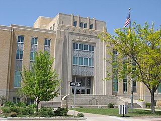
Floyd, New Mexico

Last updated

Floyd, New Mexico
Roosevelt County New Mexico Incorporated and Unincorporated areas Floyd Highlighted.svg
Location of Floyd, New Mexico
Usa edcp location map.svg
Red pog.svg
Floyd, New Mexico
Location in the United States
Coordinates: 34°12′52″N103°33′23″W / 34.21444°N 103.55639°W / 34.21444; -103.55639 [1]
Country United States
State New Mexico
County Roosevelt
Area
[2]
  Total3.08 sq mi (7.98 km2)
  Land3.08 sq mi (7.98 km2)
  Water0.00 sq mi (0.00 km2)
Elevation
[1]
4,124 ft (1,257 m)
Population
 (2020) [3]
  Total86
  Density27.92/sq mi (10.78/km2)
Time zone UTC-7 (Mountain (MST))
  Summer (DST) UTC-6 (MDT)
ZIP code
88118
Area code 505
FIPS code 35-26570
GNIS feature ID2413551 [1]

Floyd is a village in Roosevelt County, New Mexico, United States. The population was 133 at the 2010 census.

Contents

Geography

According to the United States Census Bureau, the village has a total area of 3.1 square miles (8.0 km2), all land.

Demographics

Historical population
CensusPop.Note
1960 423
1970 248−41.4%
1980 146−41.1%
1990 117−19.9%
2000 78−33.3%
2010 13370.5%
2020 86−35.3%
U.S. Decennial Census [4] [3]

As of the census [5] of 2000, there were 78 people, 30 households, and 23 families residing in the village. The population density was 25.3 people per square mile (9.8/km2). There were 33 housing units at an average density of 10.7 per square mile (4.1/km2). The racial makeup of the village was 93.59% White, 5.13% from other races, and 1.28% from two or more races. Hispanic or Latino of any race were 15.38% of the population.

There were 30 households, out of which 23.3% had children under the age of 18 living with them, 70.0% were married couples living together, 6.7% had a female householder with no husband present, and 23.3% were non-families. 13.3% of all households were made up of individuals, and 10.0% had someone living alone who was 65 years of age or older. The average household size was 2.60 and the average family size was 2.87.

In the village, the population was spread out, with 23.1% under the age of 18, 11.5% from 18 to 24, 21.8% from 25 to 44, 25.6% from 45 to 64, and 17.9% who were 65 years of age or older. The median age was 43 years. For every 100 females, there were 85.7 males. For every 100 females age 18 and over, there were 81.8 males.

The median income for a household in the village was $27,083, and the median income for a family was $36,250. Males had a median income of $46,250 versus $14,375 for females. The per capita income for the village was $13,747. There were 19.2% of families and 41.8% of the population living below the poverty line, including 61.5% of under eighteens and 19.2% of those over 64.

Climate

According to the Köppen Climate Classification system, Floyd has a semi-arid climate. [6]

Related Research Articles

<span class="mw-page-title-main">Roosevelt County, New Mexico</span> County in New Mexico, United States

Roosevelt County is a county located in the U.S. state of New Mexico. As of the 2020 census, the population was 19,191. Its county seat is Portales. The county was created in 1903 from Chaves and Guadalupe counties and named for the then-current President of the United States, Theodore Roosevelt. The county's eastern border is the Texas state line.
<span class="mw-page-title-main">Floyd, Iowa</span> City in Iowa, United States

Floyd is a city in Floyd County, Iowa, United States. The population was 313 at the time of the 2020 census.

<span class="mw-page-title-main">Centralia, Kansas</span> City in Nemaha County, Kansas

Centralia is a city in Nemaha County, Kansas, United States. As of the 2020 census, the population of the city was 485.

<span class="mw-page-title-main">Simpson, Louisiana</span> Village in Louisiana, United States

Simpson is a village in Vernon Parish, Louisiana, United States. The population was 638 at the 2010 census. It is part of the Fort Johnson South Micropolitan Statistical Area.

Danforth is a town in Washington County, Maine, United States. The town was named for proprietor Thomas Danforth. The population was 587 at the 2020 census. The town contains the villages of Danforth and Eaton. East Grand High School is located in Danforth.
<span class="mw-page-title-main">Beulah, Michigan</span> Village in Michigan, United States

Beulah is a village in the U.S. state of Michigan. It is the county seat of Benzie County, and is located within Benzonia Township. The village had a population of 313 at the 2020 census. The village sits at the southeast end of Crystal Lake, and is immediately north of the village of Benzonia.

<span class="mw-page-title-main">Pellston, Michigan</span> Village in Michigan, United States

Pellston is a village in Emmet County in the U.S. state of Michigan. The population was 822 at the 2010 census. The village is the home of Pellston Regional Airport.

<span class="mw-page-title-main">Port Austin, Michigan</span> Village in Michigan, United States

Port Austin is a village in Huron County in the U.S. state of Michigan. The population was 664 at the 2010 census. The village is within Port Austin Township.

<span class="mw-page-title-main">Millersburg, Michigan</span> Village in Michigan, United States

Millersburg is a village in Presque Isle County of the U.S. state of Michigan. The population was 206 at the 2010 census. The village is within Case Township.

<span class="mw-page-title-main">Laurie, Missouri</span> City in Missouri, US

Laurie is a city in southern Morgan and northern Camden counties, Missouri, United States. The population was 939 at the 2020 census.

<span class="mw-page-title-main">Merriman, Nebraska</span> Village in Nebraska, United States

Merriman is a village in Cherry County, Nebraska. The population was 128 at the time of the 2010 census.

<span class="mw-page-title-main">Anselmo, Nebraska</span> Village in Custer County, Nebraska, United States

Anselmo is a village in Custer County, Nebraska, United States. The population was 145 at the 2010 census.

<span class="mw-page-title-main">Springview, Nebraska</span> Village in Nebraska, United States

Springview is a village in, and the county seat of, Keya Paha County, Nebraska, United States. The population was 242 at the 2010 census.

<span class="mw-page-title-main">Table Rock, Nebraska</span> Village in Nebraska, United States

Table Rock is a village in Pawnee County, Nebraska, United States. The population was 236 at the 2020 census.
<span class="mw-page-title-main">Adamsville, Ohio</span> Village in Ohio, United States

Adamsville is a village in Muskingum County, Ohio, United States. The population was 140 at the 2020 census. It is part of the Zanesville micropolitan area.

<span class="mw-page-title-main">Sisseton, South Dakota</span> City in South Dakota, United States

Sisseton is a city in Roberts County, South Dakota, United States. The population was 2,479 at the 2020 census. It is the county seat of Roberts County. Sisseton is the home to a number of tourist attractions, including the Nicollet Tower, and is near the "Song to the Great Spirit" building on the Sisseton Wahpeton College campus. The city is named for the Sisseton division of the Native American Sioux. It also serves as an important part of the Lake Traverse Indian Reservation.

<span class="mw-page-title-main">Beech Bottom, West Virginia</span> Village in West Virginia, United States

Beech Bottom is a village in Brooke County, West Virginia, United States, situated along the Ohio River. The population was 523 at the 2010 census. It is part of the Weirton–Steubenville metropolitan area.

<span class="mw-page-title-main">Bowler, Wisconsin</span> Village in Wisconsin, United States

Bowler is a village in Shawano County, Wisconsin, United States. The population was 302 at the 2010 census.

<span class="mw-page-title-main">Hewitt, Wood County, Wisconsin</span> Village in Wisconsin, United States

Hewitt is a village in Wood County, Wisconsin, United States. The population was 828 at the 2010 census.
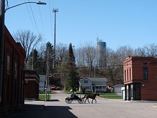
<span class="mw-page-title-main">Fairchild, Wisconsin</span> Village in Wisconsin, United States

Fairchild is a village in Eau Claire County, Wisconsin, United States. The population was 550 at the 2010 census. The village is located within the Town of Fairchild.

References

  1. 1 2 3 U.S. Geological Survey Geographic Names Information System: Floyd, New Mexico
  2. "ArcGIS REST Services Directory". United States Census Bureau. Retrieved October 12, 2022.
  3. 1 2 "Census Population API". United States Census Bureau. Retrieved October 12, 2022.
  4. "Census of Population and Housing". Census.gov. Retrieved June 4, 2015.
  5. "U.S. Census website". United States Census Bureau . Retrieved January 31, 2008.
  6. Climate Summary for Floyd, New Mexico