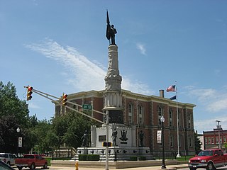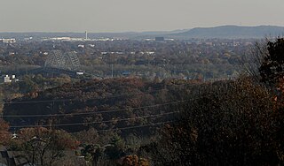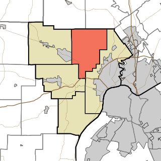
Washington County is a county in the U.S. state of Indiana. As of the 2020 United States Census, the population was 28,182. The county seat is Salem.

Randolph County is a county located in the central section of U.S. state of Indiana, on its eastern border with Ohio. As of 2020, the population was 24,502. The county seat is Winchester.

Orange County is located in southern Indiana in the United States. As of 2020, its population was 19,867. The county seat is Paoli. The county has four incorporated settlements with a total population of about 8,600, as well as several small unincorporated communities. It is divided into 10 townships which provide local services. One U.S. route and five Indiana state roads pass through or into the county.

LaPorte County is a county located in the U.S. state of Indiana. As of 2020, the population was 112,417. The county seat is the city of La Porte, and the largest city is Michigan City. This county is part of the Northwest Indiana and Michiana regions of the Chicago metropolitan area. The LaPorte County Courthouse is located in the county seat of La Porte and is listed on the National Register of Historic Places.

Harrison County is located in the far southern part of the U.S. state of Indiana along the Ohio River. The county was officially established in 1808. Its population was 39,654 as of the 2020 United States Census. Its county seat is Corydon, the former capital of Indiana.

Floyd County is a county located in the U.S. state of Indiana. Its county seat is New Albany. The population of the county was 80,484 as of the 2020 United States Census. Floyd County has the second-smallest land area in the entire state. It was formed in the year 1819 from neighboring Clark and Harrison counties. Floyd County is part of the Louisville/Jefferson County, KY–IN Metropolitan Statistical Area.

Galena is a census-designated place (CDP) in Floyd County, Indiana, United States. The population was 1,818 at the 2010 census. The CDP includes the town of Galena as well as the nearby town of Floyds Knobs and their immediate surroundings.

Georgetown is a town in Floyd County, Indiana, United States. The population was 3,805 at the 2020 census.

Greenville is an incorporated town in Floyd County, Indiana. The population was 595 at the 2010 census. Greenville is located in the greater Louisville metropolitan area.

New Albany is a city in Floyd County, Indiana, United States, situated along the Ohio River, opposite Louisville, Kentucky. The population was 37,841 as of the 2020 census. The city is the county seat of Floyd County. It is bounded by I-265 to the north and the Ohio River to the south, and is considered part of the Louisville, Kentucky Metropolitan Statistical Area. The mayor of New Albany is Jeff Gahan, a Democrat; he was re-elected in 2023.
New Albany High School is a public high school located in New Albany, Indiana, United States. Founded on October 3, 1853. New Albany High school is the oldest public high school in the state of Indiana. The school was closed from 1859 to 1864 to be made into a hospital for union soldiers during the American Civil War. The school was the first FM high school radio station (88.1) to be licensed by the Federal Communications Commission (FCC) and has had its own Public-access television cable TV channel WNAS-TV since 1980. It is a part of the New Albany-Floyd County Consolidated School Corporation.

Floyd Central High School is a public high school in the New Albany-Floyd County Consolidated School Corporation located in Floyds Knobs, an unincorporated area in Floyd County, Indiana, USA.

The geography of Indiana comprises the physical features of the land and relative location of U.S. State of Indiana. Indiana is in the north-central United States and borders on Lake Michigan. Surrounding states are Michigan to the north and northeast, Illinois to the west, Kentucky to the south, and Ohio to the east. The entire southern boundary is the Ohio River.

Center Township is one of eight townships in Vanderburgh County, Indiana, United States. As of the 2010 census, its population was 39,007 and it contained 16,306 housing units.

Lafayette Township is one of five townships in Floyd County, Indiana. As of the 2010 census, its population was 7,449 and it contained 2,856 housing units, although it remains one of the two townships in the county without an incorporated community, along with Franklin Township.
Charles Allen Prosser School of Technology (Prosser) is a vocational school in New Albany, Indiana. The school was named in honor of New Albany native Charles Allen Prosser, the "Father of Vocational Education" in the United States.

U.S. Route 150 (US 150) in Indiana is a 176.315-mile-long (283.751 km) east–west highway that travels from the Illinois state line east of Paris, Illinois to Louisville, Kentucky at the Kentucky state line. A section of US 150 from New Goshen to Vincennes travels north–south instead of east–west. US 150 travels concurrently with its parent route, US 50, from Vincennes to Shoals. Between West Terre Haute and Terre Haute, US 150 travels along part of the historic National Road. Also, from Vincennes to New Albany, the route is designated as part of Indiana's Historic Pathways, as it roughly parallels what was then part of the Buffalo Trace.
Silver Hills is an unincorporated community in Floyd County, Indiana, in the United States.
The New Albany-Floyd County Consolidated School Corporation (NAFCS) is a school district serving New Albany and Floyd County in Indiana, in the Louisville metropolitan area. The district headquarters are in New Albany.


