References
- ↑ U.S. Geological Survey Geographic Names Information System: Folly, Virginia
- ↑ Moyer, Armond; Moyer, Winifred (1958). The origins of unusual place-names. Keystone Pub. Associates. p. 51.
Municipalities and communities of Northumberland County, Virginia, United States | ||
|---|---|---|
| Town | 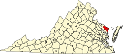 | |
| CDP | ||
| Other communities |
| |
| Footnotes | ‡This populated place also has portions in an adjacent county or counties | |
37°52′46″N76°19′40″W / 37.87944°N 76.32778°W
| | This Northumberland County, Virginia state location article is a stub. You can help Wikipedia by expanding it. |