Lake | |
|---|---|
 Lake Location in the state of Virginia  Lake Lake (the United States) | |
| Coordinates: 37°58′27″N76°28′11″W / 37.97417°N 76.46972°W | |
| Country | United States |
| State | Virginia |
| County | Northumberland |
| Time zone | UTC−5 (Eastern (EST)) |
| • Summer (DST) | UTC−4 (EDT) |
Lake is an unincorporated community in Northumberland County, Virginia, United States. Lake is on the Coan River, a tidal tributary of the Potomac River.
Municipalities and communities of Northumberland County, Virginia, United States | ||
|---|---|---|
| Town | 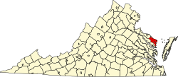 | |
| CDP | ||
| Other communities |
| |
| Footnotes | ‡This populated place also has portions in an adjacent county or counties | |
| | This Northumberland County, Virginia state location article is a stub. You can help Wikipedia by expanding it. |