Crafton is a hamlet in the civil parish of Mentmore, in Buckinghamshire, England.

Westlington is a hamlet near the village of Dinton in the civil parish of Dinton-with-Ford and Upton, Buckinghamshire, England.

Upton is a hamlet in the civil parish of Dinton-with-Ford and Upton, in Buckinghamshire, England. It is located to the north of the main village of Dinton, on the junction between the new road from Aylesbury to Thame, and the old road before it was rerouted.

The City of Colchester is a local government district with city status in Essex, England, named after its main settlement, Colchester. The district also includes the towns of West Mersea and Wivenhoe and the surrounding rural areas stretching from Dedham Vale on the Suffolk border in the north to Mersea Island in the Colne Estuary in the south.
Emmbrook is a suburb of the town of Wokingham in the county of Berkshire, England.

Waldridge is an ancient village in the civil parish of Dinton-with-Ford and Upton in Buckinghamshire, England. Although little of the village survives today, the Waldridge Manor in the nearby village of Meadle shows the approximate location of the original settlement of Waldridge Village.
Hitchin Oughton is one of the five electoral wards in Hitchin, England. It contains the Westmill estate and is named after the River Oughton. It invariably returns a Labour councillor.

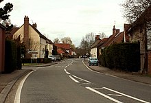
Baybridge is a small village in Hampshire, in England. It is situated to the east of Owslebury, south of Winchester.

The Prittle Brook is a 7.2 mile (11.59 km) watercourse in south Essex, England. A tributary of the River Roach, the brook rises in Thundersley and passes through Hadleigh, Leigh-on-Sea, Westcliff, Prittlewell, Rochford and discharges into the Roach and then into the North Sea via the Roach and Crouch estuaries.

Gaunt's Earthcott, sometimes spelt Gaunts Earthcott, is a hamlet in the civil parish of Almondsbury in South Gloucestershire, England. It consists of a ruined chapel, a few houses and two farms, Green Farm and Court Farm. The village is located approximately 2.5 miles (4 km) from Rudgeway and the A38 road and about the same distance from Frampton Cotterell and Winterbourne. The village is located close to the interchange between the M4 and M5 motorways. There is no real industry as such and the main economic activity in the area is farming.

Engine Common is a village in the civil parish of Iron Acton in South Gloucestershire, England. It lies about 1 mile north west of Yate.

Hinton is a village in South Gloucestershire, England. It is one mile north of Dyrham and forms part of the civil parish of Dyrham and Hinton. The Bull is the local pub.

The A105 road is an A road in London, England. It runs from Canonbury, in between Highbury and Dalston, to Enfield Town. The road is 8 miles (13 km) long. Part of the road forms Green Lanes, one of the longest streets in London, while the A105 also serves as the primary access route to the Shopping City shopping centre in Wood Green.

Kingswood is a village in the Maidstone District of Kent, England and forms part of the civil parish of Broomfield and Kingswood.

Stane Street is a 39 mi (63 km) Roman road that runs from Ermine Street at Braughing, Hertfordshire to Colchester in Essex.
Bramshott Common is part of a large expanse of heathland, near Bramshott, Hampshire, England, bordering Ludshott Common.

Brabourne Lees is a village in the civil parish of Brabourne, within the Ashford borough of Kent, England. The village (centre) is just under 5 miles (8 km) east of Ashford town centre itself geographically. By road this is a journey of about 6 miles (10 km). In 2021 it had a population of 1480.

Hunsdon is a village and civil parish in Hertfordshire, England. It is around 5.5 miles (9 km) east of Ware and 5 miles (8 km) north-west of Harlow. The population of the village taken at the 2011 Census was 1,080.
Darby Green is a village in the parish of Yateley, North East Hampshire, England. The electoral ward of Frogmore and Darby Green is separated from the rest of the parish by a small gap around Clarks Farm, until recently a composting farm in the mushroom producing industry. The ward has a boundary shared with Blackwater, which is one part of the Civil Parish of Hawley.

Hardy's Green is a hamlet in civil parish of Birch in the Colchester district, in the county of Essex, England. Nearby settlements include the city of Colchester.