
Witham is a town and civil parish in the Braintree district, in the county of Essex, England, with a population of 25,353. It is twinned with the town of Waldbröl, Germany. Witham stands between the city of Chelmsford and the city of Colchester, on the Roman road between the two. The River Brain runs through the town and joins the River Blackwater just outside.

Lexden is a suburb of Colchester and former civil parish, in the county of Essex, England. It was formerly a village, and has previously been called Lessendon, Lassendene and Læxadyne. In 2011 the ward had a population of 5,549.

Anglo-Saxon architecture was a period in the history of architecture in England from the mid-5th century until the Norman Conquest of 1066. Anglo-Saxon secular buildings in Britain were generally simple, constructed mainly using timber with thatch for roofing. No universally accepted example survives above ground. Generally preferring not to settle within the old Roman cities, the Anglo-Saxons built small towns near their centres of agriculture, at fords in rivers or sited to serve as ports. In each town, a main hall was in the centre, provided with a central hearth.

The City of Colchester is a local government district with city status in Essex, England, named after its main settlement, Colchester. The district also includes the towns of West Mersea and Wivenhoe and the surrounding rural areas stretching from Dedham Vale on the Suffolk border in the north to Mersea Island in the Colne Estuary in the south.

The Abingtons are a community in South Cambridgeshire consisting of two small villages: Little Abington and Great Abington, about 7 miles (11 km) south east of Cambridge.

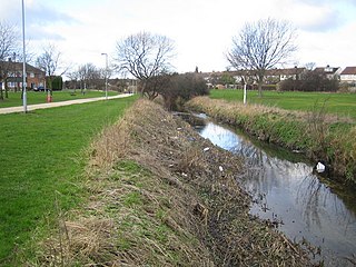
Ingatestone is a village and former civil parish in Essex, England, with a population of 5,409 inhabitants according to the 2021 census. Just north lies the village of Fryerning, the two now forming the parish of Ingatestone and Fryerning, in the Borough of Brentwood. Ingatestone lies in the Metropolitan Green Belt 20 miles north-east of London. Its built-up area straddles the A12 trunk road and the Great Eastern Main Railway Line.

West Bergholt, formerly known as Bergholt Sackville, is a large rural village and civil parish in Essex, England, lying near the border with Suffolk, close to the ancient town of Colchester. With a history going back to medieval times the village is now part of the Colchester Borough Council seat of West Bergholt and Eight Ash Green. In 2008 the village won the Class 2 category, and was placed third overall in the "Best Kept Village in Essex" competition.

Essex is a county in the East of England which originated as the ancient Kingdom of Essex and one of the seven kingdoms, or heptarchy, that went on to form the Kingdom of England.

Aldham is a village and civil parish in the City of Colchester district of Essex, England. It is located 4+1⁄2 mi (7.2 km) west of Colchester. The village is in the parliamentary constituency of Harwich and North Essex. The village has its own parish council.
Limbury is a suburb of Luton, in the Luton district, in the ceremonial county of Bedfordshire, England, and was formerly a village before Luton expanded around it. The area is roughly bounded by Bramingham Road to the north, Marsh Road to the south, Bramingham Road to the west, and Catsbrook Road, Runfold Avenue, Grosvenor Road, Bancroft Road and Blundell Road to the east.
Colchester is a historic former town [now city] located in Essex, England. It served as the first capital of the United Kingdom and is the oldest recorded town in Britain. It was raided by the Vikings during the 9th and 10th centuries. It also served as an essential location for the medieval cloth trade.

Southminster is a village and civil parish on the Dengie Peninsula in the Maldon district of Essex in the East of England. It lies about 3 miles (4.8 km) north of Burnham-on-Crouch and 10 miles (16 km) south-east of Maldon; it is approximately 52 miles (84 km) east-north-east of London. To the north is the River Blackwater, which is tidal, and, since Roman times, has been the gateway to trading in the area.

Colchester in Essex, England, has a number of notable churches.

Dedham is a village in the City of Colchester district of Essex, England. It is near the River Stour, which is the border of Essex and Suffolk. The nearest town to Dedham is the small market town of Manningtree.

Tolleshunt D'Arcy is a village situated on the Blackwater estuary in the Maldon District of Essex, England. The village is 12 miles (19 km) southwest of Colchester, 19 miles (31 km) east of Chelmsford and 30 miles (48 km) north of Southend-on-Sea.

Polstead is a village and civil parish in the Babergh district of Suffolk, England. The village lies 3 miles (4.8 km) northeast of Nayland, 5 miles (8 km) southwest of Hadleigh and 9 miles (14 km) north of Colchester. It is situated on a small tributary stream of the River Stour. In 2011 the parish had a population of 851.

Copford is a village and civil parish in the City of Colchester district of Essex, England. It is 3 kilometres (2 mi) west of Colchester, and the hamlet of Copford Green is found a short distance to the south. The poet Matthew Arnold noted he was struck by "the deeply rural character of the village and neighbourhood."

Ipswich Road, formally the A1232, is a road in Colchester, Essex, England. It was the historic coaching route and main road to Ipswich from the Middle Ages onwards, and was part of the A12, a main road in East Anglia, until the A12 was rerouted in 1974.

All Saints' Church is an Anglican parish church in the village of East Meon, Hampshire, England. It is a Grade I listed building and the oldest building in the village, lying so tight to a hill to the north of the village – part of the South Downs – that there was no room for a north aisle to be built. Most of the church dates from the Norman period, with the south chapel and south aisle being added in the 13th century.

The Colchester Arts Centre, is an arts centre in Colchester, Essex, which is located in a former Church of England parish church, the church of Saint Mary-at-the-Walls, a name derived from its proximity to the Roman town walls. The church may have had Anglo-Saxon origins but was first mentioned in the early 13th century. The building was badly damaged during the English Civil War and was fully rebuilt twice in the 18th and 19th centuries, with the exception of the 16th century bell tower which has been heavily restored. The church became redundant in 1978 and opened as an arts centre in 1980. It hosts a wide variety of events, specialising in emerging talent, with a number of well known artists having made early appearances at the venue. It is a Grade II listed building.


