Forestry in Ethiopia

Last updated

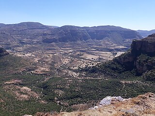
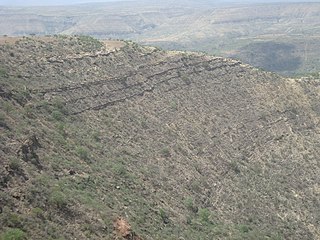
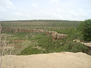
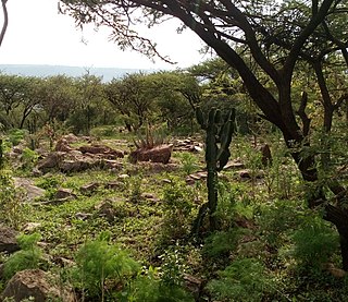
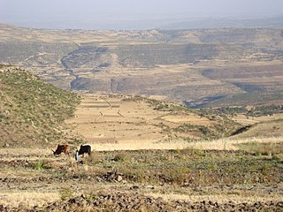
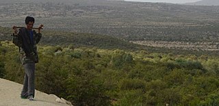
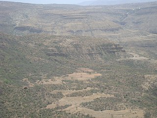
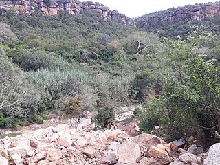
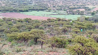
In the late nineteenth century, about 30% of Ethiopia was covered with forest . The clearing of land for agricultural use and the cutting of trees for fuel gradually changed the scene, and today forest areas have dwindled to less than 4% of Ethiopia's total land. The northern parts of the highlands are almost devoid of trees. However, about 45,000 square kilometres of dense forest exist in the southern and southwestern sections of the highlands. Some of these include coniferous forests, found at elevations above 1,600 meters, but a majority of the forestland consists primarily of woodlands found in drier areas of the highlands and in the drier areas bordering the highlands. [1]

Contents

Lumber from the coniferous forests is important to the construction industry. The broadleaf evergreen forests furnish timber that is used in construction and in the production of plywood. The woodlands are a major source of firewood and charcoal. Certain trees -- boswellia and species of commiphora —are of special economic significance. Both grow in the arid lowlands and produce gums that are the bases for frankincense and myrrh. A species of acacia found in several parts of the country is a source of gum arabic used in the manufacture of adhesives, pharmaceutical products, and confectionery. The eucalyptus, an exotic tree introduced in the late nineteenth century and grown mainly near urban areas, is a valuable source of telephone and telegraph poles, tool handles, furniture, and firewood. It is also a major source of the material from which fiberboard and particleboard are made. [1]

Data on forestry's contribution to the economy are not readily available, largely because most GDP tables aggregate data on forestry, fishing, and hunting. In 1980/81 forestry accounted for 2.5% of GDP at constant 1960/61 factor cost and 5.4% of the share attributable to the agricultural sector. [1]

Before 1974 about half of the forestland was privately owned or claimed, and roughly half was held by the government. There was little government control of forestry operations prior to the Ethiopian revolution. The 1975 land reform nationalized forestland and sawmills, which existed mostly in the south. The government controlled harvesting of forestland, and in some cases individuals had to secure permits from local peasant associations to cut trees. But this measure encouraged illegal logging and accelerated the destruction of Ethiopia's remaining forests. To ensure that conservation activity conformed with government policy and directives on land use, reforestation programs were organized through the Ministry of Agriculture and Rural Development or district offices that planned, coordinated, and monitored all work. The local peasant associations lacked decision-making authority. [1]

Reforestation

Reforestation programs resulted in the planting of millions of seedlings in community forests throughout Ethiopia. A variety of Non Governmental Organizations, which had to organize their activities through the local peasant association, supplemented government efforts to rehabilitate Ethiopia's forests. However, critics maintain that both systems caused communal resources to be developed at the expense of private needs. As a result, reforestation programs did not perform well. Seedling survival rates varied from as low as 5 to 20% in some areas to 40% in others, largely because of inadequate care and premature cutting by locals. In late 1990, Addis Ababa was in the process of launching the Ethiopian Forestry Action Plan (EFAP) to improve woodland conservation, increase public participation in reforestation projects, and prevent further depletion of existing forest resources. It remained to be seen whether this plan would improve the state of Ethiopia's forests. [1]

Some protected and reforested areas in Ethiopia have been documented:

Deforestation

It is estimated that in 2000 Ethiopia had 4,344,000 ha of natural forest area, which is 4% of its total land area. [2] Compared to other East African countries Ethiopia's deforestation rate is about average. [3] However, the deforestation rates in East Africa are second highest of the continent. Moreover, it has the smallest fraction of its forest area designated primarily for conservation. Apart from Northern Africa, East African countries show the second highest decline rates of conservation forests in the continent.

See also

Related Research Articles

<span class="mw-page-title-main">Exclosure</span> Area protected from livestock grazing

An exclosure, in an area being used extensively for grazing, is a limited area from which unwanted browsing animals, such as domestic cattle or wildlife such as deer, are excluded by fencing or other means.

<span class="mw-page-title-main">Dogu'a Tembien</span> District in Tigray Region, Ethiopia

Dogu'a Tembien is a woreda in Tigray Region, Ethiopia. It is named in part after the former province of Tembien. Nowadays, the mountainous district is part of the Southeastern Tigray Zone. The administrative centre of this woreda is Hagere Selam.

<span class="mw-page-title-main">Amanit</span> Municipality in Tigray Region, Ethiopia

Amanit is a tabia or municipality in the Dogu'a Tembien district of the Tigray Region of Ethiopia. The tabia centre is Addi Qeshofo village, located approximately 15 km to the southeast of the woreda town Hagere Selam.

<span class="mw-page-title-main">Debre Nazret</span> Municipality in Tigray Region, Ethiopia

Debre Nazret is a tabia or municipality in the Inderta district of the Tigray Region of Ethiopia. It belonged to Dogu'a Tembien up to January 2020. The tabia centre is in Togogwa town, located approximately 19 km to the east-southeast of Hagere Selam and 25 km to the west of Mekelle.

<span class="mw-page-title-main">Addi Azmera</span> Municipality in Ethiopia

Addi Azmera is a tabia or municipality in the Dogu'a Tembien district of the Tigray Region of Ethiopia. The name refers to good spring rains (“azmera”), in relation to the local microclimate. The tabia centre is in Tukhul town, located approximately half-way between the woreda town Hagere Selam and the regional capital Mekelle.

<span class="mw-page-title-main">Addilal</span> Municipality in Ethiopia

Addilal is a tabia or municipality in the Dogu'a Tembien district of the Tigray Region of Ethiopia. The tabia centre is in Addilal village, located approximately 19 km (12 mi) to the east of the woreda town Hagere Selam.

<span class="mw-page-title-main">Inda Sillasie</span> Municipality in Tigray Region, Ethiopia

Inda Sillasie is a tabia or municipality in the Dogu'a Tembien district of the Tigray Region of Ethiopia. The tabia centre is in Migichi village, located approximately 13 km to the south-southeast of the woreda town Hagere Selam.

<span class="mw-page-title-main">Walta (Dogu'a Tembien)</span> Municipality in Degua Tembien, Tigray Region, Ethiopia

Walta is a municipality in the Dogu'a Tembien district of the Tigray Region of Ethiopia. The tabia centre is in Da’erere village, located approximately 7 km to the south of the woreda town Hagere Selam.

<span class="mw-page-title-main">Mizane Birhan</span> Municipality in Ethiopia

Mizane Birhan is a tabia or municipality in the Dogu'a Tembien district of the Tigray Region of Ethiopia. The tabia centre is in Ma’idi village, located approximately 13 km to the southeast of the woreda town Hagere Selam.

<span class="mw-page-title-main">Ayninbirkekin</span> Municipality in Tigray Région, Ethiopia

Ayninbirkekin is a tabia or municipality in the Dogu'a Tembien district of the Tigray Region of Ethiopia. Literal meaning of Ayninbirkekin in Tigrinya is "We will not bend". The tabia centre is in Halah village, located approximately 8 km to the east of the woreda town Hagere Selam. Main town is Ala'isa, situated on the ridge overseeing the Giba valley.

<span class="mw-page-title-main">EthioTrees</span> Project for woodland restoration in Ethiopia

The EthioTrees Ecosystem Restoration Association, in short EthioTrees, established in 2016, is a project for environmental rehabilitation and woodland restoration in Dogu’a Tembien (Ethiopia).

<span class="mw-page-title-main">Addilal (exclosure)</span> Exclosure for woodland restoration in Ethiopia

Addilal is an exclosure located in the Dogu'a Tembien woreda of the Tigray Region in Ethiopia. The area has been protected since 1992 by the local community.

<span class="mw-page-title-main">Addi Lihtsi (exclosure)</span> Exclosure for woodland restoration in Ethiopia

Addi Lihtsi is an exclosure located in the Dogu'a Tembien woreda of the Tigray Region in Ethiopia. The area is protected by the local community.

<span class="mw-page-title-main">Lafa (exclosure)</span> Exclosure for woodland restoration in Ethiopia

Lafa is an exclosure located in the Dogu'a Tembien woreda of the Tigray Region in Ethiopia. The area has been protected since 1988 by the local community.

<span class="mw-page-title-main">Kidmi Gestet</span> Exclosure for woodland restoration in Ethiopia

Kidmi Gestet is an exclosure located in the Dogu'a Tembien woreda of the Tigray Region in Ethiopia.

Ch’elaqo is an exclosure located in the Dogu'a Tembien woreda of the Tigray Region in Ethiopia.

<span class="mw-page-title-main">Mi'am Atali (exclosure)</span> Exclosure for woodland restoration in Ethiopia

Mi'am Atali is an exclosure located in the Dogu'a Tembien woreda of the Tigray Region in Ethiopia. The area has been protected since 2010 by the local community.

<span class="mw-page-title-main">Sesemat (exclosure)</span> Exclosure for woodland restoration in Ethiopia

Sesemat is an exclosure located in the Dogu'a Tembien woreda of the Tigray Region in Ethiopia. The area has been protected since 1993 by the local community.

<span class="mw-page-title-main">Tukhul (exclosure)</span> Exclosure for woodland restoration in Ethiopia

Tukhul is an exclosure located in between the villages of Tukhul and Miheni in the Dogu'a Tembien woreda of the Tigray Region in Ethiopia. The area has been protected since 1998 by the local community.

<span class="mw-page-title-main">May Be'ati River</span> River in the Tembien highlands of Ethiopia

The May Be’ati is a river of the Nile basin. Rising in the mountains of Dogu’a Tembien in northern Ethiopia, it flows southward to empty finally in the Giba and Tekezé River.

References

  1. 1 2 3 4 5 Wubne, Mulatu. "Forestry". A Country Study: Ethiopia (Thomas P. Ofcansky and LaVerle Berry, eds.) Library of Congress Federal Research Division (1991). This article incorporates text from this source, which is in the public domain. .
  2. Earth Trends 2003 Archived 2008-11-28 at the Wayback Machine
  3. FAO. State of the World’s Forests Report 2007