Forkland, Alabama

Last updated

Forkland, Alabama
StJohnsForkland.jpg
Greene County Alabama Incorporated and Unincorporated areas Forkland Highlighted 0127376.svg
Location of Forkland in Greene County, Alabama.
Coordinates: 32°38′51″N87°52′2″W / 32.64750°N 87.86722°W / 32.64750; -87.86722
Country United States
State Alabama
County Greene
Area
[1]
  Total3.51 sq mi (9.08 km2)
  Land3.49 sq mi (9.05 km2)
  Water0.01 sq mi (0.03 km2)
Elevation
151 ft (46 m)
Population
 (2020)
  Total445
  Density127.36/sq mi (49.17/km2)
Time zone UTC-6 (Central (CST))
  Summer (DST) UTC-5 (CDT)
ZIP code
36740
Area code 334
FIPS code 01-27376
GNIS feature ID0118505

Forkland is a town in Greene County, Alabama, United States. At the 2020 census, the population was 445. [2] It was incorporated[ clarification needed ] around 1974. [3]

Contents

History

Forkland has one site on the National Register of Historic Places, St. John's-In-The-Prairie, built in 1859, and two sites nearby, Rosemount and Thornhill.

Geography

Forkland is located in southern Greene County at 32°38′52″N87°52′2″W / 32.64778°N 87.86722°W / 32.64778; -87.86722 (32.647702, -87.867236), [4] between the Black Warrior River 4 miles (6 km) to the east and the Tombigbee River 2 miles (3 km) to the west. The Black Warrior joins the Tombigbee 9 miles (14 km) to the south of Forkland, just north of Demopolis. U.S. Route 43 passes through Forkland, leading north 14 miles (23 km) to Eutaw, the county seat, and south 10 miles (16 km) to Demopolis.

According to the U.S. Census Bureau, Forkland has a total area of 3.5 square miles (9.1 km2), of which 0.01 square miles (0.03 km2), or 0.32%, is water. [5]

Demographics

Historical population
CensusPop.Note
1880 205
1970 304
1980 42941.1%
1990 66755.5%
2000 629−5.7%
2010 6493.2%
2020 445−31.4%
U.S. Decennial Census [6]
2010 [7] 2020 [8]

2020 census

Forkland town, Alabama – Racial and ethnic composition
Note: the US Census treats Hispanic/Latino as an ethnic category. This table excludes Latinos from the racial categories and assigns them to a separate category. Hispanics/Latinos may be of any race.
Race / Ethnicity (NH = Non-Hispanic)Pop 2010 [7] Pop 2020 [8] % 2010% 2020
White alone (NH)774311.86%9.66%
Black or African American alone (NH)56339186.75%87.87%
Native American or Alaska Native alone (NH)120.15%0.45%
Asian alone (NH)000.00%0.00%
Pacific Islander alone (NH)000.00%0.00%
Some Other Race alone (NH)000.00%0.00%
Mixed Race or Multi-Racial (NH)380.46%1.80%
Hispanic or Latino (any race)510.77%0.22%
Total649445100.00%100.00%

2000 Census

As of the census [9] of 2000, there were 629 people, 245 households, and 161 families residing in the town. The population density was 180.2 inhabitants per square mile (69.6/km2). There were 309 housing units at an average density of 88.5 per square mile (34.2/km2). The racial makeup of the town was 10.65% White, 89.19% Black or African American, and 0.16% from two or more races.

There were 245 households, out of which 36.3% had children under the age of 18 living with them, 35.5% were married couples living together, 27.8% had a female householder with no husband present, and 33.9% were non-families. 32.7% of all households were made up of individuals, and 10.6% had someone living alone who was 65 years of age or older. The average household size was 2.57 and the average family size was 3.32.

In the town, the population was spread out, with 31.8% under the age of 18, 6.8% from 18 to 24, 26.1% from 25 to 44, 24.5% from 45 to 64, and 10.8% who were 65 years of age or older. The median age was 34 years. For every 100 females, there were 88.3 males. For every 100 females age 18 and over, there were 77.3 males.

The median income for a household in the town was $18,698, and the median income for a family was $22,115. Males had a median income of $24,375 versus $16,544 for females. The per capita income for the town was $9,314. About 29.5% of families and 31.5% of the population were below the poverty line, including 38.2% of those under age 18 and 31.0% of those age 65 or over.

Notable people

Photographs of Forkland structures were taken for the Historic American Buildings Survey in 1933:

Related Research Articles

<span class="mw-page-title-main">Marengo County, Alabama</span> County in Alabama, United States

Marengo County is a county located in the west central portion of the U.S. state of Alabama. As of the 2020 census, the population was 19,323. The largest city is Demopolis, and the county seat is Linden. It is named in honor of the Battle of Marengo near Turin, Italy, where French leader Napoleon Bonaparte defeated the Austrians on June 14, 1800.

<span class="mw-page-title-main">Arab, Alabama</span> City in Alabama, United States

Arab is a city in Marshall County in the northern part of the U.S. state of Alabama, located 10 miles (16 km) from Guntersville Lake and Guntersville Dam, and is included in the Huntsville-Decatur Combined Statistical Area. The population was 8,461 at the 2020 census.

Selmont-West Selmont is a census-designated place (CDP) in Dallas County, Alabama, United States. At the 2020 census, the population was 2,158.

<span class="mw-page-title-main">Belk, Alabama</span> Town in Alabama, United States

Belk is a town in Fayette County, Alabama, United States. Its citizens voted to incorporate in January 1969. At the 2020 census, the population was 186.

<span class="mw-page-title-main">Berry, Alabama</span> Town in Alabama, United States

Berry is a town in Fayette County, Alabama, United States. At the 2010 census the population was 1,148, down from 1,238 at the 2000 census.

<span class="mw-page-title-main">Winfield, Alabama</span> City in Alabama, United States

Winfield is a city in Marion and Fayette counties in the U.S. state of Alabama. The population was 4,845 at the 2020 census, the second largest city in Marion County.

<span class="mw-page-title-main">Union, Alabama</span> Town in Alabama, United States

Union is a town in rural Greene County, Alabama, United States. Per the 2020 census, the population was 180. According to the 1980 U.S. Census, it was incorporated in the 1970s.

<span class="mw-page-title-main">Akron, Alabama</span> Town in Alabama, United States

Akron is a town in Hale County, Alabama, United States. In 1906, the owner of a large plantation, Waller Evan Wedgworth, sold part of his land to developers, and a construction boom followed. The town was incorporated in March 1918. At the 2010 census the population was 356, down from 521 at the 2000 census. Akron has one site on the National Register of Historic Places, the Greek Revival cottage known as Tanglewood.

<span class="mw-page-title-main">Newbern, Alabama</span> Town in Alabama, United States

Newbern is a town in Hale County, Alabama, United States. As of the 2020 census, the population of the town was 133.

<span class="mw-page-title-main">Dayton, Alabama</span> Town in Alabama, United States

Dayton is a town in Marengo County, Alabama, United States. The population was 28 at the 2020 census.

<span class="mw-page-title-main">Demopolis, Alabama</span> City in Alabama, United States

Demopolis is the largest city in Marengo County, in west-central Alabama. The population was 7,162 at the 2020 census.

<span class="mw-page-title-main">Linden, Alabama</span> City in Alabama, United States

Linden is a city in and the county seat of Marengo County, Alabama, United States. The population was 1,930 at the 2020 census, down from 2,123 at the 2010 census.

<span class="mw-page-title-main">Myrtlewood, Alabama</span> Town in Alabama, United States

Myrtlewood is a town in Marengo County, Alabama, United States. At the 2020 census the population was 70, down from 130 in 2010.

<span class="mw-page-title-main">Providence, Alabama</span> Town in Alabama, United States

Providence is a town in Marengo County, Alabama, United States. As of the 2020 United States census, the population was 167, down from 223 at the 2010 census. It incorporated sometime in the 1970s.

<span class="mw-page-title-main">Thomaston, Alabama</span> Town in Alabama, United States

Thomaston is a town in Marengo County, Alabama, United States. At the 2020 census the population was 326, down from 417 at the 2010 census.

<span class="mw-page-title-main">Hackleburg, Alabama</span> Town in Alabama, United States

Hackleburg is a town in Marion County, Alabama, United States. It incorporated on August 23, 1909. At the 2020 census, its population was 1,425, down from 1,516 at the 2010 census.

<span class="mw-page-title-main">Beatrice, Alabama</span> Town in Alabama, United States

Beatrice is a town in Monroe County, Alabama, United States. It incorporated in 1901. At the 2020 census the population was 204, down from 301 in 2010 and 412 in 2000.

<span class="mw-page-title-main">Tatum, South Carolina</span> Town in South Carolina, United States

Tatum is a town in Marlboro County, South Carolina, United States. The population was 75 at the 2010 census.

<span class="mw-page-title-main">Waterville, Washington</span> Town in Washington, United States

Waterville is a town in and the county seat of Douglas County, Washington, United States which is known for its wheat industry. As a part of Douglas County, it is part of the Wenatchee-East Wenatchee metropolitan area. The population was 1,134 at the 2020 census.
<span class="mw-page-title-main">Parkland, Wisconsin</span> Town in Wisconsin, United States

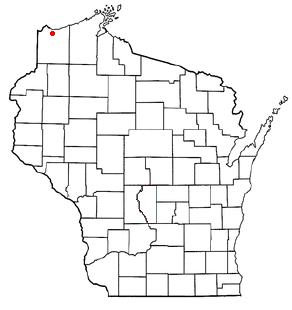
Parkland is a town in Douglas County, Wisconsin, United States. The population was 1,240 at the 2000 census. The unincorporated communities of Cutter, Parkland, Peyton, South Itasca, Sunnyside and South Range are in the town.

References

  1. "2020 U.S. Gazetteer Files". United States Census Bureau. Retrieved October 29, 2021.
  2. "Forkland town, Alabama". United States Census Bureau . Retrieved April 15, 2022.
  3. "The Tuscaloosa News - Google News Archive Search". Archived from the original on March 6, 2016.
  4. "US Gazetteer files: 2010, 2000, and 1990". United States Census Bureau. February 12, 2011. Retrieved April 23, 2011.
  5. "Geographic Identifiers: 2010 Demographic Profile Data (G001): Forkland town, Alabama". U.S. Census Bureau, American Factfinder. Retrieved October 28, 2016.[ dead link ]
  6. "Decennial Census of Population and Housing by Decades". US Census Bureau.
  7. 1 2 "P2 HISPANIC OR LATINO, AND NOT HISPANIC OR LATINO BY RACE – 2010: DEC Redistricting Data (PL 94-171) – Forkland town, Alabama". United States Census Bureau .
  8. 1 2 "P2 HISPANIC OR LATINO, AND NOT HISPANIC OR LATINO BY RACE – 2020: DEC Redistricting Data (PL 94-171) – Forkland town, Alabama". United States Census Bureau .
  9. "U.S. Census website". United States Census Bureau . Retrieved January 31, 2008.

32°38′52″N87°52′02″W / 32.647702°N 87.867236°W / 32.647702; -87.867236