Carbon County is a county in the U.S. state of Wyoming. As of the 2020 United States Census, the population was 14,537. Its county seat is Rawlins. Its south border abuts the north line of Colorado.

Sinclair is a town in Carbon County, Wyoming, United States.

Fort Bridger was originally a 19th-century fur trading outpost established in 1842, on Blacks Fork of the Green River, in what is now Uinta County, Wyoming, United States. It became a vital resupply point for wagon trains on the Oregon Trail, California Trail, and Mormon Trail. The Army established a military post here in 1858 during the Utah War, until it was finally closed in 1890. A small town, Fort Bridger, Wyoming, remains near the fort and takes its name from it.

The Wyoming State Capitol is located in the city of Cheyenne. Cheyenne is the seat of government for the U.S. state of Wyoming. Built between 1886 and 1890, the capitol is located in Cheyenne and contains the chambers of the Wyoming State Legislature as well as the office of the Governor of Wyoming. It was designated a U.S. National Historic Landmark in 1987. The Capitol underwent an extensive three-year renovation and reopened to the public on July 10, 2019.

Fort Phil Kearny was an outpost of the United States Army that existed in the late 1860s in present-day northeastern Wyoming along the Bozeman Trail. Construction began in 1866 on Friday, July 13, by Companies A, C, E, and H of the 2nd Battalion, 18th Infantry, under the direction of the regimental commander and Mountain District commander Colonel Henry B. Carrington.

Fort D. A. Russell, also known as Fort Francis E. Warren, Francis E. Warren Air Force Base and Fort David A. Russell, was a post and base of operations for the United States Army, and later the Air Force, located in Cheyenne, Wyoming. The fort had been established in 1867 to protect workers for the Union Pacific Railroad. It was named in honor of David Allen Russell, a Civil War general killed at the Battle of Opequon. In 1930, the fort's name was changed to Fort Francis E. Warren. In 1949, it became Francis E. Warren Air Force Base.

The National Register of Historic Places in the United States is a register including buildings, sites, structures, districts, and objects. The Register automatically includes all National Historic Landmarks as well as all historic areas administered by the U.S. National Park Service. Since its introduction in 1966, more than 90,000 separate listings have been added to the register.

Fort Washakie was a U.S. Army fort in what is now the U.S. state of Wyoming. The fort was established in 1869 and named Camp Augur after General Christopher C. Augur, commander of the Department of the Platte. In 1870 the camp was renamed Camp Brown in honor of Captain Frederick H. Brown, who was killed in the Fetterman Massacre in 1866.

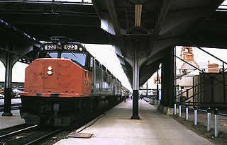
The Cheyenne Depot Museum is a railroad museum in Cheyenne, Wyoming, United States. It is located inside the 1880s Union Pacific Railroad depot. A National Historic Landmark, the station was the railroad's largest west of Council Bluffs, Iowa, and a major western example of Richardsonian Romanesque architecture.

The Ames Monument is a large pyramid in Albany County, Wyoming, designed by Henry Hobson Richardson and dedicated to brothers Oakes Ames and Oliver Ames Jr., Union Pacific Railroad financiers. It marked the highest point on the first transcontinental railroad, at 8,247 feet (2,514 m).

There is evidence of prehistoric human habitation in the region known today as the U.S. state of Wyoming stretching back roughly 13,000 years. Stone projectile points associated with the Clovis, Folsom and Plano cultures have been discovered throughout Wyoming. Evidence from what is now Yellowstone National Park indicates the presence of vast continental trading networks since around 1,000 years ago.

The following is an alphabetical list of articles related to the U.S. state of Wyoming.

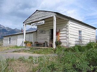
Menor's Ferry was a river ferry that crossed the Snake River near the present-day Moose, Wyoming, United States. The site was homesteaded by Bill Menor in 1892-94, choosing a location where the river flowed in a single channel, rather than the braided stream that characterizes its course in most of Jackson Hole. During the 1890s it was the only homestead west of the river. Menor's homestead included a five-room cabin, a barn, a store, sheds and an icehouse on 148 acres (60 ha), irrigated by a ditch from Cottonwood Creek and at times supplemented by water raised from the Snake River by a waterwheel. Menor operated the ferry until 1918, selling to Maude Noble, who continued operations until 1927, when a bridge was built at Moose.

Dale Creek Crossing was a railway bridge located in present-day Wyoming. The 650-foot (200 m) bridge, completed in 1868 in the southeastern Wyoming Territory, presented engineers of the United States' first transcontinental railroad one of their most difficult challenges. Dale Creek Bridge, the longest bridge on the Union Pacific Railroad (UP), reached 150 feet (46 m) above Dale Creek, two miles (3.2 km) west of Sherman, Wyoming. The first Dale Creek Bridge was a wooden structure 720 feet in length. The eastern approach to the bridge site, near the highest elevation on the UP, 8,247 feet (2,514 m) above sea level, required cutting through granite for nearly a mile. Solid rock also confronted workers on the west side of the bridge where they made a cut one mile (1.6 km) in length.
The Brigham Young Oil Well is an oil seep near Evanston, Wyoming, United States that was discovered and used by the original Mormon expedition to Utah under the leadership of Brigham Young. The party used the oil on the surface to lubricate wagon wheel hubs, as polish, and as a poultice. After the party reached Great Salt Lake, a group returned and dug a well at the seep for other pioneers. The well served until 1869 when the Union Pacific Railroad brought petroleum to Salt Lake City.

The DMJ Pick Bridge is a Parker through truss bridge located near Saratoga, Wyoming, which carries Carbon County Road CN6-508 across the North Platte River. The bridge was built from 1909 to 1910 by contractor Charles G. Sheely; it was originally located south of Fort Steele. In 1934, the bridge was moved up the river to its current location, as a new bridge had been built at its original site five years earlier. The bridge is the only Parker truss bridge remaining in Wyoming, after the Arvada Bridge was replaced in 1990.

The DML Butler Bridge is a historic bridge over the North Platte River in Carbon County, Wyoming, United States, that is listed on the National Register of Historic Places (NRHP).

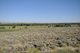
The Point of Rocks Stage Station is a former resting place at the meeting point of the Overland Trail and the Union Pacific Railroad in Sweetwater County, Wyoming, USA. It was built as a stop for the Overland Stage Line in the 1861 or 1862, equidistant between the earlier Black Buttes and Salt Wells stations, which were 28 miles (45 km) apart. The station served the stage line from 1862 to 1868. In 1868, the Union Pacific line reached Point of Rocks, putting the stage line out of business. The station then became a freight depot for nearby mines, with a road leading to Atlantic City and South Pass. The freight activity declined, and in 1877, the station became a residence. At one point it was allegedly inhabited by Jim McKee, a former member of the Hole in the Wall Gang. It became the property of the state of Wyoming in 1947 and is administered as Point of Rocks Stage Station State Historic Site.

Granger Station State Historic Site, also known as Granger Stage Station, South Bend Station and Ham's Fork Station, is a state park in Granger, Wyoming, United States, that is listed on the National Register of Historic Places (NRHP).

The Ryan Ranch is a 2,000-acre (810 ha) ranch on the east bank of the North Platte River in Carbon County, Wyoming, about 8 miles (13 km) south of Saratoga. One of the oldest ranches in the Platte Valley of central Wyoming, it was founded by Barton T. Ryan in 1874 and expanded by his son Cecil A. Ryan. The ranch headquarters comprises 17 structures arranged around a barnyard. The oldest structure is the 1875 homestead. Other buildings include sheds, shops, guest cabins, barns, trailers and a privy.


