Veii was an important ancient Etruscan city situated on the southern limits of Etruria and 16 km (9.9 mi) north-northwest of Rome, Italy. It now lies in Isola Farnese, in the comune of Rome. Many other sites associated with and in the city-state of Veii are in Formello, immediately to the north. Formello is named after the drainage channels that were first created by the Veians.

Fiumicino is a town and comune in the Metropolitan City of Rome, Lazio, central Italy, with a population of 80,500 (2019). It is known for being the site of Leonardo da Vinci–Fiumicino Airport, the busiest airport in Italy and the ninth-busiest in Europe, which serves Rome and much of central Italy.

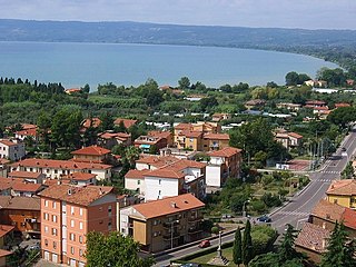
Volsinii or Vulsinii, is the name of two ancient cities of Etruria, one situated on the shore of Lacus Volsiniensis, and the other on the Via Clodia, between Clusium (Chiusi) and Forum Cassii (Vetralla). The latter was Etruscan and was destroyed by the Romans in 264 BC following an attempted revolt by its slaves, while the former was founded by the Romans using the remainder of the Etruscan population rescued from the razed city.

Allifae was an ancient town of Italy, a center of Oscan or Samnite origin, situated in the valley of the Vulturnus, at the foot of the lofty mountain group now called the Monte Matese, about 40 km northwest of Telesia, and 27 km east-northwest of Teano.

Alsium was an ancient city on the coast of Etruria, between Pyrgi and Fregenae, on the Via Aurelia, by which it is about 35 km from Rome near the modern Ladispoli. It was one of the oldest towns of Etruria, but does not appear in history until the Roman colonisation of 247 BC. It was never of great importance, except as a resort of wealthy Romans, many of whom had villas there.

Portus was a large artificial harbour of Ancient Rome located at the mouth of the Tiber on the Tyrrhenian Sea. It was established by Claudius and enlarged by Trajan to supplement the nearby port of Ostia.
The Hirpini were an ancient Samnite tribe of Southern Italy. While generally regarded as having been Samnites, sometimes they are treated as a distinct and independent nation. They inhabited the southern portion of Samnium, in the more extensive sense of that name, roughly the area now known as Irpinia from their name—a mountainous region bordering on Basilicata towards the south, on Apulia to the east, and on Campania towards the west. No marked natural boundary separated them from these neighboring nations, but they occupied the lofty masses and groups of the central Apennines, while the plains on each side, and the lower ranges that bounded them, belonged to their more fortunate neighbors. The mountain basin formed by the three tributaries of the Vulturnus —the Tamarus, Calor, and Sabatus, which, with their valleys, unite near Beneventum, surrounded on all sides by lofty and rugged ranges of mountains—is the center and heart of their territory. They occupied the Daunian Mountains to the north, while its more southern portion comprised the upper valley of the Aufidus and the lofty group of mountains where that river takes its rise.

Latium is the region of central western Italy in which the city of Rome was founded and grew to be the capital city of the Roman Empire.

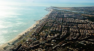
Ostia is a large neighbourhood in the Municipio X of the comune of Rome, Italy, near the ancient port of Rome, which is now a major archaeological site known as Ostia Antica. Ostia is also the only municipio or district of Rome on the Tyrrhenian Sea, and many Romans spend the summer holidays there. It is entirely situated within the municipality of Rome and is the city's seaside resort.

Isola Sacra is situated in the Lazio region of Italy south of Rome, near the Tyrrhenian Sea. It is part of the town of Fiumicino.

Eretum, was an ancient town of the Sabines, situated on the Via Salaria, at its junction with the Via Nomentana, a short distance from the Tiber, and about 30 km (19 mi) from Rome.

The Autostrada A91, also called Autostrada Roma-Fiumicino, is an autostrada 18.5 kilometres (11.5 mi) long in Italy located in the region of Lazio which connects Rome to the Leonardo da Vinci–Fiumicino Airport in Fiumicino. It is a part of the E80 European route.
Spurius Carvilius C. f. C. n., later surnamed Maximus, was the first member of the plebeian gens Carvilia to obtain the consulship, which he held in 293 BC, and again in 272 BC.
Old Latium is a region of the Apennine Peninsula bounded to the north by the Tiber River, to the east by the central Apennine Mountains, to the west by the Mediterranean Sea and to the south by Monte Circeo. It was the territory of the Latins, an Italic tribe which included the early inhabitants of the city of Rome. Later it was also settled by various Italic tribes such as the Rutulians, Volscians, Aequi, and Hernici. The region was referred to as "old" to distinguish it from the expanded region, Latium, that included the region to the south of Old Latium, between Monte Circeo and the river Garigliano – the so-called Latium adiectum. It corresponded to the central part of the modern administrative region of Lazio, Italy, and it covered an area measuring of roughly 50 Roman miles. It was calculated by Mommsen that the region's area was about 1860 square kilometres.

Passo Oscuro is a small town and beach resort situated in the comune of Fiumicino in the Lazio region of Italy, west of Rome, at the Tyrrhenian Sea, 5 km north of Fregene.
ASD Maccarese Calcio was an Italian football club headquartered in Maccarese, a frazione of Fiumicino, itself part of the Metropolitan City of Rome Capital. The club was also known as S.S. Maccarese until renamed to A.S. Giada Maccarese in 2002. In 2013, the club, known as A.S.D. Maccarese Calcio at that time, was relocated and renamed as A.S.D. Trastevere Calcio. However, since 2013, several namesake were founded as phoenix clubs of Maccarese, by the former chairman Dante Papili.
A.S.D. Roma City F.C. or in short, Roma City is an Italian football club based in Riano, Lazio region. The club, as of 2022–23 season, participates in Serie D.
A.S. Fiumicino 1926, formerly known as Fiumicino Calcio, is an Italian football club, based in Fiumicino, a suburb of Greater Rome in the Metropolitan City of Rome Capital. The club participated in Serie D and Eccellenza Lazio several times, but as of 2024-25 season, participating in Eccellenza Lazio Group A. The club also affiliated to A.S. Roma as a feeder club.

Maccarese is a locality in Lazio, Italy, in the Metropolitan City of Rome. Its administration is divided between the Municipalities of Rome and Fiumicino, of which it is a frazione.
It was entirely part of the Municipality of Rome until 1993, when the former Circoscrizione XIV, which included a part of the hamlet, became the autonomous Municipality of Fiumicino.

The Litorale Romano state nature reserve is a protected area in Lazio (Italy), established by the Ministry of the Environment with Ministerial Decree of March 29, 1996, which includes a large territory of historical-naturalistic interest within the municipalities of Rome and Fiumicino at Tiber Valley.
With its over 17,000 hectares, discontinuously distributed along the Lazio coast between Palidoro and Capocotta, it is the largest protected area overlooking the Mediterranean Sea. Its management is entrusted to the two municipalities in their respective sections of competence.


